Category:Sutton, Norfolk
Aller à la navigation
Aller à la recherche
English: Sutton is a village (with 486 dwelling houses and a population of 1226) in the English county of Norfolk. It lies next to the Norfolk Broads (Barton Broad to its south-west, and Hickling Broad to its south-east), about 16 miles north-east of Norwich on the A149 road, adjacent to the slightly larger market town of Stalham.
localité britannique du comté anglais de Norfolk  | |||||
| Téléverser des médias | |||||
| Nature de l’élément | |||||
|---|---|---|---|---|---|
| Lieu | North Norfolk, Norfolk, Angleterre de l'Est, Angleterre | ||||
| Superficie |
| ||||
 | |||||
Sous-catégories
Cette catégorie comprend 5 sous-catégories, dont les 5 ci-dessous.
Média dans la catégorie « Sutton, Norfolk »
Cette catégorie comprend 47 fichiers, dont les 47 ci-dessous.
-
 15 miles to Yarmouth - geograph.org.uk - 1152039.jpg 640 × 451 ; 95 kio
-
 A149 towards Great Yarmouth - geograph.org.uk - 5875321.jpg 1 024 × 684 ; 196 kio
-
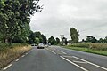 A149, Sutton - geograph.org.uk - 5875307.jpg 1 024 × 684 ; 215 kio
-
 Air Training Corps 1132 (Stalham) Squadron - geograph.org.uk - 5969215.jpg 1 600 × 1 064 ; 994 kio
-
 Drain in Sutton Fen - geograph.org.uk - 5988658.jpg 1 600 × 1 200 ; 394 kio
-
 Dyke in Sutton Fen - geograph.org.uk - 5988653.jpg 1 600 × 1 200 ; 397 kio
-
 Entering Stalham on Rectory Road - geograph.org.uk - 6085060.jpg 3 264 × 2 292 ; 1,65 Mio
-
 Entering Sutton from the South - geograph.org.uk - 1244216.jpg 640 × 480 ; 89 kio
-
 Farm track leading to the fields of Boundary Farm - geograph.org.uk - 6085077.jpg 3 264 × 2 448 ; 2,45 Mio
-
 Fen Orchid, Sutton Fen - geograph.org.uk - 5988684.jpg 1 188 × 1 600 ; 249 kio
-
 Field by Plumsgate Road - geograph.org.uk - 5988703.jpg 1 600 × 1 200 ; 382 kio
-
 Fields off Wood Street Road - geograph.org.uk - 5979487.jpg 1 600 × 1 200 ; 335 kio
-
 Floating mat of vegetation, Sutton Broad - geograph.org.uk - 5988679.jpg 1 600 × 1 200 ; 431 kio
-
 Gate on the footpath - geograph.org.uk - 4967439.jpg 640 × 360 ; 389 kio
-
 Marshland beside a reed bed - geograph.org.uk - 6103816.jpg 3 456 × 2 592 ; 4,03 Mio
-
 Mill Road - geograph.org.uk - 798344.jpg 640 × 460 ; 148 kio
-

-
 Old Yarmouth Road - geograph.org.uk - 5988689.jpg 1 600 × 1 200 ; 415 kio
-
 Ordnance Survey Cut Mark - geograph.org.uk - 4218630.jpg 640 × 480 ; 116 kio
-
 Plumsgate Road, Catfield - geograph.org.uk - 4558279.jpg 1 024 × 768 ; 640 kio
-
 Rectory Road from Church Road, Sutton - geograph.org.uk - 5969198.jpg 1 600 × 1 064 ; 668 kio
-
 Small copse and track - geograph.org.uk - 3001757.jpg 2 272 × 1 704 ; 2,14 Mio
-
 Stables and paddocks - geograph.org.uk - 798332.jpg 640 × 480 ; 168 kio
-
 Staithe Road, Sutton, Norfolk - geograph.org.uk - 2131770.jpg 1 024 × 768 ; 415 kio
-
 Sutton Garden and Aquatic Centre - geograph.org.uk - 5972302.jpg 1 600 × 1 093 ; 206 kio
-
 Sutton Hall Barn conversion - geograph.org.uk - 6085069.jpg 3 264 × 2 448 ; 1,68 Mio
-
 Sutton Mill - geograph.org.uk - 5740781.jpg 454 × 622 ; 248 kio
-
 Sutton Mill - geograph.org.uk - 5740803.jpg 633 × 365 ; 133 kio
-
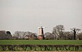 Sutton Mill seen across a crop field - geograph.org.uk - 5740801.jpg 636 × 409 ; 123 kio
-
 Sutton Mill, New Road, Sutton - geograph.org.uk - 5969218.jpg 1 064 × 1 600 ; 720 kio
-
 Sutton Road near Hickling - geograph.org.uk - 1244226.jpg 640 × 480 ; 71 kio
-
 Sutton Village Sign, Sutton, Norfolk - geograph.org.uk - 2131761.jpg 768 × 1 024 ; 417 kio
-
 Swallowtail Butterfly, Sutton Fen - geograph.org.uk - 5988656.jpg 1 600 × 1 352 ; 298 kio
-
 To North Walsham 10 - geograph.org.uk - 1737377.jpg 1 600 × 1 200 ; 429 kio
-
 View to Sutton Mill - geograph.org.uk - 1244219.jpg 640 × 480 ; 91 kio
-
 View to the A149 from car park - geograph.org.uk - 868433.jpg 480 × 640 ; 157 kio
-
 Village Sign, Sutton, Norfolk - geograph.org.uk - 2131766.jpg 1 024 × 768 ; 415 kio
-
 Wheat field next to Sutton Hall - geograph.org.uk - 6085066.jpg 3 264 × 2 448 ; 1,59 Mio
-
 Willow tree on the edge of a reed bed - geograph.org.uk - 6103814.jpg 3 456 × 2 592 ; 3,92 Mio
-
 WW1, 2 and Bosnia war memorial - geograph.org.uk - 5970571.jpg 1 064 × 1 600 ; 988 kio
-
 WW1, 2 and Bosnia war memorial - geograph.org.uk - 5970573.jpg 1 600 × 1 064 ; 1,1 Mio
-
 WW1, 2 and Bosnia war memorial - geograph.org.uk - 5970576.jpg 1 600 × 1 064 ; 1,21 Mio
-
 Field boundary, near Catfield - geograph.org.uk - 197381.jpg 640 × 479 ; 283 kio
-
 Heading east on Hall Road - geograph.org.uk - 564529.jpg 640 × 480 ; 66 kio
-
 Heading west on Hall Road - geograph.org.uk - 564504.jpg 640 × 480 ; 65 kio
-
 New driveway to Sutton Hall - geograph.org.uk - 564514.jpg 480 × 640 ; 94 kio
-
 Village Sign, Sutton - geograph.org.uk - 197924.jpg 479 × 640 ; 319 kio


_Squadron_-_geograph.org.uk_-_5969215.jpg)


