Category:Sutton, Peterborough
Aller à la navigation
Aller à la recherche
English: Sutton is a civil parish in Peterborough, Cambridgeshire, England. For electoral purposes it forms part of Glinton and Wittering ward in North West Cambridgeshire constituency.

localité britannique du comté anglais de Cambridgeshire  | |||||
| Téléverser des médias | |||||
| Nature de l’élément | |||||
|---|---|---|---|---|---|
| Lieu | City of Peterborough, Cambridgeshire, Angleterre de l'Est, Angleterre | ||||
 | |||||
Sous-catégories
Cette catégorie comprend seulement la sous-catégorie ci-dessous.
M
Média dans la catégorie « Sutton, Peterborough »
Cette catégorie comprend 115 fichiers, dont les 115 ci-dessous.
-

-
 A47 at The Drift - geograph.org.uk - 3586175.jpg 640 × 480 ; 64 kio
-
 A47 at the junction for Southorpe - geograph.org.uk - 3586179.jpg 640 × 480 ; 87 kio
-
 A47 nearing the junction for Southorpe - geograph.org.uk - 3586176.jpg 640 × 480 ; 82 kio
-
 A47 westbound - geograph.org.uk - 5966459.jpg 640 × 453 ; 52 kio
-
 A47 westbound - geograph.org.uk - 5966464.jpg 640 × 426 ; 57 kio
-
 A47 westbound - geograph.org.uk - 5966467.jpg 640 × 431 ; 55 kio
-
 A47 westbound - geograph.org.uk - 5966471.jpg 640 × 441 ; 81 kio
-
 A47 westbound - geograph.org.uk - 5966475.jpg 640 × 420 ; 91 kio
-
 A47, westbound - geograph.org.uk - 4700762.jpg 640 × 426 ; 81 kio
-
 Approach to Wansford station - geograph.org.uk - 2029928.jpg 1 280 × 960 ; 612 kio
-
 Birds above a field track - geograph.org.uk - 2433026.jpg 1 280 × 960 ; 618 kio
-
 Blossom by Sutton Heath Road - geograph.org.uk - 6118102.jpg 1 920 × 1 280 ; 1,95 Mio
-
 Crop field, Sutton Heath - geograph.org.uk - 3019645.jpg 640 × 480 ; 118 kio
-
 Crop spraying near Sutton, Peterborough - geograph.org.uk - 3879119.jpg 4 320 × 3 240 ; 5,57 Mio
-
 Dip on the A47 near Heath House - geograph.org.uk - 3586184.jpg 640 × 480 ; 88 kio
-
 Entrance to farmland on The Drift, Sutton - geograph.org.uk - 4559174.jpg 4 320 × 3 240 ; 5,7 Mio
-
 Ermine Street 3 - geograph.org.uk - 1196987.jpg 640 × 480 ; 201 kio
-
 Farmland near Upton - geograph.org.uk - 3019642.jpg 640 × 480 ; 59 kio
-
 Farmland, Manor Farm - geograph.org.uk - 3020435.jpg 640 × 480 ; 85 kio
-
 Farmland, Sutton - geograph.org.uk - 3019637.jpg 640 × 480 ; 49 kio
-
 Field by the A47 - geograph.org.uk - 6353322.jpg 1 024 × 768 ; 179 kio
-
 Field edge near Sutton Wood - geograph.org.uk - 2432965.jpg 1 280 × 960 ; 635 kio
-
 Field next to the River Nene at Wansford - geograph.org.uk - 5297920.jpg 4 546 × 2 721 ; 1,96 Mio
-
 Field of hay near Wansford - geograph.org.uk - 4560696.jpg 4 320 × 3 240 ; 5,72 Mio
-
 Field of oats and Sutton Wood - geograph.org.uk - 4560543.jpg 4 320 × 3 240 ; 5,55 Mio
-
 Field of oil seed rape - geograph.org.uk - 2432801.jpg 1 280 × 960 ; 643 kio
-
 Field of oil seed rape seen from the former Hereward Way - geograph.org.uk - 2396857.jpg 1 280 × 960 ; 633 kio
-
 Footpath along Lover's Lane - geograph.org.uk - 4559112.jpg 4 320 × 3 240 ; 5,51 Mio
-
 Gate along the Sutton Crossways track - geograph.org.uk - 4911807.jpg 800 × 600 ; 168 kio
-
 Gate on a bridleway to Sacrewell - geograph.org.uk - 6354453.jpg 1 024 × 768 ; 136 kio
-
 Gate on a footpath near Sacrewell Farm, Wansford - geograph.org.uk - 4560566.jpg 4 320 × 3 240 ; 5,94 Mio
-
 Green pond in the Nene valley - geograph.org.uk - 3084752.jpg 1 024 × 768 ; 251 kio
-
 Hay rack and manger - geograph.org.uk - 4560560.jpg 4 320 × 3 240 ; 5,98 Mio
-
 Hedgerow between fields of oil seed rape - geograph.org.uk - 2432977.jpg 1 280 × 960 ; 655 kio
-
 Hose drums shining across a stubble field - geograph.org.uk - 3084735.jpg 1 023 × 768 ; 120 kio
-
 House at Manor Farm, Sutton - geograph.org.uk - 4911909.jpg 800 × 525 ; 126 kio
-
 Information about Sutton Cross - geograph.org.uk - 2446256.jpg 4 000 × 3 000 ; 4,28 Mio
-
 Jubilee Spinney - geograph.org.uk - 2433009.jpg 1 280 × 960 ; 648 kio
-
 Kissing Gate along the Nene Way - geograph.org.uk - 4911981.jpg 800 × 564 ; 164 kio
-
 Lane to Sutton - geograph.org.uk - 1196997.jpg 640 × 480 ; 205 kio
-
 Langley Bush Road - geograph.org.uk - 2460885.jpg 640 × 480 ; 78 kio
-
 Langley Bush Road - geograph.org.uk - 5366936.jpg 640 × 480 ; 70 kio
-
 Langley Bush Road at the junction of Sutton Heath Road - geograph.org.uk - 6134701.jpg 1 920 × 1 280 ; 1,25 Mio
-
 Langley Bush Road near Stibbington - geograph.org.uk - 6134700.jpg 1 920 × 1 280 ; 879 kio
-
 Langley Bush Road towards Upton - geograph.org.uk - 3019643.jpg 640 × 480 ; 73 kio
-
 Looking across the valley at Sutton Heath - geograph.org.uk - 3220650.jpg 1 600 × 1 064 ; 422 kio
-
 Looking across the valley at Sutton Heath - geograph.org.uk - 3220660.jpg 1 600 × 1 064 ; 437 kio
-
 Looking across the valley at Sutton Heath - geograph.org.uk - 3220661.jpg 1 600 × 1 064 ; 374 kio
-
 Looking along the former Hereward Way - geograph.org.uk - 2396862.jpg 1 280 × 960 ; 628 kio
-
 Manor Farm, Sutton - geograph.org.uk - 3020432.jpg 640 × 480 ; 79 kio
-
 Men on Powerlines - geograph.org.uk - 173090.jpg 640 × 426 ; 107 kio
-
 Minor road towards Southorpe - geograph.org.uk - 3019640.jpg 640 × 480 ; 88 kio
-
 Minor road towards Southorpe - geograph.org.uk - 3019646.jpg 640 × 480 ; 86 kio
-
 Nene Valley Railway between Wansford and Castor - geograph.org.uk - 4833291.jpg 1 600 × 1 200 ; 370 kio
-
 Nene Valley Railway from Hereward Way - geograph.org.uk - 3478454.jpg 2 000 × 1 500 ; 494 kio
-
 Nene Valley Railway, distant view towards Wansford - geograph.org.uk - 4833254.jpg 1 600 × 1 200 ; 344 kio
-
 Nene Way from Sutton joining Ermine Street - geograph.org.uk - 2649047.jpg 3 458 × 2 510 ; 2,82 Mio
-
 Nene Way path towards the village of Sutton - geograph.org.uk - 4911997.jpg 800 × 530 ; 101 kio
-
 Nene Way towards Sutton - geograph.org.uk - 3020438.jpg 640 × 480 ; 72 kio
-
 Nene Way, Sutton - geograph.org.uk - 2460890.jpg 640 × 480 ; 76 kio
-
 Newly planted trees at Sutton - geograph.org.uk - 4911968.jpg 800 × 600 ; 185 kio
-
 Old pits by Sutton Heath Road - geograph.org.uk - 6353313.jpg 1 024 × 768 ; 241 kio
-
 Ordnance Survey Cut Mark - geograph.org.uk - 4109905.jpg 4 000 × 3 000 ; 3,93 Mio
-
 Ordnance Survey Flush Bracket 1036 - geograph.org.uk - 4109876.jpg 4 000 × 3 000 ; 4,28 Mio
-
 Phone box on Nene Way, Sutton - geograph.org.uk - 4911912.jpg 800 × 504 ; 136 kio
-
 Pipe in a drainage ditch - geograph.org.uk - 4911810.jpg 800 × 600 ; 173 kio
-
 Ploughed field and Jubilee Spinney - geograph.org.uk - 6353309.jpg 1 024 × 768 ; 190 kio
-
 Ploughed field and Sutton Wood - geograph.org.uk - 6354657.jpg 1 024 × 768 ; 189 kio
-
 Population of Sutton 1881-1961.png 712 × 413 ; 14 kio
-
 Power lines crossing the Nene valley - geograph.org.uk - 3084724.jpg 1 024 × 768 ; 107 kio
-
 Power lines march across the Nene Valley - geograph.org.uk - 3460880.jpg 2 000 × 1 500 ; 495 kio
-
 Private driveway in Sutton near Peterborough - geograph.org.uk - 4559105.jpg 4 320 × 3 240 ; 6,07 Mio
-
 Public footpath in Sutton - geograph.org.uk - 2649037.jpg 3 648 × 2 736 ; 4,66 Mio
-
 Pylons in a field - geograph.org.uk - 4431014.jpg 2 048 × 1 536 ; 216 kio
-
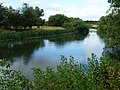
 Reflections in the River Nene - geograph.org.uk - 2029936.jpg 1 280 × 960 ; 640 kio
-
 River Nene at Wansford - geograph.org.uk - 2014907.jpg 1 280 × 960 ; 627 kio
-
 Road junction - geograph.org.uk - 5966483.jpg 640 × 422 ; 86 kio
-
 Route of dismantled railway in Sutton, Peterborough - geograph.org.uk - 4559131.jpg 4 320 × 3 240 ; 5,69 Mio
-
 Saxon meeting place at Sutton Cross - geograph.org.uk - 1923036.jpg 640 × 427 ; 100 kio
-
 Sidings east of Wansford - geograph.org.uk - 3459697.jpg 2 000 × 1 500 ; 621 kio
-
 Sidings east of Wansford - geograph.org.uk - 3460867.jpg 2 000 × 1 500 ; 582 kio
-
 Small footbridge along the Nene Way - geograph.org.uk - 4912040.jpg 800 × 547 ; 176 kio
-
-
 Sutton Cross next to Ermine Street - geograph.org.uk - 4910157.jpg 611 × 800 ; 138 kio
-
 Sutton Crossways - geograph.org.uk - 1923017.jpg 640 × 427 ; 90 kio
-
 Sutton Crossways track - geograph.org.uk - 4911904.jpg 800 × 600 ; 149 kio
-
 Sutton Heath - geograph.org.uk - 2460883.jpg 640 × 480 ; 81 kio
-
 Sutton Heath Road - geograph.org.uk - 5366934.jpg 640 × 480 ; 80 kio
-
 Sutton Heath Road - geograph.org.uk - 6118101.jpg 1 906 × 1 260 ; 1,81 Mio
-
 Sutton Heath Road at the A47 junction - geograph.org.uk - 6118103.jpg 1 880 × 1 216 ; 1,33 Mio
-
 Sutton Heath Road at the A47 junction - geograph.org.uk - 6160089.jpg 1 666 × 1 106 ; 1,28 Mio
-
 The beginning of a bridleway to Sacrewell and Wansford - geograph.org.uk - 6354660.jpg 1 024 × 768 ; 163 kio
-
 The beginning of the boardwalk by the Nene - geograph.org.uk - 3084761.jpg 1 024 × 651 ; 125 kio
-
 The Bread and Onion Line, Sutton - geograph.org.uk - 2446207.jpg 3 000 × 4 000 ; 4,33 Mio
-
 The Church of St Michael and All Saints in Sutton - geograph.org.uk - 4090634.jpg 4 000 × 3 000 ; 2,39 Mio
-
 The Church of St Michael and All Saints, Sutton - geograph.org.uk - 4911920.jpg 800 × 629 ; 212 kio
-
 The Drift - geograph.org.uk - 1196886.jpg 640 × 480 ; 207 kio
-
 The Drift - geograph.org.uk - 2460887.jpg 640 × 480 ; 75 kio
-
 The Drift, Sutton - geograph.org.uk - 2306570.jpg 1 280 × 960 ; 639 kio
-
 The former Hereward Way looking towards Southorpe - geograph.org.uk - 2432783.jpg 960 × 1 280 ; 647 kio
-
 The line of Ermine Street - geograph.org.uk - 2446229.jpg 4 000 × 3 000 ; 4,21 Mio
-
 The line of Sutton Crossways - geograph.org.uk - 1923023.jpg 640 × 427 ; 78 kio
-
 The Nene Way long distance path near Sutton - geograph.org.uk - 1319363.jpg 640 × 480 ; 116 kio
-
 The River Nene between Sutton and Wansford - geograph.org.uk - 4559628.jpg 4 320 × 3 240 ; 5,88 Mio
-
 The River Nene east of Wansford - geograph.org.uk - 4559570.jpg 4 320 × 3 240 ; 5,59 Mio
-
 The River Nene near Sutton - geograph.org.uk - 4912016.jpg 800 × 543 ; 188 kio
-
 The route of Ermine Street - geograph.org.uk - 2446224.jpg 4 000 × 3 000 ; 3,88 Mio
-
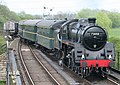
 Train approaching the Nene - geograph.org.uk - 3867939.jpg 640 × 480 ; 156 kio
-
 Tree near Sutton - geograph.org.uk - 2446196.jpg 3 000 × 4 000 ; 4,28 Mio
-
 View to the A47 - geograph.org.uk - 1196892.jpg 640 × 480 ; 208 kio
-
 Wayside cross at Sutton - geograph.org.uk - 4911796.jpg 800 × 600 ; 208 kio
-
 Wide field margin - geograph.org.uk - 1196916.jpg 640 × 480 ; 215 kio
-
 Wildflowers in a patch of boggy land - geograph.org.uk - 3084744.jpg 1 024 × 768 ; 171 kio
-
 Willowhayne House - geograph.org.uk - 3470989.jpg 1 600 × 1 000 ; 455 kio


