Category:Sutton upon Derwent
Aller à la navigation
Aller à la recherche
English: Sutton upon Derwent is a small village and civil parish on the River Derwent in the East Riding of Yorkshire, England, approximately 8 miles (13 km) to the south-east of York. The population stood at only 575 in the 2001 UK census.
village britannique  | |||||
| Téléverser des médias | |||||
| Nature de l’élément | |||||
|---|---|---|---|---|---|
| Lieu | East Riding of Yorkshire, Yorkshire de l'Est, Yorkshire-et-Humber, Angleterre | ||||
 | |||||
Sous-catégories
Cette catégorie comprend 3 sous-catégories, dont les 3 ci-dessous.
L
- Lower Derwent Nature Reserve (6 F)
S
- Sutton Bridge, Yorkshire (6 F)
Média dans la catégorie « Sutton upon Derwent »
Cette catégorie comprend 170 fichiers, dont les 170 ci-dessous.
-
 'Offices to let' near Sutton upon Derwent - geograph.org.uk - 5413714.jpg 640 × 480 ; 331 kio
-
 A Sub Station on Sandhill Lane - geograph.org.uk - 2518028.jpg 800 × 600 ; 194 kio
-
 A walk from Wilberfoss ^21 - geograph.org.uk - 2003409.jpg 800 × 600 ; 244 kio
-
 A walk from Wilberfoss ^22 - geograph.org.uk - 2003416.jpg 800 × 600 ; 260 kio
-
 A walk from Wilberfoss ^23 - geograph.org.uk - 2003418.jpg 800 × 600 ; 233 kio
-
 A walk from Wilberfoss ^24 - geograph.org.uk - 2003423.jpg 800 × 600 ; 349 kio
-
 A walk from Wilberfoss ^25 - geograph.org.uk - 2003425.jpg 800 × 600 ; 312 kio
-
 A walk from Wilberfoss ^26 - geograph.org.uk - 2003430.jpg 800 × 600 ; 274 kio
-
 A walk from Wilberfoss ^27 - geograph.org.uk - 2003436.jpg 800 × 600 ; 338 kio
-
 A walk from Wilberfoss ^28 - geograph.org.uk - 2003440.jpg 800 × 600 ; 295 kio
-
 A walk from Wilberfoss ^29 - geograph.org.uk - 2003446.jpg 800 × 600 ; 312 kio
-
 A walk from Wilberfoss ^30 - geograph.org.uk - 2003451.jpg 800 × 600 ; 355 kio
-
 A walk from Wilberfoss ^31 - geograph.org.uk - 2003456.jpg 800 × 600 ; 246 kio
-
 A walk from Wilberfoss ^32 - geograph.org.uk - 2003464.jpg 800 × 600 ; 226 kio
-
 A walk from Wilberfoss ^33 - geograph.org.uk - 2003468.jpg 800 × 600 ; 293 kio
-
 A walk from Wilberfoss ^34 - geograph.org.uk - 2003473.jpg 800 × 600 ; 228 kio
-
 A walk from Wilberfoss ^35 - geograph.org.uk - 2003476.jpg 800 × 600 ; 341 kio
-
 A walk from Wilberfoss ^36 - geograph.org.uk - 2003478.jpg 800 × 600 ; 308 kio
-
 A walk from Wilberfoss ^37 - geograph.org.uk - 2003490.jpg 800 × 600 ; 261 kio
-
 A walk from Wilberfoss ^38 - geograph.org.uk - 2003495.jpg 800 × 600 ; 282 kio
-
 A walk from Wilberfoss ^39 - geograph.org.uk - 2003499.jpg 800 × 600 ; 319 kio
-
 A walk from Wilberfoss ^40 - geograph.org.uk - 2003506.jpg 800 × 600 ; 278 kio
-
 A walk from Wilberfoss ^41 - geograph.org.uk - 2003512.jpg 800 × 600 ; 274 kio
-
 A walk from Wilberfoss ^42 - geograph.org.uk - 2003517.jpg 800 × 600 ; 354 kio
-
 A walk from Wilberfoss ^43 - geograph.org.uk - 2003523.jpg 800 × 600 ; 339 kio
-
 A walk from Wilberfoss ^44 - geograph.org.uk - 2003582.jpg 800 × 600 ; 230 kio
-
 A walk from Wilberfoss ^45 - geograph.org.uk - 2003587.jpg 800 × 600 ; 193 kio
-
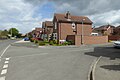
 Airey houses, Sutton upon Derwent - geograph.org.uk - 4636615.jpg 1 024 × 768 ; 211 kio
-
 Along High Lane - geograph.org.uk - 6333598.jpg 1 024 × 683 ; 420 kio
-
 Along Southwood Road - geograph.org.uk - 482405.jpg 478 × 640 ; 127 kio
-
 Alongside the Derwent - geograph.org.uk - 482400.jpg 640 × 478 ; 140 kio
-
 Approaching Hagg Bridge - geograph.org.uk - 5882125.jpg 1 024 × 576 ; 129 kio
-
 Barley and poppies - geograph.org.uk - 482409.jpg 640 × 478 ; 148 kio
-
 Behind the hedge, Newton upon Derwent - geograph.org.uk - 5738063.jpg 1 024 × 768 ; 197 kio
-
 Benchmark on a wooden post near Sutton Bridge - geograph.org.uk - 3931536.jpg 1 600 × 1 200 ; 660 kio
-
 Blackfoss Beck and utility building - geograph.org.uk - 6494357.jpg 1 024 × 768 ; 316 kio
-
 Blackfoss Beck from Sandhill Bridge - geograph.org.uk - 5717573.jpg 1 600 × 1 200 ; 1,24 Mio
-
 Blossom along Main Street - geograph.org.uk - 5362367.jpg 640 × 427 ; 238 kio
-
 Boats on River Derwent - geograph.org.uk - 722875.jpg 1 744 × 1 308 ; 1,12 Mio
-
 Boats on the Derwent at Elvington - geograph.org.uk - 1384488.jpg 640 × 480 ; 150 kio
-
 Boats on the River Derwent - geograph.org.uk - 6116922.jpg 2 048 × 1 536 ; 928 kio
-
 Bridleway to Sutton Wood - geograph.org.uk - 1386629.jpg 640 × 480 ; 131 kio
-
 Broomhill plantation - geograph.org.uk - 482406.jpg 478 × 640 ; 238 kio
-
 Cables over a ditch - geograph.org.uk - 1387112.jpg 640 × 480 ; 162 kio
-
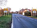
 Common Lane (B1228) towards Sutton upon Derwent - geograph.org.uk - 2359345.jpg 1 600 × 1 200 ; 372 kio
-
 Common Lane - geograph.org.uk - 2202092.jpg 640 × 480 ; 210 kio
-
 Cottages along High Lane - geograph.org.uk - 6333666.jpg 1 024 × 683 ; 445 kio
-
 Cricket Pitch - geograph.org.uk - 1386861.jpg 640 × 480 ; 98 kio
-
 Derwent and Elvington Ings - geograph.org.uk - 2202070.jpg 640 × 480 ; 171 kio
-
 Disused Watermill, Sutton upon Derwent - geograph.org.uk - 353965.jpg 640 × 480 ; 81 kio
-
 Downstream on the Derwent - geograph.org.uk - 482398.jpg 478 × 640 ; 123 kio
-
 Electricity pylon with labels - geograph.org.uk - 5710753.jpg 1 600 × 1 067 ; 239 kio
-
 Elvington Ings - geograph.org.uk - 2202072.jpg 640 × 480 ; 168 kio
-
 Entrance to Woodhouse Grange Business Centre - geograph.org.uk - 5717564.jpg 1 600 × 1 200 ; 955 kio
-
 Farm buildings, Grange Farm - geograph.org.uk - 2371642.jpg 1 600 × 1 200 ; 317 kio
-
 Farm on High Lane - geograph.org.uk - 1386636.jpg 640 × 480 ; 122 kio
-
 Farm track towards Sutton Wood - geograph.org.uk - 5717586.jpg 1 600 × 1 200 ; 721 kio
-
 Farmland near Low Farm - geograph.org.uk - 2371674.jpg 1 600 × 1 200 ; 287 kio
-
 Farmland off Sandhill Lane - geograph.org.uk - 2371652.jpg 1 600 × 1 200 ; 530 kio
-
 Farmland off Wynam Lane - geograph.org.uk - 2359356.jpg 1 600 × 1 200 ; 394 kio
-
 Field boundary at the end of Southwood Road - geograph.org.uk - 482408.jpg 640 × 478 ; 140 kio
-
 Field edge, Newton upon Derwent - geograph.org.uk - 5739480.jpg 1 024 × 768 ; 221 kio
-
 Field off Sandhill Lane - geograph.org.uk - 3564870.jpg 640 × 427 ; 99 kio
-
-
 Fir trees in Sutton Wood - geograph.org.uk - 6167356.jpg 1 024 × 768 ; 255 kio
-
 First run - geograph.org.uk - 4636619.jpg 1 024 × 768 ; 201 kio
-
 Flooded ings - geograph.org.uk - 6333596.jpg 1 024 × 683 ; 500 kio
-
 Floods at Sutton upon Derwent - geograph.org.uk - 3280061.jpg 1 024 × 768 ; 145 kio
-
 Floods January 2008 - geograph.org.uk - 722871.jpg 1 744 × 1 308 ; 1,11 Mio
-
 Footbridge at the entrance to Sutton Woods - geograph.org.uk - 3931523.jpg 1 600 × 1 200 ; 1 019 kio
-
 Footpath to Sandhill Lane - geograph.org.uk - 4636638.jpg 1 024 × 768 ; 246 kio
-
 Footpath to Sandhill Lane - geograph.org.uk - 5318360.jpg 1 024 × 768 ; 213 kio
-
 Fox Hill - geograph.org.uk - 4635751.jpg 1 024 × 768 ; 179 kio
-
 Hagg Bridge - geograph.org.uk - 2202099.jpg 640 × 480 ; 221 kio
-
 Hagg Bridge - geograph.org.uk - 3280043.jpg 1 024 × 768 ; 129 kio
-
 Hagg Bridge crosses The Beck - geograph.org.uk - 2202107.jpg 640 × 480 ; 253 kio
-
 Harvested field near Broomhill Plantation - geograph.org.uk - 4635741.jpg 1 024 × 768 ; 231 kio
-
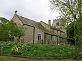
 Holly Tree Farm, Sutton Upon Derwent - geograph.org.uk - 3931720.jpg 1 600 × 1 200 ; 384 kio
-
 I need a boat to get to my boat - geograph.org.uk - 3280063.jpg 1 024 × 768 ; 131 kio
-
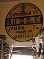
 Inside Sutton on Derwent Village Hall - geograph.org.uk - 215578.jpg 640 × 480 ; 134 kio
-
 Intake at the water treatment works near Elvington - geograph.org.uk - 3931515.jpg 1 600 × 1 200 ; 494 kio
-
 Jervis Court - geograph.org.uk - 5360762.jpg 640 × 427 ; 222 kio
-
 Junction of Sandhill Lane and High Lane - geograph.org.uk - 5717578.jpg 1 600 × 1 200 ; 458 kio
-
 Junction on the Sutton to Newton Road - geograph.org.uk - 1386631.jpg 640 × 480 ; 152 kio
-
 Main Road from Newton to Sutton on Derwent - geograph.org.uk - 46211.jpg 640 × 483 ; 101 kio
-
 Main Street - geograph.org.uk - 5360761.jpg 640 × 427 ; 218 kio
-
 Main Street, Sutton upon Derwent - geograph.org.uk - 2359350.jpg 1 600 × 1 200 ; 347 kio
-
 Minor road junction, Robin Hill - geograph.org.uk - 2371648.jpg 1 600 × 1 200 ; 353 kio
-
 Minor road towards Allerthorpe Common - geograph.org.uk - 2371666.jpg 1 600 × 1 200 ; 513 kio
-
 Near Sutton upon Derwent - geograph.org.uk - 109045.jpg 640 × 425 ; 59 kio
-
 Near Sutton upon Derwent - geograph.org.uk - 109047.jpg 640 × 425 ; 65 kio
-
 Near Sutton Wood - geograph.org.uk - 6116929.jpg 2 048 × 1 536 ; 950 kio
-
 New gate at Sutton Wood - geograph.org.uk - 3931521.jpg 1 600 × 1 200 ; 518 kio
-
 Northland Ings - geograph.org.uk - 6167350.jpg 1 024 × 768 ; 122 kio
-
 Old Circular AA sign, Sutton on Derwent (geograph 6094859).jpg 480 × 640 ; 294 kio
-
 Old petrol pump - geograph.org.uk - 482403.jpg 640 × 478 ; 153 kio
-
 Passing Grange Farm - geograph.org.uk - 6333668.jpg 1 024 × 683 ; 600 kio
-

-
-
 Pocklington Canal near Hagg Bridge - geograph.org.uk - 5414078.jpg 640 × 466 ; 440 kio
-
 Potato field, near Sutton upon Derwent - geograph.org.uk - 5413715.jpg 640 × 480 ; 614 kio
-
 Rape along The Street - geograph.org.uk - 1387110.jpg 640 × 480 ; 161 kio
-
 Ridged field - geograph.org.uk - 1386844.jpg 640 × 480 ; 132 kio
-
 Road junction near Sutton Upon Derwent - geograph.org.uk - 6494368.jpg 1 024 × 768 ; 144 kio
-
 Road junction, Newton upon Derwent - geograph.org.uk - 6494379.jpg 1 024 × 768 ; 115 kio
-
 Road through the village of Sutton on Derwent - geograph.org.uk - 215573.jpg 640 × 480 ; 146 kio
-
 Road to Sutton - geograph.org.uk - 1386634.jpg 640 × 480 ; 107 kio
-
 Road to Sutton Upon Derwent - geograph.org.uk - 1384563.jpg 640 × 480 ; 111 kio
-
 Roadside track - geograph.org.uk - 107811.jpg 640 × 480 ; 79 kio
-
 Sails Beck - geograph.org.uk - 1387116.jpg 640 × 480 ; 179 kio
-
 Sand Hill Lane - geograph.org.uk - 1386847.jpg 640 × 480 ; 112 kio
-
 Sheep and willow, Newton upon Derwent - geograph.org.uk - 5739474.jpg 1 024 × 768 ; 218 kio
-
 Shellwind Farm - geograph.org.uk - 2359343.jpg 1 600 × 1 037 ; 258 kio
-
 Southwood Road - geograph.org.uk - 482404.jpg 478 × 640 ; 128 kio
-
 Southwood Road, Sutton upon Derwent - geograph.org.uk - 2517977.jpg 800 × 600 ; 286 kio
-
 Southwood Road, Sutton Upon Derwent - geograph.org.uk - 3931735.jpg 1 600 × 1 200 ; 589 kio
-
 St Lois Farm - geograph.org.uk - 3928808.jpg 1 600 × 1 200 ; 418 kio
-
 St Lois Farm - geograph.org.uk - 6167363.jpg 1 024 × 768 ; 110 kio
-
 St Michael and All Angels, Sutton upon Derwent - geograph.org.uk - 5411925.jpg 640 × 640 ; 600 kio
-
 St Vincent Arms - geograph.org.uk - 482401.jpg 640 × 478 ; 115 kio
-
 St Vincent Arms, Sutton upon Derwent - geograph.org.uk - 2359358.jpg 1 600 × 1 200 ; 364 kio
-
 St Vincent Arms, Sutton upon Derwent - geograph.org.uk - 2517990.jpg 800 × 600 ; 231 kio
-
 Sutton Arms, Sutton upon Derwent - geograph.org.uk - 2517988.jpg 800 × 600 ; 280 kio
-
 Sutton on Derwent - geograph.org.uk - 46214.jpg 640 × 483 ; 112 kio
-
 Sutton on Derwent, postbox № YO41 196 - geograph.org.uk - 2739903.jpg 480 × 640 ; 105 kio
-
 Sutton Upon Derwent - geograph.org.uk - 5362365.jpg 640 × 427 ; 201 kio
-
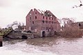 Sutton upon Derwent Mill - geograph.org.uk - 3739582.jpg 640 × 420 ; 50 kio
-
 Sutton upon Derwent Primary School - geograph.org.uk - 353956.jpg 640 × 480 ; 52 kio
-
 Sutton upon Derwent UK parish locator map.svg 1 425 × 1 107 ; 1,68 Mio
-
 Sutton upon Derwent, East Yorkshire, St Michael - geograph.org.uk - 5920484.jpg 4 608 × 3 456 ; 5,28 Mio
-
 The Beck - geograph.org.uk - 2202101.jpg 640 × 480 ; 218 kio
-
 The Beck - geograph.org.uk - 295072.jpg 640 × 480 ; 88 kio
-
 The Butts - geograph.org.uk - 1386625.jpg 640 × 480 ; 139 kio
-
 The Church of St Michael and All Angels, Sutton Upon Derwent - geograph.org.uk - 2359363.jpg 1 600 × 1 200 ; 631 kio
-
 The Dividing Line - geograph.org.uk - 722866.jpg 1 744 × 1 308 ; 1,08 Mio
-
 The river at Sutton on Derwent - geograph.org.uk - 3543593.jpg 3 240 × 4 320 ; 1,76 Mio
-
 The River Derwent at Elvington - geograph.org.uk - 107809.jpg 640 × 480 ; 53 kio
-
 The River Derwent at Elvington - geograph.org.uk - 108165.jpg 640 × 480 ; 84 kio
-
 The road into Sutton-upon-Derwent - geograph.org.uk - 295079.jpg 640 × 480 ; 87 kio
-
 The St Vincent Arms, Sutton upon Derwent - geograph.org.uk - 353953.jpg 640 × 480 ; 79 kio
-
 The Sutton Arms Sutton upon Derwent.jpg 640 × 478 ; 119 kio
-
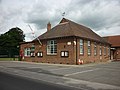 The Village Hall, Sutton upon Derwent - geograph.org.uk - 2518023.jpg 800 × 600 ; 246 kio
-
 Towards Sutton - geograph.org.uk - 2202082.jpg 640 × 480 ; 228 kio
-
 Towards the old course of the Derwent - geograph.org.uk - 482407.jpg 640 × 478 ; 133 kio
-
 Track near Sutton upon Derwent - geograph.org.uk - 5413733.jpg 549 × 640 ; 484 kio
-
 Track next to Blackfoss Beck - geograph.org.uk - 1386852.jpg 640 × 480 ; 142 kio
-
 Track to Hundred Oaks - geograph.org.uk - 2371638.jpg 1 600 × 1 200 ; 470 kio
-
 Track to Penrose farm - geograph.org.uk - 2371633.jpg 1 600 × 1 200 ; 507 kio
-
 Track to Sutton Wood - geograph.org.uk - 5738061.jpg 1 024 × 768 ; 205 kio
-
 Track to the fishing lakes at Hundred Oaks - geograph.org.uk - 5717592.jpg 1 600 × 1 200 ; 549 kio
-
 Track to Woodhouse Grange - geograph.org.uk - 2371669.jpg 1 600 × 1 200 ; 717 kio
-
 Turf fields near High Lane - geograph.org.uk - 6447878.jpg 1 024 × 683 ; 393 kio
-
 Upstream from Sutton Bridge - geograph.org.uk - 482399.jpg 640 × 478 ; 121 kio
-
 View near Low Farm - geograph.org.uk - 4636807.jpg 1 024 × 768 ; 215 kio
-
 View towards Woodhouse Farm - geograph.org.uk - 4636703.jpg 1 024 × 768 ; 202 kio
-
 Waterlogged field of oilseed rape - geograph.org.uk - 5739485.jpg 1 024 × 768 ; 161 kio
-
 Wet field of autumn sown cereal, Newton upon Derwent - geograph.org.uk - 5739491.jpg 1 024 × 699 ; 129 kio
-
 Wetland at Sutton upon Derwent - geograph.org.uk - 353990.jpg 640 × 480 ; 97 kio
-
 Wheatfield near Sutton upon Derwent - geograph.org.uk - 5318361.jpg 1 024 × 768 ; 244 kio
-
 Wheelwright Close, Sutton Upon Derwent - geograph.org.uk - 6236441.jpg 1 024 × 768 ; 115 kio
-
 Wilberforce Way - geograph.org.uk - 6519285.jpg 1 024 × 563 ; 104 kio
-
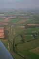
 Wind turbines at Wynham Bottoms, aerial 2018 - geograph.org.uk - 5768149.jpg 1 024 × 683 ; 89 kio
-
 Woodhouse Grange - geograph.org.uk - 1387105.jpg 640 × 480 ; 185 kio
-
 Woodhouse Grange business centre - geograph.org.uk - 6494361.jpg 1 024 × 768 ; 266 kio
-
 Woodhouse Grange Cricket Club on Sandhill Lane - geograph.org.uk - 2518035.jpg 800 × 600 ; 170 kio
-
 Wynam Lane - geograph.org.uk - 2359355.jpg 1 600 × 1 200 ; 442 kio
-
 Wynam Lane - geograph.org.uk - 5318357.jpg 1 024 × 768 ; 172 kio
-
 Wynam Lane, Sutton upon Derwent - geograph.org.uk - 2359348.jpg 1 600 × 1 200 ; 345 kio
-
 Wyneham Lane near Carlton Road - geograph.org.uk - 6519344.jpg 1 024 × 542 ; 155 kio
-
 Yorkshire Water building beside Blackfoss Beck - geograph.org.uk - 2371660.jpg 1 600 × 1 200 ; 805 kio


_towards_Sutton_upon_Derwent_-_geograph.org.uk_-_2359345.jpg)


.jpg)


_-_geograph.org.uk_-_5768152.jpg)


