Category:Swalcliffe
Vai alla navigazione
Vai alla ricerca
village and civil parish in Cherwell district, Oxfordshire, England  | |||||
| Carica un file multimediale | |||||
| Istanza di | |||||
|---|---|---|---|---|---|
| Luogo | Cherwell, Oxfordshire, Sud Est dell'Inghilterra, Inghilterra | ||||
| Popolazione |
| ||||
| Superficie |
| ||||
| sito web ufficiale | |||||
 | |||||
Sottocategorie
Questa categoria contiene le 2 sottocategorie indicate di seguito, su un totale di 2.
T
- Swalcliffe Tithe Barn (3 F)
File nella categoria "Swalcliffe"
Questa categoria contiene 135 file, indicati di seguito, su un totale di 135.
-
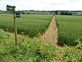
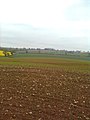
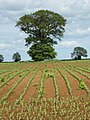
 A field of maize - geograph.org.uk - 5429114.jpg 1 024 × 768; 351 KB
-
 A growing maize crop - geograph.org.uk - 5423298.jpg 1 024 × 768; 276 KB
-
 Along the Roman road, at dusk - geograph.org.uk - 2627124.jpg 1 200 × 1 600; 481 KB
-
 Arable land near Tadmarton - geograph.org.uk - 3040719.jpg 1 024 × 680; 190 KB
-
 B4035 passes Swalcliffe Barn - geograph.org.uk - 3995487.jpg 3 648 × 2 736; 1,77 MB
-
 B4035 passes the Stag's Head - geograph.org.uk - 3995500.jpg 3 648 × 2 736; 2,34 MB
-
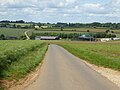
 B4035 south of Swalcliffe Mill - geograph.org.uk - 3995510.jpg 3 536 × 2 574; 2,02 MB
-
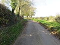
 Bakers Lane - geograph.org.uk - 1691894.jpg 1 024 × 683; 265 KB
-
 Bikes this way^ - geograph.org.uk - 389109.jpg 640 × 481; 53 KB
-
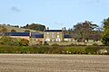
 Brakelands Farm near Swalcliffe - geograph.org.uk - 6290818.jpg 800 × 537; 89 KB
-
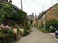
 Brick Row, Swalcliffe - geograph.org.uk - 6290821.jpg 800 × 600; 142 KB
-
 Course of a Roman Road - geograph.org.uk - 3040699.jpg 1 024 × 680; 247 KB
-
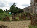
 Cross in Swalcliffe churchyard - geograph.org.uk - 3042310.jpg 1 024 × 680; 215 KB
-
 Entrance to Swalcliffe Park School - geograph.org.uk - 6290823.jpg 800 × 513; 149 KB
-
 Farm - geograph.org.uk - 389061.jpg 640 × 481; 53 KB
-
 Farmland - geograph.org.uk - 389120.jpg 640 × 481; 64 KB
-
 Farmland - geograph.org.uk - 389123.jpg 640 × 481; 55 KB
-
 Field boundary west of Tadmarton - geograph.org.uk - 1864675.jpg 640 × 480; 94 KB
-
 Footpath near Swalcliffe Grange - geograph.org.uk - 5429108.jpg 1 024 × 768; 327 KB
-
 George V postbox, Swalcliffe - geograph.org.uk - 6292070.jpg 3 888 × 5 184; 5,87 MB
-
 Grange Lane at Grange Farm - geograph.org.uk - 5596581.jpg 4 000 × 3 000; 3,59 MB
-
 Grange Lane at Grange Farm - geograph.org.uk - 5596582.jpg 4 000 × 3 000; 2,96 MB
-
 Gren Lane - geograph.org.uk - 6291270.jpg 800 × 580; 200 KB
-
 Headland track - geograph.org.uk - 5429101.jpg 1 024 × 768; 240 KB
-
 House in Swalcliffe - geograph.org.uk - 6291230.jpg 800 × 600; 88 KB
-
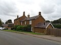 Houses on B4035, Swalcliffe - geograph.org.uk - 6291234.jpg 800 × 600; 78 KB
-
-

-

-

-

-

-
-

-
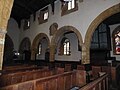
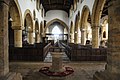 Interior of Swalcliffe church - geograph.org.uk - 3042315.jpg 1 024 × 680; 158 KB
-
 Looking into the Stour valley from Council Hill - geograph.org.uk - 2967085.jpg 1 600 × 1 200; 418 KB
-
 Madmarston Hill - geograph.org.uk - 5193175.jpg 640 × 480; 143 KB
-
 Madmarston Hill and hill fort - geograph.org.uk - 3040693.jpg 1 024 × 680; 216 KB
-
 Madmarston Hill and Jester's Hill, from the Roman road - geograph.org.uk - 2868793.jpg 1 600 × 1 200; 541 KB
-
 Madmarston Hill from the Roman road - geograph.org.uk - 2627117.jpg 1 600 × 1 200; 497 KB
-
 Near Stour Well - geograph.org.uk - 2969466.jpg 1 200 × 1 600; 507 KB
-
 Remains of wall paintings, Swalcliffe church - geograph.org.uk - 3042918.jpg 1 024 × 680; 114 KB
-
 Remains of walling paintings, Swalcliffe church - geograph.org.uk - 3042913.jpg 680 × 1 024; 115 KB
-
 Road approaching Stourwell Barn - geograph.org.uk - 5423304.jpg 1 024 × 768; 210 KB
-
 Road approaching Swalcliffe Grange - geograph.org.uk - 5429119.jpg 1 024 × 768; 248 KB
-
 Road from Grange Farm to Highways Farm - geograph.org.uk - 5596591.jpg 4 000 × 3 000; 4,03 MB
-
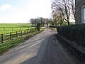
 Road near Swalcliffe Lea - geograph.org.uk - 3040723.jpg 1 024 × 680; 183 KB
-
 Road to Swalcliffe Lea - geograph.org.uk - 389053.jpg 640 × 481; 75 KB
-
 Round Hill from the Roman road - geograph.org.uk - 2627122.jpg 1 600 × 1 200; 548 KB
-
 Shutford Road - geograph.org.uk - 5193325.jpg 640 × 480; 158 KB
-
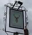 Sign for the Stag's Head, Swalcliffe - geograph.org.uk - 6291246.jpg 744 × 800; 77 KB
-
 Solitary tree in a field at Swalcliffe, Oxfordshire.jpg 640 × 480; 97 KB
-
 SS Peter ^ Paul Church, Swalcliffe - geograph.org.uk - 6291239.jpg 800 × 600; 98 KB
-
 SS Peter ^ Paul Church, Swalcliffe - geograph.org.uk - 6291242.jpg 800 × 600; 96 KB
-
 SS Peter ^ Paul, Swalcliffe, altar - geograph.org.uk - 5628824.jpg 480 × 640; 90 KB
-
 SS Peter ^ Paul, Swalcliffe, banner - geograph.org.uk - 5628804.jpg 480 × 640; 54 KB
-

-

-

-
 SS Peter ^ Paul, Swalcliffe, font - geograph.org.uk - 5628803.jpg 640 × 480; 62 KB
-

-

-

-
-

-

-

-
-
-
-
-

-
 SS Peter ^ Paul, Swalcliffe, nave - geograph.org.uk - 5628822.jpg 640 × 480; 54 KB
-
 SS Peter ^ Paul, Swalcliffe, organ - geograph.org.uk - 5628810.jpg 480 × 640; 54 KB
-
 SS Peter ^ Paul, Swalcliffe, path - geograph.org.uk - 5628172.jpg 480 × 640; 47 KB
-
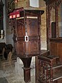 SS Peter ^ Paul, Swalcliffe, pulpit - geograph.org.uk - 5628812.jpg 480 × 640; 70 KB
-

-
-

-

-

-
-

-
-

-
-

-
-
-
-
-

-

-
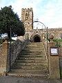 SS Peter ^ Paul, Swalcliffe, steps - geograph.org.uk - 5628169.jpg 480 × 640; 81 KB
-
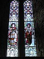
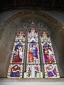
 Stained glass window, Swalcliffe church - geograph.org.uk - 3042321.jpg 680 × 1 024; 279 KB
-
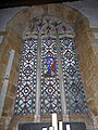
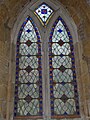
 Stained glass window, Swalcliffe church - geograph.org.uk - 3042325.jpg 680 × 1 024; 246 KB
-
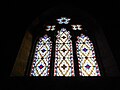
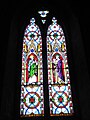
 Stained glass window, Swalcliffe church - geograph.org.uk - 3042327.jpg 680 × 1 024; 259 KB
-
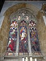
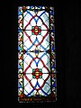
 Stained glass window, Swalcliffe church - geograph.org.uk - 3042330.jpg 680 × 1 024; 256 KB
-
 Stained glass window, Swalcliffe church - geograph.org.uk - 3042925.jpg 680 × 1 024; 214 KB
-
 Start of a Bridleway that goes to Swalcliffe - geograph.org.uk - 5596598.jpg 4 000 × 3 000; 3,99 MB
-
 Stourwell Barn - geograph.org.uk - 5429134.jpg 1 024 × 768; 262 KB
-
-
 Swalcliffe Barn - geograph.org.uk - 3052797.jpg 1 024 × 680; 241 KB
-
 Swalcliffe Barn - geograph.org.uk - 3052803.jpg 1 024 × 680; 286 KB
-
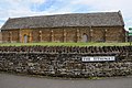
 Swalcliffe Barn Museum - geograph.org.uk - 6290825.jpg 800 × 600; 89 KB
-
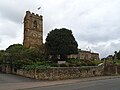
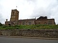
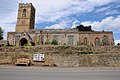
 Swalcliffe church - geograph.org.uk - 3038223.jpg 1 024 × 680; 230 KB
-
 Swalcliffe church - geograph.org.uk - 3042305.jpg 1 024 × 680; 210 KB
-

-
 Swalcliffe, Bakers Lane - geograph.org.uk - 1953336.jpg 1 024 × 768; 243 KB
-
 Swalcliffe, church tower - geograph.org.uk - 1953347.jpg 768 × 1 024; 153 KB
-
 Swalcliffe, Portaloo - geograph.org.uk - 1953367.jpg 1 024 × 768; 225 KB
-
 Swalcliffe, village tap - geograph.org.uk - 1953379.jpg 1 024 × 768; 189 KB
-
 Swalcliffe-Brick Row - geograph.org.uk - 5719589.jpg 1 600 × 1 200; 677 KB
-
 The nave of Swalcliffe church - geograph.org.uk - 3042318.jpg 680 × 1 024; 149 KB
-
 The Old Post Office, Swalcliffe - geograph.org.uk - 6291248.jpg 800 × 600; 104 KB
-
 The Old Post Office, Swalcliffe - geograph.org.uk - 6292071.jpg 5 184 × 3 888; 3,61 MB
-
 The path from Lodge Farm to the Stour valley - geograph.org.uk - 2969448.jpg 1 600 × 1 200; 454 KB
-
 The Stag Inn, Swalcliffe - geograph.org.uk - 3038228.jpg 1 024 × 680; 226 KB
-
 The Stag's Head, Swalcliffe - geograph.org.uk - 6291244.jpg 800 × 600; 113 KB
-
 The Stour, more a bridge than a ford 1 - geograph.org.uk - 2969571.jpg 1 200 × 1 600; 730 KB
-
 Track down to the Stour - geograph.org.uk - 2969564.jpg 1 200 × 1 600; 714 KB
-
 Tree in a maize field - geograph.org.uk - 5423276.jpg 768 × 1 024; 288 KB
-
 Upper Lea Farm - geograph.org.uk - 5193163.jpg 640 × 428; 146 KB
-
 View from the Stour Well road - geograph.org.uk - 2969559.jpg 1 600 × 1 200; 387 KB
-
 Austin Grounds Farm - geograph.org.uk - 389184.jpg 640 × 481; 70 KB
-
 Bridleway - geograph.org.uk - 389075.jpg 640 × 481; 68 KB
-
 Bridleway - geograph.org.uk - 389185.jpg 640 × 481; 81 KB
-
 Crossroads - geograph.org.uk - 390010.jpg 639 × 443; 55 KB
-
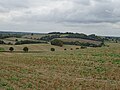
 Fields - geograph.org.uk - 389214.jpg 640 × 481; 86 KB
-
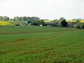 Grange Farm - geograph.org.uk - 408012.jpg 640 × 480; 100 KB
-
 Looking between bridleway and brook - geograph.org.uk - 407462.jpg 640 × 480; 117 KB
-
 Narrow road - geograph.org.uk - 390007.jpg 640 × 444; 36 KB
-
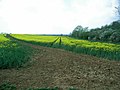
 Rape - geograph.org.uk - 408364.jpg 640 × 480; 120 KB
-
 Shutford western boundary - geograph.org.uk - 409510.jpg 640 × 480; 198 KB
-
 Village end - geograph.org.uk - 389058.jpg 640 × 481; 61 KB


_-_geograph.org.uk_-_5628793.jpg)
_-_geograph.org.uk_-_5628794.jpg)
_-_geograph.org.uk_-_5628795.jpg)
_-_geograph.org.uk_-_5628796.jpg)
_-_geograph.org.uk_-_5628797.jpg)
_-_geograph.org.uk_-_5628799.jpg)
_-_geograph.org.uk_-_5628800.jpg)
_-_geograph.org.uk_-_5628801.jpg)


_-_geograph.org.uk_-_5628802.jpg)
_-_geograph.org.uk_-_5628805.jpg)
_-_geograph.org.uk_-_5628807.jpg)
_-_geograph.org.uk_-_5628808.jpg)
_-_geograph.org.uk_-_5628811.jpg)
_-_geograph.org.uk_-_5628813.jpg)
_-_geograph.org.uk_-_5628815.jpg)
_-_geograph.org.uk_-_5628816.jpg)
_-_geograph.org.uk_-_5628818.jpg)
_-_geograph.org.uk_-_5628819.jpg)
_-_geograph.org.uk_-_5628820.jpg)
_-_geograph.org.uk_-_5628821.jpg)


_-_geograph.org.uk_-_5633006.jpg)
_-_geograph.org.uk_-_5633007.jpg)
_-_geograph.org.uk_-_5633009.jpg)
_-_geograph.org.uk_-_5633010.jpg)
_-_geograph.org.uk_-_5633011.jpg)
_-_geograph.org.uk_-_5633012.jpg)
_-_geograph.org.uk_-_5633013.jpg)
_-_geograph.org.uk_-_5633014.jpg)
_-_geograph.org.uk_-_5633015.jpg)
_-_geograph.org.uk_-_5633016.jpg)
_-_geograph.org.uk_-_5633017.jpg)
_-_geograph.org.uk_-_5633018.jpg)
_-_geograph.org.uk_-_5633020.jpg)
_-_geograph.org.uk_-_5633021.jpg)
_-_geograph.org.uk_-_5633022.jpg)
_-_geograph.org.uk_-_5633023.jpg)
_-_geograph.org.uk_-_5633024.jpg)


