Category:Swanwick, Derbyshire
Aller à la navigation
Aller à la recherche

village britannique  | |||||
| Téléverser des médias | |||||
| Nature de l’élément | |||||
|---|---|---|---|---|---|
| Lieu | Amber Valley, Derbyshire, Midlands de l'Est, Angleterre | ||||
 | |||||
Sous-catégories
Cette catégorie comprend 5 sous-catégories, dont les 5 ci-dessous.
A
- St Andrew's Church, Swanwick (4 F)
S
- SAT Congress 1966 (1 F)
- Swanwick Hall School (3 F)
Média dans la catégorie « Swanwick, Derbyshire »
Cette catégorie comprend 159 fichiers, dont les 159 ci-dessous.
-
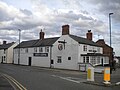
 "The Boot ^ Slipper", Swanwick - geograph.org.uk - 6201430.jpg 5 000 × 3 607 ; 3,36 Mio
-
 A Lake at The Hayes Conference Centre - geograph.org.uk - 4560572.jpg 2 592 × 1 944 ; 1,31 Mio
-
 A story of development, B6016, Swanwick - geograph.org.uk - 6086537.jpg 1 600 × 1 200 ; 865 kio
-
 A38 approaching junction with A61 - geograph.org.uk - 4045997.jpg 2 814 × 1 874 ; 2,72 Mio
-
 A38 at Watchorn Roundabout - geograph.org.uk - 5137346.jpg 640 × 480 ; 36 kio
-
 A38 Service station near Alfreton - geograph.org.uk - 1833864.jpg 640 × 480 ; 48 kio
-
 A38 towards the M1 motorway - geograph.org.uk - 1833870.jpg 640 × 480 ; 48 kio
-
 A38 turning south - geograph.org.uk - 4045998.jpg 1 600 × 1 065 ; 230 kio
-
 Alfreton Services - geograph.org.uk - 5995760.jpg 1 024 × 683 ; 257 kio
-
 B6016 east of Swanwick with bus shelters each side - geograph.org.uk - 6086503.jpg 1 600 × 1 200 ; 663 kio
-
 B6179 just north of Swanwick - geograph.org.uk - 4324158.jpg 640 × 419 ; 58 kio
-
 Blenheim Avenue, Sleet Moor - geograph.org.uk - 6201434.jpg 5 036 × 3 572 ; 3,39 Mio
-
 Broadway, Swanwick - geograph.org.uk - 1832849.jpg 640 × 480 ; 89 kio
-
 Broadway, Swanwick - geograph.org.uk - 6086505.jpg 1 600 × 1 200 ; 854 kio
-
 Building work at Hilltop Mink Farm - geograph.org.uk - 6086549.jpg 1 600 × 1 200 ; 1 007 kio
-
 Bungalows and Swanwick church - geograph.org.uk - 6086511.jpg 1 600 × 1 200 ; 847 kio
-
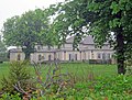 Butterley Grange - geograph.org.uk - 3394656.jpg 3 478 × 2 629 ; 2,94 Mio
-
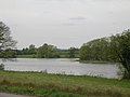 Butterley Reservoir - geograph.org.uk - 1832886.jpg 640 × 480 ; 51 kio
-
 Butterley Reservoir - geograph.org.uk - 4944934.jpg 3 072 × 1 728 ; 2,42 Mio
-
 Butterley reservoir midland train near Ripley 2.jpg 3 264 × 2 448 ; 3,27 Mio
-
 Butterley reservoir midland train near Ripley 3.jpg 3 264 × 2 448 ; 2,47 Mio
-
 Butterley reservoir near Ripley swans.jpg 3 264 × 2 448 ; 2,71 Mio
-
 Car park at The Hayes Conference Centre - geograph.org.uk - 6085527.jpg 1 600 × 1 200 ; 922 kio
-
 Centenary Tree at The Hayes Conference Centre - geograph.org.uk - 4560558.jpg 2 592 × 1 944 ; 1,32 Mio
-
 Charge Bank, Butterley Works - geograph.org.uk - 319247.jpg 640 × 446 ; 101 kio
-
 Children's outdoor play area, The Hayes Conference Centre - geograph.org.uk - 6085521.jpg 1 600 × 1 200 ; 1,04 Mio
-
 Church of St Andrew in Swanwick - geograph.org.uk - 4394387.jpg 4 000 × 3 000 ; 2,24 Mio
-
 Commemorative Garden at The Hayes Conference Centre - geograph.org.uk - 4560567.jpg 2 592 × 1 944 ; 1,27 Mio
-
 Cross Keys on Derby Road - geograph.org.uk - 4333783.jpg 1 600 × 1 117 ; 573 kio
-
 Crossroads and inn car park, Swanwick - geograph.org.uk - 6086518.jpg 1 600 × 1 200 ; 725 kio
-
 Delves Bank Road, Swanwick - geograph.org.uk - 1832861.jpg 640 × 480 ; 61 kio
-
 Delves Bank Road, Swanwick - geograph.org.uk - 6086501.jpg 1 600 × 1 200 ; 728 kio
-
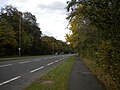
 Derby Road approaching Sleetmoor Lane - geograph.org.uk - 4324003.jpg 640 × 474 ; 58 kio
-
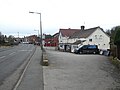
 Derby Road north of Swanwick (1) - geograph.org.uk - 5978110.jpg 1 024 × 768 ; 202 kio
-
 Derby Road north of Swanwick (2) - geograph.org.uk - 5978116.jpg 1 024 × 768 ; 112 kio
-
 Derby Road towards Alfreton - geograph.org.uk - 4333788.jpg 1 600 × 1 111 ; 502 kio
-
 Derby Road, Swanwick - geograph.org.uk - 5978122.jpg 1 024 × 768 ; 153 kio
-
 Derbyshire UK parish map highlighting Swanwick.svg 888 × 1 308 ; 2,34 Mio
-
 Derelict brick kiln - geograph.org.uk - 2672399.jpg 1 280 × 853 ; 465 kio
-
 Entering Swanwick - geograph.org.uk - 1480181.jpg 640 × 480 ; 229 kio
-
 Entering Swanwick from the south - geograph.org.uk - 4324156.jpg 640 × 432 ; 64 kio
-
 Entering Swanwick from the west - geograph.org.uk - 6201428.jpg 5 013 × 3 759 ; 3,41 Mio
-
 Entrance to Hayes Conference Centre - geograph.org.uk - 4394372.jpg 4 000 × 3 000 ; 2,66 Mio
-
 Entrance to the Butterley Company - geograph.org.uk - 319241.jpg 640 × 454 ; 90 kio
-

-
 Farmland near Swanwick - geograph.org.uk - 4394287.jpg 4 000 × 3 000 ; 1,89 Mio
-
 Farmland near the Hayes - geograph.org.uk - 1832873.jpg 640 × 480 ; 61 kio
-
 Farmland north of Swanwick Junction station - geograph.org.uk - 4236450.jpg 1 024 × 615 ; 102 kio
-
 Farmland north of the railway at Swanwick Junction - geograph.org.uk - 4236291.jpg 1 024 × 768 ; 171 kio
-
 Farmland south-east of Butterley Grange - geograph.org.uk - 4236587.jpg 1 024 × 768 ; 142 kio
-
 Field south of Swanwick and houses - geograph.org.uk - 6086547.jpg 1 600 × 879 ; 591 kio
-
 Fingerpost and airstrip near Butterley Grange - geograph.org.uk - 3394847.jpg 2 226 × 2 971 ; 2,06 Mio
-
 Fishing Peg ^23 - geograph.org.uk - 4989477.jpg 800 × 600 ; 168 kio
-
 Floral display at Swanwick - geograph.org.uk - 1480167.jpg 640 × 480 ; 248 kio
-
 Flower bed with coat of arms, Swanwick Junction - geograph.org.uk - 4236575.jpg 1 024 × 768 ; 166 kio
-
 Footbridge over polluted stream, west of Alfreton - geograph.org.uk - 2694121.jpg 3 648 × 2 736 ; 6,01 Mio
-
 Footpath by B6016, Swanwick - geograph.org.uk - 2117744.jpg 640 × 480 ; 67 kio
-
 Footpath from Swanwick Junction to Butterley - geograph.org.uk - 4236585.jpg 1 024 × 768 ; 277 kio
-
 Footpath gate, Swanwick - geograph.org.uk - 2117767.jpg 480 × 640 ; 114 kio
-
 Footpath to Hilltop Mink Farm - geograph.org.uk - 3407536.jpg 3 648 × 2 736 ; 3,35 Mio
-
 Gateway and old wall, Hilltop Mink Farm - geograph.org.uk - 6086550.jpg 1 600 × 1 200 ; 1,06 Mio
-
 Golden Jubilee Memorial, Swanwick - geograph.org.uk - 2972262.jpg 1 024 × 768 ; 217 kio
-
 Golden Jubilee monument, Swanwick - geograph.org.uk - 6086515.jpg 1 600 × 1 200 ; 939 kio
-
 Grange Farm - geograph.org.uk - 3395766.jpg 3 648 × 2 736 ; 3,55 Mio
-
 Grounds of The Hayes Conference Centre - geograph.org.uk - 6085523.jpg 1 600 × 1 200 ; 1 015 kio
-
 Hayes Conference Centre - cropped 235855.jpg 531 × 401 ; 50 kio
-
 Hedged field boundaries, north of Hermitage Farm - geograph.org.uk - 4236455.jpg 1 024 × 614 ; 119 kio
-
 Hickton Road, Swanwick - geograph.org.uk - 1832874.jpg 640 × 480 ; 51 kio
-
 Hickton Road, Swanwick - geograph.org.uk - 6086491.jpg 1 600 × 1 200 ; 750 kio
-
 Hilltop Farm - geograph.org.uk - 2117759.jpg 640 × 480 ; 51 kio
-
 Hilltop Mink Farm - geograph.org.uk - 3407245.jpg 3 648 × 2 736 ; 3,31 Mio
-
 Joinery workshop - geograph.org.uk - 2117812.jpg 640 × 480 ; 63 kio
-
 Lakeside at The Hayes Conference Centre - geograph.org.uk - 4790947.jpg 2 592 × 1 944 ; 1,38 Mio
-
 Lane and view of Swanwick - geograph.org.uk - 6086552.jpg 1 600 × 1 200 ; 1 002 kio
-

-
 Large meadow at Grange Farm - geograph.org.uk - 3395779.jpg 3 648 × 2 736 ; 2,93 Mio
-
 Little and large sheds, north of the railway - geograph.org.uk - 4236294.jpg 1 024 × 768 ; 137 kio
-
 Little Chef near Alfreton - geograph.org.uk - 2650525.jpg 3 296 × 2 472 ; 1,06 Mio
-
 Lodge and entrance to The Hayes Conference Centre - geograph.org.uk - 6086545.jpg 1 200 × 1 600 ; 1 008 kio
-
 Meadows near the Hayes Conference Centre - geograph.org.uk - 3399021.jpg 3 648 × 2 736 ; 2,75 Mio
-
 Old valve signs at the crossroads, Swanwick - geograph.org.uk - 6086528.jpg 1 600 × 1 200 ; 1,02 Mio
-
 On Derby Road, through Swanwick - geograph.org.uk - 2117776.jpg 640 × 480 ; 48 kio
-
 Orchard Crescent, Swanwick - geograph.org.uk - 5978142.jpg 1 024 × 768 ; 126 kio
-
 Over a stile towards the Derby Road - geograph.org.uk - 2117732.jpg 640 × 480 ; 93 kio
-
 Part of Broadway, Swanwick - geograph.org.uk - 6086508.jpg 1 600 × 1 200 ; 933 kio
-
 Pentrich Road Garage, Swanwick - geograph.org.uk - 5978150.jpg 1 024 × 768 ; 112 kio
-
 Pentrich Road, Swanwick - geograph.org.uk - 5978158.jpg 1 024 × 768 ; 147 kio
-
 Plaque at the Tree of Life at The Hayes Conference Centre - geograph.org.uk - 4777288.jpg 2 592 × 1 944 ; 1,27 Mio
-
 Playing fields, Sleetmoor - geograph.org.uk - 2117796.jpg 640 × 480 ; 65 kio
-
 Pollution in stream - geograph.org.uk - 2694251.jpg 3 648 × 2 736 ; 3,75 Mio
-
 Princess Elizabeth being prepared for service - geograph.org.uk - 6157659.jpg 5 001 × 3 334 ; 5,06 Mio
-

-
 Railway Bridge - geograph.org.uk - 916630.jpg 640 × 480 ; 113 kio
-
 Ripley International Airfield (. . . apparently . . .) - geograph.org.uk - 2554472.jpg 2 048 × 1 536 ; 656 kio
-
 Rockery and grounds of The Hayes Conference Centre - geograph.org.uk - 6086485.jpg 1 600 × 1 200 ; 1,08 Mio
-
 Roundabout on the B6179 near A38 services - geograph.org.uk - 1833866.jpg 640 × 480 ; 77 kio
-
 Ruinous farm building south of Swanwick - geograph.org.uk - 6086551.jpg 1 600 × 1 200 ; 1,08 Mio
-
 School outbuildings, Swanwick. - geograph.org.uk - 1168240.jpg 640 × 480 ; 62 kio
-
 Services Entrance - geograph.org.uk - 3670360.jpg 800 × 600 ; 135 kio
-
 Services Fire Station - geograph.org.uk - 3670379.jpg 800 × 600 ; 119 kio
-
 Services Petrol - geograph.org.uk - 3670394.jpg 800 × 600 ; 105 kio
-
 Signals on the line from Butterley - geograph.org.uk - 4236578.jpg 1 024 × 768 ; 163 kio
-
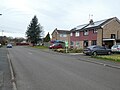
 Six houses, the same, but subtly different - geograph.org.uk - 6086498.jpg 1 600 × 1 200 ; 860 kio
-
 Sleetmoor House - geograph.org.uk - 6201433.jpg 5 067 × 3 801 ; 3,79 Mio
-
 Sleetmoor Lane - geograph.org.uk - 1480159.jpg 640 × 480 ; 243 kio
-
 Sleetmoor Road junction - geograph.org.uk - 4324150.jpg 640 × 461 ; 60 kio
-
 St Andrew's church, Swanwick - geograph.org.uk - 6086520.jpg 1 600 × 1 200 ; 810 kio
-
 St Andrew's, Swanwick - geograph.org.uk - 4333766.jpg 1 600 × 1 062 ; 612 kio
-
 Suburban housing on the B6016 - geograph.org.uk - 1168250.jpg 640 × 480 ; 69 kio
-
 Swanwick - Baptist Church - geograph.org.uk - 1124694.jpg 640 × 480 ; 69 kio
-

-

-
 Swanwick - old school - geograph.org.uk - 1124689.jpg 640 × 480 ; 58 kio
-
 Swanwick - Primitive Methodist Church - geograph.org.uk - 1124702.jpg 640 × 480 ; 73 kio
-
 Swanwick Baptist Church - geograph.org.uk - 2117788.jpg 640 × 480 ; 80 kio
-
 Swanwick Declaration Plaque at The Hayes Conference Centre - geograph.org.uk - 4782804.jpg 2 592 × 1 944 ; 1,33 Mio
-
 Swanwick Hall (road), Swanwick - geograph.org.uk - 4333768.jpg 1 600 × 1 062 ; 497 kio
-
 Swanwick Hall School, Creative Arts Annex - geograph.org.uk - 2972939.jpg 1 024 × 768 ; 98 kio
-
 Swanwick Hall.jpg 2 592 × 1 944 ; 1,85 Mio
-
 Swanwick Methodist Church, Derbyshire - geograph.org.uk - 4798328.jpg 2 592 × 1 944 ; 1,4 Mio
-
 Swanwick Parish Jubilee Memorial - geograph.org.uk - 2436851.jpg 1 024 × 768 ; 404 kio
-
 Swanwick School - geograph.org.uk - 6086542.jpg 1 600 × 1 200 ; 655 kio
-
 Swanwick School Sports College - geograph.org.uk - 6086544.jpg 1 600 × 1 200 ; 903 kio
-
 Swanwick to Butterley railway path - geograph.org.uk - 5504920.jpg 4 608 × 3 456 ; 5,22 Mio
-
 Swanwick to Butterley railway path - geograph.org.uk - 5504927.jpg 4 455 × 3 341 ; 4,68 Mio
-
 Swanwick to Butterley railway path - geograph.org.uk - 5504934.jpg 4 427 × 3 319 ; 3,43 Mio
-
 Swanwick, St Andrew - geograph.org.uk - 6360804.jpg 3 000 × 4 000 ; 4,15 Mio
-
 The back of The Hayes Conference Centre - geograph.org.uk - 4790933.jpg 2 592 × 1 944 ; 1,36 Mio
-
 The Boot ^ Slipper, Swanwick - geograph.org.uk - 5978135.jpg 1 024 × 768 ; 127 kio
-
 The builders are in ... - geograph.org.uk - 1168222.jpg 640 × 480 ; 105 kio
-
 The Cross Keys, Swanwick - geograph.org.uk - 5978128.jpg 1 024 × 768 ; 111 kio
-
 The Delves (B6016) Swanwick - geograph.org.uk - 1832860.jpg 640 × 480 ; 59 kio
-
 The Delves Farm - geograph.org.uk - 2972272.jpg 1 024 × 768 ; 159 kio
-
 The Delves in Swanwick - geograph.org.uk - 4394310.jpg 3 627 × 2 592 ; 1,96 Mio
-
 The eastern end of a grass air strip - geograph.org.uk - 4236457.jpg 1 024 × 768 ; 126 kio
-
 The entrance to the Alfreton Services on the A38 - geograph.org.uk - 5717407.jpg 2 000 × 1 500 ; 918 kio
-
 The front of The Hayes Conference Centre - geograph.org.uk - 4790926.jpg 2 592 × 1 944 ; 1,37 Mio
-
 The Gate inn, The Delves (B6016), Swanwick - geograph.org.uk - 6086493.jpg 1 600 × 1 200 ; 772 kio
-
 The Gate, Swanwick - geograph.org.uk - 1373272.jpg 640 × 426 ; 69 kio
-
 The Gate, Swanwick - geograph.org.uk - 1832856.jpg 800 × 486 ; 72 kio
-
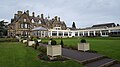 The Hayes conference centre - geograph.org.uk - 5606442.jpg 1 600 × 900 ; 347 kio
-
 The Hayes Conference Centre - geograph.org.uk - 6086488.jpg 1 600 × 1 200 ; 971 kio
-
 The Hayes Lake - geograph.org.uk - 1168215.jpg 480 × 640 ; 88 kio
-
 The Hayes Lake, Swanwick - geograph.org.uk - 2972255.jpg 1 024 × 768 ; 189 kio
-
 The larger lake at The Hayes Conference Centre - geograph.org.uk - 6086478.jpg 1 600 × 1 200 ; 1,04 Mio
-
 The smaller lake at The Hayes Conference Centre - geograph.org.uk - 6086481.jpg 1 600 × 1 200 ; 1,02 Mio
-
 The Steam Packet inn, Swanwick - geograph.org.uk - 6086524.jpg 1 600 × 1 200 ; 623 kio
-
 The Steampacket on Derby Road, Swanwick - geograph.org.uk - 4333770.jpg 1 579 × 1 582 ; 637 kio
-
 The Tree of Life at The Hayes Conference Centre - geograph.org.uk - 4777282.jpg 1 944 × 2 592 ; 906 kio
-
 Track to the Hayes (footpath) - geograph.org.uk - 1832869.jpg 640 × 480 ; 122 kio
-
 Travelling on the A38 - geograph.org.uk - 5799870.jpg 2 000 × 1 333 ; 1,83 Mio
-
 Travelling on the A38 - geograph.org.uk - 5800808.jpg 1 841 × 1 188 ; 303 kio
-
 Travelodge Parking - geograph.org.uk - 3670372.jpg 800 × 600 ; 108 kio
-
 Turners Charity Farm - geograph.org.uk - 3134569.jpg 1 600 × 1 200 ; 531 kio
-
 View from field in Swanwick - geograph.org.uk - 2117721.jpg 640 × 480 ; 67 kio
-
 War memorial outside St Andrew's church, Swanwick - geograph.org.uk - 6086532.jpg 1 200 × 1 600 ; 1,07 Mio
-
 Wood north of Sleetmoor Lane - geograph.org.uk - 1480156.jpg 640 × 480 ; 232 kio
-
 Woodland clearance - geograph.org.uk - 2117819.jpg 640 × 480 ; 139 kio
-
 Woodland path near Sleetmoor House - geograph.org.uk - 2117803.jpg 640 × 480 ; 147 kio


_-_geograph.org.uk_-_5978110.jpg)
_-_geograph.org.uk_-_5978116.jpg)


_-_geograph.org.uk_-_2554472.jpg)


,_Swanwick_-_geograph.org.uk_-_4333768.jpg)


_Swanwick_-_geograph.org.uk_-_1832860.jpg)


,_Swanwick_-_geograph.org.uk_-_6086493.jpg)


_-_geograph.org.uk_-_1832869.jpg)


