Category:Swerford
Aller à la navigation
Aller à la recherche
localité britannique du comté anglais d'Oxfordshire  | |||||
| Téléverser des médias | |||||
| Nature de l’élément | |||||
|---|---|---|---|---|---|
| Lieu | West Oxfordshire, Oxfordshire, Angleterre du Sud-Est, Angleterre | ||||
| site officiel | |||||
 | |||||
English: Swerford is a village and civil parish on the River Swere in the Cotswold Hills in Oxfordshire, England. It is about northeast of Chipping Norton. Swerford has two main neighbourhoods: Church End and East End. The area between them contains very few houses and is called Between Towns.
Sous-catégories
Cette catégorie comprend seulement la sous-catégorie ci-dessous.
M
- St Mary's Church, Swerford (3 F)
Média dans la catégorie « Swerford »
Cette catégorie comprend 95 fichiers, dont les 95 ci-dessous.
-
 A junction of roads near Coltscombe - geograph.org.uk - 5596627.jpg 4 000 × 3 000 ; 4,09 Mio
-
 Across the field - geograph.org.uk - 2032799.jpg 4 288 × 3 216 ; 1,66 Mio
-
 Across the field - geograph.org.uk - 3002214.jpg 4 320 × 3 240 ; 4,55 Mio
-
 Approaching Banbury Road Belt - geograph.org.uk - 3038253.jpg 1 024 × 680 ; 271 kio
-
 Approaching the green, Swerford (geograph 7383734).jpg 4 288 × 2 848 ; 2,48 Mio
-
 Ash Hill Farm - geograph.org.uk - 3011834.jpg 4 320 × 3 240 ; 4,95 Mio
-
 Banbury Road - geograph.org.uk - 3002355.jpg 4 320 × 3 240 ; 4,75 Mio
-
 Banbury Road milestone - geograph.org.uk - 3011776.jpg 3 240 × 4 320 ; 5,08 Mio
-
 Bridge over the River Swere - geograph.org.uk - 3038146.jpg 1 024 × 680 ; 264 kio
-
 Butler's Barn (1) - geograph.org.uk - 3011640.jpg 4 320 × 3 240 ; 5,06 Mio
-
 Butler's Barn (2) - geograph.org.uk - 3011654.jpg 4 320 × 3 240 ; 4,94 Mio
-
 Church End, Swerford (geograph 7383783).jpg 3 401 × 2 147 ; 1,21 Mio
-
 Country junction - geograph.org.uk - 2032791.jpg 4 288 × 3 216 ; 2,78 Mio
-
 Cow Lane heading to Swerford - geograph.org.uk - 5596631.jpg 4 000 × 3 000 ; 4,19 Mio
-
 Field edge bridleway - geograph.org.uk - 3002426.jpg 4 320 × 3 240 ; 4,93 Mio
-
 Footpath leaves road - geograph.org.uk - 2032794.jpg 4 288 × 3 216 ; 3,52 Mio
-
 Footpath leaves road - geograph.org.uk - 2032796.jpg 4 288 × 3 216 ; 3,6 Mio
-
 Footpath leaves road - geograph.org.uk - 3011801.jpg 4 320 × 3 240 ; 4,92 Mio
-
 Footpath to Swerford - geograph.org.uk - 3038144.jpg 1 024 × 680 ; 305 kio
-
 Four ways to go (1) - geograph.org.uk - 3002282.jpg 4 320 × 3 240 ; 4,98 Mio
-
 Four ways to go (2) - geograph.org.uk - 3002294.jpg 4 320 × 3 240 ; 4,96 Mio
-
 Four ways to go (3) - geograph.org.uk - 3002310.jpg 4 320 × 3 240 ; 5,13 Mio
-
 Four ways to go (4) - geograph.org.uk - 3002320.jpg 4 320 × 3 240 ; 4,95 Mio
-
 Four ways to go - geograph.org.uk - 3011827.jpg 4 320 × 3 240 ; 4,82 Mio
-
 Hook Norton Cutting - geograph.org.uk - 215453.jpg 640 × 480 ; 87 kio
-
 Listed buildings, Swerford (geograph 7383096).jpg 3 729 × 2 473 ; 1,48 Mio
-
 New planting - geograph.org.uk - 3002370.jpg 4 320 × 3 240 ; 4,82 Mio
-
 No way out - geograph.org.uk - 3002329.jpg 4 320 × 3 240 ; 5,03 Mio
-

-
 Old Milestone by the A361, Banbury Road, Swerford Parish (geograph 6047724).jpg 742 × 1 249 ; 390 kio
-
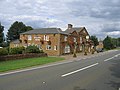
 Old Rectory Swerford Oxon Geograph-3001850-by-Michael-Dibb.jpg 4 320 × 3 240 ; 5,2 Mio
-
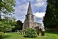
 Parish church - geograph.org.uk - 3001859.jpg 4 320 × 3 240 ; 5,06 Mio
-
 Path leaves road - geograph.org.uk - 3001915.jpg 4 320 × 3 240 ; 4,75 Mio
-
 Path meets road - geograph.org.uk - 3002337.jpg 4 320 × 3 240 ; 5,03 Mio
-
 Pomfret Castle Farm (1) - geograph.org.uk - 3002415.jpg 4 320 × 3 240 ; 4,52 Mio
-
 Pomfret Castle Farm (2) - geograph.org.uk - 3003432.jpg 4 320 × 3 240 ; 4,74 Mio
-
 Ready for sowing - geograph.org.uk - 3011747.jpg 4 320 × 3 240 ; 4,8 Mio
-
 St Mary's Lane - geograph.org.uk - 3001844.jpg 4 320 × 3 240 ; 5,08 Mio
-
 Start of bridleway - geograph.org.uk - 3011790.jpg 4 320 × 3 240 ; 5,07 Mio
-
 Start of path - geograph.org.uk - 2032792.jpg 4 288 × 3 216 ; 3,16 Mio
-
 Start of path - geograph.org.uk - 3001907.jpg 4 320 × 3 240 ; 4,9 Mio
-
 Overgrown disused railway bridge abutment - geograph.org.uk - 1477463.jpg 640 × 480 ; 116 kio
-
 Swerford Castle - geograph.org.uk - 3001873.jpg 4 320 × 3 240 ; 4,87 Mio
-
 Swerford Heath - geograph.org.uk - 5716397.jpg 1 600 × 1 200 ; 488 kio
-
 Swerford milestone.jpg 3 000 × 4 200 ; 5,86 Mio
-

-
 Swerford, St. Mary's Church, c14th octagonal font - geograph.org.uk - 5424222.jpg 2 238 × 3 548 ; 4,1 Mio
-
 Swerford, St. Mary's Church, c14th octagonal font - geograph.org.uk - 5424302.jpg 3 502 × 5 406 ; 7,22 Mio
-
 Swerford, St. Mary's Church, Capital - geograph.org.uk - 5424261.jpg 3 600 × 2 328 ; 3,57 Mio
-
 Swerford, St. Mary's Church, Roof corbel 1 - geograph.org.uk - 5424308.jpg 3 678 × 2 456 ; 3,95 Mio
-
 Swerford, St. Mary's Church, Roof corbel 2 - geograph.org.uk - 5424310.jpg 3 678 × 2 455 ; 4,21 Mio
-
 Swerford, St. Mary's Church, South western aspect - geograph.org.uk - 5424212.jpg 3 678 × 2 456 ; 5,81 Mio
-
 Swerford, St. Mary's Church, The altar - geograph.org.uk - 5424234.jpg 2 450 × 3 680 ; 5,59 Mio
-
 Swerford, St. Mary's Church, The c14th south porch - geograph.org.uk - 5424339.jpg 3 678 × 2 456 ; 6,37 Mio
-
 Swerford, St. Mary's Church, The east window of 1859 ( detail) - geograph.org.uk - 5424257.jpg 3 678 × 2 456 ; 5,1 Mio
-
 Swerford, St. Mary's Church, The John King memorial plaque - geograph.org.uk - 5424320.jpg 3 651 × 3 596 ; 7,19 Mio
-
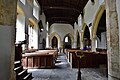
 Swerford, St. Mary's Church, The nave - geograph.org.uk - 5424230.jpg 5 314 × 3 342 ; 6,43 Mio
-
 Swerford, St. Mary's Church, The nave from the chancel - geograph.org.uk - 5424240.jpg 5 086 × 3 380 ; 7,22 Mio
-
 Swerford, St. Mary's Church, The nave from the chancel - geograph.org.uk - 5424247.jpg 3 428 × 5 362 ; 6,33 Mio
-

-
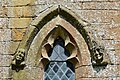 Swerford, St. Mary's Church, Two c14th label stops - geograph.org.uk - 5424333.jpg 3 678 × 2 455 ; 7,68 Mio
-
-
 Swerford-Chapel End - geograph.org.uk - 5874202.jpg 1 600 × 1 293 ; 570 kio
-
 Swerford-Church End - geograph.org.uk - 5874204.jpg 1 600 × 1 200 ; 483 kio
-
 The Cartshed - geograph.org.uk - 3002394.jpg 4 320 × 3 240 ; 5,3 Mio
-
 The footpath is blocked (1) - geograph.org.uk - 3002269.jpg 4 320 × 3 240 ; 4,74 Mio
-
 The footpath is blocked (2) - geograph.org.uk - 3002278.jpg 4 320 × 3 240 ; 4,98 Mio
-
 The Mason's Arms - geograph.org.uk - 215447.jpg 640 × 480 ; 52 kio
-
 The Masons Arms - geograph.org.uk - 3619507.jpg 4 320 × 3 240 ; 5,28 Mio
-
 The view from the hill - geograph.org.uk - 3002231.jpg 4 320 × 3 240 ; 4,56 Mio
-
 The way to Potato Town - geograph.org.uk - 3011729.jpg 4 320 × 3 240 ; 4,83 Mio
-
 The way to the farm - geograph.org.uk - 3011719.jpg 4 320 × 3 240 ; 4,63 Mio
-
 Towards Potato Town - geograph.org.uk - 3011755.jpg 4 320 × 3 240 ; 5,17 Mio
-
 Track improvements (1) - geograph.org.uk - 3011664.jpg 4 320 × 3 240 ; 4,97 Mio
-
 Track junction - geograph.org.uk - 3011707.jpg 4 320 × 3 240 ; 4,78 Mio
-
 Track meets road - geograph.org.uk - 3011760.jpg 4 320 × 3 240 ; 4,75 Mio
-
 Unnamed barn (1) - geograph.org.uk - 3002253.jpg 4 320 × 3 240 ; 4,5 Mio
-
 Unnamed barn (2) - geograph.org.uk - 3011814.jpg 4 320 × 3 240 ; 4,55 Mio
-
 View towards Ash Hill Farm - geograph.org.uk - 5429138.jpg 1 024 × 768 ; 274 kio
-
 Village green - geograph.org.uk - 3001893.jpg 4 320 × 3 240 ; 4,51 Mio
-
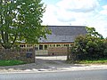
 Village Hall - geograph.org.uk - 5027573.jpg 1 600 × 900 ; 676 kio
-
 Water control at Swerford Park - geograph.org.uk - 236442.jpg 640 × 480 ; 98 kio
-
 Wheat field near Swerford - geograph.org.uk - 3038246.jpg 1 024 × 680 ; 307 kio
-
 Field boundary south of minor road - geograph.org.uk - 350612.jpg 640 × 427 ; 56 kio
-
 Frontage of Mason's Arms - geograph.org.uk - 238398.jpg 639 × 477 ; 61 kio
-
 Gatehouse for Swerford Park - geograph.org.uk - 215451.jpg 640 × 480 ; 73 kio
-
 Harvest time - geograph.org.uk - 238402.jpg 640 × 480 ; 74 kio
-
 Home Farm and radio mast - geograph.org.uk - 350618.jpg 640 × 427 ; 59 kio
-
 Ley's Field Barn - geograph.org.uk - 215443.jpg 640 × 480 ; 47 kio
-
 Line on pine trees near Showell Farm - geograph.org.uk - 350606.jpg 640 × 427 ; 109 kio
-
 Motte and Bailey, Swerford - geograph.org.uk - 215450.jpg 640 × 480 ; 79 kio
-
 Potato Town - geograph.org.uk - 238400.jpg 640 × 480 ; 57 kio
-
 Swerford Motte and Bailey - geograph.org.uk - 238409.jpg 640 × 480 ; 77 kio
-
 View south from the Banbury Road - geograph.org.uk - 215455.jpg 640 × 480 ; 62 kio
-
 View towards Highwood - geograph.org.uk - 215458.jpg 640 × 480 ; 64 kio


.jpg)


_-_geograph.org.uk_-_3011640.jpg)
_-_geograph.org.uk_-_3011654.jpg)
.jpg)


_-_geograph.org.uk_-_3002282.jpg)
_-_geograph.org.uk_-_3002294.jpg)
_-_geograph.org.uk_-_3002310.jpg)
_-_geograph.org.uk_-_3002320.jpg)


.jpg)


.jpg)


_-_geograph.org.uk_-_3002415.jpg)
_-_geograph.org.uk_-_3003432.jpg)


_-_geograph.org.uk_-_5424257.jpg)


_-_geograph.org.uk_-_3002269.jpg)
_-_geograph.org.uk_-_3002278.jpg)


_-_geograph.org.uk_-_3011664.jpg)


_-_geograph.org.uk_-_3002253.jpg)
_-_geograph.org.uk_-_3011814.jpg)


.jpg)