Category:Szalkszentmárton
Salta a la navigazzion
Và a cercà
| Posission del sogeto | | Mappa di tutte le coordinate: OpenStreetMap |
|---|
comune ungherese ,_Pet%C5%91fi_t%C3%A9r,_Szalkszentm%C3%A1rton_47f.jpg)   | |||||
| Carega su un fail audio / video | |||||
| L'è un(a) |
| ||||
|---|---|---|---|---|---|
| Sit |
| ||||
| Popolazzion |
| ||||
| Area |
| ||||
| sit ofizzial | |||||
 | |||||
Sotocategorie
Quella categoria chì la gh'ha 5 sot-categorie chì de sota, su un numer complessiv de 5.
Fail in la categoria "Szalkszentmárton"
Quella categoria chì la gh'ha denter 39 i fail riportad chì de sota, su un total de 39.
-
 Barges and view to Szalkszentmárton, 2017 Dunaújváros.jpg 1 824 × 1 360; 705 KByte
-
 Coa Hungary Town Szalkszentmarton.svg 280 × 300; 42 KByte
-
 Flag of Szalkszentmárton.svg 900 × 600; 172 KByte
-
 Szalkszentmárton 1975, Tsz gépállomás. Fortepan 70386.jpg 2 616 × 2 230; 3,25 MByte
-
 Kilátás a hajóállomás felé, Szalki-sziget, 2017 Dunaújváros.jpg 2 272 × 1 704; 1,01 MByte
-
 Kilátás a Szalkszentmártoni-félsziget felé, Szalki-sziget, 2017 Dunaújváros.jpg 2 272 × 1 704; 1,03 MByte
-
 Márton emlék, Fő út menti parkban, 2013 Szalkszentmárton 47o.jpg 2 048 × 1 536; 641 KByte
-
 Márton emlék, Fő út menti parkban, 2013 Szalkszentmárton 47p.jpg 1 536 × 2 048; 576 KByte
-
 Márton emlék, Fő út menti parkban, 2013 Szalkszentmárton 47q.jpg 1 536 × 2 048; 858 KByte
-
 Márton emlék, Fő út menti parkban, 2013 Szalkszentmárton949c.jpg 1 506 × 2 013; 725 KByte
-
 Márton emlék, Fő út menti parkban, Szalkszentmarton949.jpg 2 023 × 1 099; 634 KByte
-
 Márton emlék, Fő út menti parkban, Szalkszentmarton949a.jpg 1 973 × 1 493; 862 KByte
-
 Márton emlék, Fő út menti parkban, Szalkszentmárton 47mm.jpg 2 048 × 1 536; 662 KByte
-
 Szalkszentmarton rovastabla.png 180 × 40; 8 KByte
-
 Szalkszentmárton 47e.JPG 1 120 × 1 220; 382 KByte
-
 Szalkszentmárton 47í.JPG 2 048 × 1 536; 393 KByte
-
 Szalkszentmárton címere.jpg 2 000 × 2 419; 464 KByte
-
 Szalkszentmárton447.JPG 2 048 × 1 536; 760 KByte
-
 Szalkszentmárton7455.JPG 2 048 × 1 536; 680 KByte
-
 Szalkszentmárton7461.JPG 2 048 × 1 536; 543 KByte
-
 Szalkszentmárton7463.JPG 2 048 × 1 536; 630 KByte
-
 Szalkszentmárton7464.JPG 2 048 × 1 536; 439 KByte
-
 Szalkszentmárton7465.JPG 1 536 × 2 048; 430 KByte
-
 Szalkszentmárton7467.JPG 2 048 × 1 536; 513 KByte
-
 Szalkszentmárton7468.JPG 1 536 × 2 048; 311 KByte
-
 Szalkszentmárton7470.JPG 2 048 × 1 536; 745 KByte
-
 Szalkszentmárton9471.JPG 2 048 × 1 536; 439 KByte
-
 Szalkszentmárton9472.JPG 2 048 × 1 536; 400 KByte
-
 Szalkszentmárton9473.JPG 1 536 × 2 048; 458 KByte
-
 Szalkszentmárton9474.JPG 2 048 × 1 536; 429 KByte
-
 Szalkszentmárton9475.JPG 1 536 × 2 048; 430 KByte
-
 Szalkszentmártoni rév, 2017 Dunaújváros.jpg 1 704 × 2 272; 1,01 MByte
-
 Szalkszentmártoni tavak - panoramio.jpg 5 184 × 3 456; 6,26 MByte
-
 Szalkszentmártoni ünnepély1 BIG.jpg 1 292 × 874; 166 KByte
-
 Szalkszentmártoni ünnepély2 BIG.jpg 1 292 × 868; 179 KByte
-
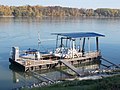
 TSL 1008 és TSL 1010 a Szalki-sziget hajóállomásnál, 2017 Dunaújváros.jpg 2 272 × 1 704; 1,04 MByte
-
 Uszályok, Szalki-sziget, 2017 Dunaújváros.jpg 2 272 × 1 704; 996 KByte
-
 View to south, Szalki Island, 2017 Dunaújváros.jpg 2 272 × 1 704; 1 000 KByte
-
 Water police, Szalki Island, 2017 Dunaújváros.jpg 2 272 × 1 704; 986 KByte


