Category:Tarrant Rawston
Aller à la navigation
Aller à la recherche
hameau britannique  | |||||
| Téléverser des médias | |||||
| Nature de l’élément | |||||
|---|---|---|---|---|---|
| Lieu |
| ||||
 | |||||
English: Tarrant Rawston is a hamlet in north Dorset, England, situated in the Tarrant Valley five miles east of Blandford Forum.
Article Wikipédia principal : Tarrant Rawston.
Sous-catégories
Cette catégorie comprend 2 sous-catégories, dont les 2 ci-dessous.
M
R
- Rawston Farm (2 F)
Média dans la catégorie « Tarrant Rawston »
Cette catégorie comprend 43 fichiers, dont les 43 ci-dessous.
-
 Ashley Wood Golf Club - geograph.org.uk - 3293917.jpg 1 024 × 768 ; 115 kio
-
 Countryside at Tarrant Rushton - geograph.org.uk - 3389096.jpg 640 × 480 ; 53 kio
-
 Entrance to Ashley Wood Golf Club - geograph.org.uk - 3389083.jpg 640 × 480 ; 82 kio
-
 Field edge at Tarrant Rushton - geograph.org.uk - 6239828.jpg 1 024 × 683 ; 322 kio
-
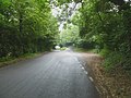
 Footpath, Tarrant Rawston - geograph.org.uk - 1144354.jpg 640 × 480 ; 174 kio
-
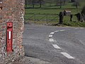
 George V postbox, Tarrant Rawston - geograph.org.uk - 1144407.jpg 480 × 640 ; 222 kio
-
 Houses near Tarrant Royston - geograph.org.uk - 3389628.jpg 640 × 480 ; 49 kio
-
 Looking towards Down Barn - geograph.org.uk - 4697996.jpg 4 168 × 3 227 ; 2,81 Mio
-
 Mid May 2012, St Mary, Tarrant Rawston - geograph.org.uk - 2952769.jpg 640 × 480 ; 110 kio
-
 Modern day hedge trimming - geograph.org.uk - 4697977.jpg 4 339 × 3 314 ; 3,93 Mio
-
 Muck spreading - geograph.org.uk - 4698010.jpg 3 255 × 3 243 ; 2,06 Mio
-
 River Tarrant, Tarrant Rawston - geograph.org.uk - 1144402.jpg 640 × 480 ; 245 kio
-
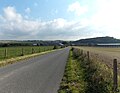
 Road along the Tarrant valley - geograph.org.uk - 2613532.jpg 640 × 480 ; 83 kio
-
 Road along the Tarrant valley - geograph.org.uk - 2613540.jpg 640 × 480 ; 106 kio
-
 Roadside view above The Cliff - geograph.org.uk - 6239827.jpg 1 024 × 683 ; 235 kio
-
 Seed Drilling on The Cliff - geograph.org.uk - 3389644.jpg 640 × 480 ; 67 kio
-
 Seed Drilling on top of The Cliff - geograph.org.uk - 3389637.jpg 640 × 480 ; 59 kio
-
 St Mary, Tarrant Rawston, churchyard (g) - geograph.org.uk - 2978083.jpg 640 × 480 ; 119 kio
-
 St Mary, Tarrant Rawston, churchyard (h) - geograph.org.uk - 2978085.jpg 640 × 480 ; 113 kio
-
 St Mary, Tarrant Rawston, churchyard (i) - geograph.org.uk - 2978087.jpg 640 × 458 ; 113 kio
-
 Tarrant Monkton, bales - geograph.org.uk - 2529741.jpg 1 024 × 768 ; 181 kio
-
 Tarrant Monkton, farm buildings - geograph.org.uk - 2529654.jpg 1 024 × 768 ; 194 kio
-
 Tarrant Monkton, farm entrance - geograph.org.uk - 2529726.jpg 1 024 × 768 ; 186 kio
-
 Tarrant Monkton, footpath - geograph.org.uk - 2529642.jpg 1 024 × 768 ; 175 kio
-
 Tarrant Monkton, gateway - geograph.org.uk - 4926485.jpg 1 024 × 768 ; 205 kio
-
 Tarrant Monkton, River Tarrant - geograph.org.uk - 2529703.jpg 1 024 × 768 ; 321 kio
-
 Tarrant Monkton, road junction - geograph.org.uk - 2529774.jpg 1 024 × 768 ; 246 kio
-
 Tarrant Monkton, sub-station - geograph.org.uk - 2529680.jpg 1 024 × 768 ; 184 kio
-
 Tarrant Monkton, The Cliff - geograph.org.uk - 2529793.jpg 1 024 × 768 ; 254 kio
-
 Tarrant Rawston, bridleway - geograph.org.uk - 4926367.jpg 1 024 × 768 ; 208 kio
-
 Tarrant Rawston, cows - geograph.org.uk - 2529409.jpg 1 024 × 768 ; 166 kio
-
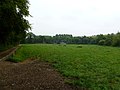
 Tarrant Rawston, footpath - geograph.org.uk - 2529339.jpg 1 024 × 768 ; 197 kio
-
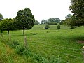
 Tarrant Rawston, footpath - geograph.org.uk - 2529593.jpg 1 024 × 768 ; 150 kio
-
 Tarrant Rawston, gate - geograph.org.uk - 2529604.jpg 1 024 × 768 ; 183 kio
-
 Tarrant Rawston, Luton Drove - geograph.org.uk - 2529622.jpg 1 024 × 768 ; 212 kio
-

-
 Tarrant Rawston, postbox № DT11 115 - geograph.org.uk - 3907390.jpg 640 × 481 ; 99 kio
-
 Tarrant Rawston, River Tarrant - geograph.org.uk - 2529443.jpg 1 024 × 768 ; 243 kio
-
 Tarrant Rawston, Stubbs Coppice - geograph.org.uk - 4926373.jpg 1 024 × 768 ; 345 kio
-
 Tarrant valley - geograph.org.uk - 2613403.jpg 640 × 450 ; 72 kio
-
 The Tarrant at Tarrant Rawston - geograph.org.uk - 759421.jpg 640 × 421 ; 375 kio
-
 Weather vane at Down Barn - geograph.org.uk - 1144665.jpg 479 × 640 ; 98 kio
-
 Weir on the River Tarrant - geograph.org.uk - 1144369.jpg 640 × 480 ; 201 kio


_-_geograph.org.uk_-_2978083.jpg)
_-_geograph.org.uk_-_2978085.jpg)
_-_geograph.org.uk_-_2978087.jpg)


