Category:Tattershall
Vai alla navigazione
Vai alla ricerca
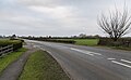
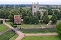
English: Tattershall is a village and civil parish in the East Lindsey district of Lincolnshire, England, located on the A153 Horncastle to Sleaford road, to the north of the village.
Français : Tattershall est un village dans le Est-Lindsey du district de Lincolnshire, en Angleterre, localisé sur la route A153 allant de Horncastle à Sleaford , 1,5 km à l'est du point où la route croise la rivière Witham. A son extrémité est, Tattershall adjoint le village de Coningsby.
village in the United Kingdom  | |||||
| Carica un file multimediale | |||||
| Istanza di | |||||
|---|---|---|---|---|---|
| Luogo | East Lindsey, Lincolnshire, Midlands Orientali, Inghilterra | ||||
| Superficie |
| ||||
 | |||||
Sottocategorie
Questa categoria contiene le 12 sottocategorie indicate di seguito, su un totale di 12.
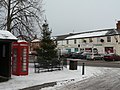
- Snow in Tattershall (9 F)
D
- Dogdyke pumping station (24 F)
F
- Fortescue Arms, Tattershall (5 F)
H
T
- Tattershall Bede Houses (13 F)
- Tattershall Bridge Cottage (8 F)
- Tattershall College (4 F)
- Tattershall Market Cross (2 F)
- Tattershall War Memorial (4 F)
- John Taverner (8 F)
File nella categoria "Tattershall"
Questa categoria contiene 200 file, indicati di seguito, su un totale di 229.
(pagina precedente) (pagina successiva)-
 11, Market Place - geograph.org.uk - 1630185.jpg 640 × 479; 67 KB
-
 19th century house - geograph.org.uk - 5892146.jpg 6 032 × 4 014; 6,23 MB
-
 A private bridge - geograph.org.uk - 5892112.jpg 6 032 × 4 014; 5,46 MB
-
 A row of shops in Tattershall - geograph.org.uk - 5892115.jpg 6 032 × 4 014; 5,28 MB
-
 A153 near Tattershall Bridge - geograph.org.uk - 5261113.jpg 4 677 × 2 900; 5,79 MB
-
 A153 Sleaford Road - geograph.org.uk - 3532145.jpg 1 776 × 1 074; 1,69 MB
-

-
 Aircraft Noise Hazard - geograph.org.uk - 3635148.jpg 2 256 × 1 504; 2,19 MB
-
 Art Gallery (geograph 5891435).jpg 6 999 × 6 177; 7,4 MB
-
 Art Gallery Entrance - geograph.org.uk - 5891438.jpg 5 102 × 5 431; 7,62 MB
-
 B1192 Thorpe Road - geograph.org.uk - 3022127.jpg 1 280 × 960; 281 KB
-
 Barley field near Tattershall - geograph.org.uk - 3021946.jpg 1 280 × 853; 242 KB
-
 Bede Houses, Tattershall - geograph.org.uk - 6108777.jpg 5 181 × 3 456; 5,57 MB
-
 Beware of noise - geograph.org.uk - 3021940.jpg 1 280 × 853; 261 KB
-
 Bovine reflections - geograph.org.uk - 977338.jpg 640 × 427; 59 KB
-
 Brick vaulted passage, Tattershall Castle - geograph.org.uk - 6283932.jpg 3 888 × 5 184; 5,45 MB
-
 Bridge at Tattershall Castle - geograph.org.uk - 4272764.jpg 3 648 × 2 736; 6,02 MB
-
 Bridge at Tattershall. - geograph.org.uk - 1630163.jpg 640 × 479; 99 KB
-
 Bridge over inner moat, Tattershall Castle - geograph.org.uk - 6109423.jpg 5 179 × 3 451; 3,98 MB
-
 Bridge over the outer moat, Tattershall Castle - geograph.org.uk - 4507777.jpg 1 000 × 750; 202 KB
-
 Buildings along High Street - geograph.org.uk - 1630173.jpg 640 × 479; 65 KB
-

-
 Car park for visitors to Tattershall Castle - geograph.org.uk - 5995304.jpg 1 600 × 1 200; 1 020 KB
-
 Carriage gate - geograph.org.uk - 702526.jpg 640 × 427; 66 KB
-
 Causeway Walk - geograph.org.uk - 702457.jpg 640 × 427; 119 KB
-
 Celebrating 35 years in steam - geograph.org.uk - 3021922.jpg 853 × 1 280; 197 KB
-
 Closed for business - geograph.org.uk - 702582.jpg 640 × 427; 62 KB
-
 Clouds at the castle - geograph.org.uk - 6309451.jpg 4 608 × 3 456; 3,04 MB
-
 Coningsby Sluice - geograph.org.uk - 4894058.jpg 3 776 × 2 520; 2,75 MB
-
 Coningsby Telephone Exchange - geograph.org.uk - 6336582.jpg 2 592 × 1 944; 1,39 MB
-
 Converted Railway Building - geograph.org.uk - 541351.jpg 640 × 480; 83 KB
-
 Daffodils, outer moat, Tattershall Castle - geograph.org.uk - 6108792.jpg 5 133 × 3 351; 7,78 MB
-
 Derelict stables, Tattershall Castle - geograph.org.uk - 6109074.jpg 5 179 × 3 451; 5,85 MB
-
 Description of Tom Thumb's Grave, Tattershall - geograph.org.uk - 6289094.jpg 1 944 × 2 592; 910 KB
-
 Detail of the keep, Tattershall Castle - geograph.org.uk - 6216619.jpg 683 × 1 024; 271 KB
-

-
 Dogdyke - panoramio.jpg 2 816 × 2 112; 2,39 MB
-
-
 Drain near Dogdyke - geograph.org.uk - 3021936.jpg 1 280 × 853; 298 KB
-
 East Drive on Castlefields estate, Tattershall - geograph.org.uk - 5995336.jpg 1 600 × 1 200; 841 KB
-
 East Drive, Tattershall - geograph.org.uk - 1630108.jpg 640 × 479; 104 KB
-

-
 English Bond - geograph.org.uk - 702506.jpg 640 × 427; 121 KB
-
 Farm buildings next to Tattershall Castle - geograph.org.uk - 6109038.jpg 5 179 × 3 451; 6,93 MB
-
 Fields north of Tattershall Castle - geograph.org.uk - 5995320.jpg 1 600 × 1 200; 812 KB
-
 Fireplace, Tattershall Castle - geograph.org.uk - 6283922.jpg 4 407 × 3 389; 3,16 MB
-
 Footbridge over the River Bain - geograph.org.uk - 2824703.jpg 1 024 × 768; 239 KB
-
 Footpath to Coningsby - geograph.org.uk - 2824714.jpg 1 024 × 768; 281 KB
-
 Footpath to Thorpe Road - geograph.org.uk - 2824719.jpg 1 024 × 768; 249 KB
-
 Former goods shed, Tattersahll (geograph 6665070).jpg 1 024 × 721; 216 KB
-

-
 Former railway crossing cottage, Tattershall - geograph.org.uk - 6265313.jpg 1 024 × 748; 191 KB
-
 Fortescue Arms - geograph.org.uk - 5748199.jpg 1 600 × 1 200; 370 KB
-
 Gallery sign - geograph.org.uk - 5892107.jpg 6 032 × 4 014; 5,69 MB
-
 Goods yard track bed - geograph.org.uk - 5892131.jpg 6 032 × 4 014; 6,58 MB
-
 Graffiti at Tattershall Castle - geograph.org.uk - 4507791.jpg 1 000 × 750; 163 KB
-
 Grange Farm - geograph.org.uk - 2824724.jpg 1 024 × 768; 209 KB
-
-
 High Street, Tattershall - geograph.org.uk - 2239394.jpg 800 × 600; 241 KB
-
 Holy Trinity Church - chancel - geograph.org.uk - 6283986.jpg 3 888 × 5 184; 4,32 MB
-
 Holy Trinity, Tattershall - geograph.org.uk - 6283969.jpg 5 184 × 3 888; 5,7 MB
-
 Hunter's House - geograph.org.uk - 3022153.jpg 1 280 × 947; 268 KB
-
 Inner and outer moats, Tattershall Castle - geograph.org.uk - 6216616.jpg 1 024 × 683; 238 KB
-
 Inner Moat at Tattershall Castle - geograph.org.uk - 4273236.jpg 3 648 × 2 736; 4,15 MB
-
 Inner moat to Tattershall Castle - geograph.org.uk - 5748162.jpg 1 600 × 1 200; 630 KB
-

-

-
-
 Keek^ - geograph.org.uk - 6309452.jpg 4 608 × 3 456; 4,43 MB
-
 King of the Castle - geograph.org.uk - 6309449.jpg 3 456 × 4 608; 4,34 MB
-
 Lake in Leisure Park viewed from Tattershall Castle tower - geograph.org.uk - 3989064.jpg 3 648 × 2 736; 4,71 MB
-
 Leaving Tattershall picnic area - geograph.org.uk - 2458307.jpg 640 × 480; 67 KB
-
 Listing but not Listed - geograph.org.uk - 1630140.jpg 640 × 480; 136 KB
-

-
 Lord Cromwell's purse symbol in Tattershall Castle - geograph.org.uk - 5995316.jpg 1 200 × 1 600; 881 KB
-
 Marker post by the River Bain - geograph.org.uk - 3022209.jpg 960 × 1 280; 313 KB
-
 Market Place, Tattershall - geograph.org.uk - 1630177.jpg 640 × 479; 76 KB
-
 Market Place, Tattershall - geograph.org.uk - 1630179.jpg 640 × 479; 81 KB
-
 Market Place, Tattershall - geograph.org.uk - 1630189.jpg 640 × 479; 91 KB
-
 Marsh Lane and Castleview, Tattershall - geograph.org.uk - 5995341.jpg 1 600 × 890; 542 KB
-
 Mason's Bridge - geograph.org.uk - 3022158.jpg 1 280 × 960; 292 KB
-
 Medieval entrance to Tattershall Castle - geograph.org.uk - 6109368.jpg 5 179 × 3 451; 7,06 MB
-
 Memorial on the village green - geograph.org.uk - 5748205.jpg 1 200 × 1 600; 851 KB
-
 Mill Drain - geograph.org.uk - 3021955.jpg 1 280 × 853; 299 KB
-
 Neglected bowling green, Tattershall - geograph.org.uk - 5995305.jpg 1 600 × 1 200; 1,1 MB
-
 Oak, Reedmace and Willow - geograph.org.uk - 1630182.jpg 640 × 479; 91 KB
-
 Off Road Bike ^ - geograph.org.uk - 702320.jpg 640 × 427; 88 KB
-
 Old railway bridge - geograph.org.uk - 1860763.jpg 640 × 426; 107 KB
-
 Old railway bridge near Coningsby - geograph.org.uk - 3022202.jpg 1 280 × 960; 338 KB
-
 Old School - geograph.org.uk - 702418.jpg 640 × 427; 73 KB
-
 Old Schoolhouse - geograph.org.uk - 5748181.jpg 1 600 × 1 199; 639 KB
-
 Old Schoolhouse - geograph.org.uk - 702422.jpg 640 × 427; 95 KB
-
 Outer moat, west of Tattershall Castle - geograph.org.uk - 6108967.jpg 5 179 × 3 451; 5,17 MB
-
 Parish priests and their people in the Middle Ages in England (1898) (14782857945).jpg 1 412 × 1 928; 742 KB
-
 Pedestrian access to Tattershall Castle - geograph.org.uk - 6109433.jpg 5 179 × 3 451; 5,89 MB
-
 Pipeline marker - geograph.org.uk - 5891432.jpg 6 032 × 4 014; 4,95 MB
-
 Platform edge - geograph.org.uk - 5892141.jpg 6 032 × 4 014; 7,79 MB
-
 Pond alongside Wharfe Lane - geograph.org.uk - 3022212.jpg 1 280 × 960; 394 KB
-
 Pow Cottage (geograph 3661893).jpg 640 × 427; 116 KB
-
 Pow Cottage - geograph.org.uk - 3661875.jpg 640 × 427; 85 KB
-
 Private drive - geograph.org.uk - 5892129.jpg 6 032 × 4 014; 6,64 MB
-
 Pub terrace - geograph.org.uk - 5892152.jpg 6 032 × 4 014; 7,33 MB
-
 Pump attendants house - Dogdyke - geograph.org.uk - 3168092.jpg 640 × 424; 288 KB
-
 Railway bridge abutment - geograph.org.uk - 6265320.jpg 1 024 × 768; 325 KB
-
 Railway bridge abutment, Hunter's Lane - geograph.org.uk - 3022185.jpg 1 280 × 952; 339 KB
-
 Railway crossing - geograph.org.uk - 5892162.jpg 9 574 × 4 491; 7,75 MB
-

-
 River Bain - geograph.org.uk - 3573465.jpg 640 × 427; 111 KB
-
 River Bain - geograph.org.uk - 702431.jpg 640 × 427; 76 KB
-

-
 River Bain, Coningsby - geograph.org.uk - 3022171.jpg 1 280 × 960; 292 KB
-
 River Witham - geograph.org.uk - 3168071.jpg 640 × 424; 243 KB
-
 River Witham - geograph.org.uk - 4957635.jpg 1 024 × 683; 128 KB
-
 River Witham at Dogdyke - geograph.org.uk - 3021916.jpg 1 280 × 838; 168 KB
-
 River Witham view from Witham Bank - geograph.org.uk - 1937011.jpg 640 × 480; 82 KB
-

-

-
 Roof and battlements, Tattershall Castle - geograph.org.uk - 6109008.jpg 5 184 × 3 456; 7,36 MB
-
 Rose Villas, Tattershall - geograph.org.uk - 3122591.jpg 640 × 427; 81 KB
-
 Ruston and Hornsby diesel engine - geograph.org.uk - 3168087.jpg 640 × 424; 270 KB
-
 Ruston-Bucyrus Excavator.png 517 × 780; 608 KB
-
 Signs at Tattershall - geograph.org.uk - 5892142.jpg 6 032 × 4 014; 5,81 MB
-
 Site of Thorpe Road level crossing - geograph.org.uk - 3022124.jpg 1 280 × 956; 228 KB
-
 Site of Thorpe Road level crossing - geograph.org.uk - 3022129.jpg 1 280 × 960; 278 KB
-
 Slabs and crosses - geograph.org.uk - 1630144.jpg 493 × 640; 82 KB
-
 Sleaford Road, Tattershall - geograph.org.uk - 4544083.jpg 426 × 640; 125 KB
-
 Slope for sliding on - geograph.org.uk - 1630194.jpg 640 × 423; 56 KB
-

-
 Sugar beet near Tattershall - geograph.org.uk - 3021951.jpg 1 280 × 853; 293 KB
-
 Superfluous stile - geograph.org.uk - 3022201.jpg 1 280 × 960; 335 KB
-
 Former Chapel - geograph.org.uk - 702537.jpg 640 × 427; 55 KB
-

-
 Tattershall Bowling Green - geograph.org.uk - 4269643.jpg 3 648 × 2 736; 4,05 MB
-
-
 Tattershall Bridge picnic area - geograph.org.uk - 2458296.jpg 640 × 480; 140 KB
-
 Tattershall Caravan and Camping Site - geograph.org.uk - 5995329.jpg 1 600 × 1 200; 988 KB
-
 Tattershall Castle (1) - geograph.org.uk - 6290402.jpg 2 592 × 1 944; 1,36 MB
-
 Tattershall Castle (2) - geograph.org.uk - 6290432.jpg 2 592 × 1 944; 1,34 MB
-
 Tattershall Castle - geograph.org.uk - 5748169.jpg 1 600 × 1 200; 675 KB
-
 Tattershall Castle - geograph.org.uk - 5995311.jpg 3 588 × 4 784; 5,14 MB
-
 Tattershall Castle - geograph.org.uk - 6283893.jpg 3 888 × 5 184; 5,16 MB
-
 Tattershall Castle Almshouses - geograph.org.uk - 4270645.jpg 3 648 × 2 736; 4,7 MB
-
 Tattershall Castle and Gatehouse - geograph.org.uk - 5748158.jpg 1 600 × 1 200; 792 KB
-

-
 Tattershall Castle keep - geograph.org.uk - 6216618.jpg 683 × 1 024; 147 KB
-
 Tattershall Castle Keep - geograph.org.uk - 6285570.jpg 3 868 × 4 724; 4,11 MB
-
 Tattershall Castle, aerial 2018 - geograph.org.uk - 5846567.jpg 800 × 533; 97 KB
-
 Tattershall Castle, aerial 2018 - geograph.org.uk - 5932412.jpg 800 × 533; 110 KB
-
 Tattershall Castle, guardhouse and moat - geograph.org.uk - 6283904.jpg 3 888 × 5 184; 6,48 MB
-
 Tattershall Church - geograph.org.uk - 5838986.jpg 1 024 × 683; 190 KB
-
 Tattershall church - geograph.org.uk - 5995314.jpg 1 600 × 1 200; 1,05 MB
-
 Tattershall church and castle moat - geograph.org.uk - 5995317.jpg 1 200 × 1 600; 696 KB
-
 Tattershall College - geograph.org.uk - 5748192.jpg 1 600 × 1 200; 705 KB
-
 Tattershall cross - geograph.org.uk - 5892094.jpg 6 032 × 4 014; 5,68 MB
-
 Tattershall former station geograph-4035437-by-Ben-Brooksbank.jpg 2 325 × 1 359; 2,63 MB
-
 Tattershall graveyard and former tiltyard - geograph.org.uk - 6109373.jpg 5 184 × 3 456; 6,51 MB
-
 Tattershall High Street - geograph.org.uk - 702532.jpg 640 × 427; 76 KB
-
 Tattershall Lakes Country Park - geograph.org.uk - 1630130.jpg 640 × 473; 83 KB
-
 Tattershall Lakes Country Park - geograph.org.uk - 1630141.jpg 519 × 640; 83 KB
-
 Tattershall Lakes Country Park, Tattershall - geograph.org.uk - 2080063.jpg 2 272 × 1 704; 999 KB
-
 Tattershall Market Place - geograph.org.uk - 1630168.jpg 640 × 479; 107 KB
-
 Tattershall Market Place - geograph.org.uk - 702561.jpg 640 × 427; 61 KB
-
 Tattershall Market Place - geograph.org.uk - 702566.jpg 640 × 427; 54 KB
-
 Tattershall picnic area - geograph.org.uk - 3817552.jpg 1 024 × 768; 203 KB
-
 Tattershall Sluice - geograph.org.uk - 702319.jpg 640 × 427; 80 KB
-
 Tattershall Sluice - geograph.org.uk - 702428.jpg 640 × 427; 79 KB
-
 Tattershall village - geograph.org.uk - 1630149.jpg 640 × 479; 93 KB
-
 Tattershall village sign - geograph.org.uk - 1630180.jpg 478 × 640; 89 KB
-
 Tattershall village sign - geograph.org.uk - 5891294.jpg 4 014 × 6 032; 4,54 MB
-
 Tattershall Village Sign - geograph.org.uk - 702577.jpg 427 × 640; 58 KB
-
 TattershallVillage.jpg 800 × 533; 357 KB
-
 Telephone Exchange Tattershall - geograph.org.uk - 2820980.jpg 1 024 × 768; 154 KB
-
 The Bede Houses, Tattershall - geograph.org.uk - 5995308.jpg 1 600 × 1 200; 1,03 MB
-
 The Bede Houses, Tattershall - geograph.org.uk - 6216620.jpg 1 024 × 683; 257 KB
-
 The Bede Houses, Tattershall - geograph.org.uk - 6284005.jpg 5 143 × 3 385; 4,07 MB
-
 The Black Horse - geograph.org.uk - 702511.jpg 640 × 427; 59 KB
-
 The centre of Tattershall - geograph.org.uk - 5891428.jpg 6 032 × 4 014; 6,18 MB
-
 The Fortescue Arms - geograph.org.uk - 5891277.jpg 8 349 × 3 928; 7,19 MB
-
 The garden in the trackbed - geograph.org.uk - 5892096.jpg 6 032 × 4 014; 5,48 MB
-
 The Horncastle Canal - geograph.org.uk - 6265325.jpg 1 024 × 768; 325 KB
-
 The moat of Tattershall Castle - geograph.org.uk - 5995330.jpg 1 600 × 1 200; 1,03 MB
-

-
 The old school and house - geograph.org.uk - 1630164.jpg 640 × 479; 108 KB
-
 The old station - geograph.org.uk - 5892138.jpg 6 032 × 4 014; 7,79 MB
-
 The Old Vicarage - geograph.org.uk - 1630175.jpg 640 × 479; 62 KB
-
 The River Bain - geograph.org.uk - 2820973.jpg 1 024 × 768; 235 KB
-
 The River Bain - geograph.org.uk - 2824707.jpg 1 024 × 768; 201 KB
-
 The River Witham near Bank Farm - geograph.org.uk - 3532841.jpg 2 256 × 1 504; 2,27 MB
-
 The road East - geograph.org.uk - 5892119.jpg 6 032 × 4 014; 5,7 MB
-
 The Up Platform - geograph.org.uk - 5892102.jpg 4 014 × 6 032; 7,37 MB
-
 The War memorial - geograph.org.uk - 5892090.jpg 4 014 × 6 032; 6,37 MB
-
 Thorpe Place - geograph.org.uk - 3022132.jpg 1 280 × 960; 263 KB
-

-
 Tom Thumb's House - geograph.org.uk - 554539.jpg 640 × 480; 67 KB
-
 Tom Thumbs House - geograph.org.uk - 102334.jpg 640 × 480; 68 KB
-
 Trees in Tattershall - geograph.org.uk - 5892135.jpg 5 282 × 4 987; 7,25 MB
-

-
 Under the spreading yew - geograph.org.uk - 2820988.jpg 1 024 × 768; 227 KB
-
 Unusual threesome of houses, Tattershall - geograph.org.uk - 5995302.jpg 1 600 × 1 065; 661 KB
-


.jpg)


.jpg)


_(14782857945).jpg)


.jpg)


_Horncastle_Canal_-_geograph.org.uk_-_4655584.jpg)


_-_geograph.org.uk_-_6290402.jpg)
_-_geograph.org.uk_-_6290432.jpg)


