Category:Thür
Salti al navigilo
Salti al serĉilo
komunumo en Rejnlando-Palatinato, Germanio    | |||||
| Alŝuti plurmedion | |||||
| Estas |
| ||||
|---|---|---|---|---|---|
| Loko | Verbandsgemeinde Mendig, distrikto Mayen-Koblenz, Rejnlando-Palatinato, Germanio | ||||
| Loĝantaro |
| ||||
| Areo |
| ||||
| Supermara alteco |
| ||||
| Alia ol | |||||
| oficiala retejo | |||||
 | |||||
Subkategorioj
Ĉi tiu kategorio havas la 3 jenajn subkategoriojn, el 3 entute.
N
- Naturschutzgebiet Thürer Wiesen (15 D)
S
Dosieroj en kategorio “Thür”
La jenaj 6 dosieroj estas en ĉi tiu kategorio, el 6 entute.
-
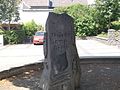
 GedenksteinJudenfriedhof Thür.JPG 2 736 × 3 648; 4,87 MB
-
 Thuerer Somporsch.jpg 2 048 × 1 536; 1,43 MB
-
 Thür in MYK.png 338 × 294; 9 KB
-
 Thür in MYK.svg 660 × 560; 230 KB
-
 Thür.JPG 1 600 × 1 200; 1,27 MB
-
 Thürer Wiesen.jpg 4 272 × 2 848; 972 KB


