Category:Thatcham
Vai alla navigazione
Vai alla ricerca
town and civil parish in Berkshire, United Kingdom  | |||||
| Carica un file multimediale | |||||
| Istanza di | |||||
|---|---|---|---|---|---|
| Luogo | West Berkshire, Berkshire, Sud Est dell'Inghilterra, Inghilterra | ||||
| Superficie |
| ||||
| sito web ufficiale | |||||
 | |||||
English: Images relating to the town of Thatcham, Berkshire, England. For more information, see the Wikipedia article Thatcham.
Sottocategorie
Questa categoria contiene le 14 sottocategorie indicate di seguito, su un totale di 14.
C
- Colthrop (13 F)
- Colthrop level crossing (11 F)
H
- Headley Ford (4 F)
K
- Kennet Comprehensive School (8 F)
M
- Monkey Marsh Lock (8 F)
O
S
T
- Thatcham railway station (36 F)
- Thatcham Reedbeds (3 F)
- Thatcham Town F.C. (7 F)
- The Nature Discovery Centre (7 F)
W
- West Berkshire Crematorium (3 F)
- Widmead Lock (4 F)
File nella categoria "Thatcham"
Questa categoria contiene 200 file, indicati di seguito, su un totale di 571.
(pagina precedente) (pagina successiva)-
 'Semi' for sale - geograph.org.uk - 1808036.jpg 800 × 548; 94 KB
-
 'Semis' for sale - geograph.org.uk - 1808095.jpg 640 × 480; 93 KB
-
 66, 68, 70 and 72 Chapel Street, Thatcham (geograph 7493513).jpg 4 080 × 3 060; 3,36 MB
-
 70 years old - geograph.org.uk - 2040012.jpg 1 024 × 768; 245 KB
-
 A Bailey bridge across the River Kennet - geograph.org.uk - 4670492.jpg 640 × 480; 120 KB
-
 A cone in the weeds - geograph.org.uk - 3050822.jpg 1 024 × 683; 292 KB
-
 A gunners view - geograph.org.uk - 2040014.jpg 1 024 × 768; 238 KB
-
 A last look - geograph.org.uk - 2845052.jpg 1 024 × 768; 185 KB
-
 A much needed fence - geograph.org.uk - 2587164.jpg 640 × 480; 65 KB
-
 A Narrow Footpath - geograph.org.uk - 6244546.jpg 2 089 × 3 325; 2,97 MB
-
 A pillbox base - geograph.org.uk - 3050813.jpg 1 024 × 683; 331 KB
-
 A-Plan Insurance on Chapel Street, Thatcham - geograph.org.uk - 4924240.jpg 2 048 × 1 536; 1,49 MB
-
 A4 - geograph.org.uk - 4863414.jpg 640 × 426; 38 KB
-
 A4 - Hambridge Road - geograph.org.uk - 5343603.jpg 640 × 457; 87 KB
-

-
 A4 - Thatcham Motor Park - geograph.org.uk - 2587067.jpg 640 × 496; 65 KB
-
 A4 Bath Road, Colthrop - geograph.org.uk - 5909135.jpg 1 024 × 684; 254 KB
-
 A4 Bath Road, Thatcham - geograph.org.uk - 5909252.jpg 1 024 × 684; 192 KB
-
 A4 Chapel Street, Thatcham - geograph.org.uk - 5909238.jpg 1 024 × 684; 245 KB
-
 A4 junction with B3421 - geograph.org.uk - 2618855.jpg 3 354 × 2 317; 991 KB
-
 A4 passes Chapel of St Thomas - geograph.org.uk - 2620667.jpg 2 976 × 2 374; 759 KB
-
 A4 roundabout at Henwick - geograph.org.uk - 2618834.jpg 3 365 × 2 517; 1 007 KB
-
 A4 towards Reading - geograph.org.uk - 5909258.jpg 1 024 × 684; 199 KB
-
 A4, approaching a roundabout - geograph.org.uk - 4863422.jpg 640 × 400; 35 KB
-
 A4, Bath Rd - geograph.org.uk - 4863508.jpg 640 × 407; 47 KB
-
 A4, Bath Rd - geograph.org.uk - 4863521.jpg 640 × 367; 38 KB
-
 A4, Bernham Hill - geograph.org.uk - 4863429.jpg 640 × 407; 36 KB
-
 A4, eastbound - geograph.org.uk - 4863435.jpg 640 × 319; 29 KB
-
 A4, eastbound - geograph.org.uk - 4863499.jpg 640 × 426; 35 KB
-
 A4, eastbound - geograph.org.uk - 4863536.jpg 640 × 270; 30 KB
-
 A4, London Rd - geograph.org.uk - 4863407.jpg 640 × 426; 38 KB
-
 A4, Thatcham - geograph.org.uk - 4863464.jpg 640 × 358; 43 KB
-
 Aggregate pile - geograph.org.uk - 4762837.jpg 640 × 426; 94 KB
-
 All filled in - geograph.org.uk - 3050837.jpg 1 024 × 683; 303 KB
-
 Another bridge - geograph.org.uk - 3042154.jpg 1 024 × 683; 250 KB
-
 Another on the list - geograph.org.uk - 2843698.jpg 1 024 × 768; 163 KB
-
 Approaching Thatcham - geograph.org.uk - 1808416.jpg 640 × 449; 50 KB
-

-
 Aylesford Way - Colthrop Industrial Estate - geograph.org.uk - 6406365.jpg 6 016 × 4 512; 2,75 MB
-
 Back of Thatcham industrial estate - geograph.org.uk - 3346800.jpg 3 235 × 2 187; 2,83 MB
-
 Back of the pillbox - geograph.org.uk - 3043406.jpg 1 024 × 683; 187 KB
-
 Back past a seat - geograph.org.uk - 3042160.jpg 1 024 × 683; 256 KB
-
 Back to the carpark - geograph.org.uk - 3050859.jpg 1 024 × 683; 262 KB
-
 Barrels, Drinks Distribution Centre - geograph.org.uk - 4755126.jpg 640 × 426; 77 KB
-
 Bath Road, Thatcham - geograph.org.uk - 5483289.jpg 2 048 × 1 536; 1,48 MB
-
 Beancroft Road junction with The Moors - geograph.org.uk - 3240761.jpg 3 648 × 2 432; 1,43 MB
-
 Beer barrels - geograph.org.uk - 4657430.jpg 640 × 426; 36 KB
-
 Beer barrels - geograph.org.uk - 4755129.jpg 640 × 426; 68 KB
-
 Beer barrels - geograph.org.uk - 5572372.jpg 640 × 426; 47 KB
-
 Bending towards Thatcham - geograph.org.uk - 3050980.jpg 1 024 × 683; 205 KB
-
 Bends ahead - geograph.org.uk - 1808400.jpg 800 × 549; 145 KB
-
 Benham Road looking towards Bourne Road - geograph.org.uk - 4679563.jpg 2 304 × 1 728; 1,05 MB
-
 Berkshire - Near Crookham Common - geograph.org.uk - 2096071.jpg 1 728 × 1 152; 340 KB
-
 Birch woodland, Crookham Common - geograph.org.uk - 3151394.jpg 2 048 × 1 536; 1,41 MB
-
 Blacklands Copse - geograph.org.uk - 1872901.jpg 640 × 458; 126 KB
-
 Blacklands Copse - geograph.org.uk - 1872905.jpg 640 × 456; 145 KB
-
 Blacklands Copse - geograph.org.uk - 1872909.jpg 640 × 458; 121 KB
-
 Bowling Green Road, Henwick - geograph.org.uk - 5482442.jpg 2 048 × 1 536; 1,51 MB
-

-

-
 Bridge ahead - geograph.org.uk - 3043306.jpg 1 024 × 683; 180 KB
-
 Bridge at Bulls Lock - geograph.org.uk - 3052058.jpg 1 024 × 683; 240 KB
-
 Bridge at Thatcham - geograph.org.uk - 4766582.jpg 640 × 455; 99 KB
-
 Bridge near the works - geograph.org.uk - 3042164.jpg 1 024 × 683; 247 KB
-
 Bridge No. 42, Kennet ^ Avon Canal - geograph.org.uk - 4766583.jpg 640 × 426; 66 KB
-
 Bridge No. 42, Kennet ^ Avon Canal - geograph.org.uk - 4766619.jpg 640 × 426; 72 KB
-
 Bridge No.44, Kennet ^ Avon Canal - geograph.org.uk - 4766633.jpg 640 × 426; 75 KB
-
 Bridge No.44, Kennet ^ Avon Canal - geograph.org.uk - 4766634.jpg 640 × 426; 69 KB
-

-
 Bridge over the weir - geograph.org.uk - 3043592.jpg 1 024 × 683; 206 KB
-
 Bridleway, Thatcham - geograph.org.uk - 6194804.jpg 1 024 × 683; 211 KB
-
 Broadway, Thatcham, UK.jpg 3 008 × 2 000; 2,4 MB
-
 Bull's Lock footbridge - geograph.org.uk - 2456323.jpg 640 × 480; 125 KB
-
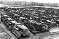 Bulldozers thatcham 1944.jpg 504 × 339; 82 KB
-
 Bungalow on Bath Road, Thatcham - geograph.org.uk - 4679565.jpg 2 304 × 1 728; 852 KB
-
 Bungalow on Floral Way, Thatcham - geograph.org.uk - 5485408.jpg 2 048 × 1 536; 1,48 MB
-
 Bury's Bank Road cattle grid - geograph.org.uk - 3240695.jpg 3 648 × 2 432; 1,96 MB
-
 Bury's Bank Road south of Ashen Copse - geograph.org.uk - 3240702.jpg 3 648 × 2 432; 1,44 MB
-
 Burys Bank Road north of New Greenham Park - geograph.org.uk - 2703302.jpg 3 648 × 2 588; 1,28 MB
-
 Business park on north bank above Colthrop lock - geograph.org.uk - 3695195.jpg 1 024 × 768; 129 KB
-
 Buttress on the bridge - geograph.org.uk - 3052063.jpg 533 × 800; 188 KB
-
 Bywash below Widmead lock (no 89) - geograph.org.uk - 3696541.jpg 1 024 × 768; 181 KB
-
 Canal towpath (Kennet ^ Avon Canal) - geograph.org.uk - 4766644.jpg 640 × 426; 113 KB
-
 Canoeists above Colthrop lock - geograph.org.uk - 3695173.jpg 1 024 × 768; 107 KB
-
 Cans in the embrasure - geograph.org.uk - 3052050.jpg 1 024 × 683; 116 KB
-
 Car Park Gate, Old Thornford Road - geograph.org.uk - 6255471.jpg 1 600 × 951; 441 KB
-
 Catholic Church of the Assumption, Thatcham - geograph.org.uk - 4680818.jpg 2 304 × 1 645; 1,36 MB
-
 Cattle grazing by Monkey Marsh lock - geograph.org.uk - 3709564.jpg 1 024 × 768; 122 KB
-
 Cattle pasture in the Kennet valley - geograph.org.uk - 3709560.jpg 1 024 × 768; 153 KB
-
 Chamberhouse Farm - geograph.org.uk - 10635.jpg 640 × 480; 172 KB
-
 Chamberhouse Farm House - geograph.org.uk - 10651.jpg 640 × 480; 175 KB
-
 Chamberhouse Mill - geograph.org.uk - 1187809.jpg 640 × 426; 180 KB
-
 Chamberhouse Mill - geograph.org.uk - 1187811.jpg 640 × 427; 191 KB
-
 Chamberhouse Mill, Thatcham - geograph.org.uk - 20157.jpg 640 × 480; 634 KB
-
 Chamberhouse Mill.jpg 850 × 394; 473 KB
-
 Chapel of St Thomas - geograph.org.uk - 4863493.jpg 640 × 479; 46 KB
-
 Charlotte Edwards - geograph.org.uk - 4762870.jpg 640 × 426; 74 KB
-

-
 Clouds in the canal - geograph.org.uk - 4766643.jpg 640 × 426; 60 KB
-
 Coldthrop Business Park - geograph.org.uk - 5971574.jpg 1 024 × 681; 112 KB
-
 Colthrop Crossing - geograph.org.uk - 3846539.jpg 1 200 × 815; 1,05 MB
-
 Colthrop Crossing Box - geograph.org.uk - 5404807.jpg 1 235 × 1 500; 195 KB
-
 Colthrop Lane Bridge - geograph.org.uk - 4762842.jpg 640 × 426; 101 KB
-
 Colthrop Lock - geograph.org.uk - 3043314.jpg 1 024 × 683; 134 KB
-
 Colthrop Lock - geograph.org.uk - 4762849.jpg 640 × 426; 72 KB
-
 Colthrop Lock - geograph.org.uk - 4762850.jpg 640 × 426; 84 KB
-
 Colthrop Lock Pipe Bridge - geograph.org.uk - 3346805.jpg 3 522 × 2 484; 2,91 MB
-
 Colthrop Manor Farm (geograph 7493435).jpg 4 080 × 3 060; 4,03 MB
-
 Colthrop weir (right) and lock (left) - geograph.org.uk - 5866275.jpg 1 024 × 683; 191 KB
-
 Computer Salvage Specialists - geograph.org.uk - 4846764.jpg 4 000 × 2 608; 1,44 MB
-
 Confirmation of the gunpit - geograph.org.uk - 3050830.jpg 1 024 × 683; 274 KB
-
 Coniferous stand - geograph.org.uk - 1872897.jpg 640 × 459; 127 KB
-
 Conway Drive - geograph.org.uk - 3341151.jpg 640 × 451; 52 KB
-
 Corner of the gunpit - geograph.org.uk - 3050825.jpg 1 024 × 683; 272 KB
-
 Cottages in Chapel Street - geograph.org.uk - 1808487.jpg 800 × 574; 80 KB
-
 Country road, Greenham, Berkshire - geograph.org.uk - 4871179.jpg 800 × 563; 211 KB
-
 Cowslip Crescent, Thatcham - geograph.org.uk - 5482785.jpg 2 048 × 1 536; 1,48 MB
-
 Crawler-crane-thatcham-1944.jpg 504 × 345; 79 KB
-
 Crookham Common - geograph.org.uk - 1818665.jpg 640 × 480; 134 KB
-
 Crookham Common Road leaves the speed limited section - geograph.org.uk - 2917974.jpg 3 253 × 2 420; 1,74 MB
-
 Crookham Common, Berkshire - geograph.org.uk - 4869573.jpg 5 640 × 3 518; 6,68 MB
-
 Crookham Hill - geograph.org.uk - 1808387.jpg 800 × 565; 131 KB
-
 Crookham Hill Bridge - geograph.org.uk - 4766585.jpg 640 × 426; 87 KB
-
 Crookham Hill intersection with Bury's Bank Road - geograph.org.uk - 3240672.jpg 3 648 × 2 432; 1,74 MB
-
 Crookham Village Store - geograph.org.uk - 6244519.jpg 3 968 × 2 232; 1 MB
-
 Crookham village stores - geograph.org.uk - 2070046.jpg 640 × 480; 53 KB
-
 Cycle Route off Pipers Way - geograph.org.uk - 4846808.jpg 4 000 × 3 000; 2,99 MB
-
 Daffodils and Agricola Way - geograph.org.uk - 4847638.jpg 4 000 × 3 000; 3,33 MB
-
 Date Stone in the lock - geograph.org.uk - 3050557.jpg 1 024 × 683; 235 KB
-
 Depot entrance - geograph.org.uk - 1187773.jpg 640 × 425; 168 KB
-
 Detail of the front - geograph.org.uk - 3043583.jpg 1 024 × 683; 242 KB
-
 Discovery Centre and Thatcham Lake - geograph.org.uk - 9571.jpg 640 × 321; 177 KB
-
 Distribution area - geograph.org.uk - 5572373.jpg 640 × 426; 50 KB
-
 Distribution Depot - geograph.org.uk - 4657428.jpg 640 × 426; 42 KB
-
 Dog Days Out - geograph.org.uk - 3044507.jpg 533 × 800; 199 KB
-
 Dove and Fountain, Peace Garden - geograph.org.uk - 29254.jpg 640 × 521; 199 KB
-
 Drinks Distribution Centre - geograph.org.uk - 4755128.jpg 640 × 426; 44 KB
-
 Drinks Distribution Centre, Thatcham - geograph.org.uk - 4755127.jpg 640 × 426; 50 KB
-
 Dull day at Colthrop lock - geograph.org.uk - 3043398.jpg 1 024 × 683; 120 KB
-
 Dunstan Park - geograph.org.uk - 1693.jpg 640 × 480; 54 KB
-
 Early signs of a cereal crop - geograph.org.uk - 2146413.jpg 640 × 480; 80 KB
-
 Edge of Crookham Common - geograph.org.uk - 1187538.jpg 640 × 426; 179 KB
-
 Electricity sub-station at Thatcham - geograph.org.uk - 1466118.jpg 640 × 427; 61 KB
-
 Elevators in the distance - geograph.org.uk - 3041933.jpg 1 024 × 683; 168 KB
-
 Embrasure by the canal - geograph.org.uk - 3043408.jpg 1 024 × 683; 208 KB
-
 Entrance of the pillbox - geograph.org.uk - 2039983.jpg 1 024 × 683; 206 KB
-
 Entrance to Widmead Lock - geograph.org.uk - 3051992.jpg 1 024 × 683; 214 KB
-
 Ex-Courage Brewery - geograph.org.uk - 4893328.jpg 640 × 426; 40 KB
-
 Ex-Courage Brewery - geograph.org.uk - 5196644.jpg 640 × 426; 29 KB
-
 Exercise Machines - geograph.org.uk - 4848113.jpg 1 600 × 1 200; 423 KB
-
 Factory by the Kennet and Avon Canal - geograph.org.uk - 4766577.jpg 640 × 426; 70 KB
-
 Falmouth Way, Thatcham - geograph.org.uk - 1808674.jpg 640 × 480; 106 KB
-
 Far as I went - geograph.org.uk - 3043602.jpg 1 024 × 683; 164 KB
-
 Farmhouse Mews - geograph.org.uk - 4899012.jpg 3 486 × 2 841; 1,71 MB
-
 Farmland and houses, Thatcham - geograph.org.uk - 1808611.jpg 640 × 427; 117 KB
-
 Farmland, Thatcham - geograph.org.uk - 1808576.jpg 640 × 480; 133 KB
-
 Farmland, Thatcham - geograph.org.uk - 1808682.jpg 640 × 480; 159 KB
-
 Farmland, Thatcham - geograph.org.uk - 2122816.jpg 640 × 480; 173 KB
-
 Farmland, Thatcham - geograph.org.uk - 2817391.jpg 640 × 480; 132 KB
-
 Farmland, Thatcham - geograph.org.uk - 4374547.jpg 640 × 480; 264 KB
-
 Farmland, Thatcham - geograph.org.uk - 6194803.jpg 1 024 × 683; 214 KB
-
 Fence to the Kennet - geograph.org.uk - 3042173.jpg 533 × 800; 163 KB
-
 Field by the Kennet ^ Avon Canal - geograph.org.uk - 4766638.jpg 640 × 426; 89 KB
-
 Field by the Kennet ^ Avon Canal - geograph.org.uk - 4785569.jpg 2 638 × 1 436; 473 KB
-
 Field side path - Harts Hill - geograph.org.uk - 2456326.jpg 480 × 640; 94 KB
-
 Field south of Monkey Marsh Lock - geograph.org.uk - 5866272.jpg 1 024 × 683; 222 KB
-
 Fields in the summer - geograph.org.uk - 2146405.jpg 640 × 480; 90 KB
-
 Fields south of Thatcham - geograph.org.uk - 3145586.jpg 2 048 × 1 536; 1,6 MB
-
 Flag on the Corner - geograph.org.uk - 4847620.jpg 4 000 × 3 000; 2,58 MB
-
 Flood in Ashbourne Way - geograph.org.uk - 2317430.jpg 640 × 480; 72 KB
-
 Flooded Fields of Waterside Farm - geograph.org.uk - 6407033.jpg 5 184 × 3 880; 2,03 MB
-
 Flooded gravel pit, Crookham Common, Berkshire - geograph.org.uk - 4857842.jpg 5 118 × 3 493; 5 MB
-
 Floral Way - geograph.org.uk - 1808114.jpg 800 × 586; 91 KB
-
 Floral Way - geograph.org.uk - 1912300.jpg 640 × 480; 93 KB
-
 Floral Way at the junction of London Road - geograph.org.uk - 5481258.jpg 2 048 × 1 536; 1,47 MB
-
 Floral Way junction with Foxgrove Way - geograph.org.uk - 2824572.jpg 3 648 × 2 736; 893 KB
-
 Floral Way junction with Lawrences Way - geograph.org.uk - 2824591.jpg 3 648 × 2 736; 1,28 MB
-
 Florco Building - geograph.org.uk - 4846759.jpg 4 000 × 3 000; 1,96 MB
-
 Flotsam in the lock - geograph.org.uk - 3044805.jpg 1 024 × 683; 207 KB
-
 Flutterby craft barn Newbury - geograph.org.uk - 3337412.jpg 2 146 × 1 240; 1,02 MB
-
 Footpath and cycleway crossing Hurford Drive - geograph.org.uk - 4848136.jpg 4 000 × 3 000; 3,12 MB
-
 Former Courage brewery - geograph.org.uk - 4893327.jpg 640 × 426; 35 KB
-
 Former Courage Brewery - geograph.org.uk - 5655396.jpg 640 × 425; 33 KB
-
 Former Courage Brewery - geograph.org.uk - 5655397.jpg 640 × 426; 41 KB
-
 Former Courage Brewery - geograph.org.uk - 5782703.jpg 640 × 426; 43 KB
-
 Foxglove Way, Thatcham - geograph.org.uk - 4898829.jpg 3 661 × 2 542; 1,66 MB
-
 Front of the Type 22 - geograph.org.uk - 3050663.jpg 1 024 × 683; 263 KB
-
 Gate across the towpath - geograph.org.uk - 3050552.jpg 1 024 × 683; 185 KB
-
 Gate to the lake - geograph.org.uk - 3052247.jpg 1 024 × 683; 277 KB
-
 Geese across the Kennet - geograph.org.uk - 3052250.jpg 1 024 × 683; 238 KB
-
 Glebelands, Thatcham - geograph.org.uk - 4847706.jpg 3 940 × 3 000; 2,21 MB
-
 Going in the lock - geograph.org.uk - 3051995.jpg 1 024 × 683; 247 KB
-
 Golf Range, Lower Henwick Farm - geograph.org.uk - 4901020.jpg 5 184 × 3 456; 4,58 MB
-
 Grassington Place - Thatcham - geograph.org.uk - 1808082.jpg 640 × 416; 70 KB
-
 Grassland east of Thatcham - geograph.org.uk - 2146402.jpg 640 × 480; 106 KB
-
 Grazing land, Kennet Valley - geograph.org.uk - 4762900.jpg 640 × 426; 64 KB
-
 Grazing sheep at Thatcham, Berkshire.jpg 640 × 426; 178 KB
-
 Greenham - panoramio.jpg 1 608 × 1 068; 600 KB
-
 Greenham and Crookham Commons - geograph.org.uk - 1187536.jpg 640 × 427; 140 KB
-
 Greenham Common airbase remains - geograph.org.uk - 5539591.jpg 640 × 480; 161 KB


.jpg)


_-_geograph.org.uk_-_3696541.jpg)
_-_geograph.org.uk_-_4766644.jpg)


.jpg)
_and_lock_(left)_-_geograph.org.uk_-_5866275.jpg)


