Category:Thaxted
Aller à la navigation
Aller à la recherche
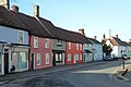
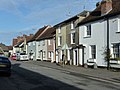
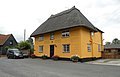
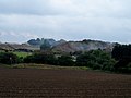
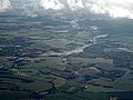
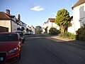
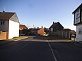
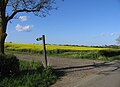
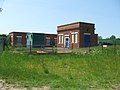
Thaxted is a civil parish in Essex, England, which includes the town of Thaxted, the small settlements of Barfield End Green, Boyton End, Cutlers Green, Monk Street, Richmond's Green, Sibley's Green and Stanbrook, and dispersed buildings, businesses and farms.

localité britannique    | |||||
| Téléverser des médias | |||||
| Nature de l’élément | |||||
|---|---|---|---|---|---|
| Lieu | Uttlesford, Essex, Angleterre de l'Est, Angleterre | ||||
| Population |
| ||||
 | |||||
Sous-catégories
Cette catégorie comprend 24 sous-catégories, dont les 24 ci-dessous.
- Bardfield End Green (1 F)
- Boyton End, Essex (2 F)
- Cutlers Green (3 F)
- Richmond's Green (1 F)
- Stanbrook (1 F)
1
- 16 Watling Street, Thaxted (6 F)
A
- Armigers, Essex (3 F)
B
- Borough, Essex (1 F)
C
- Clarence House, Thaxted (2 F)
- Thaxted Cricket Club (62 F)
G
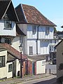
- Thaxted Guildhall (24 F)
H
- Horham Hall (20 F)
J
- John Webb's Mill, Thaxted (34 F)
M
P
- Park Farm, Thaxted (1 F)
R
- Recorder's House (1 F)
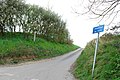
- Roads in Thaxted (8 F)
S
- The Swan, Thaxted (6 F)
T
- Thaxted railway station (2 F)
- Thaxted Town Sign (2 F)
Média dans la catégorie « Thaxted »
Cette catégorie comprend 281 fichiers, dont les 200 ci-dessous.
(page précédente) (page suivante)-
 "Guildhall" in December, Thaxted (listed building) - geograph.org.uk - 4759014.jpg 1 024 × 1 024 ; 257 kio
-
 1 - 11 (odds) Newbiggen Street, Thaxted - geograph.org.uk - 4310011.jpg 640 × 428 ; 79 kio
-
 2, 4, 6, Town Street, Thaxted - geograph.org.uk - 4309890.jpg 640 × 428 ; 76 kio
-
 Post Office Thaxted Essex England.jpg 4 996 × 3 649 ; 10,33 Mio
-
 Gift shop window Thaxted Essex England.jpg 4 265 × 3 412 ; 14,34 Mio
-
 28, 30, 32... Newbiggen Street, Thaxted - geograph.org.uk - 4310032.jpg 640 × 480 ; 90 kio
-
 42, 44, 46... Newbiggen Street, Thaxted - geograph.org.uk - 4310048.jpg 640 × 480 ; 92 kio
-
 55, 57, Newbiggen Street, Thaxted - geograph.org.uk - 4310070.jpg 640 × 428 ; 83 kio
-
 6, 8, 10... Newbiggen Street, Thaxted - geograph.org.uk - 4310021.jpg 640 × 428 ; 78 kio
-
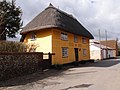
 A thatched house in Watling Lane, Thaxted - geograph.org.uk - 1455787.jpg 640 × 411 ; 47 kio
-
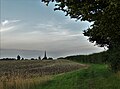
 A view of Thaxted through the mist - geograph.org.uk - 4353369.jpg 4 320 × 3 240 ; 4,95 Mio
-
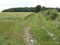
 Across The Fields - geograph.org.uk - 5235310.jpg 1 024 × 768 ; 241 kio
-
 Aggregate supply business at Armigers Farm - geograph.org.uk - 4003233.jpg 4 320 × 3 240 ; 4,31 Mio
-
 Allotments, Bardfield End, Thaxted - geograph.org.uk - 4308367.jpg 640 × 480 ; 103 kio
-
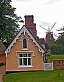 Almshouses and windmill, Thaxted - geograph.org.uk - 4626427.jpg 1 291 × 1 658 ; 627 kio
-
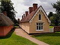 Almshouses, Thaxted - geograph.org.uk - 4626481.jpg 1 920 × 1 440 ; 908 kio
-
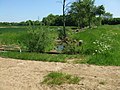
 Armigers Lakes - geograph.org.uk - 6079908.jpg 3 264 × 2 448 ; 4,26 Mio
-
 Armigers Lakes from the air - geograph.org.uk - 5137969.jpg 640 × 480 ; 123 kio
-
 B1051 towards Great Sampford - geograph.org.uk - 5795969.jpg 1 024 × 684 ; 297 kio
-
 Bardfield End Green from the air - geograph.org.uk - 5137894.jpg 640 × 480 ; 123 kio
-
 Bardfield End Green, Thaxted (listed building) (geograph 4759027).jpg 3 086 × 2 057 ; 1,37 Mio
-
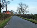
 Bardfield Road - geograph.org.uk - 5318120.jpg 1 024 × 768 ; 206 kio
-
 Bardfield Road - geograph.org.uk - 5795802.jpg 1 024 × 684 ; 199 kio
-
 Bardfield Road Thaxted from junction Dunmow Road - geograph.org.uk - 2075749.jpg 640 × 480 ; 101 kio
-
 Bardfield Road towards Thaxted - geograph.org.uk - 5795806.jpg 1 024 × 684 ; 245 kio
-
 Bardfield Road, Thaxted - geograph.org.uk - 6079926.jpg 3 264 × 2 448 ; 4,13 Mio
-
 Barn at Yardley Hall - geograph.org.uk - 3392459.jpg 800 × 534 ; 115 kio
-
 Bend In Footpath - geograph.org.uk - 5235228.jpg 1 024 × 768 ; 249 kio
-
 Blue houses in Thaxted - geograph.org.uk - 5513983.jpg 2 206 × 1 588 ; 987 kio
-
 Bridge And Guide Posts - geograph.org.uk - 5235296.jpg 768 × 1 024 ; 341 kio
-
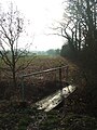
 Bridge over stream near Richmond's Green - geograph.org.uk - 3595226.jpg 3 648 × 2 736 ; 3,53 Mio
-
 Bridge over the River Chelmer - geograph.org.uk - 4378515.jpg 2 816 × 1 880 ; 3,04 Mio
-
 Bridleway on track to Goddard's Farm, Thaxted - geograph.org.uk - 4872304.jpg 1 024 × 1 024 ; 462 kio
-
 Buckingham's Farm from the air - geograph.org.uk - 2867927.jpg 640 × 480 ; 145 kio
-
 Buckingham's Farm from the air - geograph.org.uk - 5137954.jpg 640 × 480 ; 136 kio
-
 Café Christmas tree Thaxted Essex England 1.jpg 5 472 × 3 648 ; 21,77 Mio
-
 Café Christmas tree Thaxted Essex England 2.jpg 5 472 × 3 648 ; 21,37 Mio
-
 Cat at Yardley Hall - geograph.org.uk - 3392479.jpg 800 × 600 ; 161 kio
-
 Caterpillars of the small ermine moth - geograph.org.uk - 3497127.jpg 640 × 480 ; 116 kio
-
 Centre of Thaxted in 1988 - geograph.org.uk - 3999773.jpg 800 × 748 ; 140 kio
-
 Church Gate - geograph.org.uk - 846132.jpg 640 × 427 ; 104 kio
-
 Church hall on Margaret Street - geograph.org.uk - 3370581.jpg 3 648 × 2 736 ; 2,75 Mio
-
 Church Parade - geograph.org.uk - 263070.jpg 500 × 325 ; 122 kio
-
 Claypits farmhouse - geograph.org.uk - 3370514.jpg 3 648 × 2 736 ; 2,89 Mio
-
 Closed down pub in Thaxted (The Star) - geograph.org.uk - 4003664.jpg 4 090 × 2 906 ; 3,04 Mio
-
 Coat of Arms of Thaxted.jpg 1 132 × 1 168 ; 132 kio
-
 Cobbled lane leading towards Thaxted Church - geograph.org.uk - 6412582.jpg 1 200 × 1 800 ; 298 kio
-
 Cobbled street, Thaxted - geograph.org.uk - 3370536.jpg 2 736 × 3 648 ; 2,02 Mio
-
 Conservation headlands at Goddard's Farm - geograph.org.uk - 3371190.jpg 3 648 × 2 736 ; 2,72 Mio
-
 Copthall Lane, Thaxted - geograph.org.uk - 4795059.jpg 640 × 480 ; 154 kio
-
 Cottage in Thaxted - geograph.org.uk - 846187.jpg 640 × 427 ; 72 kio
-
 Cottages in Newbiggin Street, Thaxted - geograph.org.uk - 2610712.jpg 640 × 480 ; 60 kio
-
 Cottages Thaxted Essex England - Mill Row.jpg 3 548 × 5 473 ; 16,6 Mio
-
 Countryside near Thaxted from the air - geograph.org.uk - 2409274.jpg 640 × 480 ; 142 kio
-
 Crumble Cottage, Stanbrook - geograph.org.uk - 4308411.jpg 640 × 480 ; 93 kio
-
 Cutlers Green from the air - geograph.org.uk - 3021790.jpg 480 × 640 ; 133 kio
-
 Dairy Green Farm and Hill Farm from the air - geograph.org.uk - 5137918.jpg 640 × 480 ; 134 kio
-
 Dark Skies - geograph.org.uk - 5209009.jpg 1 024 × 768 ; 219 kio
-
 Debden Road leading into Thaxted - geograph.org.uk - 3497137.jpg 640 × 480 ; 119 kio
-
 Direction Sign - geograph.org.uk - 5235252.jpg 768 × 1 024 ; 184 kio
-
 Doorway of a former Pub - geograph.org.uk - 3370566.jpg 2 698 × 3 598 ; 1,34 Mio
-
 Engine house, Bolford Street, Thaxted - geograph.org.uk - 4624980.jpg 1 303 × 1 702 ; 791 kio
-
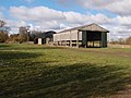
 Essex Black Barn - geograph.org.uk - 3370444.jpg 3 648 × 2 736 ; 2,78 Mio
-
 Essex fieldscape - geograph.org.uk - 5833684.jpg 3 264 × 2 448 ; 3,87 Mio
-
 Essex from the air - geograph.org.uk - 3162096.jpg 640 × 480 ; 138 kio
-
 Essex from the air - geograph.org.uk - 3162111.jpg 640 × 480 ; 144 kio
-
 Essex from the air - geograph.org.uk - 5833686.jpg 3 264 × 2 448 ; 3,56 Mio
-
 Farm buildings near Yardley Hall - geograph.org.uk - 3370628.jpg 3 648 × 2 736 ; 2,9 Mio
-
 Farm machinery at Woodhams Farm - geograph.org.uk - 3497181.jpg 640 × 480 ; 119 kio
-
 Farm track at Woodhams Farm, in Thaxted, Essex.jpg 480 × 640 ; 152 kio
-
 Field by Bardfield Road - geograph.org.uk - 5519740.jpg 1 990 × 1 454 ; 792 kio
-
 Field by the B1051, Stanbrook - geograph.org.uk - 5534061.jpg 2 048 × 1 536 ; 991 kio
-
 Field-road boundary towards Little Sampford - geograph.org.uk - 4931925.jpg 640 × 436 ; 100 kio
-
 Fishmarket St, Thaxted 1.jpg 5 184 × 3 888 ; 4,06 Mio
-
 Fishmarket St, Thaxted 2.jpg 3 801 × 5 067 ; 3,54 Mio
-
 Fishmarket Street, Thaxted - geograph.org.uk - 1363060.jpg 640 × 480 ; 116 kio
-
 Flooded River Chelmer from the air - geograph.org.uk - 3844736.jpg 640 × 480 ; 116 kio
-
 Flooded River Chelmer from the air - geograph.org.uk - 3844742.jpg 611 × 640 ; 124 kio
-
 Flooded River Chelmer from the air - geograph.org.uk - 3844747.jpg 480 × 640 ; 98 kio
-
 Folly Mill Lane - geograph.org.uk - 3917760.jpg 1 600 × 1 064 ; 527 kio
-
 Follymill Farmhouse, Thaxted (listed building) - geograph.org.uk - 3595058.jpg 3 648 × 2 736 ; 3,07 Mio
-
 Footbridge - geograph.org.uk - 5235225.jpg 768 × 1 024 ; 225 kio
-
 Footbridge And Guid Post - geograph.org.uk - 5235231.jpg 1 024 × 768 ; 329 kio
-
 Footpath - geograph.org.uk - 5235210.jpg 1 024 × 768 ; 339 kio
-
 Footpath - geograph.org.uk - 5235214.jpg 1 024 × 768 ; 194 kio
-
 Footpath - geograph.org.uk - 5235223.jpg 1 024 × 768 ; 250 kio
-
 Footpath - geograph.org.uk - 5235226.jpg 768 × 1 024 ; 388 kio
-
 Footpath - geograph.org.uk - 5235233.jpg 1 024 × 768 ; 247 kio
-
 Footpath And Field Edge - geograph.org.uk - 5235222.jpg 1 024 × 768 ; 289 kio
-
 Footpath And Sign - geograph.org.uk - 5318225.jpg 768 × 1 024 ; 282 kio
-
 Footpath Junction - geograph.org.uk - 5318217.jpg 1 024 × 768 ; 253 kio
-
 Footpath north - geograph.org.uk - 478043.jpg 640 × 480 ; 96 kio
-
 Footpath on farm track near Furthermoor Hall, Little Bardfield - geograph.org.uk - 4795123.jpg 3 648 × 2 736 ; 2,68 Mio
-
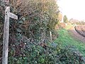
 Footpath sign - geograph.org.uk - 4931907.jpg 640 × 534 ; 221 kio
-
 Footpath to Yardley Hall - geograph.org.uk - 221959.jpg 640 × 425 ; 116 kio
-
 Ford at Thaxted - geograph.org.uk - 3415694.jpg 3 872 × 2 592 ; 2,36 Mio
-
 Former post office, Thaxted - geograph.org.uk - 4624795.jpg 1 534 × 1 254 ; 384 kio
-
 Former pub on Watling street - geograph.org.uk - 3370563.jpg 3 648 × 2 736 ; 2,43 Mio
-

-

-
 From Bardfield End Green towards Thaxted - geograph.org.uk - 4931912.jpg 640 × 454 ; 86 kio
-
 Gate And Footpath - geograph.org.uk - 5235216.jpg 1 024 × 768 ; 246 kio
-
 Gated track - geograph.org.uk - 4931926.jpg 640 × 402 ; 108 kio
-
 Going out into the open - geograph.org.uk - 5235227.jpg 768 × 1 024 ; 372 kio
-
 Guide Post And Footpath - geograph.org.uk - 5235230.jpg 768 × 1 024 ; 252 kio
-
 Guildhall, Thaxted - geograph.org.uk - 5235290.jpg 3 072 × 1 728 ; 1,04 Mio
-
 H Lowe and Co - geograph.org.uk - 846117.jpg 640 × 427 ; 58 kio
-
 Hammer Hill Farm - geograph.org.uk - 6079917.jpg 3 264 × 2 448 ; 4 Mio
-
 Hammer Hill Farm from the air - geograph.org.uk - 5137960.jpg 640 × 480 ; 132 kio
-
 Harcamlow Way - geograph.org.uk - 846090.jpg 640 × 427 ; 78 kio
-
 Hill Farm from the air - geograph.org.uk - 5137951.jpg 640 × 365 ; 110 kio
-
 Horham Hall - geograph.org.uk - 5837290.jpg 2 070 × 1 551 ; 1,71 Mio
-
 Houses in Bardfield End Green - geograph.org.uk - 5519765.jpg 1 990 × 1 454 ; 870 kio
-
 Houses on Newbiggen Street, Thaxted - geograph.org.uk - 5520455.jpg 2 304 × 1 728 ; 855 kio
-
 Houses on Park Street, Thaxted - geograph.org.uk - 5517552.jpg 1 960 × 1 412 ; 738 kio
-
 Houses on Watling Street, Thaxted - geograph.org.uk - 4309963.jpg 640 × 480 ; 89 kio
-
 Housing terrace, Newbiggin Street, Thaxted - geograph.org.uk - 4626408.jpg 1 920 × 1 440 ; 559 kio
-
 Information board for farm environmental and conservation schemes - geograph.org.uk - 3371196.jpg 2 644 × 3 526 ; 2,37 Mio
-
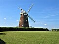
 John Webb's Windmill - geograph.org.uk - 5235208.jpg 768 × 1 024 ; 172 kio
-
 John Webb's Windmill, Thaxted - geograph.org.uk - 6160050.jpg 1 024 × 768 ; 161 kio
-
 John Webb's Windmill, Thaxted - geograph.org.uk - 6160063.jpg 768 × 1 024 ; 185 kio
-
 Lane towards Richmond's Green - geograph.org.uk - 4308481.jpg 640 × 480 ; 95 kio
-
 Linden Homes marketing suite - geograph.org.uk - 5515328.jpg 1 600 × 1 200 ; 314 kio
-
 Looking west from over Thaxted - geograph.org.uk - 5837310.jpg 3 264 × 2 448 ; 3,99 Mio
-
 Loves Farm from the air - geograph.org.uk - 2467927.jpg 640 × 609 ; 164 kio
-
 Loves Farm from the air - geograph.org.uk - 2936579.jpg 640 × 480 ; 124 kio
-
 Marked Footpath - geograph.org.uk - 5235308.jpg 768 × 1 024 ; 281 kio
-
 Maud Lamb's Cottage - geograph.org.uk - 846124.jpg 427 × 640 ; 69 kio
-
 Meadow Gardens, Thaxted - geograph.org.uk - 5515312.jpg 1 600 × 1 200 ; 345 kio
-
 Meadow Gardens, Thaxted - geograph.org.uk - 5515318.jpg 1 600 × 1 200 ; 270 kio
-
 Meadow Under The Power Lines - geograph.org.uk - 5208999.jpg 1 024 × 768 ; 212 kio
-
 Mill End, Thaxted - geograph.org.uk - 5534019.jpg 2 048 × 1 536 ; 1,49 Mio
-
 Mill Hill Farm and Woodhams Farm from the air - geograph.org.uk - 2467932.jpg 640 × 480 ; 117 kio
-
 Mill Row - geograph.org.uk - 846138.jpg 640 × 427 ; 77 kio
-
 Monk Street - geograph.org.uk - 4308433.jpg 640 × 480 ; 82 kio
-
 Morrismen at Thaxted - geograph.org.uk - 158171.jpg 427 × 640 ; 117 kio
-
 Mound near Armigers - geograph.org.uk - 536162.jpg 640 × 426 ; 178 kio
-
 New footpath bridge over the River Chelmer - geograph.org.uk - 3497055.jpg 640 × 480 ; 116 kio
-
 New pond and farm machinery - geograph.org.uk - 3497175.jpg 640 × 480 ; 120 kio
-
 Newbiggen Street - geograph.org.uk - 5086446.jpg 2 147 × 3 221 ; 1,54 Mio
-
 Newbiggen Street cottages - geograph.org.uk - 845636.jpg 640 × 427 ; 68 kio
-
 Newbiggen Street cottages - geograph.org.uk - 845642.jpg 640 × 427 ; 64 kio
-
 Newbiggen Street, Thaxted - geograph.org.uk - 1154074.jpg 640 × 427 ; 79 kio
-
 Newsagent and post office, Thaxted - geograph.org.uk - 4308397.jpg 640 × 428 ; 77 kio
-
 Nice thatch - geograph.org.uk - 3370604.jpg 3 648 × 2 736 ; 2,81 Mio
-
 October sky above Thaxted - geograph.org.uk - 2591443.jpg 1 800 × 1 200 ; 231 kio
-
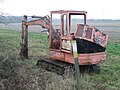 Old Digger - geograph.org.uk - 5235302.jpg 1 024 × 768 ; 260 kio
-
 Open countryside near Debden - geograph.org.uk - 1717941.jpg 640 × 427 ; 72 kio
-
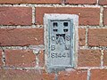 Ordnance Survey Flush Bracket S1441 - geograph.org.uk - 4711382.jpg 4 000 × 3 000 ; 4,32 Mio
-
 Parish church, Thaxted - geograph.org.uk - 5235704.jpg 1 728 × 3 072 ; 726 kio
-
 Park Street Garage, Thaxted - geograph.org.uk - 5517550.jpg 2 048 × 1 536 ; 1,48 Mio
-
 Park Street, Thaxted - geograph.org.uk - 5517538.jpg 2 304 × 1 728 ; 851 kio
-
 Park Street, Thaxted - geograph.org.uk - 5517540.jpg 2 304 × 1 728 ; 871 kio
-
 Path through Barley Field, near Dovehouse Farm - geograph.org.uk - 3595195.jpg 3 648 × 2 736 ; 4,34 Mio
-
 Pond and Barns at The Lodge - geograph.org.uk - 562443.jpg 640 × 480 ; 114 kio
-
 Poultry shed at Sibley's Green - geograph.org.uk - 3370476.jpg 2 933 × 2 200 ; 1,04 Mio
-
 Prior's Hall from the air - geograph.org.uk - 5137909.jpg 640 × 480 ; 127 kio
-
 Public footpath and track - geograph.org.uk - 4931927.jpg 640 × 463 ; 86 kio
-
 Public footpath and track towards the woods - geograph.org.uk - 4931928.jpg 640 × 429 ; 89 kio
-
 Pumping station near Thaxted - geograph.org.uk - 3497145.jpg 640 × 480 ; 116 kio
-
 Pylons - geograph.org.uk - 5235229.jpg 768 × 1 024 ; 166 kio
-
 Richmond's Green - geograph.org.uk - 3370491.jpg 3 648 × 2 736 ; 2,71 Mio
-
 River Chelmer - geograph.org.uk - 3497062.jpg 640 × 480 ; 119 kio
-
 River Chelmer - geograph.org.uk - 3497156.jpg 640 × 480 ; 120 kio
-
 Road bend, Richmond's Green - geograph.org.uk - 4308452.jpg 640 × 480 ; 134 kio
-
 Road Junction - geograph.org.uk - 5235246.jpg 1 024 × 768 ; 161 kio
-
 Road Junction - geograph.org.uk - 5235314.jpg 1 024 × 768 ; 241 kio
-
 Road junction, Bardfield End Green - geograph.org.uk - 4004206.jpg 4 320 × 3 240 ; 2,96 Mio
-
 Road Scene - geograph.org.uk - 5318153.jpg 768 × 1 024 ; 242 kio
-
 Road towards the Sampfords - geograph.org.uk - 4308360.jpg 640 × 480 ; 109 kio
-
 Roadside nature reserve - geograph.org.uk - 4308422.jpg 640 × 480 ; 82 kio
-
 Rooster Booster - geograph.org.uk - 3370434.jpg 3 648 × 2 736 ; 2,75 Mio
-
 Sheep in field, near Follymill, Thaxted - geograph.org.uk - 3595063.jpg 3 648 × 2 736 ; 3,39 Mio
-
 Shops on Town Street, Thaxted - geograph.org.uk - 6087701.jpg 1 882 × 1 220 ; 1,22 Mio
-
 Shops, Watling Street, Thaxted - geograph.org.uk - 1363086.jpg 640 × 480 ; 93 kio
-
 Small bridge on B1051 - geograph.org.uk - 4308402.jpg 640 × 480 ; 129 kio
-
 South of Thaxted - geograph.org.uk - 5517857.jpg 4 882 × 3 626 ; 3,55 Mio
-
 Spot the harrows - geograph.org.uk - 3371184.jpg 3 648 × 2 736 ; 2,61 Mio
-
 Stanbrook from the air - geograph.org.uk - 2409288.jpg 640 × 480 ; 108 kio
-
 Stars Wood - geograph.org.uk - 693554.jpg 640 × 426 ; 80 kio
-
 Stomping through Sibley's Green - geograph.org.uk - 3370464.jpg 3 648 × 2 736 ; 2,87 Mio
-
 Swollen stream with old tree - geograph.org.uk - 1599375.jpg 640 × 480 ; 226 kio
-
 Church, Bolford Street, Thaxted - geograph.org.uk - 1363032.jpg 640 × 467 ; 126 kio
-
 Thaxted 1744092 55a2e00f.jpg 640 × 430 ; 124 kio
-
 Thaxted Almshouses - geograph.org.uk - 2499483.jpg 1 600 × 1 200 ; 459 kio
-
 Thaxted Almshouses - geograph.org.uk - 845584.jpg 640 × 427 ; 73 kio
-
 Thaxted almshouses and mill - geograph.org.uk - 1355497.jpg 428 × 640 ; 77 kio
-
 Thaxted almshouses windmill.jpg 1 600 × 1 024 ; 384 kio
-
 Thaxted Bacchus.jpg 1 875 × 2 500 ; 264 kio
-
 Thaxted Baptist Church - geograph.org.uk - 4624584.jpg 1 278 × 1 405 ; 535 kio
-
 Thaxted Baptist Church - geograph.org.uk - 845347.jpg 640 × 427 ; 60 kio
-
 Thaxted Beacon - geograph.org.uk - 846108.jpg 640 × 427 ; 93 kio
-
 Thaxted Church - geograph.org.uk - 3497078.jpg 640 × 480 ; 124 kio
-
 Thaxted Cottages - geograph.org.uk - 46456.jpg 640 × 480 ; 102 kio
-
 Thaxted fire station - geograph.org.uk - 836381.jpg 640 × 427 ; 205 kio
-
 Thaxted from the air - geograph.org.uk - 2867940.jpg 640 × 482 ; 138 kio
-
 Thaxted from the air - geograph.org.uk - 3162080.jpg 640 × 480 ; 149 kio
-
 Thaxted from the air - geograph.org.uk - 5137903.jpg 640 × 423 ; 143 kio
-
 Thaxted Guildhall - geograph.org.uk - 5667662.jpg 2 048 × 1 536 ; 929 kio
-
 Thaxted old fire station - geograph.org.uk - 623745.jpg 640 × 427 ; 278 kio
_-_geograph.org.uk_-_4759014.jpg)
_Newbiggen_Street,_Thaxted_-_geograph.org.uk_-_4310011.jpg)


_(geograph_4759027).jpg)


_-_geograph.org.uk_-_4003664.jpg)


_-_geograph.org.uk_-_3595058.jpg)


_1999_Mercedes-Benz_814D_(Vario)_Plaxton_Beaver_2,_Thaxted,_30_June_2011.jpg)


