Category:Theddingworth
Aller à la navigation
Aller à la recherche
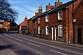
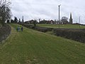
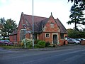
English: Theddingworth is a village and civil parish in Leicestershire, England. It lies at west of Market Harborough on the road to Lutterworth. It is on the north bank of the River Welland and the Grand Union Canal passes within a mile. There is a church, Congregational Chapel and Theddingworth railway station was a former stop on the Rugby to Market Harborough line.
localité britannique du comté anglais de Leicestershire  | |||||
| Téléverser des médias | |||||
| Nature de l’élément | |||||
|---|---|---|---|---|---|
| Lieu | Harborough, Leicestershire, Midlands de l'Est, Angleterre | ||||
| Population |
| ||||
| Superficie |
| ||||
 | |||||
Sous-catégories
Cette catégorie comprend 2 sous-catégories, dont les 2 ci-dessous.
A
T
Média dans la catégorie « Theddingworth »
Cette catégorie comprend 216 fichiers, dont les 200 ci-dessous.
(page précédente) (page suivante)-
 A4304 Theddingworth Road - geograph.org.uk - 580467.jpg 640 × 424 ; 116 kio
-
 Approaching Bridge 54 - geograph.org.uk - 3116444.jpg 3 072 × 2 048 ; 1,59 Mio
-
 Approaching Theddingworth - geograph.org.uk - 547332.jpg 640 × 432 ; 115 kio
-
 Are you warm in that boat, 'cause we're Friesian out here^ - geograph.org.uk - 3115781.jpg 3 072 × 2 048 ; 1,58 Mio
-
 Bosworth Road (A4304), Theddingworth - geograph.org.uk - 4337051.jpg 640 × 480 ; 59 kio
-
 Bridge 47 - geograph.org.uk - 546373.jpg 640 × 466 ; 150 kio
-
 Bridge 49 - geograph.org.uk - 3115771.jpg 3 072 × 2 048 ; 1,84 Mio
-
 Bridge 49 - geograph.org.uk - 3115774.jpg 3 072 × 2 048 ; 1,95 Mio
-
 Bridge 50 - geograph.org.uk - 2354859.jpg 640 × 446 ; 85 kio
-
 Bridge 50 - geograph.org.uk - 3115776.jpg 3 072 × 2 048 ; 1,78 Mio
-
 Bridge 51 - geograph.org.uk - 3115796.jpg 3 072 × 2 048 ; 1,48 Mio
-
 Bridge 52 - "It's going to rain tomorrow" - geograph.org.uk - 3115811.jpg 2 975 × 1 941 ; 1,43 Mio
-
 Bridge 52 - geograph.org.uk - 3115806.jpg 640 × 427 ; 103 kio
-
 Bridge 52, from the east - geograph.org.uk - 5545332.jpg 1 024 × 768 ; 242 kio
-
 Bridge 52, from the west - geograph.org.uk - 5562765.jpg 1 024 × 768 ; 253 kio
-
 Bridge 53 - geograph.org.uk - 3115826.jpg 3 072 × 2 048 ; 1,54 Mio
-
 Bridge 53 Grand Union Canal Leicester Section - geograph.org.uk - 444074.jpg 640 × 460 ; 129 kio
-
 Bridge 53, from the east - geograph.org.uk - 5545334.jpg 1 024 × 768 ; 299 kio
-
 Bridge 54 - geograph.org.uk - 2354867.jpg 640 × 446 ; 72 kio
-
 Bridge 54 - geograph.org.uk - 3116449.jpg 3 072 × 2 048 ; 1,74 Mio
-
 Bridge No 54, from the north-east - geograph.org.uk - 5545342.jpg 1 024 × 768 ; 198 kio
-
-

-

-
 Canal at Theddingworth Lodge Bridge in Leicestershire - geograph.org.uk - 5878502.jpg 1 280 × 960 ; 1,39 Mio
-
 Canal near Theddingworth in Leicestershire - geograph.org.uk - 5878464.jpg 1 440 × 916 ; 1,49 Mio
-
 Canal near Theddingworth in Leicestershire - geograph.org.uk - 5878468.jpg 1 280 × 848 ; 1,33 Mio
-
 Canal north-west of Theddingworth in Leicestershire - geograph.org.uk - 5879317.jpg 1 280 × 851 ; 1 020 kio
-
 Canal north-west of Theddingworth, Leicestershire - geograph.org.uk - 5878586.jpg 1 280 × 905 ; 1,34 Mio
-
 Canal south of Laughton in Leicestershire - geograph.org.uk - 5880120.jpg 1 280 × 960 ; 1,27 Mio
-
 Canal winding hole south of Laughton, Leicestershire - geograph.org.uk - 5881670.jpg 1 280 × 909 ; 1,05 Mio
-
 Canalside pasture south of Laughton in Leicestershire - geograph.org.uk - 5880159.jpg 1 280 × 878 ; 1,22 Mio
-
 Canalside pasture south of Laughton in Leicestershire - geograph.org.uk - 5883803.jpg 1 280 × 883 ; 1,17 Mio
-
 Canalside pasture south of Laughton in Leicestershire - geograph.org.uk - 5883811.jpg 1 440 × 869 ; 1,33 Mio
-
 Cattle grazing in the Laughton Hills - geograph.org.uk - 5545330.jpg 1 024 × 768 ; 258 kio
-
 Cemetery, Theddingworth - geograph.org.uk - 4337028.jpg 640 × 480 ; 88 kio
-
 Compact and bijou narrowboat butty - geograph.org.uk - 5879361.jpg 1 280 × 1 280 ; 1,95 Mio
-
 Compton House, Theddingworth - geograph.org.uk - 4337025.jpg 640 × 480 ; 79 kio
-
 Cows by Station Road - geograph.org.uk - 2496061.jpg 640 × 427 ; 71 kio
-
 Farmland south-east of Laughton in Leicestershire - geograph.org.uk - 5884588.jpg 1 280 × 913 ; 1,19 Mio
-
 Farmland south-east of Mowsley in Leicestershire - geograph.org.uk - 5880073.jpg 1 280 × 873 ; 1,2 Mio
-
 Farmland south-east of Mowsley in Leicestershire - geograph.org.uk - 5880074.jpg 1 280 × 897 ; 1,24 Mio
-
 Grand Union Canal (Leicester Arm) - geograph.org.uk - 4987759.jpg 480 × 640 ; 55 kio
-
 Grand Union Canal (Leicester Arm) - geograph.org.uk - 4987761.jpg 640 × 480 ; 101 kio
-
 Grand Union Canal (Leicester Arm) - geograph.org.uk - 4987763.jpg 480 × 640 ; 111 kio
-
 Grand Union Canal (Leicester Arm) - geograph.org.uk - 4987765.jpg 480 × 640 ; 68 kio
-
 Grand Union Canal (Leicester Arm) - geograph.org.uk - 4987767.jpg 640 × 480 ; 74 kio
-
 Grand Union Canal (Leicester Arm) - geograph.org.uk - 4987771.jpg 480 × 640 ; 76 kio
-
 Grand Union Canal (Leicester Arm) - geograph.org.uk - 4987772.jpg 480 × 640 ; 58 kio
-
 Grand Union Canal (Leicester Arm) - geograph.org.uk - 4987773.jpg 480 × 640 ; 50 kio
-
 Grand Union Canal (Leicester Arm) - geograph.org.uk - 4987776.jpg 480 × 640 ; 56 kio
-
 Grand Union Canal (Leicester Arm) - geograph.org.uk - 4991089.jpg 480 × 640 ; 79 kio
-
 Grand Union Canal (Leicester Arm) - geograph.org.uk - 4991090.jpg 640 × 480 ; 75 kio
-
 Grand Union Canal (Leicester Arm) - geograph.org.uk - 4991091.jpg 640 × 480 ; 47 kio
-
 Grand Union Canal (Leicester Arm) - geograph.org.uk - 4991092.jpg 640 × 480 ; 82 kio
-
 Grand Union Canal (Leicester Arm) - geograph.org.uk - 4991093.jpg 640 × 480 ; 54 kio
-
 Grand Union Canal (Leicester Arm) - geograph.org.uk - 4991114.jpg 640 × 480 ; 80 kio
-
 Grand Union Canal (Leicester Arm) - geograph.org.uk - 4991115.jpg 640 × 480 ; 88 kio
-
 Grand Union Canal near Theddingworth in Leicestershire - geograph.org.uk - 5878589.jpg 960 × 1 280 ; 1,48 Mio
-
 Grand Union Canal south of Laughton in Leicestershire - geograph.org.uk - 5883854.jpg 1 440 × 962 ; 1,76 Mio
-
 Grand Union Canal south of Laughton in Leicestershire - geograph.org.uk - 5883916.jpg 1 280 × 960 ; 1,77 Mio
-
 Grand Union Canal south of Laughton, Leicestershire - geograph.org.uk - 5880190.jpg 1 440 × 965 ; 1,71 Mio
-
 Grand Union Canal south of Laughton, Leicestershire - geograph.org.uk - 5880935.jpg 1 440 × 879 ; 1,56 Mio
-
 Grand Union Canal south of Laughton, Leicestershire - geograph.org.uk - 5880962.jpg 1 440 × 909 ; 1,34 Mio
-
 Grand Union Canal south of Laughton, Leicestershire - geograph.org.uk - 5882621.jpg 1 280 × 960 ; 1,55 Mio
-
 Grand Union Canal south of Mowsley, Leicestershire - geograph.org.uk - 5879408.jpg 1 600 × 927 ; 1,22 Mio
-
 Grand Union Canal south of Mowsley, Leicestershire - geograph.org.uk - 5879412.jpg 1 280 × 960 ; 1 007 kio
-
 Grand Union Canal south of Mowsley, Leicestershire - geograph.org.uk - 5879414.jpg 1 280 × 960 ; 1,32 Mio
-
 Grand Union Canal south-east of Laughton in Leicestershire - geograph.org.uk - 5884631.jpg 1 280 × 960 ; 1,45 Mio
-

-
 Grand Union Canal south-east of Mowsley, Leicestershire - geograph.org.uk - 5880078.jpg 1 440 × 961 ; 1,31 Mio
-
 Grand Union Canal, Leicester Section - geograph.org.uk - 3471658.jpg 640 × 480 ; 90 kio
-
 Grand Union Canal, Leicester Section - geograph.org.uk - 3473135.jpg 640 × 480 ; 60 kio
-

-

-

-

-

-

-

-
 Grand Union Canal, Leicestershire - geograph.org.uk - 545469.jpg 640 × 475 ; 164 kio
-
 Grass snake - geograph.org.uk - 546386.jpg 640 × 586 ; 57 kio
-
 Grazing sheep near Hothorpe Hills, Northants - geograph.org.uk - 547291.jpg 513 × 640 ; 107 kio
-
 House on the A4304, Theddingworth - geograph.org.uk - 4337049.jpg 640 × 480 ; 66 kio
-
 It's what boating's all about - geograph.org.uk - 3115786.jpg 3 072 × 2 048 ; 1,7 Mio
-
 Ivy Lodge Farm Bridge near Laughton, Leicestershire - geograph.org.uk - 5880937.jpg 1 280 × 960 ; 1,41 Mio
-
 Ivy Lodge Farm Bridge near Laughton, Leicestershire - geograph.org.uk - 5880952.jpg 1 280 × 960 ; 1,39 Mio
-
 Kicklewell Spinney Bridge near Laughton in Leicestershire - geograph.org.uk - 5880091.jpg 1 280 × 944 ; 1,39 Mio
-
 Kicklewell Spinney Bridge near Laughton in Leicestershire - geograph.org.uk - 5880117.jpg 1 280 × 886 ; 1,49 Mio
-
 Kicklewell Spinney, from the south - geograph.org.uk - 5545328.jpg 1 024 × 768 ; 167 kio
-
 Lane to Gumley - geograph.org.uk - 1622398.jpg 640 × 428 ; 99 kio
-
 Lane to Gumley - geograph.org.uk - 1624670.jpg 428 × 640 ; 91 kio
-
 Laughton Hills, from the south - geograph.org.uk - 5545333.jpg 1 024 × 768 ; 210 kio
-
 Laughton Lodge Bridge near Laughton in Leicestershire - geograph.org.uk - 5883869.jpg 1 280 × 859 ; 1,34 Mio
-
 Laughton Lodge Bridge near Laughton in Leicestershire - geograph.org.uk - 5883879.jpg 1 280 × 960 ; 1,48 Mio
-
 Laughton Lodge Bridge near Laughton in Leicestershire - geograph.org.uk - 5883902.jpg 1 280 × 897 ; 1,41 Mio
-
 Laughton Manor Farm Bridge in Leicestershire - geograph.org.uk - 5884621.jpg 1 440 × 916 ; 1,55 Mio
-
 Laughton Manor Farm Bridge in Leicestershire - geograph.org.uk - 5884626.jpg 1 440 × 921 ; 1,46 Mio
-
 Leicester 20 Miles - geograph.org.uk - 545461.jpg 480 × 640 ; 159 kio
-
 Leicester Section Bridge 52 - winding hole - geograph.org.uk - 3115825.jpg 3 072 × 2 048 ; 1,68 Mio
-
 Lone tree, south of Kicklewell Spinney - geograph.org.uk - 5562774.jpg 1 024 × 768 ; 176 kio
-
 Main Street, Theddingworth - geograph.org.uk - 4337032.jpg 640 × 480 ; 64 kio
-
 Manor Farm, Theddingworth - geograph.org.uk - 4337035.jpg 640 × 480 ; 59 kio
-
 Milking time at Bridge 49 - geograph.org.uk - 5562776.jpg 1 024 × 768 ; 259 kio
-
 Moored narrowboats near Theddingworth in Leicestershire - geograph.org.uk - 5879319.jpg 960 × 1 280 ; 1,23 Mio
-
 Moored narrowboats near Theddingworth in Leicestershire - geograph.org.uk - 5879325.jpg 960 × 1 280 ; 1,44 Mio
-
 Mowsley Road - geograph.org.uk - 2494128.jpg 640 × 480 ; 112 kio
-
 Mowsley Road - geograph.org.uk - 311032.jpg 640 × 480 ; 128 kio
-
 Pasture and woodland south of Laughton in Leicestershire - geograph.org.uk - 5880164.jpg 1 280 × 849 ; 1,19 Mio
-
 Pasture and woodland south of Laughton in Leicestershire - geograph.org.uk - 5883833.jpg 1 280 × 960 ; 1,66 Mio
-
 Pasture and woodland south of Laughton in Leicestershire - geograph.org.uk - 5883839.jpg 1 280 × 960 ; 1,51 Mio
-
 Pasture south of Laughton in Leicestershire - geograph.org.uk - 5880830.jpg 1 280 × 861 ; 1,14 Mio
-
 Pasture south of Laughton in Leicestershire - geograph.org.uk - 5882618.jpg 1 280 × 851 ; 1,15 Mio
-
 Pasture south-east of Laughton in Leicestershire - geograph.org.uk - 5884609.jpg 1 280 × 861 ; 1,3 Mio
-
 Railway bridge - geograph.org.uk - 5301936.jpg 480 × 640 ; 45 kio
-
-

-

-
 Road over the Grand Union Canal (Leicester Arm) - geograph.org.uk - 4987778.jpg 480 × 640 ; 100 kio
-
 Rugby-Market Harborough Railway - geograph.org.uk - 2125956.jpg 640 × 480 ; 84 kio
-
 Sheep grazing , south of Kicklewell Spinney - geograph.org.uk - 5545326.jpg 1 024 × 768 ; 129 kio
-
 Sheep grazing below the Laughton Hills - geograph.org.uk - 5545337.jpg 1 024 × 768 ; 169 kio
-
 Sheep on Hothorpe Hills - geograph.org.uk - 296407.jpg 640 × 480 ; 52 kio
-
 Small working narrowboat on the Grand Union Canal - geograph.org.uk - 5879333.jpg 1 280 × 960 ; 1,44 Mio
-
 Station Road - geograph.org.uk - 2494143.jpg 640 × 480 ; 103 kio
-
 Station Road, Theddingworth - geograph.org.uk - 4337040.jpg 640 × 480 ; 80 kio
-
 Theddingworth - geograph.org.uk - 147743.jpg 640 × 427 ; 120 kio
-
 Theddingworth Congregational Chapel - geograph.org.uk - 5173326.jpg 480 × 640 ; 50 kio
-
 Theddingworth Congregational Church - geograph.org.uk - 2135271.jpg 640 × 480 ; 103 kio
-
 Theddingworth Congregational Church. - geograph.org.uk - 415041.jpg 640 × 480 ; 122 kio
-
 Theddingworth entrance sign - geograph.org.uk - 2369316.jpg 640 × 480 ; 71 kio
-
 Theddingworth Farmland - geograph.org.uk - 2125950.jpg 640 × 480 ; 63 kio
-
 Theddingworth Footpath - geograph.org.uk - 2125948.jpg 640 × 480 ; 78 kio
-
 Theddingworth from the Green Lane - geograph.org.uk - 763148.jpg 640 × 480 ; 76 kio
-
 Theddingworth Lodge Bridge in Leicestershire - geograph.org.uk - 5878471.jpg 1 280 × 1 280 ; 1,89 Mio
-
 Theddingworth Lodge Bridge in Leicestershire - geograph.org.uk - 5878498.jpg 1 280 × 916 ; 1,42 Mio
-
 Theddingworth parish church - geograph.org.uk - 5173324.jpg 480 × 640 ; 106 kio
-
 Theddingworth parish church - geograph.org.uk - 5287689.jpg 480 × 640 ; 99 kio
-

-
 Theddingworth Station - geograph.org.uk - 2124942.jpg 640 × 550 ; 87 kio
-
 Theddingworth Station - geograph.org.uk - 2124951.jpg 640 × 480 ; 111 kio
-
 Theddingworth Village Hall - geograph.org.uk - 2125261.jpg 640 × 480 ; 75 kio
-
 Theddingworth Village Hall - geograph.org.uk - 4337048.jpg 640 × 480 ; 68 kio
-
 Theddingworth Village Hall. - geograph.org.uk - 415037.jpg 640 × 568 ; 83 kio
-
 Theddingworth, Laughton Hills - geograph.org.uk - 3473197.jpg 640 × 480 ; 88 kio
-
 Theddingworth-Road from Gumley - geograph.org.uk - 2134792.jpg 480 × 640 ; 118 kio
-
 Theddingworth-Station Road - geograph.org.uk - 2133696.jpg 640 × 480 ; 84 kio
-
 Towpath on the Grand Union Canal - geograph.org.uk - 545468.jpg 640 × 463 ; 149 kio
-
 View towards Theddingworth - geograph.org.uk - 546207.jpg 640 × 448 ; 102 kio
-
 Welcome to Theddingworth - geograph.org.uk - 547359.jpg 640 × 450 ; 96 kio
-
 Ancient Beech. - geograph.org.uk - 415051.jpg 640 × 480 ; 120 kio
-
 Barn - geograph.org.uk - 311051.jpg 640 × 480 ; 107 kio
-
 Barn by Mowsley Road - geograph.org.uk - 311025.jpg 640 × 480 ; 78 kio
-
 Bosworth Road near Theddingworth - geograph.org.uk - 547345.jpg 640 × 474 ; 111 kio
-
 Bosworth Road, Theddingworth - geograph.org.uk - 547325.jpg 640 × 403 ; 102 kio
-
 Bridge 50 from the road - geograph.org.uk - 311028.jpg 640 × 480 ; 90 kio
-
 Bridge 51 on the Grand Union Canal - geograph.org.uk - 294182.jpg 640 × 480 ; 141 kio
-
 Bridge 52 - geograph.org.uk - 546166.jpg 640 × 397 ; 125 kio
-
 Cape Lubenham - geograph.org.uk - 580474.jpg 543 × 640 ; 122 kio
-
 Cemetery. - geograph.org.uk - 415045.jpg 640 × 480 ; 117 kio
-
 Composting in progress. - geograph.org.uk - 322041.jpg 640 × 480 ; 103 kio
-
 Country lane towards Theddingworth - geograph.org.uk - 547301.jpg 640 × 480 ; 119 kio
-
 Country road to the East - geograph.org.uk - 311048.jpg 640 × 480 ; 107 kio
-
 Country road to the West - geograph.org.uk - 296439.jpg 640 × 480 ; 119 kio
-
 Country Road towards Gumley - geograph.org.uk - 311050.jpg 640 × 480 ; 68 kio
-
 Dick's Hill - geograph.org.uk - 296424.jpg 640 × 480 ; 100 kio
-
 Entering Theddingworth village - geograph.org.uk - 547329.jpg 640 × 424 ; 100 kio
-
 Entrance to 'The Wrongs Farm', Sibbertoft - geograph.org.uk - 175951.jpg 640 × 480 ; 112 kio
-
 Entrance to Home Farm Hothorpe - geograph.org.uk - 296409.jpg 640 × 480 ; 65 kio
-
 Entrance to Hothorpe Hall - geograph.org.uk - 547311.jpg 640 × 471 ; 131 kio
-
 Fields - geograph.org.uk - 296435.jpg 640 × 480 ; 140 kio
-
 Fields - geograph.org.uk - 296437.jpg 640 × 480 ; 53 kio
-
 Fields near Theddingworth - geograph.org.uk - 296436.jpg 640 × 480 ; 109 kio
-
 Freeman's Bridge - geograph.org.uk - 546360.jpg 640 × 482 ; 140 kio
-
 Gate and Fields - geograph.org.uk - 296410.jpg 640 × 542 ; 81 kio
-
 Gated road to Laughton - geograph.org.uk - 547318.jpg 640 × 408 ; 96 kio
-
 Grand Union Canal, Leicestershire - geograph.org.uk - 545466.jpg 640 × 570 ; 152 kio
-
 Grand Union Canal, Leicestershire - geograph.org.uk - 546381.jpg 640 × 540 ; 132 kio
-
 Grazing sheep at Scoborough - geograph.org.uk - 547379.jpg 640 × 418 ; 116 kio
-
 Green lane north of Theddingworth - geograph.org.uk - 763143.jpg 640 × 480 ; 97 kio
-
 Harborough Road near Theddingworth - geograph.org.uk - 547362.jpg 640 × 445 ; 94 kio
-
 Harborough Road towards Market Harborough - geograph.org.uk - 547370.jpg 640 × 495 ; 124 kio
-
 Harborough Road towards Market Harborough - geograph.org.uk - 547372.jpg 640 × 302 ; 79 kio
-
 Hothorpe Hills - geograph.org.uk - 296405.jpg 640 × 480 ; 60 kio
-
 Ivy Lodge Farm viewed from Laughton Hills - geograph.org.uk - 293062.jpg 640 × 480 ; 76 kio
-
 Lane close to Hothorpe Hills - geograph.org.uk - 547302.jpg 640 × 541 ; 125 kio
-
 Lane from Theddingworth to Laughton Hills - geograph.org.uk - 311042.jpg 640 × 480 ; 109 kio
-
 Lane junction - geograph.org.uk - 547308.jpg 640 × 480 ; 108 kio
-
 Lane to Gumley - geograph.org.uk - 547381.jpg 640 × 480 ; 117 kio
-
 Leicester 22 Miles - geograph.org.uk - 546367.jpg 503 × 640 ; 163 kio
-
 Living Milestone No 2 - geograph.org.uk - 545463.jpg 471 × 640 ; 165 kio
-
 Mill Hill Farm Entrance - geograph.org.uk - 296441.jpg 640 × 480 ; 88 kio
-

-
 Muddy track - geograph.org.uk - 297910.jpg 640 × 480 ; 87 kio
-
 Narrowboats near Bridge 52 - geograph.org.uk - 546169.jpg 640 × 452 ; 131 kio
-
 On the brink of the Hothorpe Hills - geograph.org.uk - 296408.jpg 640 × 480 ; 59 kio
-
 Pipebridge - geograph.org.uk - 546401.jpg 640 × 487 ; 128 kio
-

-
 Recycling facilities - geograph.org.uk - 322048.jpg 640 × 480 ; 75 kio
-
 Road Junction - geograph.org.uk - 296422.jpg 640 × 463 ; 95 kio


,_Theddingworth_-_geograph.org.uk_-_4337051.jpg)


_-_geograph.org.uk_-_4987759.jpg)
_-_geograph.org.uk_-_4987761.jpg)
_-_geograph.org.uk_-_4987763.jpg)
_-_geograph.org.uk_-_4987765.jpg)
_-_geograph.org.uk_-_4987767.jpg)
_-_geograph.org.uk_-_4987771.jpg)
_-_geograph.org.uk_-_4987772.jpg)
_-_geograph.org.uk_-_4987773.jpg)
_-_geograph.org.uk_-_4987776.jpg)
_-_geograph.org.uk_-_4991089.jpg)
_-_geograph.org.uk_-_4991090.jpg)
_-_geograph.org.uk_-_4991091.jpg)
_-_geograph.org.uk_-_4991092.jpg)
_-_geograph.org.uk_-_4991093.jpg)
_-_geograph.org.uk_-_4991114.jpg)
_-_geograph.org.uk_-_4991115.jpg)


_-_geograph.org.uk_-_4987778.jpg)


