Category:Theddlethorpe All Saints
Aller à la navigation
Aller à la recherche
English: Theddlethorpe All Saints is a village and civil parish in the East Lindsey district, in the county of Lincolnshire, England.
village au Royaume-Uni  | |||||
| Téléverser des médias | |||||
| Nature de l’élément | |||||
|---|---|---|---|---|---|
| Lieu | East Lindsey, Lincolnshire, Midlands de l'Est, Angleterre | ||||
 | |||||
Sous-catégories
Cette catégorie comprend 3 sous-catégories, dont les 3 ci-dessous.
Média dans la catégorie « Theddlethorpe All Saints »
Cette catégorie comprend 145 fichiers, dont les 145 ci-dessous.
-
 2nd pillbox on the edge of the dunes - geograph.org.uk - 2215807.jpg 768 × 576 ; 224 kio
-
 A bend in the Great Eau - geograph.org.uk - 4404478.jpg 640 × 480 ; 62 kio
-
 A boggy inlet back across the saltmarsh - geograph.org.uk - 2323092.jpg 1 152 × 864 ; 285 kio
-
 A marshy inlet on the beach - geograph.org.uk - 2319921.jpg 1 280 × 960 ; 231 kio
-
 A walk behind Cloves Bridge - geograph.org.uk - 3906342.jpg 640 × 427 ; 39 kio
-
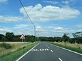 A1031 Saltfleet Road northbound - geograph.org.uk - 3670021.jpg 640 × 480 ; 57 kio
-
 Access through the dunes - geograph.org.uk - 2469192.jpg 1 024 × 768 ; 183 kio
-

-
 All Saints' church - geograph.org.uk - 6264074.jpg 1 024 × 683 ; 222 kio
-
 All Saints' nave - geograph.org.uk - 6264076.jpg 1 024 × 675 ; 233 kio
-
 All Saints' nave - geograph.org.uk - 6264088.jpg 1 024 × 683 ; 215 kio
-
 Approaching a bend on Thacker Bank - geograph.org.uk - 4407105.jpg 640 × 480 ; 83 kio
-
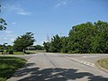
 Approaching Theddlethorpe All Saints - geograph.org.uk - 1939907.jpg 640 × 480 ; 53 kio
-
 Barefoot boys walking the shoreline - geograph.org.uk - 3638659.jpg 640 × 427 ; 43 kio
-

-
 Beach near the normal high water mark - geograph.org.uk - 2319907.jpg 1 408 × 1 056 ; 247 kio
-
 Bend in Saltfleet Road - geograph.org.uk - 4404668.jpg 640 × 480 ; 95 kio
-
 Between the dunes - geograph.org.uk - 2469217.jpg 1 024 × 768 ; 160 kio
-
 Brick bridge over a drain off Will Row - geograph.org.uk - 3767193.jpg 640 × 427 ; 79 kio
-

-
 Bull with cows, Theddlethorpe All Saints. - geograph.org.uk - 465257.jpg 640 × 480 ; 83 kio
-
 Churchill Lane carpark, path to the sea - geograph.org.uk - 4637476.jpg 640 × 427 ; 80 kio
-

-
 Clam collage - geograph.org.uk - 3994539.jpg 640 × 480 ; 121 kio
-

-
 Cow in a drain off Station Road - geograph.org.uk - 3691351.jpg 2 256 × 1 504 ; 2,53 Mio
-
 Crop field, High Bridge - geograph.org.uk - 4407104.jpg 640 × 480 ; 60 kio
-
 Crop field, Theddlethorpe - geograph.org.uk - 4404899.jpg 640 × 480 ; 84 kio
-
-
 Derelict farmhouse - geograph.org.uk - 3994381.jpg 640 × 480 ; 105 kio
-
 Derelict farrnhouse, Theddlethorpe - geograph.org.uk - 4404676.jpg 640 × 388 ; 99 kio
-
 Drain beside Churchill Lane - geograph.org.uk - 4404505.jpg 640 × 480 ; 86 kio
-
 Drain beside High Gate - geograph.org.uk - 4404891.jpg 640 × 480 ; 102 kio
-
 Drain beside Saltfleet Road, Theddlethorpe - geograph.org.uk - 4404494.jpg 640 × 480 ; 100 kio
-
 Dune edge - geograph.org.uk - 3994533.jpg 640 × 480 ; 66 kio
-
 Dyke by Churchill Lane - geograph.org.uk - 3994375.jpg 640 × 480 ; 100 kio
-
 Edge of the old firing range area - geograph.org.uk - 2215836.jpg 1 075 × 806 ; 210 kio
-
 Entering Theddlethorpe - geograph.org.uk - 4404486.jpg 640 × 480 ; 46 kio
-
 Entering Theddlethorpe village - geograph.org.uk - 4404502.jpg 640 × 457 ; 53 kio
-
 Expanding dunes - geograph.org.uk - 2469211.jpg 1 024 × 768 ; 106 kio
-
 Family silhouetted on the beach - geograph.org.uk - 3638658.jpg 640 × 427 ; 18 kio
-
-
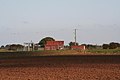
 Farm building, Hall Farm - geograph.org.uk - 4404902.jpg 640 × 480 ; 51 kio
-
 Farm Track from Will Row to Old Engine Drain - geograph.org.uk - 3767164.jpg 640 × 427 ; 43 kio
-
 Farmland near Two Mile Bank - geograph.org.uk - 1010258.jpg 640 × 457 ; 152 kio
-
 Farmland near Two Mile Bank Drain - geograph.org.uk - 1010247.jpg 640 × 457 ; 175 kio
-
 Farmland, High Gate - geograph.org.uk - 4404888.jpg 640 × 480 ; 79 kio
-
 Farmland, Theddlethorpe - geograph.org.uk - 4404491.jpg 640 × 480 ; 70 kio
-

-
 Fields near Theddlethorpe Primary School - geograph.org.uk - 4659045.jpg 4 704 × 3 152 ; 6,99 Mio
-

-
 Frozen spume at the high tide mark - 2 - geograph.org.uk - 2215824.jpg 768 × 576 ; 225 kio
-
 Frozen spume at the high tide mark - geograph.org.uk - 2215816.jpg 973 × 730 ; 223 kio
-
 Gate into the dunes - geograph.org.uk - 2468202.jpg 1 024 × 768 ; 147 kio
-
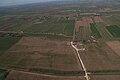
 Gayton le Marsh Grange, aerial 2014 - geograph.org.uk - 3965792.jpg 640 × 427 ; 59 kio
-

-
 Great Eau - geograph.org.uk - 4177166.jpg 1 024 × 683 ; 261 kio
-
 Great Eau and side drain near Cloves Bridge - geograph.org.uk - 3906366.jpg 640 × 427 ; 69 kio
-
 Great Eau at Cloves Bridge, aerial 2016 - geograph.org.uk - 4879346.jpg 427 × 640 ; 56 kio
-
 Great Eau at Cloves Bridge, aerial 2016 - geograph.org.uk - 4879350.jpg 640 × 427 ; 58 kio
-

-
 Great Eau from High Bridge - geograph.org.uk - 2517201.jpg 1 280 × 960 ; 262 kio
-

-
 Great Eau near Saltfleetby All Saints - geograph.org.uk - 2276442.jpg 640 × 437 ; 135 kio
-
 Great Eau SE of Gayton Windfarm, aerial 2018 - geograph.org.uk - 5645966.jpg 800 × 533 ; 59 kio
-

-
 Great Eau SW of Theddlethorpe, aerial 2014 - geograph.org.uk - 3871440.jpg 1 024 × 683 ; 144 kio
-
 Great Eau towards Cloves Bridge, aerial 2015 - geograph.org.uk - 4668226.jpg 640 × 290 ; 32 kio
-
 Grove Road - geograph.org.uk - 3688319.jpg 2 256 × 1 504 ; 2,08 Mio
-
 Healey lane towards Park Farm - geograph.org.uk - 2517216.jpg 1 280 × 960 ; 354 kio
-
 High Bridge over the Great Eau - geograph.org.uk - 481871.jpg 640 × 427 ; 115 kio
-
 High Gate - geograph.org.uk - 4404892.jpg 640 × 480 ; 57 kio
-
 House near Cloves Bridge - geograph.org.uk - 3906347.jpg 1 024 × 683 ; 145 kio
-
 JackieDaveKingsHeadInn.jpg 1 024 × 683 ; 185 kio
-

-
 Kings Head at Theddlethorpe - geograph.org.uk - 2507968.jpg 640 × 480 ; 86 kio
-
 Making ready for a ride on the beach - geograph.org.uk - 3638653.jpg 640 × 427 ; 52 kio
-

-
 Mill Road - geograph.org.uk - 4178074.jpg 1 024 × 683 ; 230 kio
-
 Mill Road, Theddlethorpe - geograph.org.uk - 4404901.jpg 640 × 480 ; 67 kio
-

-
 Old Tank near Rimac - geograph.org.uk - 1500113.jpg 640 × 480 ; 50 kio
-

-
 Path passing Pill Box in Theddlethorpe Nature Reserve - geograph.org.uk - 6405461.jpg 4 608 × 3 456 ; 5,49 Mio
-
 Pattern on the beach - geograph.org.uk - 2182607.jpg 1 024 × 768 ; 150 kio
-
 Pillbox in the dunes - geograph.org.uk - 4864113.jpg 2 000 × 1 333 ; 1,05 Mio
-
 Pillbox on the edge of the dunes - geograph.org.uk - 2215757.jpg 819 × 614 ; 228 kio
-
 Pond in the dunes - geograph.org.uk - 2469215.jpg 1 024 × 768 ; 215 kio
-
 Power lines crossing Thacker Bank - geograph.org.uk - 4314530.jpg 1 024 × 749 ; 117 kio
-
 Pumping station near Gayton Engine - geograph.org.uk - 3168152.jpg 640 × 427 ; 48 kio
-
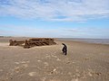 Remains of a tank sinking into the sand - geograph.org.uk - 2319899.jpg 1 408 × 1 056 ; 258 kio
-
 Returning from a ride on the beach - geograph.org.uk - 3638667.jpg 640 × 427 ; 32 kio
-
 Riders on the beach by Theddlethorpe Dunes - geograph.org.uk - 3638664.jpg 640 × 427 ; 29 kio
-

-

-

-

-

-
 Ridge and Furrow on High Gate - geograph.org.uk - 2323117.jpg 1 152 × 864 ; 272 kio
-
 Rood Screen - geograph.org.uk - 6264080.jpg 1 024 × 683 ; 236 kio
-
 Rood Screen - geograph.org.uk - 6264083.jpg 1 024 × 683 ; 216 kio
-
 Salt Marsh near Saltfleetby - geograph.org.uk - 4864123.jpg 2 000 × 1 333 ; 1,11 Mio
-
 Saltfleet Road (A1031) - geograph.org.uk - 4404497.jpg 640 × 480 ; 66 kio
-
 Saltfleetby - Theddlethorpe Dues NNR - geograph.org.uk - 1500078.jpg 640 × 480 ; 64 kio
-
 Saltfleetby, aerial 2014 - geograph.org.uk - 3966776.jpg 640 × 427 ; 58 kio
-
 Saltfleetby, aerial 2014 - geograph.org.uk - 3966779.jpg 640 × 427 ; 51 kio
-

-
 Sand with ripples - geograph.org.uk - 4009320.jpg 640 × 480 ; 69 kio
-
 Sign on the sands - geograph.org.uk - 2159675.jpg 1 024 × 768 ; 86 kio
-
 Stranded log east of the saltmarsh - geograph.org.uk - 2319912.jpg 1 280 × 960 ; 326 kio
-
 Sunset, the Grove, in Grove Road - geograph.org.uk - 3767211.jpg 640 × 427 ; 73 kio
-
 Swan in Two Mile Bank Drain - geograph.org.uk - 1010305.jpg 640 × 457 ; 194 kio
-
 Swans and Cloves Bridge - geograph.org.uk - 3062641.jpg 1 024 × 768 ; 178 kio
-
 Telephone and post box near Theddlethorpe St Helen - geograph.org.uk - 4314525.jpg 1 024 × 768 ; 217 kio
-
 Thacker Bank - geograph.org.uk - 4404904.jpg 640 × 480 ; 72 kio
-
 Thacker Bank from Hall Farm entrance - geograph.org.uk - 2507962.jpg 640 × 480 ; 99 kio
-
 Thacker Bank view - geograph.org.uk - 6264096.jpg 1 024 × 683 ; 236 kio
-
 Thacker Bank, approaching Theddlethorpe All Saints - geograph.org.uk - 2515454.jpg 1 280 × 960 ; 317 kio
-
 The Great Eau after the rains - geograph.org.uk - 481868.jpg 640 × 427 ; 81 kio
-
 The Great Eau River - geograph.org.uk - 290751.jpg 640 × 480 ; 104 kio
-
 The Great Eau River - geograph.org.uk - 291573.jpg 640 × 480 ; 98 kio
-
 The Great Eau, High Bridge - geograph.org.uk - 4407103.jpg 640 × 480 ; 53 kio
-
 The sea from Theddlethorpe Dunes - geograph.org.uk - 6405473.jpg 4 608 × 3 456 ; 3,73 Mio
-
 The tank in the sand - geograph.org.uk - 2323099.jpg 1 152 × 864 ; 244 kio
-

-
 Theddlethorpe All Saints - geograph.org.uk - 4177372.jpg 1 024 × 683 ; 290 kio
-
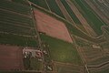
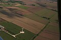
 Theddlethorpe All Saints, aerial 2015 - geograph.org.uk - 4303015.jpg 1 024 × 683 ; 99 kio
-
 Theddlethorpe All Saints, aerial 2015 - geograph.org.uk - 4684024.jpg 640 × 427 ; 68 kio
-
 Theddlethorpe cattle - geograph.org.uk - 4178217.jpg 1 024 × 683 ; 254 kio
-
 Theddlethorpe Community Primary School - geograph.org.uk - 2316514.jpg 1 152 × 864 ; 257 kio
-
 Theddlethorpe footpath - geograph.org.uk - 4177240.jpg 1 024 × 683 ; 383 kio
-
 Theddlethorpe Primary School - geograph.org.uk - 4404898.jpg 640 × 480 ; 57 kio
-

-
 Track from Will Row to the Great Eau - geograph.org.uk - 3767200.jpg 640 × 427 ; 63 kio
-
 Track off Will Row, near Theddlethorpe - geograph.org.uk - 2517173.jpg 1 280 × 960 ; 904 kio
-
 Track through the dunes - geograph.org.uk - 2469185.jpg 1 024 × 768 ; 168 kio
-
 Tracks in the sand - geograph.org.uk - 4009314.jpg 640 × 480 ; 79 kio
-
 Turn right for Saltfleet - geograph.org.uk - 1939909.jpg 640 × 480 ; 66 kio
-

-

-

-

-
 Will Row at The Elms - geograph.org.uk - 6080892.jpg 4 000 × 3 000 ; 3,67 Mio
-
 Will Row heading towards Poplar and Tuxworth Farms - geograph.org.uk - 6080896.jpg 4 000 × 3 000 ; 2,83 Mio
-


_-_geograph.org.uk_-_4401380.jpg)


_-_geograph.org.uk_-_6138286.jpg)
_-_geograph.org.uk_-_6138294.jpg)


_-_geograph.org.uk_-_4404497.jpg)


_-_geograph.org.uk_-_5148881.jpg)


