Category:Theres
Vai alla navigazione
Vai alla ricerca
comune tedesco  _COA.svg)  | |||||
| Carica un file multimediale | |||||
| Istanza di |
| ||||
|---|---|---|---|---|---|
| Parte di |
| ||||
| Luogo | Haßberge, Bassa Franconia, Baviera, Germania | ||||
| Capo del governo |
| ||||
| Popolazione |
| ||||
| Superficie |
| ||||
| Altezza sul mare |
| ||||
| sito web ufficiale | |||||
 | |||||
Sottocategorie
Questa categoria contiene le 8 sottocategorie indicate di seguito, su un totale di 8.
File nella categoria "Theres"
Questa categoria contiene 39 file, indicati di seguito, su un totale di 39.
-
 DEU Theres (a) COA.svg 592 × 666; 92 KB
-
 DEU Theres COA.svg 592 × 666; 227 KB
-
 Wappen von Theres.png 481 × 544; 74 KB
-
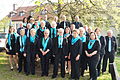 Chor des Gesangverein Obertheres.JPG 4 912 × 3 264; 3,66 MB
-
 D-6-74-180-10 Hofportal.jpg 2 244 × 1 560; 992 KB
-
 D-6-74-180-10 Wohnhaus.jpg 3 534 × 3 102; 2,63 MB
-
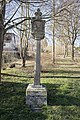
 D-6-74-180-11 Bildstock (2).jpg 2 288 × 4 800; 3,4 MB
-
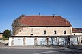 D-6-74-180-13 Scheune.jpg 6 000 × 4 000; 6,2 MB
-
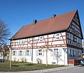 D-6-74-180-14 Wohnhaus.jpg 4 590 × 4 000; 5 MB
-
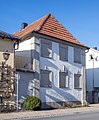 D-6-74-180-15 Wohnhaus.jpg 2 898 × 3 510; 2,86 MB
-
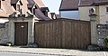 D-6-74-180-16 Hoftor.jpg 3 668 × 1 896; 2,09 MB
-
 D-6-74-180-16 Wohnhaus.jpg 4 446 × 3 719; 3,57 MB
-
 D-6-74-180-17 Hoftor.jpg 3 510 × 2 861; 2,87 MB
-
 D-6-74-180-21 Bildstock (1).jpg 4 000 × 5 136; 8,54 MB
-
 D-6-74-180-21 Bildstock (2).jpg 2 466 × 2 658; 2,36 MB
-
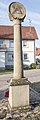
 D-6-74-180-29 Bildstock, Röden (Theres) (1).jpg 2 976 × 4 528; 3,89 MB
-
 D-6-74-180-3 Rathaus.jpg 3 428 × 3 435; 2,51 MB
-
 D-6-74-180-30 Bildstock (2).jpg 4 000 × 6 000; 11,72 MB
-
 D-6-74-180-32 Wegkreuz (2).jpg 3 996 × 3 167; 5,37 MB
-
 D-6-74-180-32 Wegkreuz, Nähe Kr HAS 4 (Theres) (1).jpg 4 000 × 5 312; 8,68 MB
-
 D-6-74-180-35 Rathaus.jpg 3 732 × 3 246; 2,92 MB
-
 D-6-74-180-36 Bildstock.jpg 1 936 × 5 576; 3,36 MB
-
 D-6-74-180-37 Bildstock (2).jpg 1 928 × 5 768; 2,9 MB
-
 D-6-74-180-37 Bildstock (3).jpg 1 744 × 1 936; 1,16 MB
-
 D-6-74-180-39 Bildstock.jpg 4 000 × 6 000; 6,29 MB
-
 D-6-74-180-40 Bildstock.jpg 1 928 × 5 008; 3,83 MB
-
 D-6-74-180-41 Wegkreuz, Waldsachsener Straße (Theres).jpg 4 000 × 6 000; 10,14 MB
-
 D-6-74-180-42 Wegkreuz, Rothhofleite (Theres).jpg 4 000 × 5 539; 7,19 MB
-
 D-6-74-180-43 Kirche St Karl Borromäus.jpg 2 816 × 4 872; 2,72 MB
-
 D-6-74-180-44 Scheune.jpg 2 958 × 2 232; 1,92 MB
-
 D-6-74-180-45 Wegkreuz.jpg 3 816 × 5 328; 7,4 MB
-
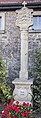
 D-6-74-180-48 Mariensäule.jpg 4 000 × 6 000; 7,63 MB
-
 D-6-74-180-67 Hoftor.jpg 696 × 984; 230 KB
-
 D-6-74-180-67 Wohnhaus.jpg 4 000 × 5 144; 4,54 MB
-
 D-6-74-180-69 Wegkreuz.jpg 2 904 × 5 112; 4,98 MB
-
 D-6-74-180-72 Scheune.jpg 3 726 × 2 976; 2,72 MB
-
 D-6-74-180-72 Torpfeiler (1).jpg 1 912 × 3 600; 2,36 MB
-
 D-6-74-180-72 Torpfeiler (2).jpg 2 144 × 3 888; 2,43 MB
-
 Theres in HAS.svg 567 × 580; 363 KB


.jpg)


.jpg)
.jpg)
_(1).jpg)

.jpg)
.jpg)
_(1).jpg)

.jpg)

.jpg)
.jpg)


.jpg)
.jpg)
.jpg)