Category:Theydon Bois
Zur Navigation springen
Zur Suche springen

Dorf in der Grafschaft Essex, England  | |||||
| Medium hochladen | |||||
| Ist ein(e) | |||||
|---|---|---|---|---|---|
| Ort | Epping Forest, Essex, East of England, England | ||||
| Verschieden von | |||||
| offizielle Website | |||||
 | |||||
Unterkategorien
Es werden 7 von insgesamt 7 Unterkategorien in dieser Kategorie angezeigt:
In Klammern die Anzahl der enthaltenen Kategorien (K), Seiten (S), Dateien (D)
Medien in der Kategorie „Theydon Bois“
Folgende 200 Dateien sind in dieser Kategorie, von 298 insgesamt.
(vorherige Seite) (nächste Seite)-
 Cemetery pink rose trellis at Theydon Bois, Essex, England 01.JPG 5.340 × 3.434; 14,88 MB
-
 Cemetery pink rose trellis at Theydon Bois, Essex, England 02.JPG 5.472 × 3.648; 17,02 MB
-
 Cemetery pink rose trellis at Theydon Bois, Essex, England 03.JPG 5.472 × 3.648; 12 MB
-
 Cemetery pink roses at Theydon Bois, Essex, England.JPG 3.760 × 3.148; 6,55 MB
-
 Cemetery rose trellis and graves at Theydon Bois, Essex, England 03.JPG 5.472 × 3.648; 18,88 MB
-
 Cemetery white and pink rose trellis at Theydon Bois, Essex, England.JPG 5.472 × 3.648; 15,76 MB
-
 Cemetery white rose at Theydon Bois, Essex, England.JPG 4.563 × 3.135; 4,72 MB
-
 Cemetery white rose trellis at Theydon Bois, Essex, England.JPG 4.184 × 3.103; 10,31 MB
-
 Cemetery white roses at Theydon Bois, Essex, England.JPG 5.472 × 3.648; 10,94 MB
-
 Cemetery pink rose at Theydon Bois, Essex, England.JPG 3.334 × 3.230; 5,59 MB
-
 Roding Valley from Abridge to Theydon Bois Essex England cooler.jpg 6.240 × 4.160; 20,09 MB
-
 Roding Valley from Abridge to Theydon Bois Essex England sharper.jpg 6.240 × 4.160; 20,7 MB
-
 Roding Valley from Abridge to Theydon Bois Essex England warmer.jpg 6.240 × 4.160; 21,2 MB
-
 A Bridge in Abridge - geograph.org.uk - 1873718.jpg 640 × 428; 84 KB
-
 A cast iron lamp, Theydon Bois, Essex, England.JPG 3.332 × 5.231; 19,05 MB
-
 A dormer window, Theydon Bois, Essex, England.JPG 3.648 × 5.472; 11,98 MB
-
-
 A hanging basket, Theydon Bois, Essex, England.JPG 3.648 × 5.472; 8,73 MB
-
 A house with a pub sign in Theydon Bois.jpg 1.024 × 768; 998 KB
-
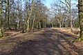
 A Parallel Path - geograph.org.uk - 6088187.jpg 3.375 × 4.463; 3,09 MB
-

-

-
 A pond with rushes westwards outside the Woodland Trust wood Theydon Bois Essex England.JPG 2.656 × 4.339; 6,72 MB
-

-

-

-
 A raised decking with furniture, Theydon Bois, Essex, England.JPG 5.320 × 3.648; 19 MB
-
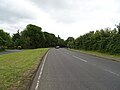
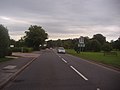
 Abridge Road (B172) - geograph.org.uk - 6207283.jpg 800 × 497; 97 KB
-
 Abridge Road - geograph.org.uk - 6207281.jpg 640 × 480; 57 KB
-
 Abridge Road at junction of Market Place - geograph.org.uk - 2546717.jpg 1.600 × 1.200; 609 KB
-
 Abridge Road heading for Abridge - geograph.org.uk - 2547280.jpg 1.600 × 1.200; 551 KB
-
 Abridge Road north of Abridge - geograph.org.uk - 2547285.jpg 1.600 × 1.200; 642 KB
-
 Abridge Road overlooking Roding Hall - geograph.org.uk - 2546719.jpg 1.600 × 1.200; 515 KB
-
 Advance warning on the M11 - geograph.org.uk - 2973944.jpg 640 × 480; 113 KB
-
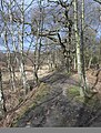
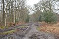
 Along the green ride - geograph.org.uk - 5286936.jpg 640 × 427; 117 KB
-
 Approaching the Bell Common Tunnel - geograph.org.uk - 6317007.jpg 1.024 × 576; 80 KB
-
 Autumn sunlight near Jack's Hill - geograph.org.uk - 4239811.jpg 3.178 × 2.119; 4,93 MB
-
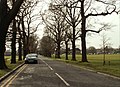
 Avenue of Oaks across Theydon Green - geograph.org.uk - 2596380.jpg 3.648 × 2.736; 4,31 MB
-
 B172 - geograph.org.uk - 5903154.jpg 1.024 × 681; 204 KB
-
 B172 flyover - geograph.org.uk - 5894258.jpg 1.024 × 563; 118 KB
-
 B172, Epping Forest - geograph.org.uk - 5903156.jpg 1.024 × 681; 200 KB
-
 B172, Theydon Bois - geograph.org.uk - 6207280.jpg 800 × 600; 84 KB
-
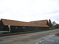 Barns, Piggotts Farm, Abridge - geograph.org.uk - 91253.jpg 640 × 480; 54 KB
-
 Bell Common Cricket Ground - geograph.org.uk - 1213146.jpg 640 × 480; 155 KB
-
 Birch Wood footpath - geograph.org.uk - 2500805.jpg 3.648 × 2.736; 5,12 MB
-
 Bird Scarer on Piggotts Farm - geograph.org.uk - 1873666.jpg 428 × 640; 81 KB
-
 Blunts Farm - geograph.org.uk - 2911162.jpg 1.600 × 1.067; 344 KB
-
 Booker Plaque - geograph.org.uk - 1873255.jpg 640 × 428; 61 KB
-
 Boundary of Theydon Bois wood Essex England ~ M11 variable road sign.JPG 4.560 × 3.648; 8,42 MB
-
 Boundary with deer sanctuary - geograph.org.uk - 2500835.jpg 3.648 × 2.736; 4,54 MB
-
 Brambles eastwards outside the Woodland Trust wood Theydon Bois Essex England.JPG 5.472 × 3.648; 17,72 MB
-
 Bridge over Central Line, Theydon Bois - geograph.org.uk - 4777733.jpg 640 × 480; 131 KB
-
 Bridge over River Roding, Abridge - geograph.org.uk - 5295339.jpg 640 × 480; 129 KB
-
 Bridge Work - geograph.org.uk - 1873166.jpg 640 × 428; 71 KB
-
 Brown field, Theydon Bois - geograph.org.uk - 4778127.jpg 640 × 480; 104 KB
-
 Building over Bell Common Tunnel - geograph.org.uk - 5908808.jpg 1.024 × 681; 116 KB
-
 Bull and Forest Drive - geograph.org.uk - 1873119.jpg 640 × 435; 66 KB
-
 Bus Shelter, Coppice Row, Theydon Bois - geograph.org.uk - 3211233.jpg 4.320 × 3.240; 4,78 MB
-
 Car Park at Jack's Hill - geograph.org.uk - 5037836.jpg 4.000 × 2.666; 7,28 MB
-
 Cell phone mobile phone mast at Theydon Bois, Essex, England.JPG 3.648 × 5.472; 9,59 MB
-
 Cemetery, Theydon Bois - geograph.org.uk - 3391044.jpg 640 × 480; 137 KB
-
 Centenary Walk approaches Theydon Road - geograph.org.uk - 5908804.jpg 1.024 × 681; 210 KB
-
 Centenary Walk, Epping Forest - geograph.org.uk - 5903138.jpg 1.024 × 681; 248 KB
-
 Centenary Walk, Epping Forest - geograph.org.uk - 5903141.jpg 1.024 × 681; 232 KB
-
 Centenary Walk, Epping Forest - geograph.org.uk - 5903143.jpg 1.024 × 681; 242 KB
-
 Centenary Walk, Epping Forest - geograph.org.uk - 5903157.jpg 1.024 × 681; 230 KB
-
 Centenary Walk, Epping Forest - geograph.org.uk - 5903173.jpg 1.024 × 681; 256 KB
-
 Centenary Walk, Epping Forest - geograph.org.uk - 5903180.jpg 1.024 × 681; 257 KB
-
 Central Line towards London - geograph.org.uk - 4777789.jpg 640 × 480; 158 KB
-

-
 Clouds from the Woodland Trust wood Theydon Bois Essex England 01.JPG 5.472 × 3.648; 4,63 MB
-
 Clouds from the Woodland Trust wood Theydon Bois Essex England 02.JPG 5.472 × 3.648; 4,04 MB
-
 Clouds over Epping Forest - geograph.org.uk - 6088621.jpg 4.889 × 3.456; 2,96 MB
-
 Coppice Row and Green, Theydon Bois - geograph.org.uk - 2546737.jpg 1.600 × 1.200; 683 KB
-
 Coppice Row by Theydon Green - geograph.org.uk - 2547277.jpg 1.600 × 1.200; 478 KB
-
 Coppice Row, Epping Forest - geograph.org.uk - 2546962.jpg 1.600 × 1.200; 549 KB
-
 Coppice Row, Theydon Bois - geograph.org.uk - 2547274.jpg 1.594 × 1.116; 417 KB
-
 Coppice Row, Theydon Bois - geograph.org.uk - 2547276.jpg 1.600 × 1.200; 539 KB
-
 Coppice Row, Theydon Bois - geograph.org.uk - 2547278.jpg 1.600 × 1.200; 508 KB
-
 Coppice Row, Theydon Bois - geograph.org.uk - 2910227.jpg 4.320 × 3.240; 3,83 MB
-
 Coppice Row, Theydon Bois - geograph.org.uk - 6207159.jpg 800 × 600; 135 KB
-
 Coppice Row, Theydon Bois - geograph.org.uk - 6207163.jpg 800 × 600; 84 KB
-
 Coppice Row, Theydon Bois - geograph.org.uk - 6214894.jpg 5.184 × 3.888; 5,29 MB
-
 Corporation of London, Epping Forest - geograph.org.uk - 6088618.jpg 4.915 × 3.456; 3,46 MB
-
 Dairy Farm Cottage - geograph.org.uk - 5295348.jpg 640 × 480; 119 KB
-
 Damselfly by the Roding - geograph.org.uk - 1873794.jpg 640 × 428; 46 KB
-
 Dead tree and sky eastwards outside the Woodland Trust wood Theydon Bois Essex England.JPG 3.648 × 5.472; 11,78 MB
-
 Deer Sanctuary near Theydon Bois - geograph.org.uk - 123936.jpg 640 × 480; 107 KB
-
 Ditch and footpath up to Epping Lane - geograph.org.uk - 5295421.jpg 640 × 480; 153 KB
-
 Drive, Theydon Cemetery - geograph.org.uk - 4777928.jpg 640 × 480; 133 KB
-
 Earthbank. Epping Forest - geograph.org.uk - 5903159.jpg 1.024 × 681; 302 KB
-
 Elizabeth II postbox on Coppice Row, Theydon Bois - geograph.org.uk - 6214885.jpg 3.495 × 4.521; 3,2 MB
-
 Entrance, Theydon Cemetery - geograph.org.uk - 4777902.jpg 640 × 480; 186 KB
-
 Epping Forest - geograph.org.uk - 2118129.jpg 1.280 × 856; 328 KB
-
 Epping Forest - geograph.org.uk - 5038799.jpg 4.000 × 2.666; 7,18 MB
-
 Epping Forest - geograph.org.uk - 5903139.jpg 1.024 × 681; 251 KB
-
 Epping Forest - geograph.org.uk - 5903144.jpg 1.024 × 681; 274 KB
-
 Epping Forest - geograph.org.uk - 5903146.jpg 1.024 × 681; 287 KB
-
 Epping Forest - geograph.org.uk - 5903158.jpg 1.024 × 681; 266 KB
-
 Epping Forest - geograph.org.uk - 5903179.jpg 1.024 × 681; 233 KB
-
 Epping Forest, at Jack's Hill - geograph.org.uk - 4892633.jpg 1.600 × 1.064; 832 KB
-
 Epping Forest, at Jack's Hill - geograph.org.uk - 4892644.jpg 1.600 × 1.064; 795 KB
-
 Epping Forest, the Long Running, at Jack's Hill - geograph.org.uk - 4892639.jpg 1.600 × 1.064; 402 KB
-
 Epping Forest, the Long Running, at Jack's Hill - geograph.org.uk - 4892645.jpg 1.600 × 1.064; 522 KB
-
 Epping Forest, the Long Running, at Jack's Hill - geograph.org.uk - 4892648.jpg 1.600 × 1.064; 603 KB
-
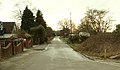
 Epping Lane, Abridge - geograph.org.uk - 6241216.jpg 1.024 × 768; 101 KB
-
 Epping Lane, near Abridge - geograph.org.uk - 6241231.jpg 1.024 × 768; 191 KB
-
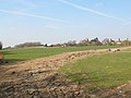
 Essex farmland - geograph.org.uk - 5894257.jpg 1.024 × 681; 155 KB
-
 Fallen beech, Epping Forest - geograph.org.uk - 4801145.jpg 640 × 480; 219 KB
-
 Farm Road, Hydes Farm, Abridge - geograph.org.uk - 91254.jpg 640 × 480; 82 KB
-
 Farmland by the Central Line - geograph.org.uk - 5894263.jpg 1.024 × 681; 114 KB
-
 Farmland north of Epping Lane - geograph.org.uk - 5295424.jpg 640 × 480; 113 KB
-
 Fields by Abridge Road - geograph.org.uk - 2547286.jpg 1.600 × 1.200; 584 KB
-
 Footbridge in Epping Thicks - geograph.org.uk - 2551416.jpg 3.648 × 2.736; 4,89 MB
-
 Footbridge Over the M11 - geograph.org.uk - 1873338.jpg 640 × 428; 68 KB
-
 Footbridge to Birch Wood - geograph.org.uk - 2499243.jpg 4.320 × 3.240; 4,69 MB
-
 Footpath entrance - geograph.org.uk - 2499196.jpg 4.320 × 3.240; 4,85 MB
-
 Footpath gate near Epping - geograph.org.uk - 2526608.jpg 640 × 480; 117 KB
-
 Footpath to Hydes Farm - geograph.org.uk - 1873779.jpg 428 × 640; 82 KB
-
 Footpath to Piggotts Farm - geograph.org.uk - 1873638.jpg 640 × 428; 88 KB
-
 Footpath to Theydon Bois - geograph.org.uk - 4777623.jpg 640 × 480; 155 KB
-
 Forest Drive, Theydon Bois - geograph.org.uk - 2526636.jpg 640 × 480; 90 KB
-
 Forest Drive, Theydon Bois - geograph.org.uk - 2526643.jpg 640 × 480; 90 KB
-
 Frank Foster House, Theydon Bois - geograph.org.uk - 6207155.jpg 800 × 600; 145 KB
-
 Future Avenue - geograph.org.uk - 1873262.jpg 428 × 640; 84 KB
-
 George V postbox on Coppice Row, Theydon Bois - geograph.org.uk - 6214888.jpg 3.279 × 5.184; 3,9 MB
-
 George V postbox on Loughton Lane, Theydon Bois - geograph.org.uk - 6214878.jpg 3.184 × 5.184; 4,14 MB
-
 Grassland eastwards outside the Woodland Trust wood Theydon Bois Essex England.JPG 5.472 × 3.648; 7,58 MB
-
 Graylands, Theydon Bois - geograph.org.uk - 2910243.jpg 4.320 × 3.240; 4,01 MB
-
 Great Gregories - geograph.org.uk - 2551513.jpg 3.648 × 2.736; 2,11 MB
-
 Great Gregories Lane - geograph.org.uk - 5286656.jpg 640 × 427; 103 KB
-
 Great Gregories Lane near Epping - geograph.org.uk - 2526587.jpg 480 × 640; 114 KB
-
 Great Gregories Lane, near Epping - geograph.org.uk - 2526581.jpg 640 × 480; 131 KB
-
 Green Belt - geograph.org.uk - 1873190.jpg 640 × 428; 65 KB
-
 Green Belt Underground - geograph.org.uk - 1873145.jpg 640 × 428; 96 KB
-
 Green Glade, Theydon Bois - geograph.org.uk - 2526661.jpg 640 × 480; 73 KB
-
 Green Ride - geograph.org.uk - 2499118.jpg 4.320 × 3.240; 4,79 MB
-
 Group of birches, Epping Forest - geograph.org.uk - 3391459.jpg 640 × 480; 196 KB
-
 Group of trees on Theydon Green - geograph.org.uk - 2596313.jpg 3.648 × 2.736; 4,71 MB
-
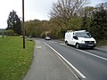
 Heading to Theydon Bois - geograph.org.uk - 1873943.jpg 640 × 428; 90 KB
-
 Heaps of stone - geograph.org.uk - 4778027.jpg 640 × 480; 142 KB
-
 Heathfield Cottage - geograph.org.uk - 2911385.jpg 3.386 × 2.194; 2,97 MB
-
 Hill Farm - geograph.org.uk - 5295418.jpg 640 × 480; 97 KB
-
 Hill Farm, near Abridge - geograph.org.uk - 6241270.jpg 1.024 × 768; 143 KB
-
 Houses on Abridge Road - geograph.org.uk - 6207282.jpg 800 × 497; 69 KB
-
 Houses on Coppice Row, Theydon Bois - geograph.org.uk - 6207164.jpg 800 × 569; 88 KB
-

-
 Houses on The Green, Theydon Bois - geograph.org.uk - 6207158.jpg 800 × 600; 129 KB
-
 Jack's Hill - geograph.org.uk - 5037842.jpg 4.000 × 2.666; 7,93 MB
-
 Jack's Hill, Epping Forest - geograph.org.uk - 1344243.jpg 640 × 480; 122 KB
-

-

-
 Landfill site - geograph.org.uk - 218595.jpg 640 × 480; 67 KB
-
 Last Of The Apple Blossom - geograph.org.uk - 1873304.jpg 428 × 640; 43 KB
-
 Loughton Lane - geograph.org.uk - 726186.jpg 640 × 463; 103 KB
-
 Loughton Lane, Theydon Bois - geograph.org.uk - 2910233.jpg 4.320 × 3.240; 4,34 MB
-
 Loughton Lane, Theydon Bois - geograph.org.uk - 2910247.jpg 4.320 × 3.240; 4,29 MB
-
 Loughton Lane, Theydon Bois - geograph.org.uk - 4778118.jpg 640 × 480; 142 KB
-
 Loughton Lane, Theydon Bois - geograph.org.uk - 6214879.jpg 4.883 × 3.494; 4,1 MB
-
 Loughton Lane, Theydon Bois.jpg 4.096 × 3.072; 6,22 MB
-
 M11 bridge over Abridge Road (B172) - geograph.org.uk - 4777889.jpg 640 × 480; 144 KB
-
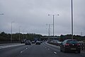
 M11, northbound - geograph.org.uk - 3149470.jpg 640 × 480; 79 KB
-
 M25 anticlockwise - geograph.org.uk - 4226094.jpg 640 × 480; 43 KB
-
 M25 entrance to Bell Common Tunnel - geograph.org.uk - 4226096.jpg 640 × 469; 41 KB
-
 M25, anti-clockwise - geograph.org.uk - 3246257.jpg 640 × 430; 32 KB
-

-
 Meadow East of Theydon Bois - geograph.org.uk - 1873982.jpg 640 × 428; 109 KB
-
 Near Oak Hill, Epping Forest, Theydon Bois - geograph.org.uk - 4921450.jpg 2.361 × 1.771; 2,32 MB
-
 New Growth ^ M11 - geograph.org.uk - 1873318.jpg 640 × 428; 74 KB
-
 North from Theydon Bois - geograph.org.uk - 3895768.jpg 1.024 × 768; 348 KB
-
 Old thatched cottage at Theydon Bois - geograph.org.uk - 439239.jpg 640 × 480; 93 KB
-
 Older pollarded trees near Jacks Hill - geograph.org.uk - 2811485.jpg 3.648 × 2.255; 3,62 MB
-

-
 On top of Bell Common Tunnel - geograph.org.uk - 5908809.jpg 1.024 × 681; 144 KB
-

-
 Part of Theydon Park Road - geograph.org.uk - 1131754.jpg 640 × 371; 63 KB
-

-
 Piercing Hill - geograph.org.uk - 5375434.jpg 4.000 × 3.000; 4,6 MB
-
 Piercing Hill, Theydon Bois - geograph.org.uk - 2910226.jpg 4.320 × 3.240; 4,89 MB
-
 Piggotts Farm - geograph.org.uk - 1873649.jpg 640 × 428; 84 KB
-
 Playground near Debden Green - geograph.org.uk - 1214257.jpg 640 × 480; 145 KB
-
 Ploughed field - geograph.org.uk - 5894250.jpg 1.024 × 681; 107 KB
-
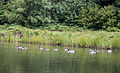
 Pond at Theydon Green - geograph.org.uk - 4386859.jpg 4.000 × 3.000; 3,97 MB
-
 Pond at Theydon Green - geograph.org.uk - 4386863.jpg 4.000 × 3.000; 3,95 MB
-
 Post Office and shops on Coppice Row, Theydon Bois - geograph.org.uk - 6214887.jpg 5.184 × 3.327; 2,03 MB
-
 Public footpath near Epping - geograph.org.uk - 2526600.jpg 480 × 640; 134 KB
-
 Public footpath to Theydon Bois - geograph.org.uk - 4777659.jpg 640 × 480; 192 KB
-
 Queen Victoria, Theydon Bois, CM16 (2792306130).jpg 2.560 × 1.920; 1,02 MB
-
 Railway, Theydon Bois - geograph.org.uk - 6207278.jpg 800 × 600; 175 KB
-
 Red Oaks Mead, Loughton Lane, Theydon Bois - geograph.org.uk - 2910288.jpg 4.320 × 3.240; 3,76 MB
-
 Reed Mace - geograph.org.uk - 1873804.jpg 428 × 640; 49 KB
-
 Ride to Ambresbury Banks - geograph.org.uk - 2830801.jpg 3.648 × 2.255; 4,4 MB
-
 Riding through Theydon Green - geograph.org.uk - 2596335.jpg 3.527 × 2.185; 3,52 MB
-
 River Roding - geograph.org.uk - 3411605.jpg 640 × 480; 126 KB
-
 River Roding - geograph.org.uk - 3411627.jpg 640 × 480; 111 KB
-
 River Roding - geograph.org.uk - 5295345.jpg 640 × 480; 127 KB
-
 River Roding - geograph.org.uk - 5295351.jpg 640 × 480; 160 KB
-
 River Roding Abridge - geograph.org.uk - 1873732.jpg 640 × 428; 75 KB
-
 River Roding and Roding Hall, Abridge - geograph.org.uk - 3411583.jpg 640 × 480; 148 KB
-
 River Roding, Abridge - geograph.org.uk - 91249.jpg 640 × 480; 110 KB


_-_geograph.org.uk_-_6207283.jpg)


_-_geograph.org.uk_-_4777889.jpg)


.jpg)


