Category:Thorpe St Andrew
Aller à la navigation
Aller à la recherche
Norsk bokmål: Thorpe St Andrew er en landsby i Norfolk i England. Stedet er en forstad til Norwich, og administrasjonssenter for distriktet Broadland.
localité britannique du comté anglais de Norfolk  | |||||
| Téléverser des médias | |||||
| Nature de l’élément | |||||
|---|---|---|---|---|---|
| Lieu | Broadland, Norfolk, Angleterre de l'Est, Angleterre | ||||
| Superficie |
| ||||
| site officiel | |||||
 | |||||
Sous-catégories
Cette catégorie comprend 10 sous-catégories, dont les 10 ci-dessous.
C
- Cremorne House, Norfolk (3 F)
E
- Environs of Thorpe St Andrew (1 F)
P
- Pinebanks Tower (2 F)
R
- Racecourse Plantation (13 F)
S
- St Andrews Hospital Northside (82 F)
- St Andrews Hospital, Norwich (11 F)
T
V
Média dans la catégorie « Thorpe St Andrew »
Cette catégorie comprend 554 fichiers, dont les 200 ci-dessous.
(page précédente) (page suivante)-
 ECR(1851) p46 - Thorpe.jpg 1 948 × 796 ; 488 kio
-

-
 19th century bridge over Yarmouth Road (A1042) - geograph.org.uk - 5678224.jpg 640 × 469 ; 280 kio
-
 19th century graves in Thorpe cemetery - geograph.org.uk - 5682175.jpg 640 × 577 ; 489 kio
-
 19th century gravestones in Thorpe cemetery - geograph.org.uk - 5682119.jpg 640 × 480 ; 354 kio
-
 240 Thorpe Road - geograph.org.uk - 6192978.jpg 800 × 590 ; 108 kio
-
 A boat travelling upstream the Yare - geograph.org.uk - 1387413.jpg 640 × 562 ; 123 kio
-

-
 A former driveway and footpath - geograph.org.uk - 5682190.jpg 640 × 480 ; 448 kio
-
 A frosty morning in Thorpe cemetery - geograph.org.uk - 5682128.jpg 640 × 607 ; 510 kio
-
 A frosty morning in Thorpe cemetery - geograph.org.uk - 5682170.jpg 640 × 480 ; 371 kio
-
 A glimpse of the Summer House - geograph.org.uk - 6087563.jpg 800 × 584 ; 217 kio
-

-
 A leisurely day by the river - geograph.org.uk - 1387384.jpg 640 × 480 ; 97 kio
-
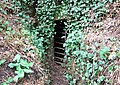 A private tunnel (exit) - geograph.org.uk - 6087571.jpg 800 × 569 ; 248 kio
-
 A private tunnel - geograph.org.uk - 6087568.jpg 800 × 600 ; 525 kio
-
 A private tunnel - geograph.org.uk - 6087572.jpg 800 × 580 ; 499 kio
-
 A quiet day on the River Yare - geograph.org.uk - 1387397.jpg 640 × 480 ; 95 kio
-
 A rather wet Cary's Meadow - geograph.org.uk - 6087610.jpg 800 × 578 ; 146 kio
-
 A sewage manhole on Cary's Meadow - geograph.org.uk - 6087585.jpg 800 × 600 ; 235 kio
-
 A shady path - geograph.org.uk - 1387332.jpg 480 × 640 ; 155 kio
-

-
 A woodland walk - geograph.org.uk - 1387335.jpg 480 × 640 ; 144 kio
-
 Access into Belmore Plantation, Thorpe St Andrew - geograph.org.uk - 2850072.jpg 640 × 480 ; 315 kio
-
 Access road to Bannatyne Health Club - geograph.org.uk - 5678424.jpg 640 × 475 ; 262 kio
-
 Advice for walkers - geograph.org.uk - 6087578.jpg 800 × 589 ; 122 kio
-
 An ancient willow on Cary's Meadow - geograph.org.uk - 6087603.jpg 800 × 573 ; 157 kio
-
 Anti-tank block in Thorpe St Andrew - geograph.org.uk - 2255283.jpg 640 × 480 ; 180 kio
-

-

-
-
-

-
 Archant Print - geograph.org.uk - 5678092.jpg 640 × 480 ; 283 kio
-
 Archant printing works, Thorpe, Norwich - geograph.org.uk - 2254798.jpg 640 × 480 ; 150 kio
-
 Bannatyne Health Club on Northside - geograph.org.uk - 5678423.jpg 640 × 467 ; 256 kio
-
 Bannatyne Health Club on Northside - geograph.org.uk - 5678431.jpg 640 × 480 ; 351 kio
-
 Barber shop and petrol station - geograph.org.uk - 4865187.jpg 1 600 × 1 200 ; 530 kio
-

-
 Belmore Plantation, Thorpe St Andrew - geograph.org.uk - 2526353.jpg 640 × 480 ; 325 kio
-
 Big exhausts - geograph.org.uk - 1279117.jpg 640 × 480 ; 65 kio
-
 Blocked road - geograph.org.uk - 5678485.jpg 640 × 474 ; 395 kio
-
 Blocked road with no way out ^ - geograph.org.uk - 2254825.jpg 640 × 480 ; 147 kio
-
 Boat on the River Yare - geograph.org.uk - 3708261.jpg 640 × 430 ; 97 kio
-
 Boats moored in the staithe - geograph.org.uk - 6087591.jpg 800 × 582 ; 156 kio
-
 Bramble patch on Cary's Meadow - geograph.org.uk - 6087628.jpg 800 × 580 ; 164 kio
-

-
 Bridge crossing Yarmouth Road (A1042) - geograph.org.uk - 5678218.jpg 468 × 640 ; 302 kio
-
 Bridge over Yarmouth Road (A1042) - geograph.org.uk - 5678195.jpg 640 × 480 ; 298 kio
-
 Bristly Ox-tongue (Helminthotheca echioides) - geograph.org.uk - 5527436.jpg 571 × 640 ; 490 kio
-
 Broadland Business Park (South) - geograph.org.uk - 5528879.jpg 640 × 480 ; 286 kio
-
 Broadland Business Park (South) - geograph.org.uk - 5528898.jpg 640 × 480 ; 308 kio
-
 Broadland Business Park - Evander Norwich - geograph.org.uk - 5528910.jpg 640 × 546 ; 339 kio
-
 Broadland Business Park - Evander Norwich - geograph.org.uk - 5528995.jpg 640 × 467 ; 231 kio
-
 Broadland Business Park - Evander Norwich - geograph.org.uk - 5529001.jpg 640 × 513 ; 277 kio
-
 Broadland Business Park - geograph.org.uk - 4822195.jpg 640 × 360 ; 263 kio
-
 Broadland Business Park - Lovewell Blake - geograph.org.uk - 5528808.jpg 640 × 476 ; 251 kio
-
 Broadland Business Park - Lovewell Blake - geograph.org.uk - 5528823.jpg 640 × 476 ; 304 kio
-
 Broadland Business Park - Lovewell Blake - geograph.org.uk - 5528832.jpg 640 × 480 ; 305 kio
-
 Broadland Business Park - Old Chapel Way - geograph.org.uk - 5528990.jpg 640 × 474 ; 250 kio
-

-

-
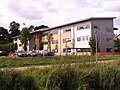
 Broadland District Council Emergency Centre - - geograph.org.uk - 6087656.jpg 2 592 × 3 456 ; 3,05 Mio
-

-

-

-

-

-
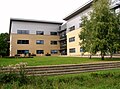
 Broadland District Council Emergency Centre - geograph.org.uk - 6087424.jpg 800 × 594 ; 131 kio
-
 Broadland District Council Emergency Centre - Stairwell - geograph.org.uk - 6087645.jpg 3 456 × 2 592 ; 3,72 Mio
-

-
-
-

-

-

-

-
 Bungalow Lane level crossing, Thorpe St Andrew - geograph.org.uk - 2255303.jpg 640 × 480 ; 131 kio
-
 Bungalow Lane level crossing, Thorpe St Andrew - geograph.org.uk - 2255306.jpg 640 × 480 ; 123 kio
-

-
 Bus shelter on Thorpe Road - geograph.org.uk - 6193042.jpg 800 × 557 ; 168 kio
-
 Bus Shelter,South Hill Road -Norwich - geograph.org.uk - 780615.jpg 640 × 480 ; 100 kio
-
 Business premises in St Andrew's Park - geograph.org.uk - 5678425.jpg 640 × 480 ; 315 kio
-
 Business premises in St Andrew's Square - geograph.org.uk - 5678110.jpg 640 × 480 ; 291 kio
-
 Business premises in the Broadland Business Park - geograph.org.uk - 5678464.jpg 640 × 469 ; 328 kio
-
 Business premises in the Broadland Business Park - geograph.org.uk - 5678496.jpg 640 × 479 ; 270 kio
-
 Business property off Northside - geograph.org.uk - 5678428.jpg 640 × 480 ; 296 kio
-

-
 Car park at Bannatyne Health Club on Northside - geograph.org.uk - 5678433.jpg 640 × 390 ; 287 kio
-
 Car park at Lakeside 200 - geograph.org.uk - 5682206.jpg 640 × 480 ; 338 kio
-
 Car park at the Norvic Clinic - geograph.org.uk - 5678564.jpg 640 × 480 ; 270 kio
-
 Car park by Cary's Meadow - geograph.org.uk - 6087576.jpg 800 × 577 ; 174 kio
-
 Cary's Meadow (sign) - geograph.org.uk - 6087577.jpg 800 × 605 ; 93 kio
-
 Cary's Meadow - geograph.org.uk - 3431255.jpg 640 × 424 ; 65 kio
-
 Cary's Meadow in mid-March - geograph.org.uk - 6087620.jpg 800 × 564 ; 138 kio
-
 Cary's Meadow, Thorpe St. Andrew - geograph.org.uk - 6087630.jpg 3 456 × 2 592 ; 3,95 Mio
-
 Cary's Meadow, Thorpe St. Andrew - geograph.org.uk - 6087632.jpg 3 456 × 1 614 ; 2,01 Mio
-
 Cary's Meadow, Thorpe St. Andrew - geograph.org.uk - 6087634.jpg 3 367 × 2 448 ; 3,09 Mio
-
 Cary's Meadow, Thorpe St. Andrew - geograph.org.uk - 6087635.jpg 3 456 × 2 592 ; 3,99 Mio
-
 City Heights - geograph.org.uk - 6193099.jpg 800 × 575 ; 106 kio
-
-

-

-
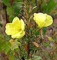
 Common Evening-primrose (Oenothera biennis) - geograph.org.uk - 5527354.jpg 596 × 640 ; 598 kio
-
 Common Evening-primrose (Oenothera biennis) - geograph.org.uk - 5527357.jpg 632 × 640 ; 358 kio
-
 Common Evening-primrose (Oenothera biennis) - geograph.org.uk - 5527366.jpg 539 × 640 ; 567 kio
-
 Common Evening-primrose (Oenothera biennis) - geograph.org.uk - 5527368.jpg 582 × 640 ; 612 kio
-
 Common Evening-primrose (Oenothera biennis) - geograph.org.uk - 5527370.jpg 619 × 640 ; 665 kio
-
 Common Evening-primrose (Oenothera biennis) - geograph.org.uk - 5527371.jpg 625 × 640 ; 638 kio
-
 Common Evening-primrose (Oenothera biennis) - geograph.org.uk - 5527373.jpg 614 × 640 ; 595 kio
-
 Common Fleabane (Pulicaria dysenterica) - geograph.org.uk - 5527379.jpg 581 × 640 ; 549 kio
-
-
 Common Lane, Thorpe St Andrew - geograph.org.uk - 2255309.jpg 640 × 480 ; 157 kio
-
 Commonwealth war grave in Thorpe cemetery - geograph.org.uk - 5682161.jpg 555 × 640 ; 522 kio
-
 Concrete pipes acting as road blocks - geograph.org.uk - 5678573.jpg 640 × 541 ; 357 kio
-
 Cottage by the River - geograph.org.uk - 1964528.jpg 640 × 475 ; 121 kio
-

-
 Cottages by playing field, School Lane - geograph.org.uk - 2841753.jpg 640 × 480 ; 204 kio
-
 Cottages in Pound Lane, Thorpe St Andrew - geograph.org.uk - 2526322.jpg 640 × 480 ; 230 kio
-
 Cottages in South Hill Road, Thorpe St Andrew - geograph.org.uk - 2850060.jpg 640 × 480 ; 144 kio
-
 Cottages in South Hill Road, Thorpe St Andrew - geograph.org.uk - 2850063.jpg 640 × 480 ; 194 kio
-

-

-
 Crossing gate at Bungalow Lane level crossing - geograph.org.uk - 2255305.jpg 480 × 640 ; 145 kio
-
 Cultivated field with winter crop - geograph.org.uk - 1068359.jpg 640 × 348 ; 60 kio
-
 Culvert at the staithe's end - geograph.org.uk - 6087595.jpg 800 × 557 ; 152 kio
-
 Cycle path by Dussindale Drive - geograph.org.uk - 4865157.jpg 1 600 × 1 200 ; 625 kio
-
 Cycle path through the Broadland Business Park - geograph.org.uk - 5678098.jpg 640 × 480 ; 411 kio
-
 Descending the steel steps - geograph.org.uk - 5682208.jpg 640 × 474 ; 420 kio
-
 Diesel Multiple Unit from Norwich To Cromer - geograph.org.uk - 2255280.jpg 640 × 480 ; 115 kio
-
 Disused road to Northside - geograph.org.uk - 5678202.jpg 640 × 477 ; 380 kio
-
 Dry pond in Belmore Plantation, Thorpe St Andrew - geograph.org.uk - 2526337.jpg 640 × 480 ; 281 kio
-
 Dussindale Drive - geograph.org.uk - 4865163.jpg 1 600 × 1 200 ; 453 kio
-
 East Gatehouse - geograph.org.uk - 5678169.jpg 640 × 419 ; 250 kio
-
 Edward VII pillar post box number NR7 710 - geograph.org.uk - 2254844.jpg 480 × 640 ; 154 kio
-
 Elephants at Reception - geograph.org.uk - 6087511.jpg 800 × 590 ; 135 kio
-
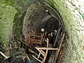
 Emergency escape hatch - geograph.org.uk - 6087651.jpg 2 592 × 3 456 ; 3,19 Mio
-
 Entrance gate to Yarmouth Road cemetery - geograph.org.uk - 5682141.jpg 550 × 640 ; 496 kio
-
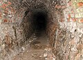
 Entrance into a tunnel - geograph.org.uk - 6087567.jpg 800 × 580 ; 563 kio
-
 Entrance into Cary's Meadow - geograph.org.uk - 6087575.jpg 800 × 571 ; 184 kio
-
 Entrance portal into offices - geograph.org.uk - 5682199.jpg 640 × 476 ; 294 kio
-
 Entrance to Thorpe End - geograph.org.uk - 5682188.jpg 640 × 511 ; 403 kio
-
 Fire engine on the way to an emergency - geograph.org.uk - 6192982.jpg 800 × 555 ; 149 kio
-
 Flats on the north side of Thorpe Road - geograph.org.uk - 6193109.jpg 800 × 585 ; 108 kio
-
 Flats on Thorpe Road - geograph.org.uk - 6193105.jpg 800 × 583 ; 93 kio
-
 Flats overlooking Thorpe Road - geograph.org.uk - 6193103.jpg 800 × 581 ; 98 kio
-
 Flooding beneath a railway bridge - geograph.org.uk - 2254820.jpg 640 × 480 ; 218 kio
-
 Flooding on Cary's Meadow - geograph.org.uk - 6087612.jpg 800 × 575 ; 170 kio
-
 Flooding on Cary's Meadow - geograph.org.uk - 6087619.jpg 800 × 582 ; 165 kio
-
 Footbridge crossing Yarmouth Road (A1042) - geograph.org.uk - 5678216.jpg 640 × 471 ; 297 kio
-
 Footbridge over Yarmouth Road (A1042) - geograph.org.uk - 5678193.jpg 640 × 480 ; 313 kio
-
 Footbridge over Yarmouth Road (A1042) - geograph.org.uk - 5678208.jpg 640 × 479 ; 324 kio
-
 Footbridge to Northside - geograph.org.uk - 5678197.jpg 640 × 480 ; 327 kio
-
 Footpath into Belmore Plantation - geograph.org.uk - 2850069.jpg 640 × 480 ; 297 kio
-
 Footpath on Northside - geograph.org.uk - 5678468.jpg 640 × 480 ; 391 kio
-
 Footpath through Belmore Plantation - geograph.org.uk - 2850077.jpg 640 × 480 ; 305 kio
-
 Footpath to Dussindale Drive, Thorpe St Andrew - geograph.org.uk - 2526362.jpg 640 × 480 ; 246 kio
-
 Footpath to Thorpe Hall Close - geograph.org.uk - 6087596.jpg 800 × 575 ; 230 kio
-
 Former road to Southside - geograph.org.uk - 5678444.jpg 640 × 480 ; 351 kio
-
 Francis Stone Court - geograph.org.uk - 5678234.jpg 640 × 475 ; 265 kio
-
 Front of thorpe st andrew.jpg 4 128 × 3 096 ; 5,47 Mio
-
 Frosty headstones in Thorpe cemetery - geograph.org.uk - 5682178.jpg 640 × 480 ; 358 kio
-
 Frosty path in Thorpe cemetery - geograph.org.uk - 5682123.jpg 640 × 476 ; 355 kio
-
 Gateway in Thorpe cemetery - geograph.org.uk - 5682167.jpg 640 × 480 ; 361 kio
-
 Gateway on path - geograph.org.uk - 5682135.jpg 640 × 469 ; 352 kio
-
 Gazebo, Yarmouth Road - geograph.org.uk - 1164847.jpg 512 × 640 ; 121 kio
-
 GoGoHares - GoGoCreate - geograph.org.uk - 6087446.jpg 800 × 668 ; 473 kio
-
 Grave in the corner - geograph.org.uk - 5682163.jpg 535 × 640 ; 455 kio
-
 Graves in the eastern section of Thorpe cemetery - geograph.org.uk - 5682151.jpg 640 × 480 ; 356 kio
-
 Graves in Thorpe cemetery - geograph.org.uk - 5682116.jpg 640 × 480 ; 344 kio
-
 Grazing and woodland near the River Yare - geograph.org.uk - 4792102.jpg 640 × 437 ; 41 kio
-
 Hart's tongue fern (Asplenium scolopendrium) - geograph.org.uk - 5527416.jpg 640 × 480 ; 434 kio
-
 Hart's tongue fern (Asplenium scolopendrium) - geograph.org.uk - 5527417.jpg 640 × 480 ; 418 kio
-
 Hart's tongue fern (Asplenium scolopendrium) - geograph.org.uk - 5527426.jpg 640 × 621 ; 532 kio
-
 Hart's tongue fern (Asplenium scolopendrium) - geograph.org.uk - 5678606.jpg 640 × 560 ; 507 kio
-

-
 Height indicators - geograph.org.uk - 1188602.jpg 640 × 480 ; 78 kio
-
 High grass between the graves in Thorpe cemetery - geograph.org.uk - 5682131.jpg 640 × 480 ; 341 kio
-
 House in Yarmouth Road (A1242) - geograph.org.uk - 6087560.jpg 800 × 570 ; 112 kio
-
 House off Yarmouth Road (A1042) - geograph.org.uk - 5682184.jpg 640 × 474 ; 332 kio
-
 House on Pound Lane - geograph.org.uk - 4933786.jpg 640 × 480 ; 104 kio
-
 Houses adjacent to Thorpe cemeter - geograph.org.uk - 5682165.jpg 640 × 480 ; 375 kio
-
 Houses at the end of Thorpe Hall Close - geograph.org.uk - 6087609.jpg 800 × 584 ; 172 kio
-
 Houses in Thorpe Hall Close - geograph.org.uk - 6087589.jpg 800 × 595 ; 188 kio
-
 Houses in Yarmouth Road (A1242) - geograph.org.uk - 6087602.jpg 800 × 575 ; 201 kio
-
 Houses off Francis Stone Court - geograph.org.uk - 5678171.jpg 640 × 469 ; 295 kio
-
 Houses on Plumstead Road East, Norwich - geograph.org.uk - 4933766.jpg 640 × 480 ; 61 kio
-
 Houses on Plumstead Road East, Norwich - geograph.org.uk - 4933779.jpg 640 × 480 ; 71 kio
-
 Houses on Southside - geograph.org.uk - 5678186.jpg 640 × 479 ; 393 kio
-
 Insignia Healthcare Solutions - geograph.org.uk - 4933755.jpg 640 × 480 ; 52 kio
-

-
 Junction of Central Avenue and Northside - geograph.org.uk - 5678119.jpg 640 × 480 ; 308 kio
-
 K6 Telephone Kiosk (1).jpg 1 502 × 2 448 ; 1,05 Mio
-
 Lakeside 200 - geograph.org.uk - 5682205.jpg 640 × 480 ; 305 kio
-
 Lakeside 200 - geograph.org.uk - 5682207.jpg 640 × 474 ; 358 kio
-
 Large house converted into flats - geograph.org.uk - 6192981.jpg 800 × 588 ; 115 kio
-
 Large house overlooking Thorpe Road - geograph.org.uk - 6192979.jpg 800 × 614 ; 128 kio
-
 Lofty buddleia - geograph.org.uk - 5678525.jpg 635 × 640 ; 417 kio
-
 Maidens Close, Thorpe St Andrew - geograph.org.uk - 4865127.jpg 1 600 × 1 200 ; 486 kio
-
 Mallard duck - geograph.org.uk - 5528957.jpg 3 456 × 2 592 ; 3,83 Mio
_-_geograph.org.uk_-_5678222.jpg)
_-_geograph.org.uk_-_5678224.jpg)


_on_a_wall_on_Northside_-_geograph.org.uk_-_5678607.jpg)


_-_geograph.org.uk_-_6087571.jpg)


_-_geograph.org.uk_-_5678218.jpg)
_-_geograph.org.uk_-_5678195.jpg)
_-_geograph.org.uk_-_5527436.jpg)
_-_geograph.org.uk_-_5528879.jpg)
_-_geograph.org.uk_-_5528898.jpg)


_-_geograph.org.uk_-_6087577.jpg)


_-_flowers_-_geograph.org.uk_-_5527360.jpg)
_-_flowers_-_geograph.org.uk_-_5527362.jpg)
_-_flowers_-_geograph.org.uk_-_5527363.jpg)
_-_geograph.org.uk_-_5527354.jpg)
_-_geograph.org.uk_-_5527357.jpg)
_-_geograph.org.uk_-_5527366.jpg)
_-_geograph.org.uk_-_5527368.jpg)
_-_geograph.org.uk_-_5527370.jpg)
_-_geograph.org.uk_-_5527371.jpg)
_-_geograph.org.uk_-_5527373.jpg)
_-_geograph.org.uk_-_5527379.jpg)


_-_geograph.org.uk_-_5678216.jpg)
_-_geograph.org.uk_-_5678193.jpg)
_-_geograph.org.uk_-_5678208.jpg)


_-_geograph.org.uk_-_5527416.jpg)
_-_geograph.org.uk_-_5527417.jpg)
_-_geograph.org.uk_-_5527426.jpg)
_-_geograph.org.uk_-_5678606.jpg)
_growing_on_a_wall_-_geograph.org.uk_-_5678603.jpg)


_-_geograph.org.uk_-_6087560.jpg)
_-_geograph.org.uk_-_5682184.jpg)


_-_geograph.org.uk_-_6087602.jpg)


_-_geograph.org.uk_-_6087600.jpg)

.jpg)


_p46_-_Thorpe.jpg)