Category:Thrussington
Aller à la navigation
Aller à la recherche
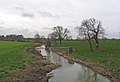
English: Thrussington is a village and civil parish in the Charnwood district of Leicestershire, England. It is on the River Wreake, near to Rearsby, Ratcliffe on the Wreake and Brooksby, and not far from the path of the Fosse Way. The parish has a population of about 500.
localité britannique du comté anglais de Leicestershire  | |||||
| Téléverser des médias | |||||
| Nature de l’élément | |||||
|---|---|---|---|---|---|
| Lieu | Charnwood, Leicestershire, Midlands de l'Est, Angleterre | ||||
| Population |
| ||||
 | |||||
Sous-catégories
Cette catégorie comprend 2 sous-catégories, dont les 2 ci-dessous.
T
- Thrussington War Memorial (1 F)
Média dans la catégorie « Thrussington »
Cette catégorie comprend 212 fichiers, dont les 200 ci-dessous.
(page précédente) (page suivante)-
 1 Hoby Road, Thrussington - geograph.org.uk - 5777869.jpg 1 280 × 960 ; 402 kio
-
 1 Hoby Road, Thrussington - geograph.org.uk - 6372319.jpg 3 776 × 2 520 ; 4,28 Mio
-
 1 Seagrave Road, Thrussington (The Hollies) - geograph.org.uk - 5777569.jpg 1 280 × 883 ; 341 kio
-
 1, Hoby Road, Thrussington - geograph.org.uk - 1560594.jpg 640 × 480 ; 100 kio
-
 2 Hoby Road, Thrussington - geograph.org.uk - 5777871.jpg 1 280 × 960 ; 395 kio
-
 28 Church Lane, Thrussington - geograph.org.uk - 5781568.jpg 1 086 × 1 280 ; 492 kio
-
 36 Ratcliffe Road, Thrussington - geograph.org.uk - 5777884.jpg 1 280 × 960 ; 409 kio
-
 41-49 Back Lane, Thrussington - geograph.org.uk - 5781545.jpg 1 280 × 960 ; 392 kio
-
 9 Seagrave Road, Thrussington - geograph.org.uk - 5777583.jpg 1 280 × 960 ; 364 kio
-
 A lay-by on the A46 - geograph.org.uk - 5834824.jpg 1 600 × 900 ; 446 kio
-
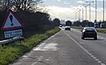
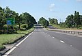 A46 11 miles to Leicester - geograph.org.uk - 4581123.jpg 1 600 × 1 088 ; 385 kio
-
 A46 approaching junction to Seagrave and Thrussington - geograph.org.uk - 4581212.jpg 2 256 × 1 496 ; 871 kio
-
 A46 Fosse Way central reservation - geograph.org.uk - 6630854.jpg 1 600 × 1 114 ; 135 kio
-
 A46 Fosse Way from Newark - geograph.org.uk - 6012482.jpg 640 × 424 ; 73 kio
-
 A46 Fosse Way northwards - geograph.org.uk - 6630856.jpg 1 600 × 1 070 ; 120 kio
-
 A46 Fosse Way to Leicester - geograph.org.uk - 6012483.jpg 640 × 426 ; 68 kio
-
 A46 from Seagrave to Six Hills, aerial 2020 - geograph.org.uk - 6603408.jpg 533 × 800 ; 56 kio
-
 A46 heading north towards Newark - geograph.org.uk - 3038717.jpg 640 × 480 ; 56 kio
-
 A46 heading north towards Newark - geograph.org.uk - 3038722.jpg 640 × 480 ; 48 kio
-
 A46 northbound - geograph.org.uk - 3651854.jpg 640 × 512 ; 64 kio
-
 A46 northbound - geograph.org.uk - 3651855.jpg 640 × 485 ; 43 kio
-
 A46 parking area - geograph.org.uk - 4581178.jpg 2 256 × 1 444 ; 803 kio
-
 A46 towards Six Hills Cafe - geograph.org.uk - 4581201.jpg 2 172 × 1 440 ; 899 kio
-
 Ashes alongside Old Gate Lane - geograph.org.uk - 5777542.jpg 1 280 × 869 ; 460 kio
-
 At the end of the day - geograph.org.uk - 238732.jpg 640 × 427 ; 60 kio
-
 Ball games prohibited on the green - geograph.org.uk - 5777618.jpg 960 × 1 280 ; 638 kio
-
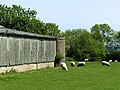 Barn and sheep at Launsdale Farm - geograph.org.uk - 5777561.jpg 1 280 × 960 ; 528 kio
-
 Bench mark, The Green, Thrussington - geograph.org.uk - 5777891.jpg 960 × 1 280 ; 395 kio
-
 Benchmark on buttress of Holy Trinity Church - geograph.org.uk - 6495675.jpg 1 024 × 684 ; 247 kio
-

-
 Bishop's Green, Old Gate Lane - geograph.org.uk - 5777532.jpg 1 280 × 960 ; 599 kio
-
 Blackbird singing on the high wire - geograph.org.uk - 5781705.jpg 1 280 × 960 ; 253 kio
-

-
-
 Cattle walkway eastwards - geograph.org.uk - 3578521.jpg 640 × 486 ; 37 kio
-
 Cattle walkway westwards - geograph.org.uk - 3578522.jpg 640 × 501 ; 48 kio
-

-

-
 Cottage on Old Gate Road, Thrussington - geograph.org.uk - 4792190.jpg 800 × 529 ; 159 kio
-
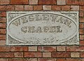 Datestone, former Wesleyan Chapel, Thrussington - geograph.org.uk - 5787235.jpg 1 280 × 923 ; 477 kio
-

-

-
 Dovecote at Manor Farm - geograph.org.uk - 5777890.jpg 960 × 1 280 ; 271 kio
-
 Driveway to Thrussington Grange - geograph.org.uk - 5360730.jpg 640 × 450 ; 112 kio
-
 Farmland along Seagrave Road - geograph.org.uk - 6616409.jpg 800 × 554 ; 73 kio
-
 Farmland near Thrussington - geograph.org.uk - 238624.jpg 640 × 427 ; 88 kio
-
 Farmland near Thrussington - geograph.org.uk - 238634.jpg 640 × 427 ; 94 kio
-
 Farmland near Thrussington - geograph.org.uk - 3039392.jpg 640 × 480 ; 65 kio
-
 Field and hedge with tracks - geograph.org.uk - 2815241.jpg 640 × 480 ; 67 kio
-
 Fields and water tank by Old Gate Road - geograph.org.uk - 2815242.jpg 640 × 480 ; 69 kio
-
 Footpath and kissing gate along Seagrave Road - geograph.org.uk - 4792660.jpg 800 × 612 ; 173 kio
-
 Footpath from Thrussington to Ragdale - geograph.org.uk - 5581310.jpg 4 000 × 3 000 ; 3,43 Mio
-
 Footpath from Thrussington to Ragdale - geograph.org.uk - 5581318.jpg 4 000 × 3 000 ; 3,2 Mio
-
 Footpath from Thrussington to Ragdale - geograph.org.uk - 5581322.jpg 4 000 × 3 000 ; 3,64 Mio
-
 Footpath off Thrussington Road - geograph.org.uk - 3039444.jpg 640 × 480 ; 112 kio
-
 Footpath towards Hoby near Thrussington Mill - geograph.org.uk - 5781712.jpg 1 280 × 960 ; 560 kio
-
 Former coach house attached to 1 Seagrave Road - geograph.org.uk - 5777574.jpg 1 280 × 960 ; 414 kio
-
 Former farm buildings, Church Lane, Thrussington - geograph.org.uk - 5781563.jpg 1 280 × 960 ; 389 kio
-
 Former navigation channel, Melton Mowbray Navigation - geograph.org.uk - 5781751.jpg 1 280 × 960 ; 635 kio
-

-
 Former Wesleyan Chapel, Thrussington - geograph.org.uk - 5787232.jpg 1 280 × 996 ; 392 kio
-
 Hoby Road enters Thrussington - geograph.org.uk - 855493.jpg 640 × 346 ; 61 kio
-
 Hoby Road leaving Thrussington - geograph.org.uk - 6372323.jpg 3 776 × 2 520 ; 3,34 Mio
-
 Hoby Road out of Thrussington - geograph.org.uk - 3039420.jpg 640 × 480 ; 81 kio
-
 Holiday cabins at Thrussington Mill - geograph.org.uk - 5781739.jpg 1 280 × 960 ; 570 kio
-
 Holy Trinity Church - geograph.org.uk - 6495975.jpg 1 024 × 684 ; 136 kio
-
 Holy Trinity Church in Thrussington - geograph.org.uk - 4790426.jpg 800 × 593 ; 149 kio
-
 House and field in Thrussington - geograph.org.uk - 2631356.jpg 640 × 453 ; 79 kio
-
 Launsdale Farm, Thrussington - geograph.org.uk - 5777529.jpg 1 280 × 960 ; 472 kio
-
 Lay-by on Seagrave Road - geograph.org.uk - 3591171.jpg 1 024 × 585 ; 86 kio
-
 Leaning telegraph pole on Old Gate Road - geograph.org.uk - 5360731.jpg 640 × 489 ; 159 kio
-
 Leicester Thrussington Travelodge - geograph.org.uk - 3038724.jpg 640 × 480 ; 49 kio
-
 Limited bridleway southwards from Six Hills - geograph.org.uk - 4389989.jpg 640 × 427 ; 70 kio
-
 Little Chef on the A46 near Thrussington - geograph.org.uk - 3038726.jpg 640 × 480 ; 49 kio
-
 Little Thatch, 43 The Green, Thrussington - geograph.org.uk - 5777600.jpg 1 280 × 960 ; 442 kio
-
 Little Thatch, 43 The Green, Thrussington - geograph.org.uk - 5777898.jpg 1 280 × 960 ; 391 kio
-
 Manor Farmhouse, Thrussington - geograph.org.uk - 5777887.jpg 1 280 × 960 ; 617 kio
-
 New woodland near Thrussington - geograph.org.uk - 5781704.jpg 1 280 × 960 ; 461 kio
-
 New woodland near Thrussington - geograph.org.uk - 5781706.jpg 1 280 × 960 ; 471 kio
-
 New woodland near Thrussington, with footpath - geograph.org.uk - 5781710.jpg 1 280 × 960 ; 380 kio
-
 Newly ploughed field - geograph.org.uk - 5777521.jpg 960 × 1 280 ; 508 kio
-
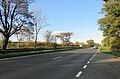
 North along the A46 - geograph.org.uk - 857131.jpg 640 × 480 ; 66 kio
-
 North of Ratcliffe Road - geograph.org.uk - 3578523.jpg 640 × 487 ; 43 kio
-

-

-
 Old gang mower at Thrussington Mill - geograph.org.uk - 5781722.jpg 1 280 × 960 ; 718 kio
-
 Old Gate Road - geograph.org.uk - 5777513.jpg 1 280 × 960 ; 590 kio
-
 Old Gate Road - geograph.org.uk - 5787229.jpg 1 280 × 960 ; 456 kio
-
 Old Gate Road heading north towards the A46 - geograph.org.uk - 3039400.jpg 640 × 480 ; 89 kio
-
 Old Gate Road leaving Thrussington - geograph.org.uk - 6372320.jpg 3 776 × 2 520 ; 3,08 Mio
-
 Old Gate Road near Thrussington, Leicestershire - geograph.org.uk - 141367.jpg 640 × 427 ; 186 kio
-

-
 Old Gate Road towards A46 - geograph.org.uk - 2815243.jpg 640 × 484 ; 70 kio
-
 Old Gate Road towards A46 - geograph.org.uk - 2815245.jpg 640 × 489 ; 81 kio
-
 Old Gate Road towards Thrussington - geograph.org.uk - 2815244.jpg 640 × 503 ; 68 kio
-
 Old Gate Road towards Thrussington - geograph.org.uk - 2815247.jpg 640 × 517 ; 108 kio
-
 Old Gate Road towards Thrussington - geograph.org.uk - 2815248.jpg 640 × 454 ; 75 kio
-
 Old Gate Road towards Thrussington - geograph.org.uk - 5360733.jpg 640 × 457 ; 99 kio
-
 Old Gate Road towards Thrussington - geograph.org.uk - 5360734.jpg 640 × 475 ; 121 kio
-
 Old Gate Road, Thrussington - geograph.org.uk - 5777585.jpg 1 280 × 960 ; 478 kio
-
 Old Gate Road-Fosse Way (A46) junction - geograph.org.uk - 2815239.jpg 640 × 505 ; 125 kio
-
 Old Hall Farmhouse - geograph.org.uk - 1020230.jpg 640 × 427 ; 72 kio
-
 Old Hall Farmhouse, Thrussington - geograph.org.uk - 5781562.jpg 1 280 × 960 ; 481 kio
-
 Old Hall Farmhouse, Thrussington - geograph.org.uk - 5781578.jpg 1 280 × 970 ; 346 kio
-
 Overgrown corner and fields on 09 March 2017 - geograph.org.uk - 5360735.jpg 640 × 511 ; 204 kio
-
 Overgrown corner and fields on 15 February 2012 - geograph.org.uk - 2815249.jpg 640 × 489 ; 155 kio
-
 Paddock and buildings near Thrussington - geograph.org.uk - 884163.jpg 640 × 552 ; 147 kio
-
 Pipe bridge crossing the River Wreake - geograph.org.uk - 4790429.jpg 800 × 562 ; 141 kio
-
 Public footpath along Seagrave Road - geograph.org.uk - 4792665.jpg 800 × 602 ; 185 kio
-
 Public footpath to Ragdale Hall - geograph.org.uk - 884171.jpg 640 × 484 ; 102 kio
-
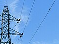
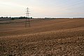
 Pylons north of Thrussington - geograph.org.uk - 884140.jpg 640 × 458 ; 81 kio
-
 Pylons north of Thrussington - geograph.org.uk - 884148.jpg 640 × 480 ; 71 kio
-
 Ratcliffe Road towards Ratcliffe - geograph.org.uk - 3578524.jpg 640 × 474 ; 40 kio
-
 Ratcliffe Road towards Thurssington - geograph.org.uk - 3578525.jpg 640 × 515 ; 33 kio
-
 Ratcliffe Road, Thrussington - geograph.org.uk - 6517475.jpg 1 280 × 851 ; 814 kio
-
 Rearsby Road bridge crosses the River Wreake - geograph.org.uk - 5628069.jpg 3 457 × 2 377 ; 693 kio
-
 Rearsby Road bridge crossing the River Wreake - geograph.org.uk - 4790428.jpg 800 × 484 ; 124 kio
-
 Rearsby Road bridge crossing the River Wreake - geograph.org.uk - 4790431.jpg 800 × 568 ; 165 kio
-
 Rearsby Road bridge, Thrussington - geograph.org.uk - 5787245.jpg 1 280 × 960 ; 438 kio
-
 Rearsby Road towards Rearsby - geograph.org.uk - 6602972.jpg 1 600 × 1 114 ; 465 kio
-
 Red Campion (Silene dioica) - geograph.org.uk - 5777557.jpg 1 280 × 960 ; 653 kio
-
 Regent Street, Thrussington - geograph.org.uk - 5787236.jpg 1 280 × 960 ; 285 kio
-
 River Wreake - geograph.org.uk - 2351138.jpg 640 × 437 ; 66 kio
-
 River Wreake at Thrussington - geograph.org.uk - 5787242.jpg 1 280 × 960 ; 524 kio
-
 River Wreake on a snowy day - geograph.org.uk - 4931587.jpg 640 × 441 ; 100 kio
-
 River Wreake towards Melton Mowbray - geograph.org.uk - 2351139.jpg 640 × 411 ; 59 kio
-

-
 River Wreake, Thrussington - geograph.org.uk - 3039425.jpg 640 × 480 ; 99 kio
-
 Rivet bench mark, Rearsby Road bridge, Thrussington - geograph.org.uk - 5787243.jpg 1 280 × 1 280 ; 545 kio
-
 Seagrave Road approaching the A46 - geograph.org.uk - 6517751.jpg 1 280 × 851 ; 1,08 Mio
-
 Seagrave Road heading towards Thrussington - geograph.org.uk - 2859455.jpg 1 024 × 611 ; 88 kio
-
 Seagrave Road into Thrussington - geograph.org.uk - 2631357.jpg 640 × 497 ; 111 kio
-
 Seagrave Road towards Seagrave - geograph.org.uk - 2631351.jpg 640 × 477 ; 85 kio
-
 Seagrave Road towards Thrussington - geograph.org.uk - 2631352.jpg 640 × 501 ; 94 kio
-
 Seagrave Road towards Thrussington - geograph.org.uk - 3039395.jpg 640 × 480 ; 58 kio
-
 Seagrave Road towards Thrussington - geograph.org.uk - 6248151.jpg 800 × 480 ; 76 kio
-
 Seagrave Road towards Trussington - geograph.org.uk - 6601830.jpg 1 600 × 1 068 ; 345 kio
-
 Seagrave Road, Trussington - geograph.org.uk - 6601835.jpg 1 600 × 1 122 ; 971 kio
-
 Service station on the A46 - geograph.org.uk - 3038716.jpg 640 × 441 ; 39 kio
-
 Sheep in field - geograph.org.uk - 2631358.jpg 640 × 466 ; 71 kio
-
 Sign at end of driveway to Thrussington Grange - geograph.org.uk - 5360736.jpg 640 × 554 ; 174 kio
-
 Sign on leaning telegraph pole on Old Gate Road - geograph.org.uk - 5360737.jpg 640 × 618 ; 145 kio
-
 Six Hills junction, A46 - geograph.org.uk - 2393361.jpg 640 × 429 ; 60 kio
-
 Six Hills Services, A46 - geograph.org.uk - 3651848.jpg 640 × 417 ; 49 kio
-
 Skittles on the Green, Thrussington - geograph.org.uk - 5777603.jpg 960 × 1 280 ; 636 kio
-
 Skittles on the Green, Thrussington - geograph.org.uk - 5777612.jpg 960 × 1 280 ; 760 kio
-
 South along the A46 Fosse Way - geograph.org.uk - 4792676.jpg 800 × 484 ; 96 kio
-
 Stack of hay bales next to Seagrave Road - geograph.org.uk - 4792192.jpg 800 × 515 ; 100 kio
-
 Stone pillar with urn, Old Gate Road, Thrussington - geograph.org.uk - 5777537.jpg 1 280 × 960 ; 713 kio
-

-
 The Blue Lion Public House, Thrussington - geograph.org.uk - 6601841.jpg 1 600 × 1 065 ; 438 kio
-
 The Blue Lion Public House, Thrussington - geograph.org.uk - 6602965.jpg 1 117 × 1 600 ; 302 kio
-
 The Blue Lion, Thrussington - geograph.org.uk - 3039411.jpg 640 × 455 ; 64 kio
-
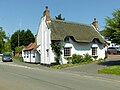
 The Blue Lion, Thrussington - geograph.org.uk - 855483.jpg 640 × 425 ; 62 kio
-
 The centre of Thrussington - geograph.org.uk - 3591161.jpg 1 024 × 715 ; 107 kio
-
 The Elms near Thrussington - geograph.org.uk - 883473.jpg 640 × 442 ; 77 kio
-
 The end of Old Gate Road - geograph.org.uk - 5777525.jpg 1 280 × 960 ; 452 kio
-
 The Green, Thrussington - geograph.org.uk - 5777593.jpg 1 280 × 960 ; 520 kio
-
 The Green, Thrussington - geograph.org.uk - 5777617.jpg 960 × 1 280 ; 622 kio
-
 The Green, Thrussington - geograph.org.uk - 5777894.jpg 1 280 × 960 ; 319 kio
-
 The Green, Thrussington - geograph.org.uk - 6372316.jpg 3 776 × 2 520 ; 2,98 Mio
-
 The Green, Thrussington - geograph.org.uk - 6601972.jpg 1 600 × 1 065 ; 575 kio
-
 The Hollies, 1 Seagrave Road, Thrussington - geograph.org.uk - 5777589.jpg 960 × 1 280 ; 566 kio
-
 The Homestead, Ratcliffe Road, Thrussington - geograph.org.uk - 5777888.jpg 1 280 × 960 ; 466 kio
-
 The lane from Thrussington Mill - geograph.org.uk - 5781715.jpg 1 280 × 928 ; 661 kio
-
 The lane to Thrussington Grange Farm - geograph.org.uk - 5787227.jpg 1 280 × 960 ; 487 kio
-
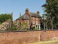
 The Manor House, Ratcliffe Road, Thrussington - geograph.org.uk - 5777885.jpg 1 280 × 960 ; 502 kio
-
-
 The River Wreake and Rearsby Mill - geograph.org.uk - 4457124.jpg 793 × 1 165 ; 107 kio
-
 The River Wreake in Thrussington, Leicestershire - geograph.org.uk - 855476.jpg 498 × 640 ; 104 kio
-
 The Star Inn - geograph.org.uk - 3788543.jpg 579 × 393 ; 61 kio
-
 The Star Inn, Thrussington - geograph.org.uk - 3591166.jpg 1 024 × 706 ; 167 kio
-
 The Star Inn, Thrussington - geograph.org.uk - 4792186.jpg 800 × 536 ; 93 kio
-
 The Star, Thrussington - geograph.org.uk - 3039406.jpg 640 × 480 ; 61 kio
-
 Thrussington - geograph.org.uk - 1020228.jpg 640 × 427 ; 75 kio
-
 Thrussington - geograph.org.uk - 6517355.jpg 1 280 × 851 ; 873 kio
-
 Thrussington Mill - geograph.org.uk - 5781733.jpg 921 × 1 280 ; 413 kio
-
 Thrussington Mill - geograph.org.uk - 5781736.jpg 1 280 × 960 ; 441 kio
-

-
 Thrussington The Blue Lion.JPG 3 400 × 2 316 ; 2,89 Mio
-
 Thrussington village centre - geograph.org.uk - 1560603.jpg 640 × 480 ; 89 kio
-
 Thrussington Village Hall - geograph.org.uk - 3039416.jpg 640 × 480 ; 101 kio
-
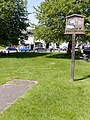
 Thrussington village sign - geograph.org.uk - 6641881.jpg 800 × 539 ; 116 kio
-
 Thrussington village sign - geograph.org.uk - 855488.jpg 424 × 640 ; 91 kio
-
 Thrussington War Memorial - geograph.org.uk - 5777877.jpg 960 × 1 280 ; 543 kio
-
 Thrussington War Memorial - geograph.org.uk - 6517570.jpg 1 280 × 851 ; 1,18 Mio
-
 Thrussington's - geograph.org.uk - 5777564.jpg 1 280 × 812 ; 283 kio
-
 Thrussington, Leicestershire - geograph.org.uk - 29634.jpg 640 × 480 ; 92 kio
-
 Track off Seagrave Road - geograph.org.uk - 2631353.jpg 640 × 513 ; 89 kio
-
 Track to North Hill Farm - geograph.org.uk - 3038720.jpg 640 × 480 ; 63 kio
-
 Tree along Seagrave Road - geograph.org.uk - 6616421.jpg 800 × 506 ; 180 kio
-
 View towards the Leicester city skyline - geograph.org.uk - 884158.jpg 553 × 640 ; 87 kio
-
 Village green Thrussington.JPG 2 288 × 1 712 ; 806 kio
-
 War memorial on The Green, Thrussington - geograph.org.uk - 6602961.jpg 1 065 × 1 600 ; 731 kio
-
 Wreake House, Thrussington - geograph.org.uk - 5787239.jpg 1 280 × 1 280 ; 576 kio
-
 Countryside near Thrussington, Leicestershire - geograph.org.uk - 141370.jpg 640 × 480 ; 162 kio
-
 Disused humpback bridge over the Wreake - geograph.org.uk - 572799.jpg 640 × 480 ; 65 kio
-
 Farmland near Thrussington - geograph.org.uk - 141382.jpg 640 × 280 ; 70 kio
-
 Farmland near Thrussington - geograph.org.uk - 141397.jpg 640 × 427 ; 113 kio
-


_-_geograph.org.uk_-_5777569.jpg)


_-_geograph.org.uk_-_6604880.jpg)
_-_geograph.org.uk_-_6604883.jpg)


_junction_-_geograph.org.uk_-_2815239.jpg)


_-_geograph.org.uk_-_5777557.jpg)


,_Melton_Mowbray_Navigation_-_geograph.org.uk_-_5782828.jpg)


