Category:Thurmaston
Aller à la navigation
Aller à la recherche
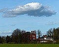
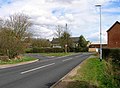
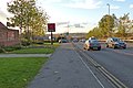
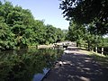
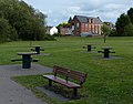
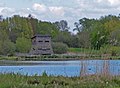
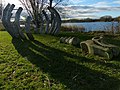
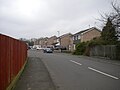
English: Thurmaston is a village and civil parish in the Charnwood district of Leicestershire, England. It is just north of Leicester. As of the 2001 census its population was 8,945.
localité britannique du comté anglais de Leicestershire  | |||||
| Téléverser des médias | |||||
| Nature de l’élément | |||||
|---|---|---|---|---|---|
| Lieu | Charnwood, Leicestershire, Midlands de l'Est, Angleterre | ||||
 | |||||
Sous-catégories
Cette catégorie comprend 4 sous-catégories, dont les 4 ci-dessous.
A
T
- Thurmaston Bus (2 F)
- Thurmaston War Memorial (2 F)
Média dans la catégorie « Thurmaston »
Cette catégorie comprend 326 fichiers, dont les 200 ci-dessous.
(page précédente) (page suivante)-
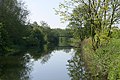
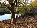
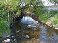
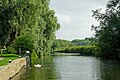
 "Full Steam Ahead" River Soar near Thurmaston Lock - geograph.org.uk - 2225733.jpg 2 805 × 2 042 ; 1,05 Mio
-
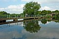
 Across Thurmaston Lock - geograph.org.uk - 2652728.jpg 640 × 456 ; 89 kio
-
 Alderton Close in Rushey Mead, Leicester - geograph.org.uk - 3777113.jpg 1 600 × 1 247 ; 538 kio
-
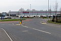
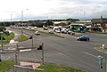
 ASDA car park - geograph.org.uk - 2638729.jpg 640 × 473 ; 80 kio
-
 ASDA car park - geograph.org.uk - 2638730.jpg 640 × 369 ; 55 kio
-
 Autumn along the Grand Union Canal - geograph.org.uk - 3244701.jpg 2 745 × 2 991 ; 3,02 Mio
-
 Barkby Lane - geograph.org.uk - 2605739.jpg 640 × 474 ; 75 kio
-
 Barkby Lodge near Barkby - geograph.org.uk - 4426751.jpg 1 600 × 1 280 ; 338 kio
-
 Barkby Thorpe - geograph.org.uk - 3487597.jpg 640 × 467 ; 44 kio
-
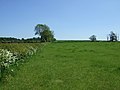
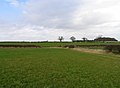
 Barkby Thorpe farmland - geograph.org.uk - 2262888.jpg 640 × 427 ; 63 kio
-
 Barkby Thorpe Lane in Thurmaston - geograph.org.uk - 3244616.jpg 3 325 × 2 215 ; 1,32 Mio
-
 Barkby Thorpe Lane towards Thurmaston - geograph.org.uk - 3238462.jpg 4 000 × 3 000 ; 3,82 Mio
-
 Barkby Thorpe towards Thurmaston - geograph.org.uk - 3487598.jpg 640 × 485 ; 44 kio
-
 Basin and boatyard north of Thurmaston Lock, Leicestershire - geograph.org.uk - 5975316.jpg 1 600 × 900 ; 1,38 Mio
-
 Birstall Lock and Bridge number 16 - geograph.org.uk - 4574023.jpg 2 000 × 1 500 ; 600 kio
-
 Birstall Lock in Leicestershire - geograph.org.uk - 5972694.jpg 1 440 × 960 ; 1,52 Mio
-
 Birstall Lock in Leicestershire - geograph.org.uk - 5972701.jpg 1 600 × 900 ; 1,68 Mio
-
 Birstall Lock in Leicestershire - geograph.org.uk - 5972742.jpg 1 280 × 960 ; 1,73 Mio
-
 Birstall Lock in Leicestershire - geograph.org.uk - 5973604.jpg 1 440 × 960 ; 1,43 Mio
-
 Birstall Lock, Watermead Country Park - geograph.org.uk - 29624.jpg 480 × 640 ; 126 kio
-
 Boats at Thurmaston boatyard - geograph.org.uk - 2652729.jpg 640 × 391 ; 65 kio
-
 Bridge 17 Johnsons Bridge - geograph.org.uk - 2266976.jpg 800 × 531 ; 132 kio
-
-
 Bridge Business Park car park - geograph.org.uk - 2652730.jpg 640 × 492 ; 70 kio
-
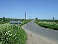
 Bridleway from Hamilton Lane to Barkby Thorpe Road - geograph.org.uk - 5145443.jpg 2 000 × 1 488 ; 260 kio
-
 Bridleway near Barkby Thorpe - geograph.org.uk - 2962969.jpg 640 × 480 ; 100 kio
-
 Brook Street - geograph.org.uk - 2652831.jpg 640 × 368 ; 56 kio
-
 Bus turning circle, Rushey Mead - geograph.org.uk - 5310439.jpg 1 024 × 768 ; 125 kio
-
 By the railway line - geograph.org.uk - 4437905.jpg 640 × 426 ; 62 kio
-
 By the railway line, Thurmaston - geograph.org.uk - 4437911.jpg 640 × 385 ; 84 kio
-
 Canada geese near Birstall Lock in Leicestershire - geograph.org.uk - 5973614.jpg 1 280 × 960 ; 1,52 Mio
-
 Canada geese near Birstall Lock in Leicestershire - geograph.org.uk - 5973615.jpg 1 600 × 900 ; 1,9 Mio
-
 Car park at Watermead Country Park - geograph.org.uk - 640274.jpg 640 × 480 ; 63 kio
-
 Charnwood Water ski ^ Wakeboard Club - geograph.org.uk - 4212850.jpg 1 600 × 1 213 ; 425 kio
-
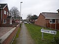
 Colby Drive, Thurmaston (1) - geograph.org.uk - 5311628.jpg 1 024 × 768 ; 84 kio
-
 Colby Drive, Thurmaston (2) - geograph.org.uk - 5311630.jpg 1 024 × 768 ; 112 kio
-
 Colby Drive, Thurmaston (3) - geograph.org.uk - 5311650.jpg 1 024 × 768 ; 122 kio
-
 Costco superstore in Thurmaston - geograph.org.uk - 3913389.jpg 1 600 × 1 098 ; 315 kio
-
 Country lane to Barkby Thorpe - geograph.org.uk - 4118360.jpg 640 × 480 ; 70 kio
-
 Cycle route 6 crossing the Grand Union Canal at Birstall Lock - geograph.org.uk - 2839166.jpg 4 000 × 3 000 ; 4,85 Mio
-
 Dickinson Way, Thurmaston - geograph.org.uk - 5311679.jpg 1 024 × 768 ; 97 kio
-
 Down the ramp - geograph.org.uk - 2652686.jpg 480 × 640 ; 108 kio
-
 Duck weed - geograph.org.uk - 2652732.jpg 640 × 503 ; 81 kio
-
 Entrance to Charnwood Water ski ^ Wakeboard Club - geograph.org.uk - 4212803.jpg 1 600 × 1 284 ; 817 kio
-
 Entrance to Thurmaston Boatyard - geograph.org.uk - 2652733.jpg 640 × 473 ; 83 kio
-
 Farm track south of Barkby Thorpe - geograph.org.uk - 4664245.jpg 800 × 504 ; 98 kio
-
-
 Farmland and hedgerow north of Hamilton - geograph.org.uk - 4664203.jpg 800 × 600 ; 177 kio
-
 Farmland and track near Barkby Thorpe - geograph.org.uk - 4115921.jpg 1 600 × 1 139 ; 365 kio
-
 Farmland near Barkby Thorpe - geograph.org.uk - 2962970.jpg 640 × 480 ; 82 kio
-
 Farmland north of Hamilton - geograph.org.uk - 4664208.jpg 649 × 800 ; 178 kio
-
 Farmland on the edge of Hamilton - geograph.org.uk - 4118377.jpg 1 600 × 1 258 ; 646 kio
-
 Farmland on the edge of Leicester - geograph.org.uk - 4664211.jpg 800 × 600 ; 167 kio
-
 Farmland on the edge of Syston - geograph.org.uk - 4427941.jpg 1 600 × 1 159 ; 410 kio
-
 Farmland south of Barkby Thorpe - geograph.org.uk - 4664232.jpg 800 × 622 ; 172 kio
-
 Farmland towards Hamilton - geograph.org.uk - 2962957.jpg 640 × 480 ; 115 kio
-
 Farmland towards small woodland - geograph.org.uk - 2962965.jpg 640 × 480 ; 71 kio
-
 Field of Canada Geese next to Alderton Close - geograph.org.uk - 4208027.jpg 1 600 × 1 200 ; 552 kio
-
 Fields at Barkby Thorpe - geograph.org.uk - 3487599.jpg 640 × 487 ; 54 kio
-
 Fields by Hamilton - geograph.org.uk - 2970698.jpg 640 × 431 ; 45 kio
-
 Fields off Melton Road - geograph.org.uk - 3029001.jpg 2 423 × 1 973 ; 2,05 Mio
-
 Firemen training at King Lear's Lake - geograph.org.uk - 3969859.jpg 1 600 × 1 177 ; 553 kio
-
 Fisherman on the River Soar - geograph.org.uk - 4211083.jpg 1 600 × 1 328 ; 772 kio
-
 Fishermen - geograph.org.uk - 2652734.jpg 453 × 640 ; 115 kio
-
 Flooded paths at Watermead Country Park - geograph.org.uk - 3254140.jpg 3 257 × 2 561 ; 1,44 Mio
-
 Footbridge across Newark Road - geograph.org.uk - 3029015.jpg 2 366 × 1 962 ; 1,69 Mio
-
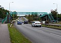
 Footbridge across the A607 - geograph.org.uk - 4790096.jpg 800 × 544 ; 147 kio
-
 Footbridge across the A607 Newark Road - geograph.org.uk - 4208085.jpg 1 600 × 1 134 ; 387 kio
-
 Footbridge across the River Soar by Birstall Lock - geograph.org.uk - 5973488.jpg 1 280 × 960 ; 1,52 Mio
-
 Footbridge entrance - geograph.org.uk - 2652687.jpg 640 × 493 ; 98 kio
-

-
 Footbridge over the A607 - geograph.org.uk - 5199721.jpg 1 469 × 1 102 ; 672 kio
-
 Footbridge over the canal - geograph.org.uk - 2652737.jpg 640 × 482 ; 94 kio
-
 Footpath and gate along the River Soar - geograph.org.uk - 4211112.jpg 1 600 × 1 254 ; 684 kio
-
 Footpath and gate north of Hamilton - geograph.org.uk - 4664214.jpg 800 × 617 ; 246 kio
-
 Footpath to Barkby and Barkby Thorpe - geograph.org.uk - 2970700.jpg 640 × 468 ; 57 kio
-
 Footpath to Uttoxeter Close, Rushey Mead - geograph.org.uk - 5310388.jpg 1 024 × 768 ; 159 kio
-
 Former Primitive Methodist Church - geograph.org.uk - 4967330.jpg 1 600 × 1 065 ; 486 kio
-
 Garage on Church Hill Road, Thurmaston - geograph.org.uk - 5311664.jpg 1 024 × 768 ; 106 kio
-
 Garden by moored boat - geograph.org.uk - 2652738.jpg 640 × 517 ; 157 kio
-
 Geese at the Watermead Country Park South - geograph.org.uk - 4861901.jpg 800 × 622 ; 125 kio
-
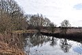 Grand Union Canal - geograph.org.uk - 2267054.jpg 800 × 531 ; 135 kio
-
 Grand Union Canal - Leicester - geograph.org.uk - 2267057.jpg 800 × 531 ; 94 kio
-
 Grand Union Canal - Leicester Branch - geograph.org.uk - 2266989.jpg 800 × 531 ; 114 kio
-
 Grand Union Canal - Leicester Branch - geograph.org.uk - 2267060.jpg 800 × 531 ; 133 kio
-
 Grand Union Canal at the Watermead Country Park - geograph.org.uk - 3244691.jpg 4 000 × 3 000 ; 2,63 Mio
-
 Grand Union Canal east of Wanlip in Leicestershire - geograph.org.uk - 5975729.jpg 1 440 × 960 ; 1,63 Mio
-
 Grand Union Canal in the Watermead Country Park - geograph.org.uk - 3777148.jpg 1 600 × 1 275 ; 681 kio
-
 Grand Union Canal in the Watermead Country Park - geograph.org.uk - 3777176.jpg 1 600 × 1 285 ; 832 kio
-
 Grand Union Canal in Thurmaston - geograph.org.uk - 3244680.jpg 4 000 × 3 000 ; 4,85 Mio
-
 Grey heron at King Lear's Lake - geograph.org.uk - 4162358.jpg 1 195 × 1 600 ; 383 kio
-
 Hamilton Lane towards Barkby Thorpe - geograph.org.uk - 2970701.jpg 640 × 455 ; 49 kio
-
 Horse riders on Barkby Lane - geograph.org.uk - 3816301.jpg 1 600 × 1 123 ; 448 kio
-
 House at Mill Lane Car Park - geograph.org.uk - 2652739.jpg 640 × 544 ; 68 kio
-
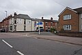
 Houses in Thurmaston - geograph.org.uk - 2652740.jpg 640 × 388 ; 57 kio
-
 Houses on Church Street - geograph.org.uk - 2652688.jpg 640 × 510 ; 99 kio
-
 Humberstone Lane - geograph.org.uk - 2652689.jpg 640 × 422 ; 71 kio
-
 Humberstone Lane, Leicester - geograph.org.uk - 497320.jpg 613 × 640 ; 117 kio
-
 Humberstone Lane, Thurmaston - geograph.org.uk - 497352.jpg 640 × 623 ; 119 kio
-
 Industrial estate by Watermead Country Park - geograph.org.uk - 4434198.jpg 640 × 446 ; 62 kio
-
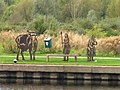 Iron sculptures - geograph.org.uk - 2652741.jpg 640 × 480 ; 101 kio
-
 January sunset at King Lear's Lake,Watermead Country Park,Leicester - geograph.org.uk - 2225711.jpg 3 648 × 2 736 ; 4,32 Mio
-
 Jewry Wall Museum column with Hadrian Inscription.jpg 1 071 × 1 600 ; 229 kio
-
 John Merricks Lake, Watermead Country Park - geograph.org.uk - 756717.jpg 640 × 480 ; 134 kio
-
 Johnson's Bridge 17 - geograph.org.uk - 2351049.jpg 640 × 385 ; 58 kio
-
 Johnson's Bridge north-west of Thurmaston, Leicestershire - geograph.org.uk - 5975538.jpg 1 280 × 960 ; 1,53 Mio
-
 Johnson's Bridge north-west of Thurmaston, Leicestershire - geograph.org.uk - 5975542.jpg 1 280 × 960 ; 1,46 Mio
-
 June Avenue, Thurmaston - geograph.org.uk - 497367.jpg 540 × 640 ; 96 kio
-
 King Lear - geograph.org.uk - 4426750.jpg 1 600 × 1 200 ; 406 kio
-
 King Lear's Lake - geograph.org.uk - 5549104.jpg 600 × 800 ; 165 kio
-
 King Lear's Lake at the Watermead Country Park - geograph.org.uk - 3777163.jpg 1 600 × 1 200 ; 648 kio
-
 King Lear's Lake at the Watermead Country Park - geograph.org.uk - 3816325.jpg 1 600 × 1 200 ; 736 kio
-
 King Lear's Lake at Watermead Country Park - geograph.org.uk - 3762002.jpg 1 600 × 1 273 ; 428 kio
-
 King Lear's Lake at Watermead Country Park - geograph.org.uk - 3762116.jpg 1 600 × 1 295 ; 294 kio
-
 King Lear's Lake, Watermead Country Park Leicester - geograph.org.uk - 1942697.jpg 3 035 × 1 690 ; 1,78 Mio
-

-

-

-
 Kissing gate at Mill Lane car park - geograph.org.uk - 2652742.jpg 640 × 548 ; 126 kio
-
 Lake and wind turbine - geograph.org.uk - 3777169.jpg 1 600 × 1 164 ; 539 kio
-
 Lake at the Watermead Country Park - geograph.org.uk - 3760649.jpg 1 600 × 1 215 ; 554 kio
-
 Lake at Watermead Country Park - geograph.org.uk - 3759375.jpg 1 600 × 1 123 ; 289 kio
-
 Lake at Watermead Country Park South - geograph.org.uk - 3787209.jpg 1 243 × 1 600 ; 419 kio
-
 Lake at Watermead Country Park South - geograph.org.uk - 5143102.jpg 800 × 557 ; 98 kio
-
 Lane heading towards Barkby Thorpe - geograph.org.uk - 4664218.jpg 800 × 596 ; 80 kio
-
 Lane leading to Nether Hall - geograph.org.uk - 4118373.jpg 1 600 × 1 165 ; 469 kio
-
 Lane towards Barkby Thorpe - geograph.org.uk - 2962959.jpg 640 × 480 ; 64 kio
-
 Lane towards Barkby Thorpe - geograph.org.uk - 2962971.jpg 640 × 480 ; 66 kio
-
 Late afternoon at Watermead - geograph.org.uk - 364049.jpg 640 × 480 ; 57 kio
-
 Leicester city boundary, Rushey Mead - geograph.org.uk - 5310452.jpg 1 024 × 768 ; 97 kio
-
 Leicester Marina - geograph.org.uk - 4211004.jpg 1 600 × 1 139 ; 529 kio
-
 Leicester Marina - geograph.org.uk - 5405872.jpg 800 × 600 ; 138 kio
-

-
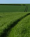
 Lines of straw waiting to be baled - geograph.org.uk - 4115818.jpg 1 600 × 1 200 ; 656 kio
-
 Mark Convenience Store - geograph.org.uk - 2652690.jpg 640 × 458 ; 69 kio
-
 Meadow Lane Playing Fields - geograph.org.uk - 584299.jpg 640 × 480 ; 74 kio
-
 Melton Brook near Hamilton - geograph.org.uk - 4664153.jpg 800 × 600 ; 217 kio
-
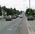
 Melton Road - geograph.org.uk - 2652691.jpg 640 × 430 ; 60 kio
-
 Melton Road at Canal Street, Thurmaston - geograph.org.uk - 4966873.jpg 1 600 × 1 065 ; 406 kio
-
 Melton Road towards Leicester - geograph.org.uk - 2652692.jpg 640 × 492 ; 58 kio
-
 Melton Road towards Leicester - geograph.org.uk - 2652693.jpg 640 × 433 ; 67 kio
-
 Melton Road towards Leicester - geograph.org.uk - 2652744.jpg 640 × 539 ; 59 kio
-
 Melton Road towards Melton Mowbray - geograph.org.uk - 2652745.jpg 640 × 572 ; 80 kio
-
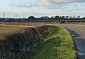
 Melton Road towards Thurmaston - geograph.org.uk - 2904164.jpg 640 × 440 ; 100 kio
-
 Melton Road, Thurmaston - geograph.org.uk - 497643.jpg 640 × 529 ; 93 kio
-
 MGM Boats Ltd sign - geograph.org.uk - 2652743.jpg 640 × 368 ; 62 kio
-
 MGM Boats Ltd, Thurmaston - geograph.org.uk - 6179491.jpg 1 600 × 1 200 ; 417 kio
-
 Midland main line railway from Humberstone Lane bridge - geograph.org.uk - 5096325.jpg 2 000 × 1 500 ; 292 kio
-
 Midland main line railway south of Barkby Thorpe Lane - geograph.org.uk - 5060464.jpg 2 000 × 1 500 ; 276 kio
-
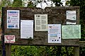 Mill Lane car park notice board - geograph.org.uk - 2652746.jpg 640 × 423 ; 99 kio
-
 Mill Lane car park sign - geograph.org.uk - 2652747.jpg 640 × 613 ; 143 kio
-
 Miller Close - geograph.org.uk - 3823007.jpg 640 × 480 ; 80 kio
-
 Narrow boats at Watermead Country Park - geograph.org.uk - 48516.jpg 627 × 640 ; 157 kio
-
 Narrowboats moored along the River Soar - geograph.org.uk - 5143108.jpg 800 × 600 ; 162 kio
-
 Navigation sign, River Soar, Birstall - geograph.org.uk - 6164184.jpg 1 866 × 1 400 ; 522 kio
-
 Newark Road - geograph.org.uk - 2652695.jpg 640 × 486 ; 87 kio
-
 North end of King Lear's Lake - geograph.org.uk - 3762082.jpg 1 600 × 1 118 ; 322 kio
-
 Oil seed rape crop at Barkby - geograph.org.uk - 4664867.jpg 800 × 582 ; 181 kio
-
 OS benchmark - Syston, factory unit on Britannia Way - geograph.org.uk - 5199729.jpg 857 × 1 142 ; 464 kio
-
 OS rivet - Thurmaston, footbridge support - geograph.org.uk - 5199725.jpg 1 142 × 857 ; 691 kio
-
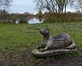 Otter carving at the Watermead Country Park - geograph.org.uk - 3759395.jpg 1 600 × 1 298 ; 806 kio
-
 Owen Close - geograph.org.uk - 3823009.jpg 640 × 480 ; 70 kio
-
 Path across the Watermead Country Park - geograph.org.uk - 3762214.jpg 1 600 × 1 221 ; 678 kio
-
 Path along the edge of King Lear's Lake - geograph.org.uk - 3762152.jpg 1 600 × 1 074 ; 622 kio
-
 Path along the Grand Union Canal - geograph.org.uk - 3244667.jpg 3 165 × 2 724 ; 2,76 Mio
-
 Path in Watermead Country Park South - geograph.org.uk - 4210970.jpg 1 600 × 1 200 ; 508 kio
-
 Path leading to the A607 Newark Road - geograph.org.uk - 4427980.jpg 1 600 × 1 231 ; 622 kio
-
 Path north along the Grand union Canal - geograph.org.uk - 4212831.jpg 1 600 × 1 387 ; 1,06 Mio
-
 Path through Watermead Country Park South - geograph.org.uk - 4232896.jpg 1 600 × 1 260 ; 750 kio
-
 Paths in Watermead Country Park - geograph.org.uk - 6164187.jpg 1 600 × 1 200 ; 347 kio
-
 Pedestrian access to the A607 - geograph.org.uk - 4770553.jpg 2 000 × 1 500 ; 326 kio
-
 Picnic area along the River Soar in Thurmaston - geograph.org.uk - 4211569.jpg 1 600 × 1 259 ; 479 kio
-
 Plover Bird Hide at the Watermead Country Park - geograph.org.uk - 4471487.jpg 1 024 × 752 ; 258 kio
-
 Plover Bird Hide at Watermead Country Park - geograph.org.uk - 4208048.jpg 1 600 × 1 304 ; 657 kio
-
 Postbox along Melton Road - geograph.org.uk - 3028977.jpg 2 807 × 2 063 ; 2,59 Mio
-
 Railway bridge over Church Hill Road, Thurmaston - geograph.org.uk - 5311674.jpg 1 024 × 768 ; 148 kio
-
 Railway cutting near Thurmaston - geograph.org.uk - 4437908.jpg 640 × 426 ; 92 kio
-
 Railway cutting near Thurmaston - geograph.org.uk - 4437909.jpg 640 × 426 ; 70 kio
-
 Ramp and steps - geograph.org.uk - 2652696.jpg 640 × 479 ; 90 kio
-
 Ramp down from footbridge - geograph.org.uk - 2652697.jpg 640 × 480 ; 99 kio
-
 Rather derelict looking - geograph.org.uk - 4755187.jpg 640 × 426 ; 56 kio
-
 Remains of the chapel of St. John the Evangelist, Thurmaston (geograph 7141516).jpg 768 × 1 024 ; 275 kio
-
 Rib cage climbing frame - geograph.org.uk - 3777153.jpg 1 600 × 1 200 ; 734 kio
-
 Rib cage climbing frame - geograph.org.uk - 3777160.jpg 1 501 × 1 600 ; 816 kio
-
 Ridgeway Drive, Thurmaston - geograph.org.uk - 5311636.jpg 1 024 × 768 ; 114 kio
-
 River footbridge (geograph 2652748).jpg 640 × 432 ; 71 kio
-
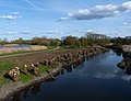
 River Soar and canal near Thurmaston, Leicestershire (geograph 5975485).jpg 1 440 × 1 080 ; 1,73 Mio
-
 River Soar and canal near Thurmaston, Leicestershire - geograph.org.uk - 5975489.jpg 1 440 × 960 ; 1,23 Mio
-
 River Soar at Birstall in Leicestershire - geograph.org.uk - 5974616.jpg 1 440 × 960 ; 1,55 Mio
-
 River Soar below Thurmaston Lock in Leicestershire - geograph.org.uk - 5974884.jpg 1 600 × 900 ; 1,56 Mio
-

-
 River Soar in the Watermead Country Park - geograph.org.uk - 4426749.jpg 1 600 × 1 230 ; 358 kio
-

-
 River Soar near Birstall in Leicestershire - geograph.org.uk - 5974650.jpg 1 280 × 960 ; 1,8 Mio
-
 River Soar near Birstall Lock in Leicestershire - geograph.org.uk - 5973655.jpg 960 × 1 280 ; 1,9 Mio
-
 River Soar near Birstall Lock, Leicestershire - geograph.org.uk - 5973740.jpg 1 440 × 960 ; 1,56 Mio
-
 River Soar near Thurmaston, Leicestershire - geograph.org.uk - 5975443.jpg 1 440 × 960 ; 1,11 Mio
-
 River Soar near Thurmaston, Leicestershire - geograph.org.uk - 5975445.jpg 1 440 × 960 ; 1,38 Mio
-
 River Soar near Thurmaston, Leicestershire - geograph.org.uk - 5975470.jpg 1 440 × 960 ; 1,53 Mio
-
 River Soar north of Birstall Lock, Leicestershire - geograph.org.uk - 5973735.jpg 1 600 × 900 ; 1,45 Mio


_-_geograph.org.uk_-_5311628.jpg)
_-_geograph.org.uk_-_5311630.jpg)
_-_geograph.org.uk_-_5311650.jpg)


.jpg)


.jpg)
.jpg)


