Category:Thurnby
Vai alla navigazione
Vai alla ricerca
village in Leicestershire, United Kingdom | |||||
| Carica un file multimediale | |||||
| Istanza di | |||||
|---|---|---|---|---|---|
| Luogo | Thurnby and Bushby, Harborough, Leicestershire, Midlands Orientali, Inghilterra | ||||
 | |||||
Sottocategorie
Questa categoria contiene un'unica sottocategoria, indicata di seguito.
T
File nella categoria "Thurnby"
Questa categoria contiene 49 file, indicati di seguito, su un totale di 49.
-
A47 Uppingham Road, Leicester - geograph.org.uk - 455147.jpg 640 × 619; 153 KB
-
Centre of Thurnby - geograph.org.uk - 2473610.jpg 640 × 480; 97 KB
-
Court Road in Thurnby - geograph.org.uk - 3275007.jpg 4 000 × 3 000; 2,26 MB
-
Daffodils, Uppingham Road. - geograph.org.uk - 736483.jpg 640 × 480; 135 KB
-
Driveway - geograph.org.uk - 186735.jpg 640 × 411; 106 KB
-
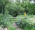
Footpath into the woods - geograph.org.uk - 186766.jpg 640 × 561; 179 KB
-
James Coles ^ Sons Nurseries, Thurnby - geograph.org.uk - 2473621.jpg 640 × 480; 117 KB
-
Leicester skyline - geograph.org.uk - 472568.jpg 640 × 358; 73 KB
-
Main Street, Thurnby - geograph.org.uk - 4473407.jpg 640 × 360; 88 KB
-
Spencefield Lane, Evington, Leicester - geograph.org.uk - 455143.jpg 503 × 640; 136 KB
-
Spencefield Lane, Evington, Leicester - geograph.org.uk - 455146.jpg 640 × 480; 121 KB
-
St Luke's Church of England Primary School, Thurnby (geograph 6424275).jpg 3 776 × 2 520; 4,13 MB
-
Milestone on Winkerdale Hill - geograph.org.uk - 186398.jpg 480 × 640; 125 KB
-
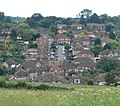
VIEW OF THURNBY.jpg 1 280 × 960; 253 KB
-
A view from Covert Lane, Scraptoft - geograph.org.uk - 470979.jpg 640 × 565; 134 KB
-
A47 Uppingham Road near Leicester - geograph.org.uk - 455152.jpg 640 × 525; 115 KB
-
Beeby Road, Keyham Lane junction - geograph.org.uk - 472562.jpg 640 × 463; 84 KB
-
Beeby Road, Leicestershire - geograph.org.uk - 472508.jpg 505 × 640; 89 KB
-
Cattle Sheds - geograph.org.uk - 205492.jpg 640 × 480; 89 KB
-
Covert Lane east of Leicester - geograph.org.uk - 470993.jpg 539 × 640; 128 KB
-
Covert Lane east of Leicester - geograph.org.uk - 470995.jpg 640 × 637; 172 KB
-
Disused railway and tunnel - geograph.org.uk - 186742.jpg 640 × 480; 74 KB
-
Farm buildings - geograph.org.uk - 470990.jpg 503 × 640; 124 KB
-
Farmland near Stoughton, Leicester - geograph.org.uk - 101729.jpg 640 × 427; 96 KB
-
Footpath at Thurnby near Leicester - geograph.org.uk - 101727.jpg 640 × 427; 132 KB
-
Grange Lane, Thurnby - geograph.org.uk - 455149.jpg 640 × 460; 100 KB
-
Hills and Hollows - geograph.org.uk - 369022.jpg 640 × 480; 39 KB
-
Houghton Lane, near Stoughton - geograph.org.uk - 101740.jpg 640 × 427; 113 KB
-
Landmark Tree, Uppingham Road, Leicester - geograph.org.uk - 736618.jpg 480 × 640; 101 KB
-
Looking towards Thurnby - geograph.org.uk - 456192.jpg 522 × 640; 127 KB
-
Main Street, Thurnby - geograph.org.uk - 455151.jpg 640 × 302; 81 KB
-
Public Bridleway - geograph.org.uk - 455153.jpg 640 × 424; 102 KB
-
Public Bridleway - geograph.org.uk - 456032.jpg 566 × 640; 135 KB
-
Public footpath to Thurnby - geograph.org.uk - 470994.jpg 640 × 434; 139 KB
-
Scraptoft Lane, Leicester - geograph.org.uk - 470975.jpg 555 × 640; 111 KB
-
Scraptoft Lane, Leicester - geograph.org.uk - 470977.jpg 491 × 640; 99 KB
-
Scraptoft Lane, Leicestershire - geograph.org.uk - 472497.jpg 640 × 480; 129 KB
-
Scraptoft Lane, Leicestershire - geograph.org.uk - 472505.jpg 480 × 640; 112 KB
-
Stable and store - geograph.org.uk - 205493.jpg 640 × 480; 101 KB
-
The Garden Centre at Coles Nursery - geograph.org.uk - 101743.jpg 640 × 480; 184 KB
-
The green, Bushby, Leicester - geograph.org.uk - 101714.jpg 479 × 640; 170 KB
-
Thurnby near Leicester - geograph.org.uk - 101713.jpg 640 × 333; 79 KB
-
Track - geograph.org.uk - 186761.jpg 640 × 460; 66 KB
-
Wadkins Way, Bushby, Leicester - geograph.org.uk - 101707.jpg 640 × 427; 85 KB
-
Winkadale cows - geograph.org.uk - 456040.jpg 640 × 480; 153 KB
-
Winkerdale Hill - geograph.org.uk - 186397.jpg 640 × 434; 83 KB


