Category:Thursford
Aller à la navigation
Aller à la recherche
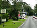
English: Thursford is a village and a civil parish in the English county of Norfolk. The village is 16.3 miles south-west of Cromer, 24.5 miles north-west of Norwich and 121 miles north-east of London. The village lies 6.9 miles north-west of the nearby town of Fakenham. The nearest railway station is at Sheringham for the Bittern Line which runs between Sheringham, Cromer and Norwich. The nearest airport is Norwich International Airport. The village once had its own Thursford railway station which is now closed. It is a proposed stop on the Norfolk Orbital Railway.
localité britannique du comté anglais de Norfolk  | |||||
| Téléverser des médias | |||||
| Nature de l’élément | |||||
|---|---|---|---|---|---|
| Lieu | North Norfolk, Norfolk, Angleterre de l'Est, Angleterre | ||||
| Superficie |
| ||||
| Réputé identique à | Thursford (page en doublon, paroisse civile) | ||||
 | |||||
Sous-catégories
Cette catégorie comprend 4 sous-catégories, dont les 4 ci-dessous.
A
C
- Chad arms (3 F)
- Thursford Collection (5 F)
- Crawfish Inn, Thursford (3 F)
Média dans la catégorie « Thursford »
Cette catégorie comprend 155 fichiers, dont les 155 ci-dessous.
-
-
 Neale(1818) p3.094 - Thursford Hall, Norfolk.jpg 1 824 × 1 216 ; 589 kio
-
 A twin oak - geograph.org.uk - 952480.jpg 480 × 640 ; 164 kio
-
 A View Towards Thursford Church - geograph.org.uk - 4609521.jpg 640 × 480 ; 447 kio
-
 A148 - geograph.org.uk - 3835044.jpg 640 × 430 ; 78 kio
-
 A148 - geograph.org.uk - 3835047.jpg 640 × 430 ; 47 kio
-
 A148 at Thursford village boundary - geograph.org.uk - 3630049.jpg 640 × 481 ; 95 kio
-
 A148 near Thursford - geograph.org.uk - 4642408.jpg 640 × 427 ; 326 kio
-
 A148 westbound at Thursford - geograph.org.uk - 3630091.jpg 640 × 480 ; 66 kio
-
 A148 westbound nearing B1354 junction - geograph.org.uk - 3630076.jpg 640 × 480 ; 37 kio
-
 A148, Brookhill Plantation - geograph.org.uk - 4642311.jpg 640 × 427 ; 368 kio
-
 Abandoned and ruined - geograph.org.uk - 952543.jpg 640 × 480 ; 176 kio
-
 Ancient oak tree in Thursford Wood Nature Reserve - geograph.org.uk - 952452.jpg 480 × 640 ; 179 kio
-
 Approach to the A148 near Hurrel's Grove - geograph.org.uk - 550587.jpg 640 × 480 ; 74 kio
-
 Approaching Clarks Lane - geograph.org.uk - 952396.jpg 480 × 640 ; 185 kio
-
 Approaching the A148 from Hindringham - geograph.org.uk - 4180596.jpg 640 × 480 ; 102 kio
-
 Approaching Thursford Green - geograph.org.uk - 950963.jpg 640 × 462 ; 118 kio
-
 Autumnal foliage - geograph.org.uk - 989091.jpg 480 × 640 ; 162 kio
-
 Beech trees and bluebells - geograph.org.uk - 3947111.jpg 640 × 480 ; 312 kio
-
 Bluebells in Great Heath Plantation - geograph.org.uk - 3947109.jpg 640 × 606 ; 357 kio
-
 Bracken growing beside the path - geograph.org.uk - 952470.jpg 480 × 640 ; 157 kio
-
 Brick Kiln Road - geograph.org.uk - 989104.jpg 640 × 480 ; 129 kio
-
 Brick Kiln Road past Great Heath Plantation - geograph.org.uk - 989118.jpg 480 × 640 ; 153 kio
-
 Building on Clark's Lane - geograph.org.uk - 4609483.jpg 640 × 480 ; 409 kio
-
 Carl Frei Concert Organ (detail) - geograph.org.uk - 4609334.jpg 640 × 480 ; 522 kio
-
 Cemetery in Cemetery Lane, Thursford - geograph.org.uk - 4180590.jpg 640 × 480 ; 184 kio
-
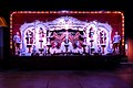
 Christmas lights at Thursford in Norfolk - geograph.org.uk - 5998276.jpg 4 032 × 3 024 ; 3,96 Mio
-
 Clark's Lane (Track) - geograph.org.uk - 4609472.jpg 640 × 480 ; 444 kio
-
 Clarks Lane - geograph.org.uk - 952384.jpg 480 × 640 ; 169 kio
-
 Cornfield, Thursford - geograph.org.uk - 4609477.jpg 640 × 480 ; 423 kio
-
 Cottage Flowers - geograph.org.uk - 2844532.jpg 2 848 × 2 134 ; 909 kio
-
 Cottage on the edge of Great Heath Plantation - geograph.org.uk - 989114.jpg 640 × 459 ; 153 kio
-
 Cultivated field - geograph.org.uk - 989111.jpg 640 × 480 ; 148 kio
-
 Deep shade in the trees - geograph.org.uk - 6230011.jpg 2 000 × 1 333 ; 2,29 Mio
-
 Entering Fantasy Land - geograph.org.uk - 5213375.jpg 5 472 × 3 648 ; 4,82 Mio
-
 Entrance to Brookhill Farm - geograph.org.uk - 952436.jpg 480 × 640 ; 118 kio
-
 Entrance to the Thursford Collection - geograph.org.uk - 4609272.jpg 640 × 480 ; 534 kio
-
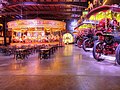
 Exhibition Area, The Thursford Collection - geograph.org.uk - 4609275.jpg 640 × 480 ; 511 kio
-
 Fairground ride at Thursford in Norfolk - geograph.org.uk - 5998312.jpg 4 032 × 3 024 ; 4,36 Mio
-
 Fantasy Land, The Thursford Collection - geograph.org.uk - 4609451.jpg 640 × 480 ; 446 kio
-
 Farm implement in a field - geograph.org.uk - 4180594.jpg 640 × 480 ; 115 kio
-
 Field adjoining Thursford Wood - geograph.org.uk - 952589.jpg 640 × 436 ; 133 kio
-
 Filling station by the A148 - geograph.org.uk - 3835042.jpg 640 × 430 ; 95 kio
-
 Foden Tractor at The Thursford Collection - geograph.org.uk - 4609285.jpg 640 × 480 ; 513 kio
-
 Footpath marker at the end of Clarks Lane - geograph.org.uk - 952390.jpg 480 × 640 ; 163 kio
-
 Footpath to Thursford - geograph.org.uk - 952393.jpg 480 × 640 ; 129 kio
-
 Footpath to Thursford church - geograph.org.uk - 4180573.jpg 640 × 480 ; 172 kio
-

-
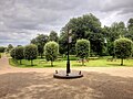
 Gates to the Park - geograph.org.uk - 510129.jpg 640 × 480 ; 156 kio
-
 Grassy path through the wood - geograph.org.uk - 952461.jpg 480 × 640 ; 171 kio
-
 Great Heath Plantation - geograph.org.uk - 989077.jpg 640 × 480 ; 141 kio
-
 Guard dogs on patrol - geograph.org.uk - 952415.jpg 480 × 640 ; 168 kio
-
 Gulf filling station, A148 - geograph.org.uk - 4057990.jpg 1 024 × 701 ; 481 kio
-
 Gunthorpe Hall - geograph.org.uk - 510154.jpg 640 × 480 ; 92 kio
-
 Harvested cereal field - geograph.org.uk - 952526.jpg 640 × 480 ; 149 kio
-
 Hedgerow field boundary - geograph.org.uk - 952582.jpg 640 × 480 ; 110 kio
-
 Hedges by the road - geograph.org.uk - 6230000.jpg 2 000 × 1 333 ; 1,58 Mio
-
 House on High Street - geograph.org.uk - 950960.jpg 640 × 480 ; 112 kio
-
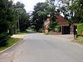
 Houses in Thursford - geograph.org.uk - 4180565.jpg 640 × 480 ; 148 kio
-
 In Fantasy Land - geograph.org.uk - 5213398.jpg 640 × 427 ; 84 kio
-
 In Fantasy Land - geograph.org.uk - 5213408.jpg 3 648 × 5 472 ; 2,62 Mio
-
 In Fantasy Land - geograph.org.uk - 5213416.jpg 3 648 × 5 472 ; 2,76 Mio
-
 In Fantasy Land - geograph.org.uk - 5213424.jpg 5 472 × 3 648 ; 6,49 Mio
-
 Interesting brickwork - geograph.org.uk - 952552.jpg 480 × 640 ; 205 kio
-
 Joining the A148 at the Crawfish Inn - geograph.org.uk - 4642438.jpg 640 × 427 ; 338 kio
-

-
 Near Station Farm - geograph.org.uk - 6230005.jpg 1 996 × 1 213 ; 396 kio
-
 North Lane, Thursford Green - geograph.org.uk - 4609458.jpg 640 × 480 ; 402 kio
-
 Northbound A148 near Parkside Garage - geograph.org.uk - 4642381.jpg 640 × 480 ; 457 kio
-
 Northbound A148 near Thursford - geograph.org.uk - 4642412.jpg 640 × 427 ; 363 kio
-
 Padlocked gate and warning signs - geograph.org.uk - 952411.jpg 480 × 640 ; 178 kio
-
 Parkside Garage and Tyres, Thursford - geograph.org.uk - 4642400.jpg 640 × 480 ; 428 kio
-
 Passing the Parr Plantation - geograph.org.uk - 6230009.jpg 1 894 × 1 152 ; 501 kio
-
 Plants for sale - geograph.org.uk - 950958.jpg 480 × 640 ; 141 kio
-
 Ploughman's Lane (track) - geograph.org.uk - 3851247.jpg 3 088 × 2 056 ; 3,87 Mio
-
 Pumpkin House under construction - geograph.org.uk - 5950842.jpg 2 592 × 1 944 ; 2,83 Mio
-
 Road signs - geograph.org.uk - 989100.jpg 640 × 480 ; 109 kio
-
 Road Works at a Rural Junction near Thursford - geograph.org.uk - 4642431.jpg 640 × 480 ; 389 kio
-
 Ruined building in corner of field - geograph.org.uk - 952535.jpg 480 × 640 ; 185 kio
-
 Sign at the start of the footpath - geograph.org.uk - 952449.jpg 480 × 640 ; 176 kio
-
 Southbound A148 Approaching Thursford - geograph.org.uk - 4642418.jpg 640 × 480 ; 442 kio
-
 Southbound A148 near Parkside Garage - geograph.org.uk - 4642378.jpg 640 × 480 ; 396 kio
-
 Southbound A148 near Thursford - geograph.org.uk - 4642396.jpg 640 × 480 ; 386 kio
-
 Southbound A148 near Thursford - geograph.org.uk - 4642440.jpg 640 × 427 ; 336 kio
-
 St Andrew's Church, Thursford - geograph.org.uk - 4609526.jpg 640 × 481 ; 593 kio
-
 Stile and Barbed Wire Fence near Thursford - geograph.org.uk - 4609488.jpg 640 × 480 ; 501 kio
-
 The Crawfish Inn, A148 - geograph.org.uk - 3835045.jpg 640 × 429 ; 66 kio
-
 The Crawfish Inn, Thursford, 9 March 2009 (2).JPG 2 560 × 1 920 ; 3,21 Mio
-
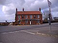
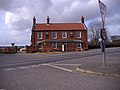 The Crawfish Public House - geograph.org.uk - 1198065.jpg 640 × 480 ; 75 kio
-
 The Entrance to Fantasy Land - geograph.org.uk - 5213390.jpg 4 816 × 3 211 ; 2,91 Mio
-
 The Marenghi 98 key showman's organ - Thursford, Norfolk - geograph.org.uk - 5998287.jpg 4 032 × 3 024 ; 3,41 Mio
-
 The Old Hall, Thursford - geograph.org.uk - 2844519.jpg 2 848 × 2 134 ; 749 kio
-
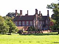 The Old Hall, Thursford - geograph.org.uk - 2844528.jpg 2 848 × 2 134 ; 981 kio
-
 The road by Thursford Green - geograph.org.uk - 4180563.jpg 640 × 480 ; 162 kio
-
 The road past Thursford Common - geograph.org.uk - 4180561.jpg 640 × 480 ; 96 kio
-
 The Road to Thursford Green - geograph.org.uk - 4642427.jpg 640 × 480 ; 348 kio
-
 The skeleton of a roof - geograph.org.uk - 952571.jpg 480 × 640 ; 165 kio
-
 The Thursford Collection Exhibition Hall - geograph.org.uk - 4609277.jpg 640 × 480 ; 494 kio
-
 The Thursford Collection Gondola Merry-Go-Round - geograph.org.uk - 4609379.jpg 640 × 480 ; 611 kio
-
 This way to Clarkes Lane - geograph.org.uk - 952408.jpg 480 × 640 ; 178 kio
-
 Through the woods - geograph.org.uk - 952404.jpg 480 × 640 ; 159 kio
-
 Thursford cemetery - geograph.org.uk - 5616251.jpg 3 456 × 2 592 ; 3,93 Mio
-

-
 Thursford Collection, Organs - geograph.org.uk - 4609339.jpg 640 × 481 ; 514 kio
-
 Thursford Collection, Picnic Area - geograph.org.uk - 4609274.jpg 640 × 480 ; 434 kio
-

-
 Thursford Fantasy Land - geograph.org.uk - 5998298.jpg 4 032 × 3 024 ; 3,55 Mio
-
 Thursford Green - geograph.org.uk - 4609467.jpg 640 × 480 ; 516 kio
-
 Thursford Green, North Lane - geograph.org.uk - 4609539.jpg 640 × 481 ; 482 kio
-
 Thursford Green, The Street - geograph.org.uk - 4609536.jpg 640 × 480 ; 444 kio
-
 Thursford Methodist Church, Thursford Green - geograph.org.uk - 4609465.jpg 640 × 480 ; 545 kio
-
 Thursford Road Approaching the Crawfish Inn - geograph.org.uk - 4642434.jpg 640 × 427 ; 330 kio
-
 Thursford Show - geograph.org.uk - 3352664.jpg 2 816 × 2 112 ; 2,57 Mio
-
 Thursford village centre - geograph.org.uk - 4180569.jpg 640 × 480 ; 100 kio
-
 Thursford WW1 Memorial - geograph.org.uk - 4583521.jpg 2 592 × 3 456 ; 2,95 Mio
-
 Thursford WW2 memorial - geograph.org.uk - 4583526.jpg 2 592 × 3 456 ; 3,08 Mio
-
 Thursford, Church Lane Junction - geograph.org.uk - 4642428.jpg 640 × 480 ; 358 kio
-
 Thursford, Un-named Road - geograph.org.uk - 4642421.jpg 640 × 427 ; 360 kio
-
 Thursford.jpg 640 × 480 ; 107 kio
-
 Track into Great Heath Plantation - geograph.org.uk - 3947107.jpg 640 × 452 ; 221 kio
-
 Tracked dumper hire depot - geograph.org.uk - 462869.jpg 640 × 427 ; 80 kio
-
 Traction Engines in the Thursford Collection - geograph.org.uk - 4609289.jpg 640 × 481 ; 587 kio
-
 Tractor tyre marks - geograph.org.uk - 952407.jpg 480 × 640 ; 190 kio
-
 Tree-lined footpath to Thursford Wood - geograph.org.uk - 952402.jpg 480 × 640 ; 173 kio
-
 View east across Cemetery Lane and farmland - geograph.org.uk - 570080.jpg 480 × 640 ; 47 kio
-
 View east along a farm track - geograph.org.uk - 1123048.jpg 640 × 480 ; 152 kio
-
 View east along High Street - geograph.org.uk - 950981.jpg 480 × 640 ; 169 kio
-
 View east along the A148 (Holt Road) - geograph.org.uk - 952441.jpg 640 × 459 ; 106 kio
-
 View northwest across stubble - geograph.org.uk - 570096.jpg 640 × 480 ; 48 kio
-
 View southwest along the A148 (Holt Road) - geograph.org.uk - 952438.jpg 480 × 640 ; 129 kio
-
 View towards Thursford Wood - geograph.org.uk - 952424.jpg 640 × 480 ; 106 kio
-
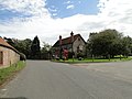
 Village green, village sign and village hall - geograph.org.uk - 950988.jpg 640 × 463 ; 153 kio
-
 Welcome To Thursford - geograph.org.uk - 5213348.jpg 5 472 × 3 648 ; 6,27 Mio
-

-
 Where cattle once used to graze - geograph.org.uk - 952464.jpg 480 × 640 ; 162 kio
-
 Wind Turbine - geograph.org.uk - 313071.jpg 640 × 480 ; 92 kio
-
 Wonky road sign - geograph.org.uk - 989110.jpg 640 × 480 ; 153 kio
-
 Wood pasture in Thursford Wood - geograph.org.uk - 952455.jpg 480 × 640 ; 172 kio
-
 Airfield - geograph.org.uk - 313061.jpg 640 × 480 ; 95 kio
-

-
 Bridleway leading north to Sharrington Road - geograph.org.uk - 550776.jpg 640 × 480 ; 70 kio
-
 Driveway to camping site - geograph.org.uk - 570276.jpg 480 × 640 ; 87 kio
-
 Entrance to the cemetery in Cemetery Lane - geograph.org.uk - 570067.jpg 640 × 480 ; 104 kio
-
 Frog Hall Farm - geograph.org.uk - 570108.jpg 640 × 480 ; 57 kio
-
 Heading east towards Frog Hall Farm - geograph.org.uk - 570104.jpg 480 × 640 ; 86 kio
-
 Little Barney Lane - geograph.org.uk - 570270.jpg 640 × 480 ; 112 kio
-
 North Lane - geograph.org.uk - 570060.jpg 640 × 480 ; 58 kio
-
 Ploughman's Lane - geograph.org.uk - 570110.jpg 480 × 640 ; 61 kio
-
 Public bridleway to Osier Carr - geograph.org.uk - 570282.jpg 480 × 640 ; 125 kio
-
 Reservoir - geograph.org.uk - 510121.jpg 640 × 480 ; 88 kio
-
 Row of cottages - geograph.org.uk - 510955.jpg 640 × 480 ; 102 kio
-
 Rural Road - geograph.org.uk - 313081.jpg 640 × 480 ; 150 kio
-
 Signs at junction - geograph.org.uk - 550592.jpg 480 × 640 ; 60 kio
-
 South towards Barney - geograph.org.uk - 462840.jpg 640 × 480 ; 88 kio
-
 Wade's Beck Bridge - geograph.org.uk - 313052.jpg 640 × 480 ; 136 kio

_p3.094_-_Thursford_Hall,_Norfolk.jpg)


_-_geograph.org.uk_-_4609334.jpg)


_-_geograph.org.uk_-_4609472.jpg)


_-_geograph.org.uk_-_3851247.jpg)


.JPG)


_-_geograph.org.uk_-_4609370.jpg)


_-_geograph.org.uk_-_4609356.jpg)


_-_geograph.org.uk_-_952441.jpg)

_-_geograph.org.uk_-_952438.jpg)


