Category:Ticknall
Vai alla navigazione
Vai alla ricerca
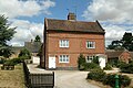
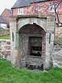
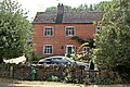
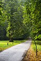
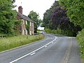
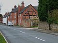
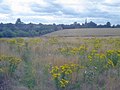
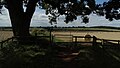
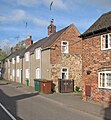
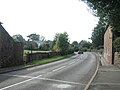
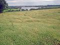
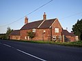
English: Ticknall is a small village in South Derbyshire, England. Situated on the A514 road, close to Melbourne, it has three pubs, several small businesses, and a primary school. Two hundred years ago it was considerably larger and noisier with lime quarries, tramways and potteries. Coal was also dug close to the village. Close to the village is Calke Abbey, now a National Trust property.
village and civil parish in South Derbyshire, Derbyshire, England  | |||||
| Carica un file multimediale | |||||
| Istanza di | |||||
|---|---|---|---|---|---|
| Luogo | South Derbyshire, Derbyshire, Midlands Orientali, Inghilterra | ||||
 | |||||
Sottocategorie
Questa categoria contiene le 10 sottocategorie indicate di seguito, su un totale di 10.
G
- St George's church, Ticknall (24 F)
H
- Heath Wood (10 F)
L
- The Lock-Up, Ticknall (3 F)
M
- The Middle Lodge, Ticknall (4 F)
S
- Sheffield House, Ticknall (4 F)
- The Staff of Life, Ticknall (3 F)
T
- Ticknall Tramway (25 F)
W
- The Wheel Inn, Ticknall (10 F)
File nella categoria "Ticknall"
Questa categoria contiene 200 file, indicati di seguito, su un totale di 282.
(pagina precedente) (pagina successiva)-
 26 High Street, Ticknall.jpg 1 600 × 1 200; 420 KB
-
 55 and 57 Main Street, Ticknall.jpg 1 280 × 853; 372 KB
-
 85 and 87 Main Street, Ticknall.jpg 1 280 × 878; 460 KB
-
 A grassy track to the caravan site - geograph.org.uk - 5584163.jpg 2 000 × 1 333; 2,22 MB
-
 A pair of trees - geograph.org.uk - 5584147.jpg 2 000 × 1 333; 1,69 MB
-
 A spring at Ticknall - geograph.org.uk - 387489.jpg 480 × 640; 107 KB
-
 A woodland path - geograph.org.uk - 5491453.jpg 2 000 × 1 333; 3,14 MB
-
 Above the tunnel - geograph.org.uk - 6132329.jpg 2 000 × 1 333; 3,31 MB
-
 Alcove with pillar fountain, High Street, Ticknall.jpg 5 184 × 2 920; 6,61 MB
-
 Along the path - geograph.org.uk - 5616390.jpg 640 × 360; 75 KB
-
 An observation tower - geograph.org.uk - 5584169.jpg 2 000 × 1 333; 2,31 MB
-
 Approach to Ticknall - geograph.org.uk - 5390147.jpg 5 376 × 3 024; 2,66 MB
-
 Arch Farmhouse, Ticknall.jpg 1 280 × 854; 590 KB
-
 Archway House, Ticknall.jpg 1 280 × 853; 515 KB
-
 Autumn in Calke Park - geograph.org.uk - 5337789.jpg 2 000 × 1 333; 2,85 MB
-
 Autumn Walk in Calke - geograph.org.uk - 2709063.jpg 4 272 × 2 847; 3,74 MB
-
 Avenue of limes leading into Calke Abbey parkland - geograph.org.uk - 5126652.jpg 1 064 × 1 600; 599 KB
-
 B5006 Road Junction - geograph.org.uk - 386704.jpg 640 × 480; 93 KB
-
 Bantons Lane - geograph.org.uk - 1429222.jpg 640 × 480; 85 KB
-
 Barley crop at White Leys - geograph.org.uk - 1431958.jpg 640 × 480; 100 KB
-
 Barley crop at Woodside Farm - geograph.org.uk - 1429501.jpg 640 × 480; 94 KB
-
 Barley field near White Leys - geograph.org.uk - 1431871.jpg 480 × 640; 92 KB
-
 Bend ahead on Coal Lane - geograph.org.uk - 2967590.jpg 1 024 × 768; 142 KB
-
 Box Lane - geograph.org.uk - 4574878.jpg 1 200 × 900; 327 KB
-
 Brick Kiln, Ticknall.jpg 640 × 480; 128 KB
-

-
 Bridleway near Knowle Hill Farm - geograph.org.uk - 3878001.jpg 3 816 × 2 736; 1,99 MB
-
 Bridleway to Warsick Lane - geograph.org.uk - 4377243.jpg 1 200 × 900; 243 KB
-
 Bridleway, Ticknall - geograph.org.uk - 2514178.jpg 1 496 × 1 122; 650 KB
-
 Brierfield House, Ticknall.jpg 1 280 × 853; 581 KB
-
 Brookside Cottage - geograph.org.uk - 5390724.jpg 800 × 600; 142 KB
-
 Bullocks grazing near Ticknall - geograph.org.uk - 1429221.jpg 640 × 459; 74 KB
-
 Burton Road (A514) - geograph.org.uk - 3557299.jpg 640 × 480; 72 KB
-
 Burton Road (A514), Ticknall - geograph.org.uk - 3557302.jpg 640 × 480; 75 KB
-
 Burton Road (A514), Ticknall - geograph.org.uk - 4668678.jpg 640 × 480; 433 KB
-
 Burton Road, Ticknall - geograph.org.uk - 5616575.jpg 640 × 360; 67 KB
-
 By Standley's Barn - geograph.org.uk - 5989402.jpg 2 000 × 1 333; 2,08 MB
-
 Calke Abbey access road south of Middle Lodge - geograph.org.uk - 4063493.jpg 1 600 × 1 200; 872 KB
-
 Calke Abbey Estate, Ticknall, Derbyshire - geograph.org.uk - 1988209.jpg 683 × 1 024; 278 KB
-
 Calke Park - geograph.org.uk - 4601503.jpg 800 × 531; 147 KB
-
 Calke Park Deer - geograph.org.uk - 5352186.jpg 2 000 × 1 328; 2,39 MB
-
 Car park and conveniences - geograph.org.uk - 4658798.jpg 1 600 × 1 066; 400 KB
-
 Chequers Inn Ticknall.jpg 3 700 × 2 416; 1,36 MB
-
 Common field speedwell (Veronica persica) - geograph.org.uk - 393851.jpg 640 × 480; 252 KB
-
 Cottages along Melbourne Lane - geograph.org.uk - 4623192.jpg 800 × 600; 143 KB
-
 Cottages at Ticknall - geograph.org.uk - 5390995.jpg 5 376 × 3 024; 3,17 MB
-
 Cottages on Main Street, Ticknall - geograph.org.uk - 5390988.jpg 5 376 × 3 024; 3,03 MB
-
 Cottages on Melbourne Lane - geograph.org.uk - 3530018.jpg 1 200 × 900; 243 KB
-
 Cottages, High Street, Ticknall.jpg 640 × 360; 73 KB
-
 Country Lane leading to Milton - geograph.org.uk - 4623142.jpg 800 × 504; 105 KB
-
 Crest of a Hill near Heath Farm - geograph.org.uk - 4375446.jpg 4 000 × 3 000; 2,71 MB
-
 Crop field east of Ticknall - geograph.org.uk - 3557311.jpg 640 × 480; 89 KB
-
 Crop field near Ticknall - geograph.org.uk - 3557294.jpg 640 × 480; 65 KB
-
 Cruck - geograph.org.uk - 387586.jpg 640 × 480; 86 KB
-
 Dead fallen tree - geograph.org.uk - 4602269.jpg 800 × 531; 130 KB
-
 Derby Hills Farm - geograph.org.uk - 3530066.jpg 1 200 × 900; 96 KB
-
 Derby House, Ticknall.jpg 1 280 × 942; 347 KB
-
 Derbyshire UK parish map highlighting Ticknall.svg 888 × 1 308; 2,35 MB
-
 Dimminsdale branch of the Ticknall Tramway - geograph.org.uk - 4285033.jpg 1 200 × 900; 351 KB
-
 Disused barn near Tadsor Farm - geograph.org.uk - 615763.jpg 640 × 446; 125 KB
-
 Disused barn seen from Mereoak Lane - geograph.org.uk - 4658510.jpg 1 600 × 1 066; 391 KB
-
 Disused lime works at Ticknall - geograph.org.uk - 1423527.jpg 640 × 480; 141 KB
-
 Entering Ticknall - geograph.org.uk - 3943329.jpg 3 033 × 1 940; 2,47 MB
-
 Entrance to Calke Abbey - geograph.org.uk - 4623180.jpg 800 × 566; 159 KB
-
 Entrance to Foremark Hall - geograph.org.uk - 680939.jpg 640 × 429; 60 KB
-
 Entrance to Knowle Hill Farm - geograph.org.uk - 5734774.jpg 4 945 × 3 706; 4,87 MB
-
 Entrance to Pottery Wood - geograph.org.uk - 5465974.jpg 1 280 × 960; 585 KB
-
 Entrance to Stantons Wood and bridleway - geograph.org.uk - 4296797.jpg 1 200 × 900; 185 KB
-
 Farmland above Staunton Harold Reservoir - geograph.org.uk - 4602279.jpg 800 × 531; 132 KB
-
 Farmland and sheep - geograph.org.uk - 393872.jpg 640 × 480; 261 KB
-
 Farmland at Broadstone Lane End - geograph.org.uk - 1431885.jpg 640 × 480; 80 KB
-
 Farmland fields - geograph.org.uk - 4424372.jpg 1 600 × 1 200; 279 KB
-
 Farmland near Ticknall - geograph.org.uk - 393863.jpg 640 × 480; 268 KB
-
 Field entrance off Burton Road - geograph.org.uk - 3557298.jpg 640 × 480; 90 KB
-
 Fields and the Jubilee Plantation - geograph.org.uk - 4373408.jpg 4 000 × 3 000; 2,5 MB
-
 Fields and Trees near Ticknall - geograph.org.uk - 2603273.jpg 2 896 × 1 944; 1,3 MB
-
 Fields near Ticknall - geograph.org.uk - 5565949.jpg 2 000 × 1 333; 1,83 MB
-
 Fields north of Ticknall - geograph.org.uk - 1429349.jpg 640 × 480; 76 KB
-
-
 Footbridge over Scots Brook - geograph.org.uk - 3530045.jpg 1 200 × 900; 287 KB
-
 Footpath Approaching Ashby Road near Ticknall - geograph.org.uk - 4373426.jpg 4 000 × 3 000; 3,43 MB
-
 Footpath by White Leys - geograph.org.uk - 401882.jpg 640 × 478; 95 KB
-
 Footpath near Knowle Farm - geograph.org.uk - 286620.jpg 640 × 426; 147 KB
-
 Footpath Near Seven Spouts - geograph.org.uk - 2603218.jpg 2 896 × 1 944; 1,31 MB
-
 Footpath Near Seven Spouts - geograph.org.uk - 2603253.jpg 2 896 × 1 944; 1,35 MB
-
 Footpath Near Seven Spouts - geograph.org.uk - 2603309.jpg 2 896 × 1 944; 1,3 MB
-
 Footpath steps - geograph.org.uk - 5465982.jpg 1 280 × 960; 755 KB
-
 Footpath through oilseed rape - geograph.org.uk - 401813.jpg 640 × 480; 97 KB
-
 Footpath to Derby Road - geograph.org.uk - 4658518.jpg 1 600 × 1 066; 464 KB
-
 Footpath to Derby Road with The Scaddows beyond - geograph.org.uk - 4658521.jpg 1 600 × 1 066; 521 KB
-
 Footpath to Smisby - geograph.org.uk - 67076.jpg 640 × 480; 101 KB
-
 Footpath to South of Ticknall - geograph.org.uk - 4373416.jpg 4 000 × 3 000; 2,77 MB
-
 Footpath to the High Street from Narrow Lane - geograph.org.uk - 4658527.jpg 1 600 × 1 066; 727 KB
-
 Footpath to Ticknall - geograph.org.uk - 1429219.jpg 640 × 480; 88 KB
-
 Footpath to Vees Wood - geograph.org.uk - 1429483.jpg 640 × 480; 93 KB
-
 Footpath to White Leys - geograph.org.uk - 4602275.jpg 1 024 × 680; 318 KB
-
 Footpaths by Foremark reservoir - geograph.org.uk - 393783.jpg 640 × 480; 327 KB
-
 Foremark Reservoir - geograph.org.uk - 3558551.jpg 3 264 × 2 448; 2,85 MB
-
 Foremarke Park Farm - geograph.org.uk - 143819.jpg 640 × 480; 91 KB
-
 Fresh growth in the field - geograph.org.uk - 5565960.jpg 2 000 × 1 333; 1,75 MB
-
 Gate leading down to the pool by Seven Spouts - geograph.org.uk - 2602587.jpg 2 896 × 1 944; 1,46 MB
-
 Grazing near Lamont Wood - geograph.org.uk - 3557291.jpg 640 × 480; 78 KB
-
 Hangman's Stone and Footpath - geograph.org.uk - 2603206.jpg 2 896 × 1 944; 1,33 MB
-

-
 Hangman's Stone in Isolation - geograph.org.uk - 2604431.jpg 1 944 × 2 896; 1,34 MB
-
 Harpur Almshouses, Ticknall.jpg 640 × 360; 83 KB
-
 Harpur Avenue, Ticknall - geograph.org.uk - 2514176.jpg 1 496 × 1 122; 698 KB
-
 Hayes Farmhouse, Ticknall.jpg 1 280 × 889; 264 KB
-
 High Street, Ticknall - geograph.org.uk - 5616599.jpg 640 × 360; 57 KB
-
 High Street, Ticknall - geograph.org.uk - 5616604.jpg 640 × 360; 66 KB
-
 High Street, Ticknall.jpg 640 × 480; 437 KB
-
 Honeysuckle Barn, Ticknall - geograph.org.uk - 5391004.jpg 5 376 × 3 024; 3,16 MB
-
 Horse Jumps - geograph.org.uk - 2603194.jpg 2 896 × 1 944; 1,3 MB
-
 House in Ticknall, Derbyshire - geograph.org.uk - 1660018.jpg 480 × 640; 71 KB
-

-
 June meadows near Knowle Hill - geograph.org.uk - 5616388.jpg 640 × 360; 69 KB
-
 Knowle Hill - geograph.org.uk - 4063468.jpg 1 600 × 1 200; 593 KB
-
 Knowle Hill - geograph.org.uk - 5615843.jpg 640 × 360; 82 KB
-
 Knowle Hill - geograph.org.uk - 5616378.jpg 640 × 360; 83 KB
-
 Knowle Hill cottage - geograph.org.uk - 5616394.jpg 640 × 360; 81 KB
-
 Knowle Hill from the bottom - geograph.org.uk - 5615841.jpg 640 × 360; 76 KB
-
 Knowle Hill from the north - geograph.org.uk - 5615850.jpg 640 × 360; 74 KB
-
 Knowle Hill near Ticknall - geograph.org.uk - 6325856.jpg 5 184 × 2 920; 6,44 MB
-
 Knowle Hill, Ticknall - geograph.org.uk - 358794.jpg 640 × 480; 78 KB
-
 Landscape viewed from Coal Lane - geograph.org.uk - 4373354.jpg 4 000 × 3 000; 3,29 MB
-
 Lay-by in an old loop of road - geograph.org.uk - 5462253.jpg 1 280 × 960; 381 KB
-
 Lime Kiln House, Ticknall.jpg 1 280 × 867; 384 KB
-
 Looking across the fields - geograph.org.uk - 6039504.jpg 2 000 × 1 234; 1,48 MB
-
 Looking up the drive - geograph.org.uk - 6132333.jpg 2 000 × 1 333; 3,4 MB
-
 Maize stalks - geograph.org.uk - 5359105.jpg 2 000 × 1 333; 2,58 MB
-
 Mature Parasol near The Rookery - geograph.org.uk - 1429084.jpg 480 × 640; 112 KB
-
 Mature Woodland in Calke Park - geograph.org.uk - 2301467.jpg 3 296 × 2 472; 1,09 MB
-

-
 Meadow near Middle Lodge - geograph.org.uk - 1429195.jpg 640 × 474; 63 KB
-
 Meadow north of Jubilee Plantation - geograph.org.uk - 1429208.jpg 640 × 480; 86 KB
-
 Mereoak Lane - geograph.org.uk - 4130086.jpg 1 200 × 900; 281 KB
-
 Methodist Chapel, Ticknall - geograph.org.uk - 5860661.jpg 864 × 1 280; 386 KB
-
 Methodist Chapel, Ticknall.jpg 1 600 × 1 200; 601 KB
-
 Methodist Church - geograph.org.uk - 257085.jpg 426 × 640; 155 KB
-
 Minor road heading east - geograph.org.uk - 3557295.jpg 640 × 480; 67 KB
-

-
 Minor road towards Ticknall - geograph.org.uk - 3557292.jpg 640 × 480; 68 KB
-
 Mixed farming near Ticknall - geograph.org.uk - 393886.jpg 640 × 480; 303 KB
-
 Narrow Lane in Ticknall - geograph.org.uk - 3878065.jpg 3 988 × 2 984; 3,11 MB
-
 Near Scaddows Farm - geograph.org.uk - 5989398.jpg 2 000 × 1 333; 2,42 MB
-
 New growth in the field - geograph.org.uk - 5584151.jpg 2 000 × 1 333; 2 MB
-
 Old barn - geograph.org.uk - 5462254.jpg 1 280 × 960; 305 KB
-
 Old Wayside Cross (geograph 6497618).jpg 720 × 960; 186 KB
-
 On the National Forest Way, NW of Ticknall - View NW - geograph.org.uk - 5617259.jpg 5 184 × 2 920; 4,49 MB
-
 Overgrown ditch or ha-ha - geograph.org.uk - 4602283.jpg 800 × 531; 176 KB
-
 Path by Perimeter Fence of Calke Deer Park - geograph.org.uk - 2301450.jpg 3 296 × 2 472; 1,15 MB
-
 Path through the reserve - geograph.org.uk - 2602573.jpg 2 896 × 1 944; 1,36 MB
-
 Pillar Fountain at Melbourne Lane Junction, Ticknall.jpg 1 600 × 1 200; 569 KB
-
 Pillar Fountain at The Green, Ticknall.jpg 1 600 × 1 200; 674 KB
-
 Pillar Fountain in front of 24 Ashby Road, Ticknall.jpg 1 600 × 1 200; 673 KB
-
 Pillar Fountain in front of 33 Main Street, Ticknall.jpg 951 × 1 024; 1,2 MB
-
 Pillar Fountain in front of 38 Main Street, Ticknall.jpg 1 366 × 1 821; 731 KB
-
 Pillar Fountain in front of 39 High Street, Ticknall.jpg 1 600 × 1 200; 587 KB
-
 Pillar Fountain in front of 53 High Street, Ticknall.jpg 1 600 × 1 200; 550 KB
-
 Pillar Fountain near 76 Main Street, Ticknall.jpg 1 489 × 1 117; 487 KB
-
 Pillar Fountain opposite 145 Main Street, Ticknall.jpg 1 600 × 1 200; 720 KB
-
 Pillar Fountain opposite 55 and 57 Main Street, Ticknall.jpg 1 600 × 1 200; 372 KB
-
 Pillar Fountain south of Woodbine Cottage, Ticknall.jpg 1 600 × 1 200; 417 KB
-
 Pillar Fountain west of 76 Main Street, Ticknall.jpg 853 × 1 280; 475 KB
-
 Pillar Fountain, Banton's Lane, Ticknall.jpg 853 × 1 280; 487 KB
-

-
 Pond in The Oaklands - geograph.org.uk - 4658210.jpg 1 600 × 1 066; 555 KB
-

-
 Private Fishing near Seven Spouts - geograph.org.uk - 2602591.jpg 1 944 × 2 896; 1,36 MB
-
 Private road to Woodside Farm - geograph.org.uk - 2967614.jpg 1 024 × 929; 155 KB
-
 Public footpath - geograph.org.uk - 393842.jpg 640 × 480; 295 KB
-
 Public Footpath at Knowle Hill - geograph.org.uk - 3876109.jpg 3 832 × 2 764; 1,98 MB
-
 Public footpath at Vees Wood - geograph.org.uk - 1429496.jpg 640 × 480; 84 KB
-
 Public footpath near White Leys - geograph.org.uk - 1431901.jpg 640 × 480; 94 KB
-
 Public footpath through Vee's Wood - geograph.org.uk - 1429491.jpg 640 × 480; 87 KB
-
 Rape crop near White Leys - geograph.org.uk - 1431960.jpg 640 × 480; 113 KB
-
 Repton Road - geograph.org.uk - 4668674.jpg 640 × 480; 363 KB
-
 Restored lime kiln, Ticknall Limeyards - geograph.org.uk - 5860671.jpg 1 280 × 853; 600 KB
-
 Restored lime kiln, Ticknall Limeyards - geograph.org.uk - 5860672.jpg 853 × 1 280; 418 KB
-

-
 Road to the farm - geograph.org.uk - 5989405.jpg 2 000 × 1 333; 3,04 MB
-
 Rolled hay bales in a field by the Burton Road - geograph.org.uk - 4658572.jpg 1 600 × 1 066; 405 KB
-
 Rose Lane, Ticknall - geograph.org.uk - 3557307.jpg 640 × 480; 86 KB
-
 Royal Oak House, Ticknall.jpg 1 280 × 960; 505 KB
-
 Scaddows Cottage - geograph.org.uk - 3622160.jpg 1 200 × 900; 144 KB
-
 Scaddows Wood - geograph.org.uk - 393913.jpg 640 × 480; 278 KB
-
 Scots Brook - geograph.org.uk - 3530048.jpg 1 200 × 900; 344 KB
-
 Southwood House farmhouse - geograph.org.uk - 1825157.jpg 1 200 × 900; 191 KB
-
 Spring Cottage - geograph.org.uk - 387480.jpg 640 × 480; 103 KB
-
 Spring House, High Street, Ticknall.jpg 640 × 360; 67 KB
-
 Stanton Road (A514) - geograph.org.uk - 3557312.jpg 640 × 480; 56 KB
-
 Staunton Harold Reservoir - geograph.org.uk - 4789137.jpg 1 600 × 1 067; 247 KB
-
 Staunton Harold Reservoir - geograph.org.uk - 5361236.jpg 2 000 × 1 333; 365 KB
-
 Staunton Lane - geograph.org.uk - 4668652.jpg 640 × 480; 484 KB
-
 Straw bales by St George's - geograph.org.uk - 4658809.jpg 1 600 × 1 066; 459 KB
-
 Tadsor Farm - geograph.org.uk - 5989395.jpg 2 000 × 1 333; 2,31 MB
-

-
 The entrance to Scaddows Farm Shop - geograph.org.uk - 3943378.jpg 3 292 × 1 736; 2,63 MB
-
 The Former Royal Oak - geograph.org.uk - 5991977.jpg 1 024 × 576; 221 KB
-
 The garden at Knowle Hill - geograph.org.uk - 5616372.jpg 640 × 360; 51 KB


_-_geograph.org.uk_-_3557299.jpg)
,_Ticknall_-_geograph.org.uk_-_3557302.jpg)
,_Ticknall_-_geograph.org.uk_-_4668678.jpg)


_-_geograph.org.uk_-_393851.jpg)


_and_Melbourne_Lane,_Ticknall_-_geograph.org.uk_-_5874871.jpg)


.jpg)


_-_geograph.org.uk_-_3557312.jpg)


