Category:Tiroler Straße
Zur Navigation springen
Zur Suche springen
Landesstraße in Tirol   | |||||
| Medium hochladen | |||||
| Ist ein(e) | |||||
|---|---|---|---|---|---|
| Ort | Tirol, Österreich | ||||
| Länge |
| ||||
 | |||||
Deutsch: Die Tiroler Straße (B 171) ist eine Landesstraße in Tirol, die durch das Inntal von Kufstein bis Landeck führt.
English: The Tiroler Straße (B 171) is a road in Tyrol, Austria, leading from Kufstein to Landeck through the Inn valley.
Unterkategorien
Es werden 13 von insgesamt 13 Unterkategorien in dieser Kategorie angezeigt:
In Klammern die Anzahl der enthaltenen Kategorien (K), Seiten (S), Dateien (D)
B
H
K
- Karresschluchtbrücke (5 D)
M
- Meilenstein, Imst (10 D)
- Meilenstein, Zirl (5 D)
- Mühlauer Brücke (11 D)
O
- Ötztaler Talbrücke (12 D)
R
U
Medien in der Kategorie „Tiroler Straße“
Folgende 49 Dateien sind in dieser Kategorie, von 49 insgesamt.
-
 4 139 auf der Strecke 1974-01.jpg 1.000 × 684; 190 KB
-
 4 Trasse2.jpg 750 × 522; 87 KB
-
 Arlbergbahn km058 volare o 34912 Kirche7Schmerzenx.jpg 2.394 × 1.465; 390 KB
-
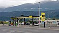 Avanti petrol station Neu Rum 20230809.jpg 4.000 × 2.250; 2,33 MB
-
 B171 Blick auf A12.jpg 1.500 × 1.003; 1,48 MB
-
 B171-AT.svg 512 × 363; 1.017 Bytes
-
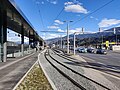 Bahnhof Rum (IMG 20230309 155001).jpg 3.950 × 2.962; 3,18 MB
-
 Eigenhofen, Ortskapelle Sankt Pankratius Dm65051 IMG 0710 2019-07-30 12.33.jpg 4.643 × 3.197; 7,25 MB
-
 Flaurling vanuit Unterpettnau.jpg 2.576 × 1.952; 1,21 MB
-
 Gutshof Neuhaus.JPG 2.816 × 2.112; 1,87 MB
-
 Handl Tyrol Hauptsitz, Pians 01.JPG 5.184 × 3.456; 8,55 MB
-
 Handl Tyrol Hauptsitz, Pians 02.JPG 3.456 × 5.184; 6,83 MB
-
 Handl Tyrol Hauptsitz, Pians 03.JPG 5.184 × 3.456; 5,3 MB
-
 Handl Tyrol Hauptsitz, Pians 04.JPG 5.049 × 3.190; 8,5 MB
-
 Handl Tyrol Hauptsitz, Pians 05.JPG 3.456 × 5.184; 6,59 MB
-
 Handl Tyrol Hauptsitz, Pians 06.JPG 5.184 × 3.456; 5,47 MB
-
 Handl Tyrol Schönwies 01.JPG 5.184 × 3.456; 6,38 MB
-
 Handl Tyrol Schönwies 02.JPG 5.184 × 3.456; 6,62 MB
-
 Handl Tyrol Schönwies 03.JPG 5.184 × 3.456; 5,37 MB
-
 Hombre barbado.jpg 3.088 × 2.056; 1,69 MB
-
 Imst, Meilensteinweg an der Tiroler Straße (1).jpg 4.608 × 3.456; 6,36 MB
-
 Imst, Meilensteinweg an der Tiroler Straße (2).jpg 4.608 × 3.456; 6,16 MB
-
 Imst, Meilensteinweg an der Tiroler Straße (3) Tschirgant.jpg 4.608 × 3.456; 5,64 MB
-
 Imst, Meilensteinweg an der Tiroler Straße (4) Nördliche Sellrainer Berge.jpg 4.608 × 3.456; 5,59 MB
-
 Kirchbichl B171 Nord.JPG 3.694 × 2.501; 4,98 MB
-
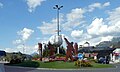
 Kufstein, Kreisverkehr Zell v S, 2.jpeg 4.416 × 2.208; 4,08 MB
-
 Kufstein, Wendlinger Kreisverkehr u Festung, 1.jpeg 4.000 × 2.400; 3,39 MB
-

-
 Kundl, Katholische Pfarrkirche Dm123449 in straatzicht foto1 2012-08-09 10.01.jpg 4.416 × 3.312; 6,55 MB
-
 Landwirtschaftliche Lehranstalt Rotholz 15.jpg 3.774 × 2.527; 5,28 MB
-
 Locherboden (3802517002).jpg 2.048 × 1.536; 481 KB
-
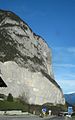 Martinswand Zirl 01.jpg 1.000 × 1.600; 295 KB
-
 Oberinntal bij Unterpettnau.jpg 2.576 × 1.952; 1,23 MB
-
 Pill, Pfarrkirche Sankt Anna Dm64617 foto1 2012-08-09 14.32.jpg 4.352 × 3.264; 6,4 MB
-
 Roppen-Innbrücke.JPG 4.320 × 3.240; 5,64 MB
-
 Tragwerk der Volderer Innbrücke.jpg 2.592 × 3.872; 4,73 MB
-
 Verkehrszeichen in Tirol 20220908 162344.jpg 4.000 × 3.000; 4,38 MB
-
 Volderer Innbrücke 2.jpg 3.872 × 2.592; 6,66 MB
-
 Volderer Innbrücke.jpg 3.363 × 2.091; 5,23 MB
-
 Volders Bundesstraße.jpg 3.825 × 2.115; 3,43 MB
-

-
 Vorwegweiser B171 - B169 + B181 + A12 Strass.jpg 1.632 × 1.224; 224 KB
-
 Widerlager ehemalige Eisenbahnbrücke Ötztal-Bahnhof 02.jpg 6.000 × 4.000; 10,03 MB
-
 Wiki takes Nordtiroler Oberland 20150606 Meilenstein bei Imst 7084.jpg 4.256 × 2.128; 4,73 MB
-
 Wiki takes Nordtiroler Oberland 20150606 Meilenstein bei Imst 7087.jpg 2.832 × 4.256; 9,35 MB
-
 Wiki takes Nordtiroler Oberland 20150606 Meilenstein bei Imst 7090.jpg 2.235 × 3.359; 5,27 MB
-
 Wiki takes Nordtiroler Oberland 20150606 ND Römerstraße Imst 7093.jpg 3.802 × 2.139; 6,35 MB
-
 Wiki takes Nordtiroler Oberland 20150606 ND Römerstraße Imst 7096.jpg 3.969 × 2.233; 5,49 MB
-
 Wiki takes Nordtiroler Oberland 20150606 ND Römerstraße Imst 7106.jpg 3.630 × 2.723; 6,91 MB


.jpg)


.jpg)
.jpg)
_Tschirgant.jpg)
_N%C3%B6rdliche_Sellrainer_Berge.jpg)


_2023-10-01_Mattes.jpg)

.jpg)


