Category:Tombolos
Zur Navigation springen
Zur Suche springen
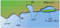
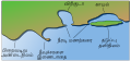
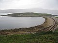
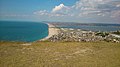
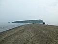
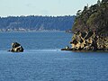
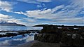
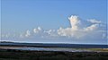
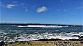
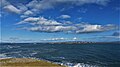
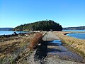
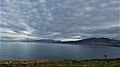
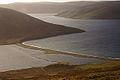
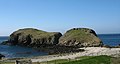
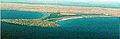
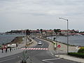
English: A tombolo is a sandy isthmus – a landform attaching an island to the mainland or another island.
Deutsch: Ein Tombolo ist ein Dünenstreifen, der eine Insel mit dem Festland oder einer anderen Insel verbindet.
Français : Un tombolo est un cordon littoral formé de sédiments (sable ou galets), reliant une île à la terre ferme, ou deux îles entre elles.
Dünenstreifen, der eine Insel mit dem Festland verbindet | |||||
| Medium hochladen | |||||
| Aussprache (Audiodatei) | |||||
|---|---|---|---|---|---|
| Unterklasse von | |||||
| Verschieden von | |||||
| |||||
Unterkategorien
Es werden 20 von insgesamt 20 Unterkategorien in dieser Kategorie angezeigt:
In Klammern die Anzahl der enthaltenen Kategorien (K), Seiten (S), Dateien (D)
A
- Angel Road (Tonosho) (24 D)
B
- Banna Minn (25 D)
C
- Chintsun (tombolo) (2 D)
D
G
- Tombolo della Giannella (1 S, 11 D)
H
K
M
- Miyatojima (23 D)
N
- The Neck (Bruny Island) (25 D)
O
P
- Palisadoes (2 D)
S
- St Ninian's Isle Tombolo (70 D)
T
- Tómbolo de Trafalgar (2 D)
U
W
- Wuyan Cape (2 D)
Medien in der Kategorie „Tombolos“
Folgende 145 Dateien sind in dieser Kategorie, von 145 insgesamt.
-
 167 Ile d'Arz.jpg 3.072 × 1.387; 2,11 MB
-
 168 Ile d'Arz.jpg 3.069 × 1.185; 1,6 MB
-
 169 Ile d'Arz.jpg 3.070 × 2.302; 2,76 MB
-
 2010-10-01 02-27-36 DSC 0354 Boris.jpg 3.872 × 2.592; 7,71 MB
-
 228 Baden Sept Îles.jpg 4.320 × 2.160; 3,85 MB
-
 2884-saunders-landscape RJ.jpg 600 × 400; 41 KB
-
 304 Pointe du Château.jpg 4.312 × 2.123; 4,03 MB
-
 Accreting coast Image6-ar.svg 1.481 × 697; 15 KB
-
 Accreting coast Image6-ta.svg 1.481 × 697; 107 KB
-
 Accreting coast Image6.svg 1.481 × 697; 15 KB
-
 Agios Loukas, Kythnos.jpg 3.680 × 2.760; 1,98 MB
-
 Algae 5210, Dingle Peninsula, Co. Kerry, Ireland.jpg 1.920 × 1.080; 505 KB
-
 Algae-5313, Dingle Peninsula, Co. Kerry, Ireland.jpg 1.920 × 1.080; 512 KB
-
 Aoshima Island Aerial photograp 2017.jpg 2.500 × 1.900; 4,83 MB
-
 Aoshima Miyazaki Japan.jpg 1.500 × 1.500; 1,91 MB
-
 Ard Neackie - geograph.org.uk - 238145.jpg 640 × 480; 60 KB
-
 Bagh Rubha Ruaidh - geograph.org.uk - 219380.jpg 640 × 480; 93 KB
-
 Baleal,Ferrel vista aérea.jpg 1.251 × 668; 150 KB
-
 Balmeanach Bay - geograph.org.uk - 953084.jpg 640 × 480; 96 KB
-
 Beach and Eilean Tràighe - geograph.org.uk - 1272309.jpg 640 × 414; 245 KB
-
 Beach bunny - geograph.org.uk - 953370.jpg 480 × 640; 135 KB
-
 Beach, reef and tombolo, Sea Palling - geograph.org.uk - 34239.jpg 640 × 445; 45 KB
-
 Bigbury-on-Sea from Burgh Island - geograph.org.uk - 671585.jpg 640 × 214; 40 KB
-
 Black Clouds over Eilean Dubh - geograph.org.uk - 997409.jpg 640 × 417; 57 KB
-
 Boats-0506, Dingle Peninsula, Co. Kerry, Ireland.jpg 1.920 × 1.080; 323 KB
-
 Brandon Bay-4416, Dingle Peninsula, Co. Kerry, Ireland.jpg 1.920 × 1.080; 241 KB
-
 Brandon Point-4874, Dingle Peninsula, Co. Kerry, Ireland.jpg 1.920 × 1.080; 577 KB
-
 Burgh Island - waterfront buildings - geograph.org.uk - 671010.jpg 640 × 284; 41 KB
-
 Burgh Island Causeway Leisure Club - geograph.org.uk - 1474895.jpg 640 × 480; 79 KB
-
 Bàgh na Dòirlinne, Gigha - geograph.org.uk - 814671.jpg 640 × 427; 75 KB
-
 Cabo Rojo NWR, Salt Flats (23261823173).jpg 3.072 × 2.048; 4,88 MB
-
 Camas a' Mhòr Bheòil - geograph.org.uk - 377725.jpg 640 × 425; 294 KB
-
 Causeway to An Leth Meadhanach - geograph.org.uk - 71904.jpg 1.600 × 1.200; 541 KB
-
 Central Gugh from The Bar - geograph.org.uk - 1341831.jpg 640 × 278; 66 KB
-
 Chesil Beach from New Ground.jpg 3.104 × 1.746; 1,63 MB
-
 Chiringashima and tombolo 20180430.jpg 2.160 × 1.620; 2,2 MB
-
 Chiringashima from Mount Uomidake 20180430.jpg 2.160 × 1.620; 2,03 MB
-
 Chuckanut Island and Lion Rock.jpg 4.446 × 3.334; 3,14 MB
-
 Coastal Erosion-4230, Dingle Peninsula, Co. Kerry, Ireland.jpg 1.920 × 1.080; 388 KB
-
 Dales Voe - geograph.org.uk - 52986.jpg 640 × 432; 56 KB
-
 Dales Voe - geograph.org.uk - 811930.jpg 640 × 405; 48 KB
-
 Dogashima Tombolo April 7 1033 2.jpg 5.546 × 3.697; 14,78 MB
-
 Dogashima Tombolo April 7 1033.jpg 5.568 × 3.712; 16,27 MB
-
 Dogashima Tombolo April 7 1034 1.jpg 5.257 × 3.642; 16,47 MB
-
 Dogashima Tombolo April 7 1042.jpg 5.568 × 3.712; 17,02 MB
-
 Dogashima Tombolo April 7 1043.jpg 5.568 × 3.712; 17,68 MB
-
 Dogashima Tombolo April 7 1104.jpg 5.406 × 3.604; 13,35 MB
-
 Dogashima Tombolo April 7 1108.jpg 5.517 × 3.678; 13,88 MB
-
 Dogashima Tombolo April 7 1110 2.jpg 5.459 × 3.639; 13,98 MB
-
 Dogashima Tombolo Panorama April 7 3.jpg 9.467 × 5.989; 31,53 MB
-
 Dogashima Tombolo Panorama April 7 4.jpg 23.084 × 3.260; 47,41 MB
-
 Dogashima Tombolo Panorama April 7.jpg 13.968 × 3.030; 25,55 MB
-
 Double Tombolo - geograph.org.uk - 465697.jpg 640 × 371; 39 KB
-
 Dune flora - geograph.org.uk - 1465919.jpg 640 × 480; 93 KB
-
 Feniglia01.jpg 2.272 × 1.704; 769 KB
-
 Feniglia03.jpg 2.272 × 1.704; 687 KB
-
 Flooding-5636, Dingle Peninsula, Co. Kerry, Ireland.jpg 1.920 × 1.080; 251 KB
-
 France Giens Tombolo.jpg 10.420 × 2.896; 3,84 MB
-
 Galtagarthayre.jpg 640 × 431; 69 KB
-
 High Tide-0270, Brandon Bay, Co. Kerry, Ireland.jpg 1.920 × 1.080; 437 KB
-
 High Tide-0497, Dingle Peninsula, Co. Kerry, Ireland.jpg 1.920 × 1.080; 525 KB
-
 High Tide-0524, Dingle Peninsula, Co. Kerry, Ireland.jpg 1.920 × 1.080; 412 KB
-
 Ile de la Baie de Loya.jpg 7.000 × 4.181; 9,63 MB
-
 Ile Ségal-PLOUARZEL.jpg 4.288 × 2.848; 4,57 MB
-
 Illa do Santo do Mar (Marin) 113.jpg 4.032 × 3.024; 3,88 MB
-
 Isthme de Langlade.jpg 3.648 × 2.489; 7,11 MB
-
 Kiket Island.jpg 4.160 × 3.120; 3,16 MB
-
 Kuroshima Venus Road, gaikan.jpg 6.016 × 4.000; 6,85 MB
-
 Langlade - Anse du gouverneur.jpg 5.160 × 3.440; 16,09 MB
-
 Langlade Petit Miquilon.jpg 4.089 × 2.044; 8,55 MB
-
 Le Cap, Miquelon and Langlade Island.jpg 3.328 × 2.448; 7,3 MB
-
 Look-out-4438, Dingle Peninsula, Co. Kerry, Ireland.jpg 1.920 × 1.080; 351 KB
-
 Look-out-4770, Dingle Peninsula, Co. Kerry, Ireland.jpg 1.920 × 1.080; 357 KB
-
 Low Tide-3485, Brandon Bay, Co. Kerry, Ireland.jpg 1.920 × 1.080; 392 KB
-
 Marsh-3801, Dingle Peninsula, Co. Kerry, Ireland.jpg 1.920 × 1.080; 291 KB
-
 Miquelon & Langlade Islands, FR.jpg 2.962 × 2.829; 4,66 MB
-
 Monument-1020748, Dingle Peninsula, Co. Kerry, Ireland.jpg 4.896 × 3.672; 3,34 MB
-
 Nesebar-old-2.jpg 6.264 × 2.986; 8,66 MB
-
 Nesebar-oldtown-imagesfrombulgaria.jpg 1.632 × 1.224; 574 KB
-
 Ness of Sound Brother Isle.jpg 640 × 409; 34 KB
-
 Nessebar, Bulgaria (9330465864).jpg 4.363 × 3.272; 4,49 MB
-
 Nessofsound.jpg 640 × 187; 88 KB
-
 North Ayre - geograph.org.uk - 181230.jpg 640 × 457; 82 KB
-
 On the sand at Bigbury-on-Sea - geograph.org.uk - 1475023.jpg 640 × 480; 90 KB
-
 Pans Rocks - geograph.org.uk - 1098507.jpg 640 × 485; 44 KB
-
 Pony-trekkers - geograph.org.uk - 1464188.jpg 640 × 480; 92 KB
-
 Praia do Santo (Marín) 05.jpg 4.032 × 3.024; 3,67 MB
-
 Praia do Santo (Marín) 06.jpg 3.024 × 4.032; 3,93 MB
-
 Praia do Santo (Marín) 07.jpg 3.024 × 4.032; 4,33 MB
-
 Presqu ile de giens.png 515 × 619; 601 KB
-
 Rabbit warren in the tombolo - geograph.org.uk - 953376.jpg 640 × 480; 130 KB
-
 Saint Pierre and Miquelon Islands - SRTM.jpg 3.835 × 904; 252 KB
-
 Sainte-Marie (vue de l'îlet).JPG 2.211 × 1.229; 1,05 MB
-
 Sand bar to Gugh - geograph.org.uk - 1766260.jpg 640 × 480; 63 KB
-
 Sanshirou is.JPG 1.024 × 768; 231 KB
-
 Sato Shoal.jpg 2.478 × 2.563; 1,27 MB
-
 Sato Tombolo from viewspot.jpg 6.000 × 4.000; 8,26 MB
-
 Scotts Head (Dominica).JPG 3.872 × 2.592; 4,6 MB
-
 Scotts Head from village (Dominica).JPG 3.872 × 2.592; 4,29 MB
-
 Sept Îles et son tombolo.jpg 3.072 × 2.304; 3,25 MB
-
 Sheep-4858, Dingle Peninsula, Co. Kerry, Ireland.jpg 1.920 × 1.080; 316 KB
-
 Shore processes and shoreline development (1919) (14783887493).jpg 2.560 × 1.686; 656 KB
-
 Sign-1010483, Conor Pass, Co. Kerry, Ireland.jpg 4.896 × 3.672; 2,08 MB
-
 Sign-4391, Dingle Peninsula, Co. Kerry, Ireland.jpg 1.920 × 1.080; 309 KB
-
 Sign-4787, Dingle Peninsula, Co. Kerry, Ireland.jpg 1.920 × 1.080; 791 KB
-
 Sign-4898, Dingle Peninsula, Co. Kerry, Ireland.jpg 1.920 × 1.080; 300 KB
-
 Sign-8764, Tralee Bay, Co. Kerry, Ireland.jpg 1.920 × 1.080; 387 KB
-
 Site of the battle - geograph.org.uk - 962171.jpg 640 × 467; 108 KB
-
 South Ayre, Dales Voe - geograph.org.uk - 1200786.jpg 640 × 426; 63 KB
-
 South Ayre, Dales Voe - geograph.org.uk - 2862.jpg 529 × 347; 125 KB
-
 Stile-4489, Dingle Peninsula, Co. Kerry, Ireland.jpg 1.920 × 1.080; 348 KB
-
 Stile-4785, Dingle Peninsula, Co. Kerry, Ireland.jpg 1.920 × 1.080; 647 KB
-
 Stone Wall-4911, Dingle Peninsula, Co. Kerry, Ireland.jpg 1.920 × 1.080; 344 KB
-
 Symbol-4887, Dingle Peninsula, Co. Kerry, Ireland.jpg 1.920 × 1.080; 282 KB
-

-
 The fishing party - geograph.org.uk - 1599451.jpg 640 × 480; 95 KB
-
 The Maen Gwenonwy tombolo - geograph.org.uk - 1171878.jpg 640 × 480; 123 KB
-

-
 The Ynys y Fydlyn tombolo - geograph.org.uk - 1267069.jpg 640 × 341; 45 KB
-
 The Ynys y Fydlyn tombolo - geograph.org.uk - 1267874.jpg 640 × 480; 72 KB
-
 Tombolo at Braes - geograph.org.uk - 377732.jpg 640 × 425; 300 KB
-
 Tombolo at Mossyard - geograph.org.uk - 171183.jpg 640 × 479; 118 KB
-
 Tombolo at Sandwood bay - geograph.org.uk - 827738.jpg 640 × 476; 88 KB
-
 Tombolo at the Braes - geograph.org.uk - 953088.jpg 640 × 480; 108 KB
-

-

-
 Tombolo connecting Eilean Aoidhe to the mainland - geograph.org.uk - 1650114.jpg 1.600 × 1.200; 492 KB
-
 Tombolo Paximadhi Eboea.jpg 2.272 × 1.704; 1,95 MB
-
 Tombolo sainte marie martinique.JPG 5.796 × 1.802; 1,93 MB
-
 Tombolo sainte marie martinique2.JPG 7.473 × 1.750; 2,2 MB
-
 TomboloStocktonIslandAshlandCounty crop.jpg 450 × 148; 8 KB
-
 TomboloStocktonIslandAshlandCounty.jpg 450 × 221; 11 KB
-
 Tomolo-one-example.jpg 4.032 × 3.024; 2,66 MB
-
 Tómbolo que une a Illa e a Praia do Santo 01.jpg 3.024 × 4.032; 3,01 MB
-
 Tómbolo que une a Illa e a Praia do Santo 02.jpg 3.024 × 4.032; 2,51 MB
-
 Tómbolo que une a Illa e a Praia do Santo 03.jpg 3.024 × 4.032; 4,52 MB
-
 Tómbolo que une a Illa e a Praia do Santo 04.jpg 4.032 × 3.024; 2,38 MB
-
 View east from Cnoc Mor - geograph.org.uk - 1403755.jpg 640 × 480; 84 KB
-
 Views of Nesebar 05.JPG 2.592 × 1.944; 2,07 MB
-
 Walker-5103, Dingle Peninsula, Co. Kerry, Ireland.jpg 1.920 × 1.080; 293 KB
-
 Waves on tombolo - geograph.org.uk - 1290468.jpg 640 × 410; 51 KB
-
 Aird Fhada - geograph.org.uk - 336638.jpg 640 × 480; 125 KB
-
 Ardneakie - geograph.org.uk - 28267.jpg 640 × 480; 82 KB
-

-
 BASA-1735K-1-345-8-Nesebar, Bulgaria, 1929.jpeg 1.565 × 965; 414 KB


.jpg)


_113.jpg)


.jpg)


_05.jpg)
_06.jpg)
_07.jpg)


.JPG)


.JPG)
.JPG)


_(14783887493).jpg)


_Bar_linking_Gugh_to_St_Agnes,_from_Gugh_-_geograph.org.uk_-_357390.jpg)


