Category:Tongwynlais
Aller à la navigation
Aller à la recherche
village au Royaume-Uni  | |||||
| Téléverser des médias | |||||
| Nature de l’élément | |||||
|---|---|---|---|---|---|
| Lieu | Cardiff, pays de Galles | ||||
 | |||||
Cymraeg: Mae Tongwynlais yn bentref mawr yn Ne Cymru. Mae'n gorwedd o fewn cyffiniau ward etholaeth Eglwys Newydd & Tongwynlais yng Nghaerdydd.
Sous-catégories
Cette catégorie comprend 5 sous-catégories, dont les 5 ci-dessous.
Média dans la catégorie « Tongwynlais »
Cette catégorie comprend 194 fichiers, dont les 194 ci-dessous.
-
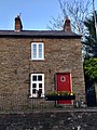
 10, Merthyr Road, Tongwynlais, March 2019.jpg 1 536 × 2 048 ; 974 kio
-
 12, Merthyr Road, Tongwynlais, March 2019.jpg 1 536 × 2 048 ; 1,01 Mio
-
 14 Merthyr Road, Tongwynlais, March 2019.jpg 4 032 × 3 024 ; 3,93 Mio
-
 16, Merthyr Road, Tongwynlais, March 2019.jpg 1 536 × 2 048 ; 955 kio
-
 18, Merthyr Road, Tongwynlais, March 2019.jpg 1 536 × 2 048 ; 965 kio
-
 20, Merthyr Road, Tongwynlais, March 2019.jpg 1 536 × 2 048 ; 979 kio
-
 2010 Wales Cardiff Community Tongwynlais map.svg 512 × 546 ; 341 kio
-
 2024 Wales Cardiff Community Tongwynlais map.svg 512 × 546 ; 319 kio
-
 22, Merthyr Road, Tongwynlais, March 2019.jpg 1 536 × 2 048 ; 759 kio
-
 4, Merthyr Road, Tongwynlais, March 2019.jpg 1 536 × 2 048 ; 1,13 Mio
-
 6 Merthyr Road, Tongwynlais, March 2019.jpg 1 536 × 2 048 ; 1 Mio
-
 8, Merthyr Road, Tongwynlais, March 2019.jpg 1 536 × 2 048 ; 938 kio
-
 A Dragon - geograph.org.uk - 3398326.jpg 2 690 × 1 035 ; 1,19 Mio
-
 A470 north from M4 junction 32 - geograph.org.uk - 3125874.jpg 640 × 410 ; 50 kio
-
 A470 slip road passes under A4054 - geograph.org.uk - 2180817.jpg 640 × 480 ; 77 kio
-
 Across the B4262 river bridge near Taffs Well - geograph.org.uk - 4597769.jpg 800 × 600 ; 129 kio
-
 Ainon Baptist Church, Tongwynlais - geograph.org.uk - 2180966.jpg 640 × 480 ; 75 kio
-
 Arch on a forest track - geograph.org.uk - 2975210.jpg 640 × 480 ; 128 kio
-
 Ashvale House,Ynysfach Yard, Tongwynlais - geograph.org.uk - 4597724.jpg 800 × 704 ; 131 kio
-
 Bend in path at edge of M4 motorway - geograph.org.uk - 2183268.jpg 640 × 480 ; 110 kio
-
 Bethesda United Reformed Church, Tongwynlais - geograph.org.uk - 2181692.jpg 640 × 566 ; 85 kio
-
 Birch Hill, Tongwynlais - geograph.org.uk - 2180873.jpg 640 × 480 ; 96 kio
-
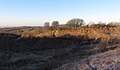 Blaengwynlais Quarry - geograph.org.uk - 4798861.jpg 4 000 × 2 336 ; 1,94 Mio
-
 Bus stops, eastern edge of Tongwynlais - geograph.org.uk - 2181905.jpg 640 × 480 ; 117 kio
-
-
 Canalside Cottages, Tongwynlais - geograph.org.uk - 2745305.jpg 1 500 × 850 ; 1,29 Mio
-
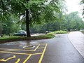 Car park - geograph.org.uk - 2975298.jpg 640 × 480 ; 110 kio
-
 Cardiff , Coryton Interchange gantry - geograph.org.uk - 2181910.jpg 640 × 490 ; 73 kio
-
 Cardiff , The M4 Motorway - geograph.org.uk - 3926534.jpg 4 288 × 2 848 ; 4,54 Mio
-
 Cardiff , The M4 Motorway - geograph.org.uk - 3926535.jpg 4 288 × 2 848 ; 4,91 Mio
-
 Cardiff , The M4 Motorway - geograph.org.uk - 3928402.jpg 4 240 × 2 776 ; 5,76 Mio
-
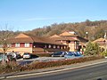 Cardiff International Hotel - geograph.org.uk - 2182021.jpg 640 × 480 ; 76 kio
-
 Cardiff UK community map (Tongwynlais).svg 1 187 × 1 266 ; 438 kio
-
 Cardiff ward location - Whitchurch Tongwynlais.png 800 × 570 ; 115 kio
-
 Cars cross the Taff near Taffs Well - geograph.org.uk - 4597659.jpg 800 × 586 ; 107 kio
-
 Castell Coch Castle near Cardiff - geograph.org.uk - 6338488.jpg 5 184 × 2 920 ; 6,32 Mio
-
 Castell Coch Castle near Cardiff - geograph.org.uk - 6338494.jpg 5 184 × 2 920 ; 4,57 Mio
-
 Castell Coch Castle near Cardiff - geograph.org.uk - 6432203.jpg 1 199 × 1 799 ; 464 kio
-
 Castell Coch Golf Course - geograph.org.uk - 5460289.jpg 2 813 × 1 602 ; 2,06 Mio
-
 Castell Coch View, Tongwynlais - geograph.org.uk - 424425.jpg 640 × 480 ; 80 kio
-
 Castell Heights Golf Club - geograph.org.uk - 4829415.jpg 3 264 × 2 448 ; 2,26 Mio
-
 Castle Rd, Tongwynlais - geograph.org.uk - 2188941.jpg 4 000 × 3 000 ; 1,25 Mio
-
 Castle View, Tongwynlais - geograph.org.uk - 2181765.jpg 640 × 556 ; 94 kio
-

-
 Church in Tongwynlais - geograph.org.uk - 2000099.jpg 640 × 480 ; 78 kio
-
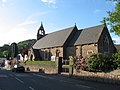
 Church of St Michael ^ All Angels, Tongwynlais - geograph.org.uk - 2188926.jpg 4 000 × 3 000 ; 1,41 Mio
-
 Church of St Michael ^ All Angels, Tongwynlais - geograph.org.uk - 2188937.jpg 4 000 × 3 000 ; 1,31 Mio
-

-
 Concrete pillar sections at Blaengwynlais Quarry - geograph.org.uk - 4798864.jpg 4 000 × 3 000 ; 5,75 Mio
-

-
 Cottage, Bwlch-y-cwm - geograph.org.uk - 1833273.jpg 3 296 × 2 472 ; 1,9 Mio
-
 Crossing the river west of Junction 32 - geograph.org.uk - 3125862.jpg 640 × 447 ; 54 kio
-
 Cwm Gwynlais, Tongwynlais - geograph.org.uk - 2183030.jpg 640 × 455 ; 77 kio
-
 Cycle route footbridge near Tongwynlais - geograph.org.uk - 2181859.jpg 640 × 583 ; 185 kio
-

-

-
 Disused quarry, Rhiwbina Hill - geograph.org.uk - 1833285.jpg 3 296 × 2 472 ; 1,89 Mio
-
 Dragon next to the car park - geograph.org.uk - 2975308.jpg 640 × 480 ; 119 kio
-

-
 Edge of Greenmeadow Wood, Tongwynlais - geograph.org.uk - 2181773.jpg 640 × 516 ; 90 kio
-

-
 Fforest Fawr - geograph.org.uk - 6301015.jpg 1 024 × 678 ; 215 kio
-
 Fforestganol Track - geograph.org.uk - 5460440.jpg 3 264 × 2 448 ; 2,88 Mio
-
 Fields above Tongwynlais - geograph.org.uk - 1732003.jpg 640 × 480 ; 87 kio
-
 Footpath across Fields - geograph.org.uk - 5460431.jpg 3 264 × 2 448 ; 2,9 Mio
-
 Footpath beside the A470 under the M4 at J32 - geograph.org.uk - 4757726.jpg 4 000 × 3 000 ; 2,82 Mio
-
 Footpath into Fforest Ganol - geograph.org.uk - 1833314.jpg 3 296 × 2 472 ; 1,86 Mio
-
 Footpath into Fforestganol, off Rhiwbina Hill - geograph.org.uk - 1833227.jpg 3 296 × 2 472 ; 1,79 Mio
-
 Footpath sign and stile - geograph.org.uk - 1833216.jpg 3 296 × 2 472 ; 1,93 Mio
-

-
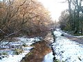 Fragment of the disused Glamorganshire Canal - geograph.org.uk - 2183224.jpg 640 × 480 ; 126 kio
-
 Frog And Mice - geograph.org.uk - 5676729.jpg 1 200 × 1 600 ; 372 kio
-
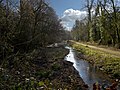 Glamorganshire Canal, Tongwynlais - geograph.org.uk - 2746013.jpg 1 500 × 1 125 ; 2,04 Mio
-
 Grants Close, Tongywnlais - geograph.org.uk - 2183071.jpg 640 × 462 ; 69 kio
-
 Harris ^ Rowe, Tongwynlais - geograph.org.uk - 4597739.jpg 800 × 647 ; 106 kio
-
 Heol-yr-Ynys railway bridge near Taffs Well - geograph.org.uk - 2180763.jpg 640 × 480 ; 106 kio
-
 Heol-yr-Ynys railway bridge near Taffs Well - geograph.org.uk - 4597670.jpg 800 × 600 ; 118 kio
-
 Heol-yr-Ynys railway bridge near Taffs Well - geograph.org.uk - 4597806.jpg 611 × 800 ; 149 kio
-
-
-

-

-

-
 Iron Bridge Road south of the A470 - geograph.org.uk - 2183199.jpg 640 × 480 ; 109 kio
-
 Iron Bridge Road towards Tongwynlais - geograph.org.uk - 4598162.jpg 800 × 702 ; 201 kio
-
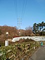
 Ironbridge electricity substation, Tongwynlais - geograph.org.uk - 4598157.jpg 800 × 550 ; 117 kio
-
 Junction 32 on the M4 - geograph.org.uk - 2682343.jpg 4 389 × 2 999 ; 4,58 Mio
-
 Junction 32, M4 - geograph.org.uk - 3141812.jpg 640 × 480 ; 467 kio
-
 Lewis Arms - Tongwynlais.jpg 2 664 × 1 850 ; 2,62 Mio
-
 Llwybr Castell Castell Coch Path - geograph.org.uk - 3899843.jpg 640 × 480 ; 159 kio
-
 Llwybr Ceffyl Bwlch y Cwm Bridleway - geograph.org.uk - 3899811.jpg 640 × 480 ; 156 kio
-

-
 Looking down Rhiwbina Hill - geograph.org.uk - 1833245.jpg 3 296 × 2 472 ; 1,76 Mio
-
 M4 at J32 - geograph.org.uk - 3672114.jpg 640 × 430 ; 37 kio
-
 M4 at Junction 32 - geograph.org.uk - 2938127.jpg 640 × 481 ; 62 kio
-
 M4 crossing the River Taf - geograph.org.uk - 3683050.jpg 640 × 430 ; 42 kio
-
 M4 eastbound at junction 32 - geograph.org.uk - 2448455.jpg 640 × 480 ; 37 kio
-
 M4 eastbound towards junction 32 - geograph.org.uk - 4321793.jpg 1 600 × 1 169 ; 856 kio
-
 M4 J32 interchange - geograph.org.uk - 4757721.jpg 4 000 × 3 000 ; 2,99 Mio
-
 M4 J32 interchange - geograph.org.uk - 4757730.jpg 4 000 × 3 000 ; 3,06 Mio
-
 M4 J32 interchange - geograph.org.uk - 4757735.jpg 4 000 × 3 000 ; 2,39 Mio
-
 M4 Motorway Intersection near Tongwynlais - geograph.org.uk - 609448.jpg 640 × 480 ; 108 kio
-
 Market Street, Tongwynlais - geograph.org.uk - 2181154.jpg 640 × 480 ; 65 kio
-
 Merging lanes sign east of junction 32 of M4 - geograph.org.uk - 5845470.jpg 1 600 × 1 200 ; 817 kio
-
 Merthyr Road, looking towards St Michael's and All Angels Church - geograph.org.uk - 2711048.jpg 1 600 × 1 200 ; 546 kio
-
 Mill Road, Tongwynlais - geograph.org.uk - 2181313.jpg 640 × 480 ; 60 kio
-
 Motorway Junction - geograph.org.uk - 3141797.jpg 640 × 480 ; 480 kio
-
 Motorway on slip westbound at J32 of M4 - geograph.org.uk - 5819610.jpg 1 600 × 1 279 ; 660 kio
-

-
 Northern end of the B4262 near Taffs Well - geograph.org.uk - 4597797.jpg 800 × 499 ; 113 kio
-

-
 Nos 6-8 Wyndham Street, Tongwynlais, March 2019.jpg 1 536 × 2 048 ; 884 kio
-
 NW edge of the Coryton Interchange, Cardiff - geograph.org.uk - 2181868.jpg 640 × 636 ; 103 kio
-
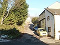
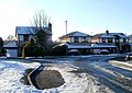
 NW edge of Tongwynlais - geograph.org.uk - 2180838.jpg 640 × 470 ; 101 kio
-
 Old Field Road, Coryton, Cardiff - geograph.org.uk - 2182094.jpg 640 × 603 ; 92 kio
-
 Old Ton Inn, Tongwynlais - geograph.org.uk - 2181433.jpg 640 × 507 ; 70 kio
-
 On Rhiwbina Hill - geograph.org.uk - 2342809.jpg 2 560 × 1 920 ; 1,7 Mio
-
 Ordnance Survey Cut Mark - geograph.org.uk - 6240555.jpg 1 024 × 649 ; 150 kio
-
 Pantgwynlais, Tongwynlais - geograph.org.uk - 2181704.jpg 640 × 480 ; 75 kio
-
 Part of the car park at Castell Coch - geograph.org.uk - 2497834.jpg 800 × 600 ; 483 kio
-

-
 Path alongside former Glamorganshire Canal - geograph.org.uk - 2183232.jpg 640 × 480 ; 133 kio
-
 Path alongside M4 motorway - geograph.org.uk - 2183276.jpg 640 × 480 ; 105 kio
-
 Path heading east alongside M4 motorway - geograph.org.uk - 2183322.jpg 640 × 480 ; 142 kio
-
 Path heads SE away from Iron Bridge Road - geograph.org.uk - 2183211.jpg 640 × 480 ; 110 kio
-
 Path to Iron Bridge Road - geograph.org.uk - 2183316.jpg 640 × 480 ; 137 kio
-
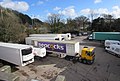 Peacocks lorry in a yard near Taffs Well - geograph.org.uk - 4597787.jpg 800 × 541 ; 105 kio
-
-
 Queen Street houses, Tongwynlais - geograph.org.uk - 2181395.jpg 613 × 640 ; 73 kio
-

-
 Railway line near Taff's Well - geograph.org.uk - 2486761.jpg 2 816 × 2 112 ; 2,08 Mio
-
 Railway near Castell Coch - geograph.org.uk - 1872336.jpg 3 296 × 2 472 ; 1,88 Mio
-
 Railway SE of Taffs Well station - geograph.org.uk - 4597672.jpg 791 × 800 ; 200 kio
-
 Railway Terrace, Tongwynlais - geograph.org.uk - 2180989.jpg 640 × 480 ; 92 kio
-
 Railway towards Taffs Well station - geograph.org.uk - 4597910.jpg 743 × 800 ; 179 kio
-
 Rhiwbina Farm - geograph.org.uk - 1833211.jpg 3 296 × 2 472 ; 1,86 Mio
-
 Rhiwbina Farm - geograph.org.uk - 1833237.jpg 3 296 × 2 472 ; 1,78 Mio
-
 River Taff upstream from the B4262 bridge - geograph.org.uk - 2180728.jpg 640 × 480 ; 69 kio
-
 Row of houses, Merthyr Road, Tongwynlais - geograph.org.uk - 2180922.jpg 640 × 495 ; 66 kio
-
 Royal Mail Delivery Office near Taffs Well - geograph.org.uk - 4597837.jpg 800 × 645 ; 155 kio
-
 Ruined cottage, Heol Pen-y-bryn - geograph.org.uk - 1833354.jpg 3 296 × 2 472 ; 1,92 Mio
-
 Slip road from the A470 - geograph.org.uk - 2180787.jpg 640 × 480 ; 82 kio
-

-
 Slow vehicles signs near Taffs Well - geograph.org.uk - 4381533.jpg 800 × 609 ; 101 kio
-
 Small tunnel under the M4 motorway - geograph.org.uk - 2183253.jpg 640 × 480 ; 135 kio
-
 Snowy picnic area, Tongwynlais - geograph.org.uk - 2183082.jpg 640 × 514 ; 121 kio
-
 Snowy sports field south of Iron Bridge Road - geograph.org.uk - 2183293.jpg 640 × 564 ; 70 kio
-

-
 Sports field, Tongwynlais - geograph.org.uk - 4598186.jpg 800 × 595 ; 140 kio
-
 St Michael and All Angels church, Tongwynlais.jpg 640 × 479 ; 69 kio
-
 St Michael's Close, Tongwynlais - geograph.org.uk - 2181407.jpg 640 × 480 ; 100 kio
-
 Start of cycle route, Merthyr Road, Tongwynlais - geograph.org.uk - 2181848.jpg 640 × 480 ; 130 kio
-

-
 Steps climb towards Greenmeadow Wood - geograph.org.uk - 2182057.jpg 640 × 484 ; 139 kio
-
 Taff Trail above Castell Coch - geograph.org.uk - 2234814.jpg 640 × 480 ; 133 kio
-
 Taff Trail above Castell Coch - geograph.org.uk - 2234824.jpg 640 × 480 ; 133 kio
-
 Taff Trail footpath near Castell Coch - geograph.org.uk - 2188944.jpg 4 000 × 3 000 ; 2,53 Mio
-
 Taff Trail north of Castell Coch - geograph.org.uk - 2234796.jpg 640 × 480 ; 139 kio
-

-
 Terraced cottages, Merthyr Rd, Tongwynlais - geograph.org.uk - 2188931.jpg 4 000 × 3 000 ; 1,84 Mio
-
 The A470 near Tongwynlais - geograph.org.uk - 2188939.jpg 4 000 × 3 000 ; 1,99 Mio
-
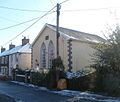
 The former Salem Chapel, Tongwynlais - geograph.org.uk - 2188936.jpg 4 000 × 3 000 ; 1,46 Mio
-
 The Gateway of the Taff Valley - geograph.org.uk - 5212102.jpg 2 560 × 1 838 ; 1,93 Mio
-
 The Lewis Arms inn - geograph.org.uk - 2497829.jpg 800 × 600 ; 366 kio
-
 The Lewis Arms near Castle Coch - geograph.org.uk - 3165101.jpg 640 × 480 ; 80 kio
-
 The Lewis Arms, Tongwynlais - geograph.org.uk - 2181220.jpg 640 × 480 ; 75 kio
-
 The Lewis Arms, Tongwynlais - geograph.org.uk - 2188929.jpg 4 000 × 3 000 ; 1,72 Mio
-
 The view NE across a snowy sports field - geograph.org.uk - 2183307.jpg 640 × 480 ; 60 kio
-

-
 Tongwynlais (18623707613).jpg 3 888 × 2 592 ; 4,93 Mio
-
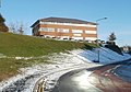
 Tongwynlais Community Primary School - geograph.org.uk - 2181741.jpg 640 × 480 ; 108 kio
-
 Tongwynlais Post Office - geograph.org.uk - 2181667.jpg 640 × 480 ; 64 kio
-
 Tongwynlais RFC social club - geograph.org.uk - 2181293.jpg 640 × 560 ; 68 kio
-
 Tongwynlais Village Hall - geograph.org.uk - 2181681.jpg 640 × 480 ; 124 kio
-
 Tongwynlais village small.jpg 253 × 171 ; 7 kio
-
 Tongwynlais, UK - panoramio.jpg 4 000 × 3 000 ; 3,02 Mio
-

-
 Track in woodland - geograph.org.uk - 2975193.jpg 640 × 480 ; 102 kio
-
 Traffic calming near the school - geograph.org.uk - 2497205.jpg 800 × 600 ; 341 kio
-
 Train south of Taffs Well station - geograph.org.uk - 4597877.jpg 800 × 681 ; 173 kio
-
 Two shops and church bell tower, Tongwynlais - geograph.org.uk - 2181336.jpg 640 × 512 ; 74 kio
-
 Tyle Castell Coch Hill - geograph.org.uk - 3899858.jpg 640 × 480 ; 146 kio
-
 Tyle Rhiwbina Hill - geograph.org.uk - 3899790.jpg 640 × 480 ; 128 kio
-
 View south from Castell Coch - geograph.org.uk - 1938400.jpg 640 × 480 ; 116 kio
-

-

-
 West side of Greenmeadow Drive, Tongwynlais - geograph.org.uk - 2181770.jpg 640 × 530 ; 101 kio
-
 West side of Wyndham Street, Tongwynlais - geograph.org.uk - 2180938.jpg 640 × 535 ; 68 kio
-
 Wooded hillside near Castell Coch - geograph.org.uk - 4724010.jpg 4 000 × 3 000 ; 5,25 Mio
-
 Wyndham St, Tongwynlais - geograph.org.uk - 2188933.jpg 4 000 × 3 000 ; 2,03 Mio
-
 Wyndham Street, Tongwynlais - geograph.org.uk - 2180930.jpg 640 × 480 ; 62 kio
-
 Ynys Fach Yard, Taffs Well - geograph.org.uk - 4597667.jpg 800 × 490 ; 89 kio
-
 Ynys Yard, Tongwynlais - geograph.org.uk - 2180749.jpg 640 × 480 ; 85 kio
-
 Ynysfach Yard, Tongwynlais - geograph.org.uk - 4597752.jpg 800 × 532 ; 97 kio


.svg)


.jpg)


