Category:Torryburn
Vai alla navigazione
Vai alla ricerca
English: Torryburn is a village in Scotland, lying on the north shore of the Firth of Forth. It is one of a number of old port communities that have existed on this coast and at one point even served as port for Dunfermline. It lies in the Bay of Torry in South Western Fife.
village in Fife, Scotland, UK | |||||
| Carica un file multimediale | |||||
| Istanza di | |||||
|---|---|---|---|---|---|
| Luogo |
| ||||
| Popolazione |
| ||||
 | |||||
Sottocategorie
Questa categoria contiene le 4 sottocategorie indicate di seguito, su un totale di 4.
C
- Crombie Old Church (19 F)
T
- Torry Bay, Fife (3 F)
- Torryburn church (5 F)
- Tuilyies Standing Stones (3 F)
File nella categoria "Torryburn"
Questa categoria contiene 15 file, indicati di seguito, su un totale di 15.
-
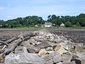
 Coastal Path. - geograph.org.uk - 79003.jpg 640 × 480; 136 KB
-
 Crombie pier - geograph.org.uk - 2018219.jpg 2 816 × 2 112; 1,18 MB
-
 Crombie Point - geograph.org.uk - 4808849.jpg 3 264 × 2 448; 4,2 MB
-
 D M Crombie - perimeter fence - geograph.org.uk - 2018237.jpg 2 816 × 2 112; 1 024 KB
-
 Fife coast near Crombie Point - geograph.org.uk - 4342755.jpg 640 × 427; 319 KB
-
 Forth estuary at Shoreside - geograph.org.uk - 4343267.jpg 640 × 427; 431 KB
-

-
-
 The Firth of Forth from Crombie - geograph.org.uk - 4808851.jpg 3 264 × 2 448; 4,15 MB
-
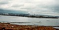
 The Firth of Forth. - geograph.org.uk - 79005.jpg 640 × 480; 109 KB
-
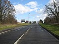
 The main road through Torryburn - geograph.org.uk - 1184608.jpg 640 × 480; 89 KB
-
 The pier at Crombie - geograph.org.uk - 4342738.jpg 640 × 427; 331 KB
-
 View towards Bo'ness - geograph.org.uk - 2549834.jpg 640 × 328; 47 KB
-
 View towards Longannet - geograph.org.uk - 4342741.jpg 640 × 427; 245 KB
-
 Wheat fields, Bullions - geograph.org.uk - 9513.jpg 640 × 418; 67 KB


