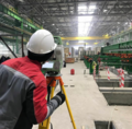
Category:Total stations
跳转到导航
跳转到搜索
instrument used in surveying and building construction; an electronic theodolite integrated with an electronic distance meter | |||||
| 上传媒体 | |||||
| 上级分类 | |||||
|---|---|---|---|---|---|
| 用途 | |||||
| |||||
分类“Total stations”中的媒体文件
以下51个文件属于本分类,共51个文件。
-
De-Tachymeter.ogg 1.9秒;19 KB
-
Automatic deformation monitoring device - Porto Metro.jpg 2,936 × 3,916;10.89 MB
-
Baustelle provisorische Rankbachbahnbrücke 107.jpg 4,000 × 6,000;7.44 MB
-
Brücke Rankbachbahn über die A 81 Böblingen, Sindelfingen 50.jpg 4,000 × 6,000;9.06 MB
-
Detall equip de control - panoramio - David Vallespí.jpg 1,200 × 1,800;217 KB
-
Detall equip de control - panoramio.jpg 1,600 × 1,064;154 KB
-
DTM-A20LG-03.jpg 1,200 × 1,600;227 KB
-
F7985CacarongMatandafvf 25.JPG 3,456 × 4,608;5.86 MB
-
Geodimeter, 1960s - National Museum of Nature and Science, Tokyo - DSC07810.JPG 5,029 × 2,553;2.56 MB
-
Geodimeter.jpg 400 × 559;34 KB
-
GeoMax Zoom90.png 1,130 × 2,899;2.94 MB
-
Großsteingrab Lüdelsen 6 2010 01.jpg 3,456 × 2,304;5.28 MB
-
Großsteingrab Lüdelsen 6 2010 02.jpg 3,456 × 2,304;4.38 MB
-
Großsteingrab Lüdelsen 6 2010 09.jpg 3,456 × 2,304;5.28 MB
-
Großsteingrab Lüdelsen 6 2010 10.jpg 3,456 × 2,304;5.55 MB
-
Großsteingrab Lüdelsen 6 2010 11.jpg 3,456 × 2,304;5.47 MB
-
Großsteingrab Lüdelsen 6 2010 17.jpg 3,456 × 2,304;4.52 MB
-
Highway Calumpit railway station construction sites 05.jpg 5,184 × 3,888;3.94 MB
-
Highway Calumpit railway station construction sites 08.jpg 5,184 × 3,888;4.72 MB
-
Highway Calumpit railway station construction sites 09.jpg 5,184 × 3,888;5.08 MB
-
Highway Calumpit railway station construction sites 10.jpg 5,184 × 3,888;5.47 MB
-
Industrial Geodesy.png 720 × 710;745 KB
-
Landmeters, Bestanddeelnr 251-3874.jpg 2,504 × 2,526;773 KB
-
Leica Geosystems mp3h8089.jpg 2,336 × 3,504;1.86 MB
-
Leica TC305 total station.JPG 3,264 × 2,448;2.11 MB
-
Leica TCRP 1203.jpg 1,200 × 2,046;1.26 MB
-
Leica Viva TS16 total station front view.jpg 2,903 × 4,354;1.33 MB
-
Leica Viva TS16 total station rear view.jpg 3,414 × 5,121;1.86 MB
-
Leica Viva TS16 total station side view.jpg 3,345 × 5,017;2.09 MB
-
Leica Viva TS16 total station.jpg 3,228 × 4,842;1.6 MB
-
Leica-tc1100-geodetic.jpg 1,113 × 1,584;1.4 MB
-
Libretto di campagna per distanziometro a infrarossi.jpg 1,272 × 929;260 KB
-
Libretto di campagna per tacheometri ordinari.jpg 1,242 × 883;259 KB
-
Oleandry J. Pilsudski House, 7, 3 Maja Av,Krakow,Poland.JPG 2,272 × 1,704;2.08 MB
-
Rec Elta 3.jpg 888 × 2,054;313 KB
-
Reglage station totale avec reflecteur.jpg 3,563 × 2,672;1.77 MB
-
Robotic-surveying-total-station-257041.jpg 837 × 1,000;144 KB
-
Royal Engineers Metcalf and Manduwi (photo Andy V Byers).JPG 2,202 × 1,658;1.76 MB
-
Sokkia 1.JPG 1,712 × 1,368;503 KB
-
Sokkia 2.jpg 1,712 × 1,368;197 KB
-
Sokkia 3.jpg 1,712 × 1,368;472 KB
-
Station TOTAL.jpg 4,032 × 2,268;2.43 MB
-
Teodolit nikon 520.jpg 676 × 1,246;123 KB
-
Theodoliet en doelwit.jpg 1,664 × 1,664;990 KB
-
Topographic survey of a bridge.jpg 4,032 × 3,024;3.68 MB
-
Total station made by Leica Geosystems.jpg 2,495 × 4,000;5.89 MB
-
Total station UOMZ Ta10 1997.tiff 2,592 × 3,872;46.75 MB
-
Total Station UOMZ Ta20 1995.tiff 1,930 × 3,708;34.71 MB
-
TS by The sea.jpg 3,968 × 2,976;3.75 MB
-
Раскопки под Канском. Геодезист с тахеометром.jpg 2,223 × 3,334;2.29 MB
-
南方全站仪.jpg 3,120 × 4,160;4.15 MB


