Category:Tregony
Aller à la navigation
Aller à la recherche
village britannique  | |||||
| Téléverser des médias | |||||
| Nature de l’élément | |||||
|---|---|---|---|---|---|
| Lieu |
| ||||
 | |||||
English: Tregony (sometimes in the past Tregoney) village in Cornwall, England, in the United Kingdom. It lies on the river Fal. In the village there is a post office and two churches. Tregony has bus links to the nearest town, which is Truro. The village is made up from two parishes namely, Tregony and Cuby. Cornelly parish was united with Tregony in 1934.
Sous-catégories
Cette catégorie comprend seulement la sous-catégorie ci-dessous.
K
- King's Arms, Tregony (2 F)
Média dans la catégorie « Tregony »
Cette catégorie comprend 11 fichiers, dont les 11 ci-dessous.
-
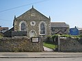 Tregony Congregational Church - geograph.org.uk - 1261069.jpg 640 × 480 ; 72 kio
-
 Cuby, the Fal valley near Tregony - geograph.org.uk - 92308.jpg 640 × 432 ; 126 kio
-
 Fore Street, Tregony - geograph.org.uk - 1477991.jpg 640 × 480 ; 87 kio
-
 Fore Street, Tregony - geograph.org.uk - 2425295.jpg 640 × 480 ; 66 kio
-
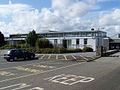 Roseland Community College - geograph.org.uk - 1476409.jpg 640 × 480 ; 77 kio
-
 Roseland Parc, Tregony - geograph.org.uk - 2425283.jpg 640 × 480 ; 77 kio
-
 Tregony Community Primary School - geograph.org.uk - 1477988.jpg 640 × 480 ; 99 kio
-
 Tregony Industrial Estate - geograph.org.uk - 303449.jpg 640 × 480 ; 128 kio
-
 Tregony Post Office - geograph.org.uk - 2537666.jpg 640 × 480 ; 116 kio
-
 Tregony, former school - geograph.org.uk - 2168501.jpg 1 024 × 681 ; 197 kio
-
 Cuby, Tregony - geograph.org.uk - 92309.jpg 640 × 433 ; 112 kio


