Category:Twywell
Vai alla navigazione
Vai alla ricerca
village and civil parish in Northamptonshire, United Kingdom  | |||||
| Carica un file multimediale | |||||
| Istanza di | |||||
|---|---|---|---|---|---|
| Luogo | North Northamptonshire, Northamptonshire, Midlands Orientali, Inghilterra | ||||
| Considerato essere uguale a | Twywell (pagina Wikimedia duplicata, parrocchia civile dell'Inghilterra) | ||||
 | |||||
Sottocategorie
Questa categoria contiene le 3 sottocategorie indicate di seguito, su un totale di 3.
File nella categoria "Twywell"
Questa categoria contiene 40 file, indicati di seguito, su un totale di 40.
-
 A wintery outlook near Twywell - geograph.org.uk - 3299222.jpg 2 560 × 1 920; 1,11 MB
-
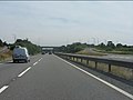
 A14 - A510 junction bridge - geograph.org.uk - 3580344.jpg 640 × 480; 54 KB
-
 A14 approaching the A510 junction - geograph.org.uk - 3580342.jpg 640 × 480; 49 KB
-
 A14 at Twywell Plantation - geograph.org.uk - 3580354.jpg 640 × 480; 51 KB
-
 A14 crossing Thrapston Road - geograph.org.uk - 3580370.jpg 640 × 480; 48 KB
-
 A14 curving near Woodwell - geograph.org.uk - 3580357.jpg 640 × 480; 56 KB
-
 A14 East of Cranford St John - geograph.org.uk - 3817714.jpg 640 × 427; 266 KB
-
 A14 east of the A510 bridge - geograph.org.uk - 3580346.jpg 640 × 480; 55 KB
-
 A14 east of the Twywell footbridge - geograph.org.uk - 3580363.jpg 640 × 480; 54 KB
-
 A14 eastbound at A510 on-slip - geograph.org.uk - 5082604.jpg 640 × 481; 56 KB
-

-
 A14 footbridge near Twywell - geograph.org.uk - 3580361.jpg 640 × 480; 60 KB
-
 A14 near Woodford - geograph.org.uk - 3819700.jpg 640 × 480; 280 KB
-
 Across the field to Slipton - geograph.org.uk - 1178607.jpg 640 × 480; 90 KB
-

-
 Damaged benchmark on a stone pillar, Twywell - geograph.org.uk - 3299161.jpg 2 560 × 1 920; 955 KB
-
 Eastbound 14 at Junction 11 - geograph.org.uk - 3817712.jpg 640 × 480; 251 KB
-
 Eastbound A14 near Twywell - geograph.org.uk - 3817717.jpg 640 × 480; 265 KB
-
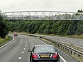
 Eastbound A14, Footbridge at Twywell - geograph.org.uk - 3817719.jpg 640 × 480; 282 KB
-
 Entrance to Twywell - geograph.org.uk - 4170381.jpg 640 × 468; 56 KB
-
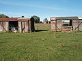 Ex railway wagons used for storage at Twywell - geograph.org.uk - 2657446.jpg 2 560 × 1 920; 1,09 MB
-
 Lay-by on the eastbound A14 - geograph.org.uk - 3580366.jpg 640 × 480; 45 KB
-
 Layby on the Westbound A14 - geograph.org.uk - 3819769.jpg 640 × 480; 238 KB
-
 Manor Farm entrance - geograph.org.uk - 3299170.jpg 2 560 × 1 920; 1 000 KB
-
 Ordnance Survey benchmark - geograph.org.uk - 4170386.jpg 640 × 480; 137 KB
-
 River Nene from Woodford Church - geograph.org.uk - 2557.jpg 640 × 427; 238 KB
-
 Road junction in Twywell - geograph.org.uk - 3299155.jpg 2 560 × 1 920; 1,18 MB
-
 The road to Grafton - geograph.org.uk - 3271707.jpg 2 592 × 1 944; 1,81 MB
-
 Twywell Hills and Dales nature reserve - geograph.org.uk - 3299211.jpg 2 560 × 1 920; 1,02 MB
-
 Twywell Hills and Dales nature reserve - geograph.org.uk - 3299215.jpg 2 560 × 1 920; 1,03 MB
-
 Twywell Plantation - geograph.org.uk - 3299195.jpg 640 × 480; 99 KB
-
 Walking through Twywell Plantation - geograph.org.uk - 3299200.jpg 2 560 × 1 920; 1 001 KB
-
 Westbound A14 at Junction 11 - geograph.org.uk - 3819801.jpg 640 × 427; 213 KB
-
 Westbound A14, footbridge near Twywell - geograph.org.uk - 3819773.jpg 640 × 480; 246 KB
-
 Deep Drainage Ditch - geograph.org.uk - 144291.jpg 640 × 480; 104 KB
-
 Field of Stubble - geograph.org.uk - 215838.jpg 640 × 480; 121 KB
-
 Footpath and former main road - geograph.org.uk - 233937.jpg 640 × 480; 89 KB
-
 Former A604 main road - geograph.org.uk - 233934.jpg 640 × 480; 91 KB
-
 Former Main Road near Woodford - geograph.org.uk - 191388.jpg 640 × 480; 81 KB
-
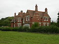 Home Farm - geograph.org.uk - 55259.jpg 640 × 480; 128 KB


