Category:Uddingston
Zur Navigation springen
Zur Suche springen
Kleinstadt in Schottland  | |||||
| Medium hochladen | |||||
| Ist ein(e) | |||||
|---|---|---|---|---|---|
| Ort |
| ||||
| Einwohnerzahl |
| ||||
 | |||||
English: Uddingston is a village in South Lanarkshire, Scotland, on the north side of the River Clyde, approximately seven miles to the south-east of Glasgow.
Français : Uddingston est une ville d' Écosse, dans le South Lanarkshire, sur la rive nord du Clyde, à environ 12 kilomètres au sud-est de Glasgow.
Simple English: Uddingston is a village in South Lanarkshire, Scotland, on the north side of the River Clyde, approximately seven miles to the south-east of Glasgow.
Unterkategorien
Es werden 7 von insgesamt 7 Unterkategorien in dieser Kategorie angezeigt:
In Klammern die Anzahl der enthaltenen Kategorien (K), Seiten (S), Dateien (D)
H
- Haughhead Bridge, Uddingston (12 D)
M
- Maryville Interchange (12 D)
T
U
- Uddingston Grammar School (2 D)
- Uddingston railway station (6 D)
- Uddingston Viaduct (6 D)
Medien in der Kategorie „Uddingston“
Folgende 50 Dateien sind in dieser Kategorie, von 50 insgesamt.
-
 Approaching M74 underpass (geograph 7304048).jpg 3.264 × 2.448; 2,26 MB
-

-

-
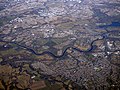 Blantyre and the River Clyde from the air (geograph 5716664).jpg 640 × 480; 245 KB
-
 Bothwell and Uddingston.svg 1.319 × 1.345; 2,63 MB
-
 Clubhouse at Bothwell Castle Policies Cricket Ground - geograph 7303948.jpg 3.360 × 2.041; 2,95 MB
-
 Clyde Walkway at Uddingston - geograph.org.uk - 377695.jpg 640 × 427; 134 KB
-

-
 Cycle path, Uddingston - geograph.org.uk - 1228117.jpg 480 × 640; 122 KB
-
 Former Uddingston Library - geograph.org.uk - 1153690.jpg 640 × 480; 68 KB
-
 Gates on railway bridge - geograph.org.uk - 1228097.jpg 640 × 480; 132 KB
-
 Horse in a field of buttercups (geograph 7196544).jpg 1.024 × 768; 354 KB
-
 Looking to Bellshill Road - Main Street Junction (geograph 7303961).jpg 2.536 × 2.124; 1,98 MB
-
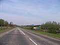
 M74 motorway at Uddingston (geograph 7117329).jpg 1.024 × 768; 210 KB
-
 M74 near Uddingston - geograph.org.uk - 1617745.jpg 640 × 480; 79 KB
-
 M74 North of Uddingston - geograph.org.uk - 1775127.jpg 640 × 480; 64 KB
-
 Main Railway Line to Glasgow - geograph.org.uk - 1617721.jpg 640 × 480; 75 KB
-
 Main Street, Uddingston (geograph 3895758).jpg 1.024 × 760; 400 KB
-
 Main Street, Uddingston - geograph.org.uk - 1228125.jpg 640 × 480; 74 KB
-
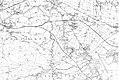 Map of Lanarkshire Sheet 011, Ordnance Survey, 1863-1865.jpg 10.704 × 7.164; 11,89 MB
-
 Map of Lanarkshire Sheet 011, Ordnance Survey, 1863-1865.tiff 10.704 × 7.164; 219,39 MB
-
 National Cycle Network Route 75 at Uddingston (geograph 6778213).jpg 1.024 × 768; 353 KB
-
 New housing development at Uddingston (geograph 7433331).jpg 3.829 × 2.871; 1,61 MB
-
 OS old series Scotland 1 63360 31 (cropped).jpg 1.944 × 1.522; 743 KB
-
 Peeing on a lamppost - geograph.org.uk - 1228138.jpg 480 × 640; 184 KB
-
 Plaque, Uddingston Footbridge - geograph.org.uk - 1229412.jpg 640 × 480; 136 KB
-
 Railway Bridge - geograph.org.uk - 5315194.jpg 1.600 × 1.200; 399 KB
-
 River Clyde - geograph.org.uk - 1228141.jpg 640 × 480; 69 KB
-
 River Clyde and Bothwell Castle - geograph.org.uk - 3209119.jpg 3.072 × 2.304; 3,36 MB
-
 River Clyde at Bothwell Castle - geograph.org.uk - 2015599.jpg 640 × 480; 145 KB
-
 River Clyde at Kylepark - geograph.org.uk - 6327742.jpg 5.152 × 3.864; 5,82 MB
-
 The B758 west of Kylepark - geograph.org.uk - 1291558.jpg 640 × 481; 53 KB
-

-

-
 The River Clyde - geograph.org.uk - 4679752.jpg 1.920 × 1.280; 1,9 MB
-
 The River Clyde - geograph.org.uk - 4679757.jpg 1.920 × 1.280; 1,87 MB
-
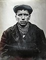 Thomas Queen (mug shot).jpg 520 × 671; 37 KB
-
 Tunnel Under M74 - geograph.org.uk - 106417.jpg 640 × 480; 168 KB
-
 Tunnock's Bakery - geograph.org.uk - 1617845.jpg 640 × 480; 76 KB
-

-
 Uddingston Cross - geograph.org.uk - 1617862.jpg 640 × 480; 65 KB
-
 Uddingston footbridge - geograph.org.uk - 1229419.jpg 640 × 480; 124 KB
-
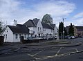 Uddingston, police station (geograph 2935125).jpg 1.010 × 743; 100 KB
-
 UddingstonMap1923.jpg 913 × 695; 153 KB
-

-

-
 Clyde Walkway near Craighead - geograph.org.uk - 341633.jpg 640 × 480; 155 KB
-
 Clyde Walkway near Craighead - geograph.org.uk - 341651.jpg 640 × 480; 192 KB
-
 Raith Haugh Nature Reserve - geograph.org.uk - 341623.jpg 640 × 480; 185 KB
-
 Uddingston Old Parish Church - geograph.org.uk - 106363.jpg 640 × 480; 113 KB
.jpg)
_(cropped2).jpg)
.jpg)


.jpg)
.jpg)
.jpg)


.jpg)


.jpg)
.jpg)
.jpg)


.jpg)


.jpg)


_(cropped).jpg)