Category:Uherčice (Břeclav District)
Vai alla navigazione
Vai alla ricerca
comune ceco   _CoA_CZ.jpg) | |||||
| Carica un file multimediale | |||||
| Istanza di | |||||
|---|---|---|---|---|---|
| Luogo |
| ||||
| Popolazione |
| ||||
| Superficie |
| ||||
| Altezza sul mare |
| ||||
| sito web ufficiale | |||||
 | |||||
Sottocategorie
Questa categoria contiene le 6 sottocategorie indicate di seguito, su un totale di 6.
File nella categoria "Uherčice (Břeclav District)"
Questa categoria contiene 20 file, indicati di seguito, su un totale di 20.
-
 Uhercice (Breclav) CoA CZ.jpg 212 × 248; 37 KB
-
 Uherčice (okres Břeclav) - dům čp. 26.jpg 4 608 × 3 072; 6,15 MB
-
 Uherčice (okres Břeclav) - hájovna čp. 291.jpg 4 608 × 3 072; 2,92 MB
-
 Uherčice (okres Břeclav) - mateřská škola obr01.jpg 4 275 × 3 003; 2,11 MB
-
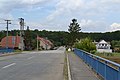 Uherčice (okres Břeclav) - most přes Svratku obr01.jpg 4 608 × 3 072; 2,29 MB
-
 Uherčice (okres Břeclav) - náves a radnice obr01.jpg 3 618 × 2 713; 1,4 MB
-
 Uherčice (okres Břeclav) - náves a socha sv Jana Nepomuckého.jpg 3 983 × 2 924; 2,31 MB
-
 Uherčice (okres Břeclav) - náves, východní část obr01.jpg 3 719 × 2 789; 1,42 MB
-
 Uherčice (okres Břeclav) - náves, západní část obr01.jpg 3 819 × 2 835; 1,58 MB
-
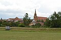 Uherčice (okres Břeclav) - pohled na kostel od hřiště.jpg 3 557 × 2 352; 1,32 MB
-
 Uherčice (okres Břeclav) - pošta.jpg 4 351 × 3 071; 2,13 MB
-
 Uherčice (okres Břeclav) - požární zbrojnice.jpg 3 581 × 2 990; 1,66 MB
-
 Uherčice (okres Břeclav) - severní konec.jpg 4 608 × 3 072; 2,65 MB
-
 Uherčice (okres Břeclav) - sokolovna čp. 257.jpg 3 847 × 2 885; 1,43 MB
-
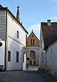 Uherčice (okres Břeclav) - ulička u radnice obr01.jpg 3 072 × 4 444; 2,03 MB
-
 Uherčice (okres Břeclav) - základní škola obr01.jpg 3 835 × 2 876; 1,43 MB
-
 Uherčice vlajka.jpg 600 × 400; 20 KB
-
 Uherčice-boží-muka-jižně-od-hřbitova2019.jpg 3 712 × 5 568; 11,37 MB
-
 Uherčice-okres-Břeclav--dům12-soška2019.jpg 5 568 × 3 712; 10,1 MB
-
 Uherčice-okres-Břeclav-dům79-dveře2019.jpg 5 568 × 3 712; 16,03 MB
_-_d%C5%AFm_%C4%8Dp._26.jpg)
_-_h%C3%A1jovna_%C4%8Dp._291.jpg)
_-_mate%C5%99sk%C3%A1_%C5%A1kola_obr01.jpg)
_-_most_p%C5%99es_Svratku_obr01.jpg)
_-_n%C3%A1ves_a_radnice_obr01.jpg)
_-_n%C3%A1ves_a_socha_sv_Jana_Nepomuck%C3%A9ho.jpg)
_-_n%C3%A1ves,_v%C3%BDchodn%C3%AD_%C4%8D%C3%A1st_obr01.jpg)
_-_n%C3%A1ves,_z%C3%A1padn%C3%AD_%C4%8D%C3%A1st_obr01.jpg)
_-_pohled_na_kostel_od_h%C5%99i%C5%A1t%C4%9B.jpg)
_-_po%C5%A1ta.jpg)
_-_po%C5%BE%C3%A1rn%C3%AD_zbrojnice.jpg)
_-_severn%C3%AD_konec.jpg)
_-_sokolovna_%C4%8Dp._257.jpg)
_-_uli%C4%8Dka_u_radnice_obr01.jpg)
_-_z%C3%A1kladn%C3%AD_%C5%A1kola_obr01.jpg)


