Category:Ulceby, North Lincolnshire
Aller à la navigation
Aller à la recherche
localité britannique du comté anglais de Lincolnshire  | |||||
| Téléverser des médias | |||||
| Nature de l’élément | |||||
|---|---|---|---|---|---|
| Lieu | North Lincolnshire, Lincolnshire, Yorkshire-et-Humber, Angleterre | ||||
 | |||||
Sous-catégories
Cette catégorie comprend 13 sous-catégories, dont les 13 ci-dessous.
A
B
- Brocklesby railway station (22 F)
L
S
T
U
- Ulceby railway station (9 F)
- Ulceby War Memorial (2 F)
Média dans la catégorie « Ulceby, North Lincolnshire »
Cette catégorie comprend 227 fichiers, dont les 200 ci-dessous.
(page précédente) (page suivante)-
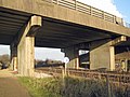
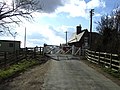
 A gated bridge^^ - geograph.org.uk - 373775.jpg 640 × 423 ; 94 kio
-
 A good crop of dandelions - geograph.org.uk - 2391691.jpg 1 024 × 768 ; 285 kio
-
 A180 approaching Brocklesby Road Bridge - geograph.org.uk - 4571600.jpg 640 × 402 ; 115 kio
-
 A180 east - geograph.org.uk - 2007146.jpg 640 × 426 ; 79 kio
-
 A180 heading east - geograph.org.uk - 2744827.jpg 640 × 480 ; 43 kio
-
 A180 towards Grimsby - geograph.org.uk - 2744826.jpg 800 × 553 ; 53 kio
-
 A180 towards Grimsby - geograph.org.uk - 2744828.jpg 640 × 480 ; 38 kio
-
 A180 towards Grimsby - geograph.org.uk - 5311904.jpg 800 × 519 ; 105 kio
-
 A180 underpass near Ulceby - geograph.org.uk - 5701352.jpg 1 600 × 1 064 ; 732 kio
-
 A180 westbound near Vale House Farm - geograph.org.uk - 3674911.jpg 640 × 479 ; 40 kio
-

-
 A180(T) Bridge - geograph.org.uk - 1651530.jpg 640 × 480 ; 346 kio
-
 Abbey Road, Ulceby - geograph.org.uk - 3722971.jpg 640 × 480 ; 98 kio
-
 Approaching Mark Cooper's Wood - geograph.org.uk - 2390340.jpg 1 024 × 768 ; 168 kio
-
 B1211 Bridge over the A180(T) - geograph.org.uk - 2448733.jpg 1 280 × 714 ; 531 kio
-
 Beck through Mark Cooper's Wood - geograph.org.uk - 2391682.jpg 1 024 × 768 ; 354 kio
-
 Brocklesby Junction - geograph.org.uk - 2089691.jpg 800 × 600 ; 189 kio
-

-
 Brocklesby Junction, aerial 2014 - geograph.org.uk - 4082863.jpg 427 × 640 ; 57 kio
-
 Brocklesby Road heading towards the railway - geograph.org.uk - 3952372.jpg 1 024 × 768 ; 94 kio
-
 Brocklesby Road near Pelham farm - geograph.org.uk - 3952377.jpg 1 024 × 768 ; 72 kio
-
 Brocklesby Road towards Brocklesby - geograph.org.uk - 5311927.jpg 800 × 547 ; 103 kio
-
 Bungalow at Zulu Farm - geograph.org.uk - 3729177.jpg 800 × 331 ; 138 kio
-
 Bystaple Lane - geograph.org.uk - 1896640.jpg 750 × 1 000 ; 909 kio
-
 Bystaple Lane LC - Interior of Control Portakabin - geograph.org.uk - 1907419.jpg 914 × 1 000 ; 674 kio
-
 Bystaple Lane level crossing - geograph.org.uk - 2889153.jpg 3 072 × 2 304 ; 1,56 Mio
-
 Carr Lane - geograph.org.uk - 3729180.jpg 800 × 451 ; 195 kio
-
 Carr Lane - geograph.org.uk - 4929522.jpg 1 024 × 768 ; 100 kio
-
 Carr Lane heading south - geograph.org.uk - 3388822.jpg 640 × 480 ; 73 kio
-
 Carr Lane junction with Cross Road - geograph.org.uk - 4016219.jpg 1 024 × 768 ; 204 kio
-
 Carr Lane near Meadow Croft Farm - geograph.org.uk - 2889169.jpg 3 072 × 2 304 ; 1,21 Mio
-
 Carr Lane near Ulceby - geograph.org.uk - 2030377.jpg 800 × 600 ; 304 kio
-
 Carr Lane, near Ashville Farm - geograph.org.uk - 2003841.jpg 1 024 × 768 ; 207 kio
-
 Carr Lane, near Ulceby Skitter - geograph.org.uk - 5023431.jpg 640 × 463 ; 392 kio
-
 Carr Lane, Ulceby Skitter - geograph.org.uk - 2003812.jpg 1 024 × 768 ; 209 kio
-
 Carr Lane, Ulceby Skitter - geograph.org.uk - 5023424.jpg 490 × 640 ; 395 kio
-
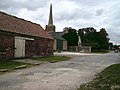 Church Lane and Manor House Farm, Ulceby - geograph.org.uk - 1048770.jpg 640 × 480 ; 76 kio
-
 Class 153 at Brocklesby - geograph.org.uk - 2567698.jpg 1 024 × 768 ; 259 kio
-
 Combine in a rape field - geograph.org.uk - 4088097.jpg 640 × 427 ; 80 kio
-
 Crop spraying near Ulceby Carr Farm - geograph.org.uk - 5023427.jpg 640 × 464 ; 420 kio
-
 Cross Road - geograph.org.uk - 2847703.jpg 1 024 × 768 ; 165 kio
-
 Cross Road from Carr Lane near Ulceby - geograph.org.uk - 2030386.jpg 800 × 600 ; 265 kio
-
 Cross Road heading south - geograph.org.uk - 3388829.jpg 640 × 480 ; 66 kio
-
 Cross Road near Glebe Farm, Ulceby - geograph.org.uk - 1403032.jpg 640 × 425 ; 68 kio
-
 Cross Road near Ulceby - geograph.org.uk - 4016230.jpg 1 024 × 768 ; 116 kio
-
 Cross Road, Ulceby - geograph.org.uk - 5022524.jpg 525 × 640 ; 495 kio
-
 Disused Hoarding Framework - geograph.org.uk - 2391827.jpg 1 024 × 768 ; 216 kio
-
 Disused quarry near Vale House Farm - geograph.org.uk - 5701388.jpg 1 600 × 1 064 ; 879 kio
-
 Ditch near Bystaple Lane Level Crossing - geograph.org.uk - 1895112.jpg 1 000 × 750 ; 911 kio
-
 Diverging Power Lines - geograph.org.uk - 1402530.jpg 640 × 425 ; 75 kio
-
 Diverging power lines - geograph.org.uk - 2847718.jpg 1 024 × 768 ; 113 kio
-
 Dividing of the ways - geograph.org.uk - 2391637.jpg 1 024 × 768 ; 201 kio
-
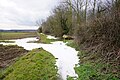
 Drain off Carr Lane - geograph.org.uk - 3388818.jpg 1 024 × 768 ; 168 kio
-
 Drain, Ulceby Skitter - geograph.org.uk - 3388834.jpg 640 × 480 ; 59 kio
-
 Entering Ulceby - geograph.org.uk - 2567151.jpg 1 024 × 768 ; 160 kio
-
 Entrance to the Disused Quarry - geograph.org.uk - 1432509.jpg 640 × 421 ; 90 kio
-
 Farm and footpath bridge under the A180 - geograph.org.uk - 4088045.jpg 640 × 427 ; 86 kio
-
 Farm building off Station Road - geograph.org.uk - 3388831.jpg 1 102 × 681 ; 167 kio
-
 Farm building, Carr Lane - geograph.org.uk - 2003851.jpg 1 024 × 768 ; 197 kio
-
 Farm track leading towards Ulceby - geograph.org.uk - 5701344.jpg 1 600 × 1 064 ; 620 kio
-
 Farm track towards Ulceby Chase Farm - geograph.org.uk - 5701225.jpg 1 600 × 1 064 ; 954 kio
-
 Farm track towards Ulceby Chase Farm - geograph.org.uk - 5701230.jpg 1 600 × 1 064 ; 712 kio
-
 Farm track towards Vale House Farm - geograph.org.uk - 5701248.jpg 1 600 × 1 064 ; 685 kio
-
 Farm track towards Vale House Farm - geograph.org.uk - 5701254.jpg 1 600 × 1 064 ; 688 kio
-
 Farmland and pylons, North Field - geograph.org.uk - 3388826.jpg 640 × 480 ; 59 kio
-
 Farmland near Wootton - geograph.org.uk - 2539580.jpg 1 600 × 1 200 ; 498 kio
-
 Farmland north of Ulceby - geograph.org.uk - 3388827.jpg 640 × 480 ; 114 kio
-
 Farmland off Carr Lane - geograph.org.uk - 3388820.jpg 640 × 480 ; 49 kio
-
 Farmland off Cross Road - geograph.org.uk - 3388824.jpg 640 × 480 ; 106 kio
-
 Farmland off West End Road - geograph.org.uk - 2539585.jpg 1 600 × 1 200 ; 594 kio
-
 Farmland towards Sweetbriar Farm - geograph.org.uk - 3388817.jpg 1 200 × 900 ; 184 kio
-
 Farmland, Ulceby Carr - geograph.org.uk - 3389060.jpg 640 × 504 ; 29 kio
-
 Farmland, Ulceby Chase Farm - geograph.org.uk - 3927947.jpg 640 × 506 ; 46 kio
-
 Fields near Thornton Abbey - geograph.org.uk - 5287296.jpg 640 × 480 ; 127 kio
-
 Footpath alongside Mark Cooper's Wood - geograph.org.uk - 5701198.jpg 1 600 × 1 064 ; 1,11 Mio
-
 Footpath alongside Mark Cooper's Wood - geograph.org.uk - 5701215.jpg 1 600 × 1 064 ; 997 kio
-
 Footpath alongside the disused quarry - geograph.org.uk - 2391853.jpg 1 024 × 768 ; 188 kio
-
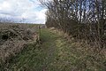
 Footpath and track - geograph.org.uk - 1427783.jpg 640 × 480 ; 264 kio
-
 Footpath at Mark Cooper's Wood - geograph.org.uk - 5701193.jpg 1 600 × 1 064 ; 1,1 Mio
-
 Footpath leading to Ulceby - geograph.org.uk - 5701341.jpg 1 600 × 1 064 ; 852 kio
-
 Footpath to Ulceby - geograph.org.uk - 3237401.jpg 640 × 427 ; 96 kio
-
 Footpath to Ulceby church - geograph.org.uk - 2567611.jpg 1 024 × 768 ; 352 kio
-
 Footpath to Ulceby, parallel to the A180 - geograph.org.uk - 4088004.jpg 640 × 427 ; 55 kio
-
 Footpath towards Mark Cooper's Wood - geograph.org.uk - 5701190.jpg 1 600 × 1 064 ; 1,06 Mio
-
 Footpath towards Mark Cooper's Wood - geograph.org.uk - 5701191.jpg 1 600 × 1 064 ; 761 kio
-
 Former chalk quarry - geograph.org.uk - 2391844.jpg 1 024 × 768 ; 212 kio
-
 Front Street (B1211) Junction with Coronation Road - geograph.org.uk - 2009872.jpg 983 × 1 000 ; 814 kio
-
 Gates and hedge to Lincolnshire farmland near Ulceby - geograph.org.uk - 3408334.jpg 1 024 × 768 ; 129 kio
-
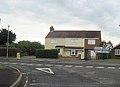
 Gillingham Rest, Ulceby - geograph.org.uk - 2021239.jpg 1 000 × 571 ; 420 kio
-

-
 Harvest near Ulceby - geograph.org.uk - 2566669.jpg 1 024 × 768 ; 254 kio
-
 Hillcrest, Carr Lane - geograph.org.uk - 2003860.jpg 1 024 × 768 ; 216 kio
-
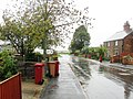
 Houses on Front Street, Ulceby - geograph.org.uk - 2011094.jpg 1 000 × 692 ; 550 kio
-
 Junction of A1077 and B1211 at Ulceby - geograph.org.uk - 2459772.jpg 640 × 466 ; 67 kio
-
 Lay-by no. 5 (from M180) east - geograph.org.uk - 3219818.jpg 1 024 × 768 ; 81 kio
-
 Lay-by ^4 A180 - geograph.org.uk - 3191983.jpg 1 024 × 596 ; 68 kio
-
 Left to Wootton, Right to Immingham - geograph.org.uk - 2354431.jpg 800 × 600 ; 224 kio
-
 Level crossing - geograph.org.uk - 2390357.jpg 1 024 × 768 ; 149 kio
-
 Level Crossing - geograph.org.uk - 251025.jpg 640 × 426 ; 127 kio
-
 Level crossing and former station house - geograph.org.uk - 3388560.jpg 1 200 × 900 ; 286 kio
-
 Level crossing and signal gantry - geograph.org.uk - 2391743.jpg 1 024 × 768 ; 147 kio
-
 Level crossing on Carr Lane - geograph.org.uk - 3388554.jpg 640 × 480 ; 88 kio
-

-

-
 Looking along the tracks towards Brocklesby Junction - geograph.org.uk - 2391758.jpg 1 024 × 768 ; 133 kio
-
 Looking north-west along Brocklesby Road - geograph.org.uk - 1204386.jpg 640 × 480 ; 67 kio
-
 Looking towards Killingholme - geograph.org.uk - 1401541.jpg 640 × 513 ; 120 kio
-

-
 Manor Farm, Ulceby - geograph.org.uk - 6025569.jpg 1 600 × 901 ; 672 kio
-
 Marker post at Mark Cooper's Wood - geograph.org.uk - 5701218.jpg 1 600 × 1 064 ; 1 013 kio
-
 Marker post near Vale House Farm - geograph.org.uk - 5701342.jpg 1 600 × 1 064 ; 1 023 kio
-
 Meadow Avenue, Ulceby - geograph.org.uk - 3722966.jpg 640 × 464 ; 59 kio
-
 Mill House - geograph.org.uk - 2889208.jpg 3 072 × 2 304 ; 1,16 Mio
-
 Mill House, Wootton Road - geograph.org.uk - 1932696.jpg 1 000 × 748 ; 504 kio
-
 Mobile library at Ulceby - geograph.org.uk - 5022819.jpg 640 × 484 ; 320 kio
-
 Near Ulceby Carr Farm - geograph.org.uk - 251204.jpg 640 × 426 ; 108 kio
-
 Near Ulceby Skitter - geograph.org.uk - 1401553.jpg 640 × 425 ; 99 kio
-
 New Housing on Coronation Road - geograph.org.uk - 2015544.jpg 1 000 × 750 ; 603 kio
-
 New Residential Development on Front Street, Ulceby - geograph.org.uk - 2011063.jpg 1 000 × 750 ; 688 kio
-
 Newsham track - geograph.org.uk - 2007089.jpg 640 × 426 ; 102 kio
-
 North Field Farm - geograph.org.uk - 844587.jpg 640 × 457 ; 69 kio
-
 North Field, near Ulceby - geograph.org.uk - 5022519.jpg 640 × 480 ; 415 kio
-

-
 North Lincolnshire farm land - geograph.org.uk - 3729185.jpg 800 × 451 ; 184 kio
-
 Old Cottage on Front Street - geograph.org.uk - 2015573.jpg 1 000 × 687 ; 673 kio
-
 Old huts next to Spur Plat Wood - geograph.org.uk - 2391728.jpg 1 024 × 768 ; 135 kio
-

-
 Old Railway Telephone Cabinet - Bystaple Lane LC - geograph.org.uk - 1907370.jpg 819 × 1 000 ; 924 kio
-
 On final approach - geograph.org.uk - 1048781.jpg 640 × 480 ; 38 kio
-
 Passenger train for Cleethorpes - geograph.org.uk - 1052551.jpg 640 × 426 ; 93 kio
-
 Patch of waste ground 1 - geograph.org.uk - 1427805.jpg 640 × 480 ; 237 kio
-
 Patch of waste ground 2 - geograph.org.uk - 1427821.jpg 480 × 640 ; 240 kio
-
 Path at Ladypits Plantation - geograph.org.uk - 5702049.jpg 1 600 × 1 064 ; 935 kio
-
 Path leading to Ladypits Plantation - geograph.org.uk - 5701353.jpg 1 600 × 1 064 ; 960 kio
-
 Path leading to Ladypits Plantation - geograph.org.uk - 5701383.jpg 1 600 × 1 064 ; 698 kio
-
 Path leading to Ladypits Plantation - geograph.org.uk - 5701392.jpg 1 600 × 1 064 ; 691 kio
-
 Path leading to Ladypits Plantation - geograph.org.uk - 5702041.jpg 1 600 × 1 064 ; 575 kio
-
 Pelham Farm - geograph.org.uk - 3237397.jpg 640 × 427 ; 54 kio
-
 Phone box, Ulceby Skitter - geograph.org.uk - 5022829.jpg 480 × 640 ; 472 kio
-
 Power lines crossing Carr Lane - geograph.org.uk - 4016217.jpg 1 024 × 748 ; 163 kio
-

-
 Priory Crescent, Ulceby - geograph.org.uk - 5022533.jpg 640 × 480 ; 359 kio
-
 Pylon and drain on Ulceby Carrs - geograph.org.uk - 5287288.jpg 524 × 640 ; 104 kio
-
 Pylon Ulceby Carr - geograph.org.uk - 4929511.jpg 753 × 1 024 ; 138 kio
-
 Pylons march across the Lincolnshire fields - geograph.org.uk - 4016225.jpg 1 024 × 768 ; 150 kio
-
 Quarry Access Road - geograph.org.uk - 2016982.jpg 1 000 × 657 ; 655 kio
-
 Quarry beside A180 - geograph.org.uk - 373798.jpg 640 × 423 ; 62 kio
-

-
 Rail Line to Thornton Abbey - geograph.org.uk - 1907441.jpg 1 000 × 834 ; 895 kio
-
 Rail tracks near Vale House Farm - geograph.org.uk - 5701335.jpg 1 600 × 1 064 ; 732 kio
-
 Rail tracks near Vale House Farm - geograph.org.uk - 5701337.jpg 1 600 × 1 064 ; 805 kio
-
 Rails west from Brocklesby - geograph.org.uk - 2459777.jpg 640 × 480 ; 97 kio
-
 Railway heading north. - geograph.org.uk - 3388816.jpg 1 200 × 900 ; 299 kio
-
 Railway Signalling Apparatus - Bystaple Lane LC - geograph.org.uk - 1907329.jpg 1 000 × 711 ; 795 kio
-
 Railway to Ulceby - geograph.org.uk - 581031.jpg 640 × 426 ; 130 kio
-
 Rape crop ready for harvest - geograph.org.uk - 1419620.jpg 640 × 480 ; 196 kio
-
 Reduce your speed, Ulceby ahead - geograph.org.uk - 3408340.jpg 1 024 × 768 ; 163 kio
-
 Ring For Gates - geograph.org.uk - 3729168.jpg 800 × 451 ; 191 kio
-
 Signals across the wheat - geograph.org.uk - 2003817.jpg 1 024 × 768 ; 163 kio
-
 Site of the old primary school, 1 - geograph.org.uk - 5689242.jpg 640 × 480 ; 88 kio
-
 Site of the old primary school, 2 - geograph.org.uk - 5689251.jpg 640 × 480 ; 94 kio
-
 Site of Ulceby C of E Primary School, 2018 - geograph.org.uk - 6025568.jpg 1 600 × 901 ; 751 kio
-
 Skitter Beck - geograph.org.uk - 2567081.jpg 1 024 × 768 ; 307 kio
-
 Slow on West End Road near Ulceby - geograph.org.uk - 4135302.jpg 1 024 × 768 ; 136 kio
-
 Southam Farm buildings at Ulceby - geograph.org.uk - 5311887.jpg 800 × 518 ; 97 kio
-
 Spoil heap - geograph.org.uk - 2391812.jpg 1 024 × 768 ; 138 kio
-
 Spruce Lane (B1211) Ulceby - geograph.org.uk - 2008465.jpg 1 000 × 685 ; 517 kio
-
 Start of the private road and fool's dump - geograph.org.uk - 1204373.jpg 640 × 480 ; 82 kio
-
 Station Road (A1077) - geograph.org.uk - 3388832.jpg 640 × 480 ; 69 kio
-
 Station Road, Ulceby - geograph.org.uk - 5022826.jpg 640 × 480 ; 430 kio
-
 Teasels and mullein by the old chalk quarry - geograph.org.uk - 4088037.jpg 640 × 427 ; 111 kio
-
 The Cleethorpes Coaster heads for Ulceby behind 60 099.jpg 2 550 × 2 830 ; 1,45 Mio
-
 The entrance to Ulceby Carr Farm - geograph.org.uk - 2003826.jpg 1 024 × 768 ; 355 kio
-
 The footpath to Ulceby - geograph.org.uk - 2391711.jpg 1 024 × 768 ; 198 kio
-
 The footpath to Ulceby Skitter - geograph.org.uk - 2567668.jpg 1 024 × 768 ; 250 kio
-
 The former Brocklesby station - geograph.org.uk - 2567678.jpg 1 024 × 768 ; 229 kio
-
 The Gatekeeper at work, Carr Lane near Ulceby - geograph.org.uk - 2030405.jpg 800 × 600 ; 305 kio
-
 The High Street in Ulceby - geograph.org.uk - 5311865.jpg 800 × 615 ; 113 kio
-
 The lane to Ulceby - geograph.org.uk - 2847715.jpg 1 024 × 768 ; 156 kio
-
 The Offices of North East Lindsey Drainage Board - geograph.org.uk - 2567635.jpg 1 024 × 768 ; 199 kio
-
 The old gate keepers cottage on Carr Lane - geograph.org.uk - 2030399.jpg 800 × 600 ; 262 kio
-
 The Railway towards Ulceby - geograph.org.uk - 1638179.jpg 640 × 440 ; 286 kio
-
 The remains of the churchyard cross, Ulceby - geograph.org.uk - 2567103.jpg 1 024 × 768 ; 241 kio
-
 The road into Ulceby - geograph.org.uk - 2028696.jpg 800 × 600 ; 281 kio
-
 The site of Ulceby Aerodrome Platform site.png 976 × 549 ; 849 kio
-
 Towards Willow Holt - geograph.org.uk - 1204890.jpg 640 × 480 ; 95 kio
-
 Track to North Field Farm - geograph.org.uk - 2003865.jpg 1 024 × 768 ; 184 kio
-
 Track to Sweetbriar Farm - geograph.org.uk - 3729162.jpg 800 × 451 ; 171 kio
-
 Track to the Pumping Station - geograph.org.uk - 2391152.jpg 1 024 × 768 ; 164 kio
-
 Track to the sewage works - geograph.org.uk - 3729188.jpg 800 × 451 ; 164 kio
-
 Track to Ulceby sewage works - geograph.org.uk - 2847710.jpg 1 024 × 768 ; 239 kio
-
 Train Coming - geograph.org.uk - 3036629.jpg 640 × 453 ; 345 kio
-
 Train near Brocklesby - geograph.org.uk - 2391142.jpg 1 024 × 768 ; 193 kio
-
 Train near the former Brocklesby railway station - geograph.org.uk - 5311917.jpg 800 × 693 ; 202 kio
-
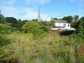
 Ulceby - geograph.org.uk - 56981.jpg 640 × 427 ; 105 kio
-
 Ulceby Carr - geograph.org.uk - 1401529.jpg 640 × 480 ; 121 kio
-
 Ulceby Carr Farm - geograph.org.uk - 2003831.jpg 1 024 × 768 ; 221 kio
-
 Ulceby Carr from a train - geograph.org.uk - 5045006.jpg 1 024 × 768 ; 104 kio
-
 Ulceby churchyard - geograph.org.uk - 6025570.jpg 1 600 × 901 ; 752 kio
-
 Ulceby Junction - geograph.org.uk - 198328.jpg 640 × 480 ; 98 kio


_Bridge_-_geograph.org.uk_-_1651530.jpg)


_-_geograph.org.uk_-_2448733.jpg)


_Junction_with_Coronation_Road_-_geograph.org.uk_-_2009872.jpg)


_east_-_geograph.org.uk_-_3219818.jpg)


_Ulceby_-_geograph.org.uk_-_2008465.jpg)

_-_geograph.org.uk_-_3388832.jpg)


