Category:Ulceby with Fordington
Aller à la navigation
Aller à la recherche
Cebuano: Ulceby with Fordington maoy parokya sa Hiniusang Gingharian. Ang Ulceby with Fordington nahimutang sa kondado sa Lincolnshire ug apil sa nasod sa Inglatera, sa habagatan-sidlakang bahin sa nasod, ka molupyo. (→Ulceby with Fordington)
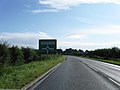
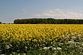
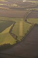
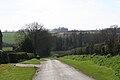
English: Ulceby with Fordington is a civil parish in the East Lindsey district of Lincolnshire, England. The parish is situated south-west from Alford. The A1028 road runs through the parish. (→Ulceby with Fordington)
Svenska: Ulceby with Fordington är en parish i Storbritannien. Den ligger i grevskapet Lincolnshire och riksdelen England, i den sydöstra delen av landet. (→Ulceby with Fordington)
localité britannique du comté anglais de Lincolnshire  | |||||
| Téléverser des médias | |||||
| Nature de l’élément | |||||
|---|---|---|---|---|---|
| Lieu | East Lindsey, Lincolnshire, Midlands de l'Est, Angleterre | ||||
 | |||||
Sous-catégories
Cette catégorie comprend 2 sous-catégories, dont les 2 ci-dessous.
U
Média dans la catégorie « Ulceby with Fordington »
Cette catégorie comprend 51 fichiers, dont les 51 ci-dessous.
-
 A1028 Bluestone Heath road - geograph.org.uk - 2694328.jpg 1 280 × 960 ; 231 kio
-
 A1028 south from Paildyke yard - geograph.org.uk - 3004245.jpg 640 × 471 ; 67 kio
-
 A1104 near Ulceby Lodge - geograph.org.uk - 3102507.jpg 2 256 × 1 504 ; 2,64 Mio
-
 A1104 west at Ulceby Lodge - geograph.org.uk - 3005554.jpg 640 × 460 ; 122 kio
-
 A16, Ulceby Cross - geograph.org.uk - 4132236.jpg 640 × 480 ; 57 kio
-

-
 Across the crop to Alford Road Plantation - geograph.org.uk - 3977369.jpg 640 × 427 ; 99 kio
-
 Airstrip, Dalby, aerial 2010 - geograph.org.uk - 4314223.jpg 640 × 372 ; 31 kio
-
 Airstrip, Dalby, aerial 2010 - geograph.org.uk - 4314229.jpg 427 × 640 ; 34 kio
-
 Bee swarm, Skendleby Psalter - geograph.org.uk - 4007409.jpg 427 × 640 ; 98 kio
-
 Claxby turning south of Ulceby - geograph.org.uk - 3004252.jpg 640 × 445 ; 83 kio
-
 Dalby, aerial 2017 - geograph.org.uk - 5504299.jpg 640 × 427 ; 49 kio
-
 Down the hedgeline towards Silver Pits - geograph.org.uk - 4007370.jpg 640 × 427 ; 54 kio
-
-
 Driby Top, aerial 2014 - geograph.org.uk - 3835327.jpg 640 × 427 ; 45 kio
-
 Earthworks at Fordington, aerial 2018 - geograph.org.uk - 5964859.jpg 800 × 533 ; 92 kio
-
 Entering Ulceby - geograph.org.uk - 3436842.jpg 2 256 × 1 504 ; 2,55 Mio
-

-
 Farm track leaving A1028 south - geograph.org.uk - 3004272.jpg 640 × 494 ; 57 kio
-
 Farm Track near Fordington Wood - geograph.org.uk - 3436850.jpg 2 256 × 1 504 ; 2,31 Mio
-
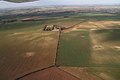
 Farmland north of Ulceby Cross, aerial 2017 - geograph.org.uk - 5531293.jpg 800 × 500 ; 61 kio
-
 Fordington - geograph.org.uk - 1938494.jpg 640 × 480 ; 63 kio
-
 Fordington junction south of Ulceby - geograph.org.uk - 3004258.jpg 640 × 469 ; 83 kio
-
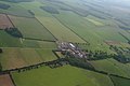
 Fordington, aerial 2019 - geograph.org.uk - 6190620.jpg 640 × 427 ; 65 kio
-
 Fordington, Low Plantation - geograph.org.uk - 5321826.jpg 640 × 427 ; 83 kio
-
 Fordington-aerial 2016 - geograph.org.uk - 5229947.jpg 427 × 640 ; 49 kio
-

-
 Haywain Motel Ulceby Cross - geograph.org.uk - 1961093.jpg 640 × 480 ; 75 kio
-
 It's Bluestone Heath^ - geograph.org.uk - 4007358.jpg 640 × 427 ; 60 kio
-
 Junction for Ulceby at Glebe Farm - geograph.org.uk - 3004248.jpg 640 × 405 ; 99 kio
-
 Junction on A1104 at Ulceby Lodge - geograph.org.uk - 3098526.jpg 1 504 × 2 256 ; 1,91 Mio
-
 Lane Junction with A1028, near Ulceby - geograph.org.uk - 2675267.jpg 1 280 × 960 ; 463 kio
-
 New hedge, Mark Vigrass was here - geograph.org.uk - 4007364.jpg 640 × 427 ; 85 kio
-
 Public footpath alongside Fordington Wood - geograph.org.uk - 1938796.jpg 640 × 480 ; 111 kio
-
 Road to Ulceby - geograph.org.uk - 3436836.jpg 2 256 × 1 504 ; 2,91 Mio
-
 Skendleby Psalter - geograph.org.uk - 3861892.jpg 640 × 427 ; 61 kio
-
 Skendleby Psalter, aerial 2014 - geograph.org.uk - 3834427.jpg 640 × 427 ; 35 kio
-
 Small pond by the road side Ulceby - geograph.org.uk - 1599082.jpg 640 × 425 ; 94 kio
-
 Sunny June evening view on the A1028 - geograph.org.uk - 4009484.jpg 640 × 427 ; 50 kio
-
 Taste of India Restaurant on Ulceby Cross - geograph.org.uk - 3435436.jpg 2 154 × 1 470 ; 1,7 Mio
-
 Tree lined road to Skendleby Psalter - geograph.org.uk - 1938784.jpg 640 × 480 ; 65 kio
-
 Ulceby Cross roundabout - geograph.org.uk - 1961091.jpg 640 × 480 ; 77 kio
-
 Ulceby Grange - geograph.org.uk - 1599071.jpg 425 × 640 ; 48 kio
-
 Ulceby Grange and wind turbine, aerial 2014 - geograph.org.uk - 3800430.jpg 640 × 427 ; 50 kio
-
 Ulceby, Grange and wind turbine, aerial 2014 - geograph.org.uk - 4035458.jpg 640 × 427 ; 46 kio
-
 Unknown structure, dated 1936 - geograph.org.uk - 3436826.jpg 2 256 × 1 504 ; 3,34 Mio
-
 Up the valley side - geograph.org.uk - 4007412.jpg 640 × 427 ; 61 kio
-
 Up the valley side - geograph.org.uk - 4007413.jpg 640 × 427 ; 84 kio
-
 White horse at the Grange, Ulceby - geograph.org.uk - 4007380.jpg 640 × 427 ; 76 kio
-
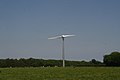 Wind turbine at Ulceby Grange - geograph.org.uk - 4007377.jpg 640 × 427 ; 25 kio
-
 Wind turbine at Ulceby Grange, aerial 2014 - geograph.org.uk - 3834301.jpg 640 × 427 ; 44 kio


_to_Ulceby,_aerial_2016_-_geograph.org.uk_-_5011581.jpg)


