Category:Ulley
Aller à la navigation
Aller à la recherche
English: Ulley is a village and civil parish of the Metropolitan Borough of Rotherham in South Yorkshire, England. It is located about east of Sheffield City Centre.
Nederlands: Ulley is een dorp (village) en civil parish in het bestuurlijke gebied Rotherham, in het Engelse graafschap South Yorkshire. De civil parish telt
village britannique | |||||
| Téléverser des médias | |||||
| Nature de l’élément | |||||
|---|---|---|---|---|---|
| Lieu | district métropolitain de Rotherham, Yorkshire du Sud, Yorkshire-et-Humber, Angleterre | ||||
| site officiel | |||||
 | |||||
Sous-catégories
Cette catégorie comprend 2 sous-catégories, dont les 2 ci-dessous.
H
- Holy Trinity Church, Ulley (7 F)
U
- Ulley Reservoir (4 F)
Média dans la catégorie « Ulley »
Cette catégorie comprend 137 fichiers, dont les 137 ci-dessous.
-
 "Royal Oak" pub sign in Ulley - geograph.org.uk - 6256131.jpg 3 392 × 4 660 ; 3,44 Mio
-
 "The Royal Oak" in Ulley - geograph.org.uk - 6256122.jpg 4 245 × 3 126 ; 2,77 Mio
-
 3 wind turbines from Penny Hill Wind Farm - geograph.org.uk - 5630533.jpg 4 316 × 2 464 ; 1,09 Mio
-
 A War Memorial at Ulley - geograph.org.uk - 2709774.jpg 800 × 600 ; 310 kio
-
 Brampton Lane - the bridge over the M1 motorway - geograph.org.uk - 3228664.jpg 4 608 × 3 072 ; 3,81 Mio
-
 Brampton Lane crosses the M1 motorway - geograph.org.uk - 2818163.jpg 1 024 × 768 ; 135 kio
-
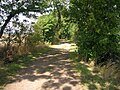
 Bridleway to Ulley - geograph.org.uk - 187448.jpg 640 × 480 ; 92 kio
-
 Carr Lane - geograph.org.uk - 1749079.jpg 480 × 640 ; 92 kio
-
 Carr Lane, Ulley - geograph.org.uk - 2818160.jpg 1 024 × 768 ; 169 kio
-
 Defibrillator at Ulley Village Hall - geograph.org.uk - 5914322.jpg 1 600 × 1 064 ; 579 kio
-
 Entering Ulley on Penny Hill Lane - geograph.org.uk - 5914142.jpg 1 600 × 1 064 ; 758 kio
-
 Entering Ulley, South Yorkshire - geograph.org.uk - 2709767.jpg 800 × 600 ; 277 kio
-
 Farmland off Penny Hill Lane - geograph.org.uk - 2573261.jpg 1 600 × 1 200 ; 488 kio
-
 Farmland off Stoket Lane - geograph.org.uk - 2573265.jpg 1 600 × 1 200 ; 591 kio
-
 First World War Memorial in Ulley - geograph.org.uk - 6256056.jpg 4 905 × 3 734 ; 4,36 Mio
-
 Flower arrangement in Holy Trinity Church, Ulley - geograph.org.uk - 3228454.jpg 4 298 × 3 070 ; 2,92 Mio
-
 Footbridge across Ulley Brook - geograph.org.uk - 5629550.jpg 5 376 × 3 024 ; 3,53 Mio
-
 Footbridge on Stow Bridge Lane - geograph.org.uk - 5914108.jpg 1 600 × 1 064 ; 894 kio
-
 Footbridge over the beck south of Ulley - geograph.org.uk - 6256157.jpg 5 184 × 3 888 ; 6,89 Mio
-
 Footbridge over the brook south of Ulley - geograph.org.uk - 4352566.jpg 1 600 × 1 200 ; 1,16 Mio
-
 Footbridge over Ulley Brook - geograph.org.uk - 5914727.jpg 1 600 × 1 064 ; 988 kio
-
 Footpath and Crop Fields near Ulley - geograph.org.uk - 5015534.jpg 4 608 × 3 456 ; 4,01 Mio
-
 Footpath junction, Stocket Lane - geograph.org.uk - 4354013.jpg 1 600 × 1 200 ; 855 kio
-
 Footpath leading to Guilthwaite Common Lane - geograph.org.uk - 5914329.jpg 1 600 × 1 064 ; 782 kio
-
 Footpath leading to Guilthwaite Common Lane - geograph.org.uk - 5914333.jpg 1 600 × 1 064 ; 750 kio
-
 Footpath leading to Guilthwaite Common Lane - geograph.org.uk - 5914336.jpg 1 600 × 1 064 ; 942 kio
-
 Footpath leading to Guilthwaite Common Lane - geograph.org.uk - 5914388.jpg 1 600 × 1 064 ; 791 kio
-
 Frosted path in Ulley Country Park - geograph.org.uk - 5628729.jpg 5 376 × 3 024 ; 4,14 Mio
-
 Heading down the Street - geograph.org.uk - 3228335.jpg 640 × 411 ; 120 kio
-
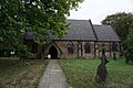 Holy Trinity Church, Ulley - geograph.org.uk - 5914165.jpg 1 600 × 1 064 ; 768 kio
-
 Holy Trinity Church, Ulley - geograph.org.uk - 5914169.jpg 1 064 × 1 600 ; 529 kio
-
 Holy Trinity Church, Ulley - geograph.org.uk - 5914175.jpg 1 600 × 1 064 ; 484 kio
-
 Holy Trinity Church, Ulley - geograph.org.uk - 5914181.jpg 1 064 × 1 600 ; 481 kio
-
 Holy Trinity Church, Ulley - geograph.org.uk - 5914184.jpg 1 140 × 1 600 ; 786 kio
-
 Holy Trinity Church, Ulley - geograph.org.uk - 5914189.jpg 1 600 × 1 064 ; 514 kio
-
 Holy Trinity Church, Ulley - geograph.org.uk - 5914191.jpg 1 064 × 1 600 ; 445 kio
-
 Holy Trinity Church, Ulley - geograph.org.uk - 5914194.jpg 1 064 × 1 600 ; 481 kio
-
 Holy Trinity Church, Ulley - geograph.org.uk - 6256784.jpg 4 971 × 3 729 ; 3,43 Mio
-
 Holy Trinity parish church, Ulley - geograph.org.uk - 5628733.jpg 5 376 × 3 024 ; 2,87 Mio
-
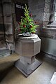
 Inside Holy Trinity Church, Ulley - geograph.org.uk - 6256150.jpg 4 890 × 3 785 ; 2,78 Mio
-
 Junction of paths on Stoker Lane - geograph.org.uk - 5914118.jpg 1 600 × 1 064 ; 967 kio
-
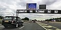
 Junction of the M1 and the M18 - geograph.org.uk - 2040503.jpg 640 × 480 ; 50 kio
-
 Looking back towards Turnshaw Farm, Ulley - geograph.org.uk - 3228478.jpg 4 386 × 2 924 ; 2,85 Mio
-
 Low afternoon sun on the Ulley reservoir - geograph.org.uk - 3230514.jpg 640 × 397 ; 56 kio
-
 M18 slip road from M1 - geograph.org.uk - 4572420.jpg 640 × 315 ; 137 kio
-
 Main Street, Ulley - geograph.org.uk - 2573258.jpg 1 600 × 1 200 ; 689 kio
-
 Main Street, Ulley - geograph.org.uk - 5628130.jpg 800 × 600 ; 119 kio
-
 Main Street, Ulley - geograph.org.uk - 5914233.jpg 1 600 × 1 064 ; 645 kio
-
 Main Street, Ulley - geograph.org.uk - 5914241.jpg 1 600 × 1 064 ; 513 kio
-
 Modern direction signs on an older post - geograph.org.uk - 5628129.jpg 584 × 800 ; 198 kio
-
 New bridge over the brook - geograph.org.uk - 1749083.jpg 640 × 480 ; 103 kio
-
 Path junction - geograph.org.uk - 1749086.jpg 640 × 480 ; 83 kio
-
 Path north of Ulley Reservoir - geograph.org.uk - 3228623.jpg 4 608 × 3 072 ; 3,08 Mio
-
 Path off Main Street, Ulley - geograph.org.uk - 5914325.jpg 1 600 × 1 064 ; 979 kio
-
 Penny Hill Lane - geograph.org.uk - 3228339.jpg 640 × 436 ; 105 kio
-
 Penny Hill Lane towards Main Street, Ulley - geograph.org.uk - 5914160.jpg 1 600 × 1 064 ; 761 kio
-
 Penny Hill Lane towards Ulley - geograph.org.uk - 5914125.jpg 1 600 × 1 064 ; 621 kio
-
 Penny Hill Lane towards Ulley - geograph.org.uk - 5914127.jpg 1 600 × 1 064 ; 916 kio
-
 Penny Hill Lane, Ulley - geograph.org.uk - 5914147.jpg 1 600 × 1 064 ; 542 kio
-
 Penny Hill Lane, Ulley - geograph.org.uk - 5914152.jpg 1 600 × 1 064 ; 552 kio
-
 Penny Hill Lane, Ulley - geograph.org.uk - 5914155.jpg 1 600 × 1 064 ; 642 kio
-
 Penny Hill Wind Farm - geograph.org.uk - 5628123.jpg 800 × 600 ; 72 kio
-
 Penny Hill Wind Farm - geograph.org.uk - 5628126.jpg 587 × 800 ; 62 kio
-
 Penny Hill Wind Farm - geograph.org.uk - 5628135.jpg 800 × 600 ; 66 kio
-
 Penny Hill Wind Farm - geograph.org.uk - 5630314.jpg 5 376 × 3 024 ; 3,78 Mio
-
 Penny Hill Wind Farm - geograph.org.uk - 5630316.jpg 1 728 × 1 080 ; 368 kio
-
 Penny Hill Wind Farm - geograph.org.uk - 6296101.jpg 1 024 × 768 ; 170 kio
-
 Pigs and poultry in muddy compound in Ulley - geograph.org.uk - 3228464.jpg 4 606 × 2 764 ; 3,55 Mio
-
 Pigs in field north of Spring Wood, Ulley - geograph.org.uk - 3228472.jpg 4 337 × 2 892 ; 2,96 Mio
-
 Post box on Main Street, Ulley - geograph.org.uk - 5914230.jpg 1 064 × 1 600 ; 851 kio
-
 Racing sailboats on Ulley Reservoir - geograph.org.uk - 3228601.jpg 4 606 × 2 764 ; 3,54 Mio
-
 Reservoir Road towards Ulley Reservoir - geograph.org.uk - 2708618.jpg 800 × 600 ; 281 kio
-
 Reservoir road Ulley - geograph.org.uk - 2818159.jpg 1 024 × 768 ; 153 kio
-
 Route 6 to Rotherham - geograph.org.uk - 187446.jpg 640 × 480 ; 82 kio
-
 Royal Oak pub, Ulley - geograph.org.uk - 4352568.jpg 1 600 × 1 200 ; 480 kio
-
 Slip road to the M18 from the M1 (North) - geograph.org.uk - 2095063.jpg 2 608 × 1 952 ; 847 kio
-
 South end of Ulley Reservoir - geograph.org.uk - 3228589.jpg 4 128 × 2 949 ; 2,76 Mio
-
 South Yorkshire Woodland Burial Ground - geograph.org.uk - 976366.jpg 640 × 480 ; 115 kio
-
 Start of footpath from Stoket Lane. - geograph.org.uk - 852905.jpg 500 × 375 ; 103 kio
-
 Start of Stoket Lane. - geograph.org.uk - 852906.jpg 500 × 375 ; 91 kio
-
 Stocket Lane bridge over Ulley Brook - geograph.org.uk - 4354020.jpg 1 600 × 1 200 ; 1,03 Mio
-
 Stoker Lane towards Penny Hill Lane - geograph.org.uk - 5914110.jpg 1 600 × 1 064 ; 1,17 Mio
-
 Stoker Lane towards Penny Hill Lane - geograph.org.uk - 5914117.jpg 1 600 × 1 064 ; 1,14 Mio
-
 Stoker Lane towards Penny Hill Lane - geograph.org.uk - 5914121.jpg 1 600 × 1 064 ; 741 kio
-
 Stoker Lane towards Penny Hill Lane - geograph.org.uk - 5914122.jpg 1 600 × 1 064 ; 882 kio
-
 Stoket Lane (Bridleway) - geograph.org.uk - 5012873.jpg 4 608 × 3 456 ; 3,88 Mio
-
 Stoket Lane (track) - geograph.org.uk - 2573260.jpg 1 600 × 1 200 ; 608 kio
-
 Stoket Lane (track) - geograph.org.uk - 2573263.jpg 1 600 × 1 200 ; 822 kio
-
 Stoket Lane - geograph.org.uk - 4352577.jpg 1 600 × 1 200 ; 680 kio
-
 Stoket Lane east of Ulley - a farm track - geograph.org.uk - 3228648.jpg 3 070 × 4 298 ; 3,49 Mio
-
 The M1 from Brampton Lane - geograph.org.uk - 2709765.jpg 800 × 600 ; 223 kio
-
 The Old Post Office, Main Street, Ulley - geograph.org.uk - 5914237.jpg 1 600 × 1 064 ; 642 kio
-
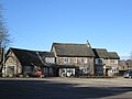
 The Royal Oak - geograph.org.uk - 5628276.jpg 800 × 600 ; 124 kio
-
 The Royal Oak, Ulley - geograph.org.uk - 2708230.jpg 800 × 600 ; 283 kio
-
 The Royal Oak, Ulley - geograph.org.uk - 2708233.jpg 600 × 800 ; 265 kio
-
 The South Yorkshire Woodland Burial Ground - geograph.org.uk - 2854327.jpg 800 × 600 ; 74 kio
-
 The South Yorkshire Woodland Burial Ground - geograph.org.uk - 2854331.jpg 800 × 600 ; 110 kio
-
 Trees by field path to Ulley - geograph.org.uk - 3228638.jpg 3 072 × 4 608 ; 3,22 Mio
-
 Turnshaw Common near Ulley - geograph.org.uk - 5015528.jpg 4 608 × 3 456 ; 4,1 Mio
-
 Turnshaw Farm, Ulley - geograph.org.uk - 6256152.jpg 4 857 × 3 576 ; 3,39 Mio
-
 Ulley - Main Street - geograph.org.uk - 956790.jpg 640 × 480 ; 64 kio
-
 Ulley - Penny Hill Lane - geograph.org.uk - 956795.jpg 640 × 480 ; 72 kio
-
 Ulley - Penny Hill Lane - geograph.org.uk - 956799.jpg 640 × 480 ; 72 kio
-
 Ulley and village sign - geograph.org.uk - 3228447.jpg 4 350 × 2 900 ; 2,6 Mio
-
 Ulley outside the church - geograph.org.uk - 3228332.jpg 640 × 441 ; 151 kio
-

-
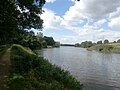
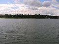 Ulley Reservoir - geograph.org.uk - 2573266.jpg 1 600 × 1 200 ; 381 kio
-
 Ulley reservoir - geograph.org.uk - 2818155.jpg 1 024 × 768 ; 140 kio
-
 Ulley Reservoir - geograph.org.uk - 5012860.jpg 4 608 × 3 456 ; 3,66 Mio
-
 Ulley Reservoir approaching dusk - geograph.org.uk - 5631064.jpg 5 376 × 3 024 ; 2,19 Mio
-
 Ulley Reservoir at peace - geograph.org.uk - 5626270.jpg 5 368 × 3 010 ; 2,17 Mio
-
 Ulley reservoir. - geograph.org.uk - 4485460.jpg 640 × 480 ; 119 kio
-
 Ulley Village Hall - geograph.org.uk - 3026020.jpg 640 × 426 ; 68 kio
-
 Ulley Village Hall - geograph.org.uk - 5914197.jpg 1 600 × 1 064 ; 460 kio
-
 Ulley village sign on Penny Hill Lane - geograph.org.uk - 5914130.jpg 1 600 × 1 064 ; 1,16 Mio
-
 Very tall mast near Spring Wood - geograph.org.uk - 4352556.jpg 1 600 × 1 200 ; 303 kio
-
 View Across Morthen Brook - geograph.org.uk - 5012889.jpg 4 608 × 3 456 ; 3,87 Mio
-
 View from the Royal Oak Public House, Ulley - geograph.org.uk - 1074074.jpg 640 × 480 ; 53 kio
-

-
 Well Dressing at Ulley Church - geograph.org.uk - 5012867.jpg 4 608 × 3 456 ; 3,79 Mio
-
 Wind turbine at the Penny Hill Wind Farm - geograph.org.uk - 5627121.jpg 800 × 600 ; 70 kio
-
 Wind turbine at the Penny Hill Wind Farm - geograph.org.uk - 5627123.jpg 600 × 800 ; 80 kio
-
 Wind turbine at the Penny Hill Wind Farm - geograph.org.uk - 5628121.jpg 581 × 800 ; 64 kio
-
 Wind turbine at Ulley Beeches - geograph.org.uk - 6256050.jpg 3 888 × 5 184 ; 5,68 Mio
-
 Wind turbine by Carr Lane - geograph.org.uk - 6256043.jpg 3 642 × 4 983 ; 4,3 Mio
-
 Wind turbine near Ulley - geograph.org.uk - 6256169.jpg 5 121 × 3 788 ; 2,47 Mio
-
 Wind turbine seen from below - geograph.org.uk - 6256172.jpg 4 543 × 3 395 ; 1,83 Mio
-
 Wind Turbines at Ulley Beeches - geograph.org.uk - 5465263.jpg 3 264 × 2 448 ; 3,06 Mio
-
 Winter scene in Ulley Country Park - geograph.org.uk - 5626850.jpg 800 × 600 ; 226 kio
-
 Conduit trig - geograph.org.uk - 131876.jpg 480 × 640 ; 113 kio
-
 Green Lane - geograph.org.uk - 187450.jpg 640 × 480 ; 103 kio
-
 Kissing Gate - geograph.org.uk - 134093.jpg 640 × 480 ; 142 kio
-
 Lake or Sky^ - geograph.org.uk - 116543.jpg 640 × 427 ; 73 kio
-
 The Royal Oak, Ulley - geograph.org.uk - 540901.jpg 640 × 428 ; 129 kio
-
 Ulley Country Park - geograph.org.uk - 84038.jpg 640 × 427 ; 55 kio
-
 Ulley Lane - geograph.org.uk - 116549.jpg 640 × 427 ; 105 kio
-
 Woodland Burial Ground - geograph.org.uk - 193243.jpg 640 × 480 ; 104 kio


_-_geograph.org.uk_-_2095063.jpg)


_-_geograph.org.uk_-_5012873.jpg)
_-_geograph.org.uk_-_2573260.jpg)
_-_geograph.org.uk_-_2573263.jpg)


