Category:Upton St Leonards
Aller à la navigation
Aller à la recherche
localité britannique du comté anglais de Gloucestershire  | |||||
| Téléverser des médias | |||||
| Nature de l’élément | |||||
|---|---|---|---|---|---|
| Lieu | Stroud, Gloucestershire, Angleterre du Sud-Ouest, Angleterre | ||||
| Population |
| ||||
 | |||||
English: Category:Villages in Gloucestershire
Sous-catégories
Cette catégorie comprend 2 sous-catégories, dont les 2 ci-dessous.
P
- Prinknash Abbey (10 F)
Média dans la catégorie « Upton St Leonards »
Cette catégorie comprend 251 fichiers, dont les 200 ci-dessous.
(page précédente) (page suivante)-
 'Didn't you read the sign^' - geograph.org.uk - 3684085.jpg 2 304 × 1 704 ; 1,6 Mio
-
 'Ex Tenebris Lux' - geograph.org.uk - 3684843.jpg 2 304 × 1 704 ; 1,62 Mio
-
 'Teal' - geograph.org.uk - 3684114.jpg 1 704 × 2 304 ; 1,45 Mio
-
 'The Chicken Coop' - geograph.org.uk - 3684124.jpg 2 304 × 1 704 ; 1,78 Mio
-
 15th century church tower, Upton St Leonards - geograph.org.uk - 3825612.jpg 615 × 800 ; 155 kio
-
 A break in the trees - geograph.org.uk - 4750822.jpg 6 000 × 4 000 ; 4,11 Mio
-
 A caravan called 'Eider' - geograph.org.uk - 3684097.jpg 1 704 × 2 304 ; 1,97 Mio
-
 A place of quiet - geograph.org.uk - 3684837.jpg 2 304 × 1 704 ; 1,22 Mio
-
 A46 passes the entrance to Prinknash Abbey Park - geograph.org.uk - 1982771.jpg 640 × 480 ; 122 kio
-
 Abbey emblem - geograph.org.uk - 3684820.jpg 2 304 × 1 704 ; 1,76 Mio
-
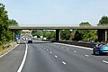
 Accommodation Bridge over the M5 near Matson - geograph.org.uk - 6114115.jpg 800 × 534 ; 604 kio
-
 Approaching M5 - geograph.org.uk - 4399066.jpg 640 × 480 ; 80 kio
-
 Artificial lake at Gloucester Services - geograph.org.uk - 5252673.jpg 6 000 × 4 000 ; 5,64 Mio
-
 Barn at Manor Farm - geograph.org.uk - 2220047.jpg 1 024 × 681 ; 165 kio
-
 Barn at Moorend - geograph.org.uk - 2220074.jpg 1 024 × 681 ; 174 kio
-
 Birchall Lane, Upton St Leonards - geograph.org.uk - 3760295.jpg 800 × 656 ; 187 kio
-
 Bondend Road houses, Upton St Leonards - geograph.org.uk - 3760452.jpg 800 × 544 ; 121 kio
-
 Bowden Hall - geograph.org.uk - 4807108.jpg 640 × 428 ; 83 kio
-
 Bowden Hall Hotel (geograph 6311934).jpg 1 024 × 768 ; 268 kio
-
 Bowden Hall Hotel - geograph.org.uk - 4928420.jpg 800 × 290 ; 70 kio
-
 Bridge over M5 - geograph.org.uk - 4624903.jpg 1 024 × 514 ; 69 kio
-
 Bridleway to Moorend - geograph.org.uk - 2218799.jpg 1 024 × 681 ; 194 kio
-
 Bridleway to Moorend - geograph.org.uk - 2220084.jpg 1 024 × 681 ; 249 kio
-
 Brookthorpe Services - geograph.org.uk - 5645402.jpg 683 × 1 024 ; 245 kio
-
 Buckholt and Rough Park Woods - geograph.org.uk - 3441724.jpg 800 × 600 ; 173 kio
-
 Bus for staff, M5 southbound services, Gloucester - geograph.org.uk - 6018534.jpg 1 024 × 614 ; 1,18 Mio
-
 Bus stop and road junction in Rough Park woodland - geograph.org.uk - 5640649.jpg 1 600 × 1 067 ; 752 kio
-
 Car park at Gloucester (Brookthorpe) services - southbound - geograph.org.uk - 5319006.jpg 1 600 × 1 067 ; 1,35 Mio
-
 Car park at Gloucester Services - geograph.org.uk - 4586903.jpg 800 × 531 ; 134 kio
-
 Car park, Gloucester Services - geograph.org.uk - 4586887.jpg 800 × 531 ; 106 kio
-

-
 Chipmunks Day Nursery, Upton St Leonards - geograph.org.uk - 3760430.jpg 800 × 527 ; 133 kio
-
 Chocolate box cottage, Upton St Leonards - geograph.org.uk - 2220065.jpg 1 024 × 681 ; 168 kio
-
 Church of St Leonard, Upton St Leonards - geograph.org.uk - 3825603.jpg 661 × 800 ; 163 kio
-
 Cleared stile - geograph.org.uk - 3597436.jpg 800 × 451 ; 198 kio
-
 Cold morning Frost at Bowden Hall Hotel - geograph.org.uk - 3258406.jpg 640 × 418 ; 74 kio
-
 Colourful character - geograph.org.uk - 3684101.jpg 1 704 × 2 304 ; 1,86 Mio
-
 Cotswold Way 051 - geograph.org.uk - 3934248.jpg 640 × 480 ; 110 kio
-
 Diverging bridleways - geograph.org.uk - 3597594.jpg 800 × 451 ; 192 kio
-

-
 Entrance to Gloucester Services - geograph.org.uk - 4586873.jpg 1 024 × 680 ; 254 kio
-
 Entrance to the walled garden at Prinknash - geograph.org.uk - 1982645.jpg 640 × 480 ; 118 kio
-
 Entrance to Upton St Leonards - geograph.org.uk - 4399063.jpg 640 × 464 ; 54 kio
-
 Entrance to Upton St Leonards recreation ground - geograph.org.uk - 3760396.jpg 800 × 636 ; 146 kio
-
 Farmland at Pecked Acres - geograph.org.uk - 2220146.jpg 1 024 × 681 ; 178 kio
-
 Farmland at Upton St Leonards - geograph.org.uk - 6311930.jpg 1 024 × 768 ; 214 kio
-
 Field north east of High Street - geograph.org.uk - 4267734.jpg 640 × 480 ; 54 kio
-
 Footbridge over M5 south near Grove Court - geograph.org.uk - 4032222.jpg 640 × 466 ; 50 kio
-
 Footbridge over M5 south of Winnycroft Farm - geograph.org.uk - 3187027.jpg 1 024 × 768 ; 508 kio
-
 Footpath off Nuthill - geograph.org.uk - 3397679.jpg 640 × 480 ; 120 kio
-
 Fun in a caravan - geograph.org.uk - 3684121.jpg 2 304 × 1 704 ; 1,74 Mio
-
 Gate and footpath near Whitley Court - geograph.org.uk - 2220134.jpg 1 024 × 681 ; 222 kio
-
 Gloucester (Brookthorpe) Services - M5 southbound - geograph.org.uk - 5440188.jpg 1 600 × 1 200 ; 322 kio
-
 Gloucester (Brookthorpe) Services - southbound - geograph.org.uk - 5319002.jpg 1 600 × 1 067 ; 1,21 Mio
-
 Gloucester (Brookthorpe) Services southbound - geograph.org.uk - 5015915.jpg 2 560 × 1 819 ; 2,07 Mio
-
 Gloucester , M5 Motorway Roadworks - geograph.org.uk - 2794461.jpg 4 288 × 2 848 ; 4,96 Mio
-
 Gloucester , M5 Motorway Roadworks - geograph.org.uk - 2794464.jpg 4 288 × 2 848 ; 3,81 Mio
-
 Gloucester , M5 Motorway Roadworks - geograph.org.uk - 2795421.jpg 4 226 × 2 754 ; 4,15 Mio
-
 Gloucester , The M5 Motorway - geograph.org.uk - 2794457.jpg 4 218 × 2 740 ; 3,1 Mio
-
 Gloucester , The M5 Motorway Roadworks - geograph.org.uk - 2795423.jpg 4 288 × 2 848 ; 4,95 Mio
-
 Gloucester , The M5 Motorway Southbound - geograph.org.uk - 2795422.jpg 4 288 × 2 848 ; 4,5 Mio
-
 Gloucester Brookthorpe Services - geograph.org.uk - 5074020.jpg 1 280 × 853 ; 291 kio
-
 Gloucester from Prinknash Abbey - geograph.org.uk - 3289646.jpg 1 600 × 1 198 ; 326 kio
-
 Gloucester Services - geograph.org.uk - 4584397.jpg 1 024 × 680 ; 308 kio
-
 Gloucester Services - geograph.org.uk - 4586894.jpg 800 × 531 ; 144 kio
-
 Gloucester Services - geograph.org.uk - 4586913.jpg 800 × 531 ; 114 kio
-
 Gloucester services south on the M5 are now open - geograph.org.uk - 4624913.jpg 1 024 × 740 ; 119 kio
-
 Gloucester Services Southbound on the M5 - geograph.org.uk - 4736279.jpg 1 200 × 799 ; 326 kio
-
 Gloucester Services Southbound on the M5 - geograph.org.uk - 4736286.jpg 1 200 × 799 ; 317 kio
-
 Gloucester Services Southbound on the M5 - geograph.org.uk - 4736290.jpg 1 200 × 799 ; 217 kio
-
 Gloucester Services Southbound on the M5 - geograph.org.uk - 4736418.jpg 1 200 × 799 ; 357 kio
-
 Gloucester Services Southbound on the M5 - geograph.org.uk - 4736423.jpg 1 200 × 799 ; 253 kio
-
 Gloucester Services Southbound on the M5 - geograph.org.uk - 4736452.jpg 1 200 × 799 ; 332 kio
-
 Gloucester Services Southbound, main building and lake - geograph.org.uk - 5439769.jpg 1 280 × 960 ; 335 kio
-
 Gloucester Services, south bound - geograph.org.uk - 6089250.jpg 4 000 × 3 000 ; 2,36 Mio
-
 Gloucester Services, southbound - building and maze - geograph.org.uk - 5439773.jpg 1 280 × 909 ; 265 kio
-
 Gloucester Services, southbound, 1 - geograph.org.uk - 4888626.jpg 1 600 × 901 ; 685 kio
-
 Gloucester Services, southbound, 2 - geograph.org.uk - 4888634.jpg 1 600 × 901 ; 659 kio
-
 Grazing near Upton St Leonards - geograph.org.uk - 3397675.jpg 640 × 480 ; 72 kio
-
 Grazing quietly - geograph.org.uk - 3684103.jpg 2 304 × 1 704 ; 1,62 Mio
-
 Hatton Court Hotel - geograph.org.uk - 3344439.jpg 3 456 × 2 304 ; 3,54 Mio
-
 High Street - geograph.org.uk - 4267725.jpg 640 × 480 ; 64 kio
-
 High Street - geograph.org.uk - 4267739.jpg 640 × 480 ; 59 kio
-
 Hillside above Upton St Leonards - geograph.org.uk - 2220079.jpg 1 024 × 681 ; 186 kio
-
 Home for the creepy crawlies - geograph.org.uk - 3684132.jpg 1 704 × 2 304 ; 1,6 Mio
-
 Horses keeping their heads down - geograph.org.uk - 4267742.jpg 640 × 480 ; 61 kio
-
 Horses on Upton Hill - geograph.org.uk - 876332.jpg 640 × 497 ; 92 kio
-
 House, Prinknash Abbey - geograph.org.uk - 3289648.jpg 1 600 × 1 275 ; 654 kio
-
 Hucclecote , M5 Motorway - geograph.org.uk - 6283946.jpg 6 000 × 4 000 ; 4,94 Mio
-

-
 Inula hookeri - geograph.org.uk - 5067859.jpg 1 599 × 1 600 ; 1,63 Mio
-
 Just follow the doves - geograph.org.uk - 3684143.jpg 2 304 × 1 704 ; 1,61 Mio
-
 Kings Head name sign, Upton St Leonards - geograph.org.uk - 3760389.jpg 420 × 640 ; 111 kio
-
 Kings Head, Upton St Leonards - geograph.org.uk - 2218937.jpg 1 024 × 681 ; 174 kio
-
 Kings Head, Upton St Leonards - geograph.org.uk - 3760310.jpg 800 × 651 ; 147 kio
-
 L.E.D. lighting array - geograph.org.uk - 3682793.jpg 1 704 × 2 304 ; 1,85 Mio
-
 Landscaping a small pool at Gloucester services - geograph.org.uk - 5319012.jpg 1 600 × 1 067 ; 1,36 Mio
-
 Lay-by for A46 in Upton Wood - geograph.org.uk - 5640644.jpg 1 600 × 1 280 ; 832 kio
-
 Lodge for Prinknash Park - geograph.org.uk - 5640652.jpg 1 600 × 1 201 ; 837 kio
-
 Lodge to Prinknash Park - geograph.org.uk - 2220041.jpg 1 024 × 681 ; 196 kio
-
 M5 at Upton St Leonards - geograph.org.uk - 2218808.jpg 1 024 × 681 ; 137 kio
-
 M5 Brookthorpe Services here soon^ - geograph.org.uk - 2046154.jpg 640 × 480 ; 58 kio
-
 M5 Motorway - access road overbridge - geograph.org.uk - 2046185.jpg 640 × 480 ; 56 kio
-

-

-

-

-
 M5 Motorway approaching Upton St Leonards - geograph.org.uk - 2046172.jpg 640 × 480 ; 51 kio
-
 M5 northbound towards Junction 11a - geograph.org.uk - 4325569.jpg 1 600 × 1 200 ; 966 kio
-
 M5 northbound towards Junction 11a - geograph.org.uk - 4325570.jpg 1 600 × 1 200 ; 920 kio
-
 M5 northbound towards Junction 11a - geograph.org.uk - 4325574.jpg 1 600 × 1 200 ; 1,19 Mio
-
 M5 passes under Winnycroft Lane - geograph.org.uk - 3260083.jpg 640 × 480 ; 41 kio
-
 M5 southbound - geograph.org.uk - 3536950.jpg 640 × 462 ; 36 kio
-
 M5 southbound - geograph.org.uk - 3536951.jpg 640 × 449 ; 54 kio
-
 M5 southbound at Upton Lane bridge - geograph.org.uk - 3260082.jpg 640 × 480 ; 36 kio
-

-

-

-

-
 Magnificent figure - geograph.org.uk - 3684083.jpg 1 704 × 2 304 ; 2,05 Mio
-
 Mature oak tree - geograph.org.uk - 2220067.jpg 1 024 × 681 ; 149 kio
-
 Minor road bridge over M5 near Sneedham's Green - geograph.org.uk - 3187018.jpg 1 024 × 768 ; 554 kio
-
 Minor road bridge over M5 north of Upton St Leonards - geograph.org.uk - 3274303.jpg 1 024 × 768 ; 447 kio
-
 Minor road over the M5 - geograph.org.uk - 2220107.jpg 1 024 × 681 ; 145 kio
-

-
 New homes at Coopers Edge - geograph.org.uk - 913146.jpg 640 × 480 ; 44 kio
-
 New homes at Coopers Edge - geograph.org.uk - 913175.jpg 640 × 480 ; 46 kio
-

-
 Northbound M5 near Gloucester - geograph.org.uk - 6114196.jpg 800 × 533 ; 546 kio
-
 Northbound M5, Upton Lane Bridge - geograph.org.uk - 6114117.jpg 800 × 534 ; 545 kio
-
 Not an official version - geograph.org.uk - 3684107.jpg 1 704 × 2 304 ; 1,75 Mio
-
 Nuthill - geograph.org.uk - 3397677.jpg 1 200 × 900 ; 292 kio
-
 Nuthill heading east - geograph.org.uk - 3397689.jpg 640 × 480 ; 109 kio
-
 Nuthill, Upton St Leonards - geograph.org.uk - 3397668.jpg 1 024 × 768 ; 292 kio
-
 Ockold End - geograph.org.uk - 876373.jpg 640 × 480 ; 117 kio
-
 On Nut Hill - geograph.org.uk - 2217399.jpg 1 024 × 681 ; 209 kio
-
 Painswick Road south of Brockworth - geograph.org.uk - 5866453.jpg 1 990 × 1 454 ; 1,43 Mio
-
 Part of a monastery garden - geograph.org.uk - 5067849.jpg 1 600 × 901 ; 952 kio
-
 Path at the end of Valley Lane - geograph.org.uk - 3597621.jpg 800 × 451 ; 198 kio
-
 Path in Upton Wood - geograph.org.uk - 2737507.jpg 1 024 × 768 ; 646 kio
-
 Path through the meadow - geograph.org.uk - 876462.jpg 640 × 480 ; 105 kio
-
 Path through Upton Wood - geograph.org.uk - 4756702.jpg 6 000 × 4 000 ; 5,38 Mio
-
 Pillbox on Nut Hill - geograph.org.uk - 2220129.jpg 1 024 × 681 ; 212 kio
-
 Pope's Wood, Road from A48 to Upton St Leonards - geograph.org.uk - 1136267.jpg 640 × 479 ; 152 kio
-
 Prinknash Abbey - geograph.org.uk - 4249008.jpg 1 536 × 2 048 ; 666 kio
-
 Prinknash Abbey - geograph.org.uk - 4249023.jpg 2 048 × 1 536 ; 1,6 Mio
-
 Prinknash Abbey - geograph.org.uk - 999711.jpg 640 × 481 ; 81 kio
-
 Prinknash Abbey Monk chiming bells - geograph.org.uk - 999715.jpg 640 × 481 ; 110 kio
-
 Prinknash Abbey near Gloucester - geograph.org.uk - 6403686.jpg 1 801 × 1 201 ; 326 kio
-
 Prinknash Monastery - geograph.org.uk - 2478600.jpg 3 088 × 2 056 ; 1,69 Mio
-
 Rance Lane, Upton St Leonards - geograph.org.uk - 3760384.jpg 800 × 710 ; 241 kio
-
 Rance Pitch bungalows, Upton St Leonards - geograph.org.uk - 3760421.jpg 800 × 510 ; 119 kio
-
 Rance Pitch houses, Upton St Leonards - geograph.org.uk - 3760402.jpg 800 × 521 ; 94 kio
-
 Reclining under a tree - geograph.org.uk - 3684087.jpg 1 704 × 2 304 ; 2,04 Mio
-
 Red brick wall - geograph.org.uk - 4248995.jpg 2 048 × 1 536 ; 1,64 Mio
-
 Reflections at a service station - geograph.org.uk - 5439777.jpg 1 280 × 960 ; 243 kio
-
 Riding up The Portway - geograph.org.uk - 3597641.jpg 800 × 451 ; 204 kio
-
 Road to the abbey - geograph.org.uk - 4249036.jpg 2 048 × 1 536 ; 1,61 Mio
-
 Road to Upton St Leonards - geograph.org.uk - 2220130.jpg 1 024 × 681 ; 124 kio
-
 Robinswood Hill in May - geograph.org.uk - 5903714.jpg 1 024 × 614 ; 991 kio
-
 Robinswood Hill, Gloucester - geograph.org.uk - 2478581.jpg 3 088 × 2 056 ; 1,58 Mio
-
 Romeo and Juliette - geograph.org.uk - 3684095.jpg 1 704 × 2 304 ; 1,82 Mio
-
 Sapphire Way, Cooper's Edge - geograph.org.uk - 2214478.jpg 800 × 600 ; 354 kio
-
 Signpost at crossroads in Upton St Leonards - geograph.org.uk - 3825539.jpg 800 × 670 ; 143 kio
-

-
 Small Lake at Bowden Hall - geograph.org.uk - 5169350.jpg 640 × 428 ; 120 kio
-
 Southbound M5, Gloucester Services - geograph.org.uk - 5445321.jpg 640 × 427 ; 322 kio
-
 St Leonards Church - geograph.org.uk - 4941107.jpg 800 × 600 ; 105 kio
-
 St. Peter's Grange, Prinknash Abbey - geograph.org.uk - 3289647.jpg 800 × 451 ; 70 kio
-
 Staites Orchard, Upton St Leonards - geograph.org.uk - 3825537.jpg 800 × 607 ; 133 kio
-
 Stile overlooking the Severn Valley - geograph.org.uk - 1076429.jpg 640 × 480 ; 102 kio
-
 Stockley Way - geograph.org.uk - 3832568.jpg 800 × 451 ; 172 kio
-
 Stroud District , M5 Motorway - geograph.org.uk - 5951376.jpg 6 000 × 4 000 ; 7,52 Mio
-
 Stroud District , M5 Motorway - geograph.org.uk - 5951377.jpg 6 000 × 4 000 ; 7,54 Mio
-
 Stroud District , M5 Motorway - geograph.org.uk - 5951378.jpg 6 000 × 4 000 ; 6,84 Mio
-
 Stroud District , M5 Motorway - geograph.org.uk - 5951379.jpg 6 000 × 4 000 ; 7,32 Mio
-
 Stroud District , M5 Motorway - geograph.org.uk - 5951385.jpg 6 000 × 4 000 ; 7,65 Mio
-
 Sundial, Upton St Leonards - geograph.org.uk - 2217368.jpg 681 × 1 024 ; 199 kio
-

-
 The Ash Path bridge over M5 - geograph.org.uk - 3187036.jpg 1 024 × 768 ; 555 kio
-
 The Ash Path bridge over M5 south - geograph.org.uk - 4032217.jpg 640 × 497 ; 51 kio
-
 The Ash Path, Upton St Leonards - geograph.org.uk - 3825576.jpg 800 × 799 ; 220 kio
-
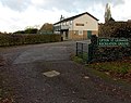
 The Birchall Memorial Institute - geograph.org.uk - 2218947.jpg 1 024 × 681 ; 130 kio
-
 The Birchall Memorial Institute - geograph.org.uk - 2218951.jpg 1 024 × 681 ; 152 kio
-

-
 The Cotswold Way at Cranham Corner - geograph.org.uk - 3832687.jpg 800 × 600 ; 334 kio
-
 The Cotswold Way at Rough Park - geograph.org.uk - 3440519.jpg 800 × 600 ; 168 kio
-
 The Cotswold Way in Upton Wood - geograph.org.uk - 3440501.jpg 800 × 600 ; 143 kio
-
 The Cotswold Way in Upton Wood - geograph.org.uk - 3440513.jpg 800 × 600 ; 181 kio
-
 The Cotswold Way in Upton Wood - geograph.org.uk - 4756710.jpg 6 000 × 4 000 ; 4,93 Mio
-
 The Cotswold Way leaving Upton Wood - geograph.org.uk - 5844102.jpg 3 776 × 2 520 ; 3,49 Mio
-
 The Cotswold Way through Buckholt Wood - geograph.org.uk - 5844100.jpg 3 776 × 2 520 ; 3,64 Mio
-
 The Cotswold Way towards Upton Wood - geograph.org.uk - 3440495.jpg 800 × 600 ; 160 kio
-
 The entrance to Prinknash Park - geograph.org.uk - 5866481.jpg 2 048 × 1 536 ; 2,59 Mio
-
 The M5 at Upton St Leonards - geograph.org.uk - 2218942.jpg 1 024 × 681 ; 160 kio
-
 The M5 southbound near Gloucester - geograph.org.uk - 3397605.jpg 640 × 480 ; 57 kio
-
 The Orangery Bowden Hall - geograph.org.uk - 4807104.jpg 640 × 428 ; 89 kio
-
 The party zone - geograph.org.uk - 3684116.jpg 1 704 × 2 304 ; 1,58 Mio
-
 The path at Rough Park - geograph.org.uk - 3441716.jpg 800 × 600 ; 149 kio
-
 The path joins Sanatorium Road - geograph.org.uk - 3441744.jpg 800 × 600 ; 229 kio


.jpg)


_services_-_southbound_-_geograph.org.uk_-_5319006.jpg)


_Services_-_M5_southbound_-_geograph.org.uk_-_5440188.jpg)
_Services_-_southbound_-_geograph.org.uk_-_5319002.jpg)
_Services_southbound_-_geograph.org.uk_-_5015915.jpg)


