Category:Uyea, Unst
Vai alla navigazione
Vai alla ricerca

island to the south of Unst, Shetland Islands, Scotland, UK  | |||||
| Carica un file multimediale | |||||
| Istanza di | |||||
|---|---|---|---|---|---|
| Parte di | |||||
| Luogo | Isole Shetland, Scozia | ||||
| Situato sul mare / lago / fiume | |||||
 | |||||
Sottocategorie
Questa categoria contiene un'unica sottocategoria, indicata di seguito.
U
File nella categoria "Uyea, Unst"
Questa categoria contiene 77 file, indicati di seguito, su un totale di 77.
-
 A misty night at Uyeasound - geograph.org.uk - 6236169.jpg 1 600 × 1 065; 416 KB
-
 A shower over Uyea - geograph.org.uk - 6323895.jpg 1 600 × 1 065; 231 KB
-

-
 Ayre of Heogland - geograph.org.uk - 3779175.jpg 1 024 × 577; 199 KB
-
 Ayre of Heogland - geograph.org.uk - 3779189.jpg 1 024 × 577; 175 KB
-
 Ayre of Heogland - geograph.org.uk - 5264487.jpg 1 600 × 900; 415 KB
-
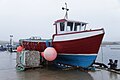 Boat on Uyeasound pier - geograph.org.uk - 5397815.jpg 1 024 × 682; 109 KB
-
 Bursoit, Uyea - geograph.org.uk - 3960326.jpg 1 024 × 681; 184 KB
-
 Clivocast pier - geograph.org.uk - 5593158.jpg 3 648 × 2 736; 3,49 MB
-
 Corbie Geo, Uyea - geograph.org.uk - 5807031.jpg 1 600 × 1 065; 552 KB
-
 Discarded salmon cages on a beach, Uyea - geograph.org.uk - 3960351.jpg 1 024 × 681; 124 KB
-
 East side of Uyeasound from the sea - geograph.org.uk - 3960370.jpg 1 024 × 681; 129 KB
-
 Enclosure at Vigrind, Uyea - geograph.org.uk - 5807024.jpg 1 600 × 1 065; 383 KB
-
 Fugla Stack, Ness of Littlegarth - geograph.org.uk - 3432365.jpg 1 024 × 681; 192 KB
-
 Hawks Ness, Uyea - geograph.org.uk - 5807022.jpg 1 600 × 1 065; 361 KB
-
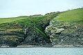
 Headland at the west end of Uyea - geograph.org.uk - 3960348.jpg 1 024 × 681; 209 KB
-
 Headland on Uyea - geograph.org.uk - 3960330.jpg 1 024 × 681; 143 KB
-
 Headland on Uyea - geograph.org.uk - 3960335.jpg 1 024 × 681; 155 KB
-
 Holm of Heogland - geograph.org.uk - 3779179.jpg 1 024 × 577; 134 KB
-
 Holm of Heogland - geograph.org.uk - 5264501.jpg 1 600 × 900; 432 KB
-
 Loch of Heogland and Holm of Heogland from Mula, Belmont - geograph.org.uk - 5468857.jpg 8 192 × 1 856; 3,61 MB
-
 MV Norholm at fish cages off Uyea - geograph.org.uk - 3126041.jpg 1 024 × 684; 158 KB
-
 North coast of Uyea - geograph.org.uk - 3960362.jpg 1 024 × 681; 187 KB
-
 Noust of Mula - geograph.org.uk - 5264481.jpg 1 600 × 900; 331 KB
-
 Noust of Mula - geograph.org.uk - 5264485.jpg 900 × 1 600; 361 KB
-
 Old salmon cages on the Ayre of Heogland - geograph.org.uk - 3779172.jpg 1 024 × 577; 169 KB
-
 Old salmon cages on the Ayre of Heogland - geograph.org.uk - 5264490.jpg 1 600 × 900; 336 KB
-
 Pier on Uyea from across Skuda Sound - geograph.org.uk - 3432378.jpg 1 024 × 681; 194 KB
-

-
 Salmon cages on the north side of Uyea - geograph.org.uk - 3960355.jpg 1 024 × 681; 106 KB
-
 Salmon farm off the south side of Uyea - geograph.org.uk - 3960380.jpg 1 024 × 682; 135 KB
-
 Salmon farm on the south side of Uyea - geograph.org.uk - 3960374.jpg 1 024 × 681; 131 KB
-
 Salmon farms on the south side of Uyea - geograph.org.uk - 3960384.jpg 1 024 × 682; 106 KB
-
 Scarf Stack, Hawks Ness, Uyea Isle - geograph.org.uk - 1497905.jpg 640 × 426; 40 KB
-
 Scarf Stack, off Uyea - geograph.org.uk - 5807018.jpg 1 600 × 1 065; 379 KB
-
 Small boat in a storm by the Uyeasound pier - geograph.org.uk - 4306800.jpg 1 024 × 681; 111 KB
-
 Stanesetter - geograph.org.uk - 687609.jpg 640 × 426; 59 KB
-
 The Haa on Uyea from Clivocast - geograph.org.uk - 2477154.jpg 800 × 533; 92 KB
-
 The Haa on Uyea from Mid Field, Uyeasound - geograph.org.uk - 5591657.jpg 1 024 × 683; 27 KB
-
 The Hall on Uyea - geograph.org.uk - 3477584.jpg 1 024 × 683; 88 KB
-
 The pier on Uyea Isle - geograph.org.uk - 1497788.jpg 640 × 426; 71 KB
-
 Tur Ness, Uyea Isle - geograph.org.uk - 1497791.jpg 640 × 426; 53 KB
-
 Tur Ness, Uyea, from the Ness of Littlegarth - geograph.org.uk - 3432356.jpg 1 024 × 682; 148 KB
-
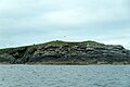
 Uyea and Haaf Gruney from Gallow Hill - geograph.org.uk - 3136616.jpg 1 024 × 681; 115 KB
-
 Uyea Hall - geograph.org.uk - 1071156.jpg 640 × 426; 71 KB
-
 Uyea Hall.jpg 640 × 393; 30 KB
-
 Uyea Isle - geograph.org.uk - 555962.jpg 640 × 426; 35 KB
-
 Uyea Isle - geograph.org.uk - 805394.jpg 640 × 426; 61 KB
-
 Uyea Isle from Clivocast - geograph.org.uk - 1497801.jpg 640 × 426; 46 KB
-
 Uyea isle from Gallow Hill - geograph.org.uk - 3136656.jpg 1 024 × 682; 95 KB
-
 Uyea isle from Ramnageo - geograph.org.uk - 2148942.jpg 800 × 533; 105 KB
-
 Uyea isle from Ramnageo - geograph.org.uk - 2148946.jpg 800 × 533; 169 KB
-
 Uyea Isle.jpg 640 × 392; 55 KB
-
 Uyea, late afternoon, from Ramnageo on Unst - geograph.org.uk - 6316091.jpg 1 600 × 1 067; 216 KB
-
 Uyeasound pier - geograph.org.uk - 4808370.jpg 1 024 × 682; 179 KB
-

-
 Vee Taing, Uyea - geograph.org.uk - 3960383.jpg 1 024 × 681; 143 KB
-
 Vee Taing, Uyea, from Rockfield, Uyeasound - geograph.org.uk - 5222032.jpg 1 024 × 683; 64 KB
-

-
-
 View from Uyea Breck towards Uyea and Fetlar - geograph.org.uk - 5102797.jpg 1 024 × 681; 107 KB
-
 View over Skuda Sound to Uyea and beyond - geograph.org.uk - 5582962.jpg 1 024 × 683; 67 KB
-

-

-
 View to the pier from Uyeasound Hall - geograph.org.uk - 5457465.jpg 1 024 × 682; 164 KB
-
 View to Uyea from above Heogland - geograph.org.uk - 2137944.jpg 800 × 534; 121 KB
-
-
 View to Uyea on a calm sunny evening - geograph.org.uk - 2963319.jpg 800 × 534; 161 KB
-
 View to Uyea on a very calm evening - geograph.org.uk - 2963328.jpg 800 × 533; 188 KB
-

-
 Wester Tail, Uyea - geograph.org.uk - 3810344.jpg 1 024 × 666; 125 KB
-
 Wester Tail, Uyea - geograph.org.uk - 3960332.jpg 1 024 × 681; 218 KB
-
 Wester Tail, Uyea - geograph.org.uk - 3960338.jpg 1 024 × 681; 193 KB
-
 Wester Tail, Uyea - geograph.org.uk - 3960344.jpg 1 024 × 681; 184 KB
-
 Winna Ness - geograph.org.uk - 805409.jpg 640 × 414; 39 KB
-
 Winna Ness, Uyea - geograph.org.uk - 1071136.jpg 640 × 426; 70 KB
-
 Winter sunset, Uyeasound - geograph.org.uk - 4794522.jpg 1 024 × 684; 126 KB


