Category:Van Diemen's Land
Salti al navigilo
Salti al serĉilo
British colony, later called Tasmania   | |||||
| Alŝuti plurmedion | |||||
| Estas |
| ||||
|---|---|---|---|---|---|
| Parto de | |||||
| Nomita laŭ | |||||
| Loko | Brita imperio | ||||
| Ĉe akvokorpo | |||||
| Dato de fondo aŭ kreo |
| ||||
| Dato de malfondo aŭ malkreo |
| ||||
| Plej alta punkto | |||||
| Areo |
| ||||
| Sekvulo |
| ||||
| Anstataŭigas |
| ||||
| Anstataŭiĝas per |
| ||||
| Alia ol | |||||
 | |||||
Subkategorioj
Ĉi tiu kategorio havas la 6 jenajn subkategoriojn, el 6 entute.
A
P
S
V
Dosieroj en kategorio “Van Diemen's Land”
La jenaj 21 dosieroj estas en ĉi tiu kategorio, el 21 entute.
-

-
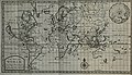 Cowley's Circumnavigation 1699.jpg 6 387 × 3 699; 5,24 MB
-

-

-
-
 AMH-8102-KB View of Van Diemensland.jpg 2 400 × 1 875; 614 KB
-
 Bank Of Van Diemans Land Logo 1830s Ledger.svg 512 × 132; 62 KB
-
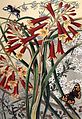 Blandfordia and Box.jpg 600 × 873; 98 KB
-
 Evans. Description of Van Diemans Land title page.jpg 2 599 × 1 482; 473 KB
-
 Fischfang der Wilden von Vandiemensland.jpg 783 × 665; 289 KB
-
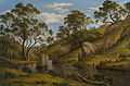
 John Glover - Mr Robinson's house on the Derwent, Van Diemen's Land - Google Art Project.jpg 5 009 × 2 490; 5,01 MB
-
 John Glover - Natives on the Ouse River, Van Diemen's Land - Google Art Project.jpg 5 001 × 3 364; 6,5 MB
-
 John Glover - The bath of Diana, Van Diemen's Land - Google Art Project.jpg 5 245 × 3 463; 6,75 MB
-
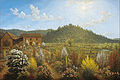
 John Glover - The River Nile, Van Diemen's Land, from Mr Glover's Farm (1837).jpg 3 000 × 1 998; 2,6 MB
-
 Hobart Town (15276699620).jpg 3 425 × 2 437; 2 MB
-
-
 Plan - Rokeby (Clarence Plains) - Church - proposed (St. Matthews) (15016633678).jpg 3 425 × 2 587; 1,02 MB
-

-
 A budgerigar with black markings from Cap de Diemen. Engravi Wellcome V0022118.jpg 3 225 × 2 176; 2,69 MB
-
 Van Diemen's Land Ensign.png 5 186 × 2 594; 89 KB
-
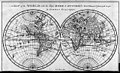
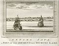
 Views of Ontong Java and Van Diemens Land 3663243111.jpg 1 107 × 1 500; 482 KB


.jpg)
.jpg)

_-_Church_-_proposed_(St._Matthews)_(15016633678).jpg)
.jpg)


