Category:Vosges mountains
Sari la navigare
Sari la căutare
medium mountain range in France .jpg)  | |||||
| Încarcă multimedia | |||||
| Este un/o | |||||
|---|---|---|---|---|---|
| Locul actual | |||||
| Constând în |
| ||||
| Lungime |
| ||||
| Cel mai înalt punct | |||||
| Suprafață |
| ||||
| Altitudine deasupra nivelului mării |
| ||||
 | |||||
Deutsch: Vogesen
English: The Vosges Mountains, a range of low mountains in eastern France, near its border with Germany.
Français : Massif des Vosges
Subcategorii
Această categorie conține următoarele 87 de subcategorii, dintr-un total de 87.
*
B
- Ballon de Belfahy (2 F)
- Ballon de Servance (37 F)
- Batteriekopf (9 F)
- Brézouard (22 F)
C
- Chalmont (17 F)
D
- Drumont (1 P, 21 F)
G
- Le Gaschney (35 F)
- Grand Ventron (10 F)
H
- Hangochet (2 F)
- Hilsenfirst (1 F)
J
- Jumeaux mountains (13 F)
- Jungfrauenkopf (5 F)
K
- Klintzkopf (3 F)
L
- Langenfeldkopf (1 F)
- Lauchenkopf (1 F)
- Louschbach (4 F)
M
- Marksteinkopf (2 F)
- Mont Ordon-Verrier (6 F)
N
- Nonselkopf (3 F)
P
- Petit Ventron (4 F)
R
- Rittempierre (11 F)
- Rocher du Coucou (12 F)
- Rossberg (chaume saint Dié) (9 F)
- Rothenbachkopf (22 F)
S
- Schneeberg (Vosges) (6 F)
- Schnepfenriedkopf (4 F)
- Schweisel (3 F)
- Spitzkoepfe (11 F)
- Steinberg (Haut-Rhin) (9 F)
- Sudel (5 F)
- Sudelkopf (2 F)
- Sérichamp (2 F)
T
- Le Tanet (17 F)
- Trehkopf (1 F)
- Tête des Chats (6 F)
- Tête des Cuveaux (8 F)
U
- Ungersberg (4 F)
V
- Voyemont (4 F)
W
- Wissgrut (11 F)
Pagini din categoria „Vosges mountains”
Această categorie conține doar următoarea pagină.
Fișiere media din categoria „Vosges mountains”
Următoarele 200 fișiere se află în această categorie, dintr-un total de 237.
(pagina anterioară) (pagina următoare)-
 - au sentier vers le steinberg 607.JPG 2.738x1.618; 3,52 MB
-
 00 2880 Badenweiler - Blick auf das Rheintal.jpg 6.626x2.100; 15,85 MB
-

-
 86 - AUBURE (Cure d'air, alt. 800 m.) - Bethel.jpg 3.869x2.441; 885 KB
-
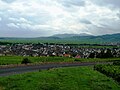
 A view of Bollschweil in Hexental (Baden).jpg 3.264x2.448; 382 KB
-
 Agricol impact on Arnica montana.JPG 3.072x1.289; 1,11 MB
-
 Albé, like a dream of Alsace.jpg 2.448x3.264; 6,8 MB
-
 Alsacia vinhas.jpg 1.600x1.200; 206 KB
-
 Amanite tue-mouches, forêt de sapins.jpg 2.592x2.142; 508 KB
-
 Andlau Bas-Rhin 2005-09-17.jpg 3.008x2.000; 1,46 MB
-
 Arnica montana production France.JPG 1.974x1.160; 611 KB
-
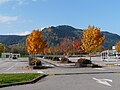
 Autumn on the Vosges mountains.jpg 3.072x2.304; 2,27 MB
-
 Autumn panoramic in the Vosges mountains.jpg 3.063x1.201; 1,02 MB
-

-
 Ballons des Vosges vus depuis la Plaine d'Alsace.jpg 1.024x768; 339 KB
-
 Belué 2(1).jpg 2.240x3.968; 4,51 MB
-
 Belué(1).jpg 3.968x2.240; 4,3 MB
-
 Blick ins Münstertal 140707.JPG 2.816x2.112; 2,38 MB
-
 Bois autour de la cascade du Nideck, Alsace.jpg 2.304x1.766; 1,49 MB
-

-
 Bois vosgien près d'Ottrott, Bas-Rhin.jpg 2.000x3.008; 1,98 MB
-
 Bois vosgien près de Mittlach, Haut-Rhin.jpg 2.000x3.008; 3,97 MB
-
 Breitenbach2008 007.jpg 1.600x1.200; 470 KB
-
 Breitfirst D27.JPG 4.608x3.072; 3,56 MB
-

-
 Bélué.png 937x581; 1,04 MB
-
 Bélué2.png 935x580; 984 KB
-
 Bélué3(1).jpg 3.968x2.240; 4,87 MB
-
 Camp celtique de la Bure - table d'orientation2.jpg 3.456x2.304; 5,16 MB
-
 Carte des Hautes Chaumes des Vosges, Thierry Alix (1576-1578).jpg 1.200x807; 1,99 MB
-
 Carte postale, Eloyes (Vosges), Vue générale (Au fond, montagne du Croc).jpg 1.640x1.065; 374 KB
-
 Champ De Fougères (236295889).jpeg 2.048x1.152; 1.008 KB
-
 Chaume de Felsach.jpg 4.320x3.240; 4,54 MB
-
 Chaume et sylves sommitales envahi par une mer nuageuse d'Alsace.jpg 1.448x836; 216 KB
-
 Cimetière gallo-romain de Beimbach.jpg 7.026x1.819; 7,99 MB
-
 Coucher de soleil au frais.jpg 4.927x2.349; 6,99 MB
-
 Coucher de soleil hivernal sur le piémont des Vosges.jpg 4.928x2.772; 5,73 MB
-
 Couleurs crépusculaires sur les Vosges.jpg 4.839x2.159; 7,8 MB
-
 Cretes vosges.jpg 2.272x1.704; 1,22 MB
-
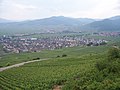
 Descending into Riquewihr through vineyards.jpg 3.008x2.000; 1,62 MB
-
 Dolleren.jpg 2.816x2.112; 1,64 MB
-

-
 Eclat-1418-bois.jpg 1.554x4.520; 1,45 MB
-
 Engelbourg 03.jpg 3.508x2.328; 1,72 MB
-
 Entrée fortofocations Purpurkopf.jpg 4.000x3.000; 5,1 MB
-
 Evette-90-paysage.JPG 312x245; 23 KB
-
 FietsenindeVogezen.JPG 4.320x3.240; 2,89 MB
-
 Fleckenstein castle P1320010.jpg 4.492x3.365; 19,33 MB
-
 Fleckenstein castle view P1310422-Pano.jpg 9.449x3.173; 26,97 MB
-
 Fleckenstein View pano.jpg 6.851x3.098; 19,38 MB
-
 Flottage des planches Schuler Théophile btv1b10215735c.jpg 1.317x1.054; 359 KB
-
 Forest in the Vosges mountains near Barr, Bas-Rhin.jpg 2.304x3.072; 3,52 MB
-
 Formation gisement houiller de Ronchamp.svg 1.098x709; 39 KB
-
 Forêt autour de la cascade du Nideck, Alsace.jpg 2.304x3.072; 3,66 MB
-
 Forêt versant nord Rocher de Mutzig.JPG 3.000x3.572; 2,79 MB
-

-

-
 Forêt vosgienne près d'Obernai (Bas-Rhin).jpg 3.008x2.000; 1,34 MB
-
 Forêt vosgienne près d'Obernai, Bas-Rhin.jpg 2.000x3.008; 1,57 MB
-
 Forêt vosgienne près de Barr, Bas-Rhin.jpg 3.008x2.000; 1,38 MB
-
 Forêt vosgienne près de Mittlach, Haut-Rhin.jpg 2.000x3.008; 3,28 MB
-
 Fr Vosges mountains from Haut-Koenigsbourg.jpg 3.648x2.736; 4,43 MB
-
 Fr Wuestenberg Pierre des druides.jpg 3.648x2.736; 5,61 MB
-
 FR-67-Landscape1.JPG 1.600x1.200; 415 KB
-
Fr-Paris--Vosges.ogg 0,7 s; 9 KB
-
 Fréland A 041.JPG 3.072x2.304; 3,16 MB
-
 Gazon du Faing.jpg 4.120x2.155; 2,13 MB
-
 GBplaine.jpg 2.272x1.704; 297 KB
-
 Goldbach-Altenbach 013.JPG 3.072x2.304; 3,14 MB
-
 Grand Ballon.Storkenkopf.jpg 2.272x1.704; 1,13 MB
-
 Guebwiller sous la neige.jpg 1.600x1.200; 720 KB
-
 Guebwiller.jpg 1.280x960; 283 KB
-
 Haut de Rittempierre Roche des Corbeaux prises au-dessus de l'Orme.jpg 2.000x1.500; 387 KB
-
 Hauts de la Schlucht 1.jpg 2.560x1.920; 2,74 MB
-
 Hauts de la Schlucht 2.jpg 2.560x1.920; 2,85 MB
-
 Hauts de la Schlucht 3.jpg 2.560x1.920; 2,85 MB
-
 Hauts de la Schlucht 4.jpg 2.560x1.920; 2,82 MB
-
 Heinrich (Henri) Ebel, Crépuscule (Abenddämmerung).jpg 716x1.000; 354 KB
-
 High Sierra in Alsace 2.jpg 3.072x2.070; 1,99 MB
-
 High Sierra in Alsace.jpg 3.072x2.304; 2,33 MB
-
 Hohbuhl.jpg 2.048x456; 149 KB
-
 Hohneck-gazonduFaing depuis Hurlin.jpg 2.368x640; 490 KB
-
 Hundskopf (Schweisel).JPG 4.320x2.880; 3,57 MB
-
 Janvier 2006 Vosges 2.jpg 1.600x1.200; 921 KB
-
 Janvier 2006 Vosges 3.jpg 1.600x1.200; 733 KB
-
 Janvier 2006 Vosges 4.jpg 1.600x1.200; 779 KB
-
 Janvier 2006 Vosges 5.jpg 1.600x1.200; 666 KB
-
 Janvier 2006 Vosges 6.jpg 1.280x960; 290 KB
-
 Janvier 2006 Vosges 7.jpg 1.280x960; 288 KB
-
 Janvier 2006 Vosges 8.jpg 1.280x960; 371 KB
-
 Janvier 2006 Vosges 9.jpg 1.280x960; 424 KB
-
 Janvier 2006 Vosges.jpg 1.600x1.200; 946 KB
-
 Jardins Parc Wesserling.jpg 3.072x2.048; 1,4 MB
-
 Kintzheim B 029.JPG 2.560x1.440; 1,16 MB
-
 Kruth vu depuis le château de Wildenstein.jpg 768x1.024; 416 KB
-
 L'abbaye de Murbach sous un soleil d'automne.JPG 3.264x2.448; 2,39 MB
-
 L'industrie obernoise au pied des Vosges.jpg 4.928x1.782; 4,94 MB
-

-
 La Hutte juillet 2010 007.JPG 4.000x3.000; 5,89 MB
-
 La Roche des Corbeaux réduite.jpg 1.500x1.125; 277 KB
-
 La Vancelle 008.JPG 2.560x1.440; 1,52 MB
-
 La Vue D En Haut (235229901).jpeg 2.048x1.366; 959 KB
-
 LaVancelleChurch.jpg 2.560x1.920; 2,34 MB
-
 Le Bonhomme 017.JPG 3.072x2.304; 3,25 MB
-
 Le Bonhomme 019.JPG 3.072x2.304; 3,05 MB
-
 Le Bonhomme, Alsace.jpg 2.357x1.707; 1,2 MB
-
 Le Donon vu depuis le Cimetière Militaire du Donon (France) - 001.jpg 4.608x3.456; 3,26 MB
-
 Le Haut-Koenigsbourg dans le flou.jpg 4.732x2.662; 7,23 MB
-

-
 Le Molkenrain.JPG 4.320x3.240; 2,95 MB
-
 Les Vosges (235229099).jpeg 2.048x1.152; 991 KB
-
 Les Vosges (236151343).jpeg 2.048x1.152; 1,07 MB
-
 Liepvre (vu du Chalmont) - panoramio.jpg 2.048x1.536; 690 KB
-
 Ligne bleue des Vosges.jpg 4.416x3.312; 1,14 MB
-
 Ligne bleue.JPG 800x600; 373 KB
-
 Los Vosgos.jpg 400x267; 30 KB
-
 Maison-vosgienne.jpg 1.801x1.477; 541 KB
-
 Massif de la Haute Bers vu depuis le Ballon d'Alsace.jpg 3.648x2.736; 2,68 MB
-
 Massif du Rossberg.jpg 2.848x2.136; 1,45 MB
-
 Metzeral (hiver 2006) 1.JPG 1.722x1.170; 276 KB
-
 Metzeral printemps.jpg 1.024x771; 905 KB
-

-
 Mohnenberg.JPG 1.600x1.200; 371 KB
-
 Mohnenberg2.jpg 4.000x3.000; 4,94 MB
-
 Molkenrain vom Großen Belchen.jpg 7.360x4.912; 11,94 MB
-
 Molkenrain.jpg 2.272x1.704; 1,1 MB
-
 Molkenrain1100.jpg 1.704x2.272; 403 KB
-
 Monument du 28e RIF.jpg 2.730x3.652; 2,77 MB
-
 Munster en hiver nov 2008.jpg 840x525; 171 KB
-
 Murbach 051.JPG 3.072x2.304; 1,97 MB
-
 Mutzig Felsbourg.jpg 400x285; 92 KB
-
 Myrtillier sauvage à l'automne.jpg 3.264x2.448; 3,1 MB
-
 Natzwiller-Vue(1).jpg 2.382x1.707; 693 KB
-
 Natzwiller-Vue(2).jpg 2.495x1.857; 891 KB
-
 Needle ice, Vosges.jpg 4.288x2.848; 7,49 MB
-
 Niedermorschwihr.jpg 1.024x768; 478 KB
-
 ObernaiMalgréNous.JPG 2.080x1.560; 422 KB
-
 Oberrheingraben-NASA-250.jpg 974x1.327; 661 KB
-
 Ormont tour relais radio-TV.JPG 4.000x3.000; 1,98 MB
-
 P1010069.JPG 1.600x1.200; 876 KB
-
 Panorama depuis la Tête du Chat sauvage.jpg 5.472x3.648; 8,47 MB
-
 Panorama depuis la vue des Vosges.jpg 3.495x2.331; 3,19 MB
-
 Panorama sur les Vosges.jpg 7.520x3.231; 11,23 MB
-
 Parc naturel des Vosges du Nord avec Château de Lœwenstein.jpg 1.368x1.824; 670 KB
-
 ParcBallonsVosges1.jpg 3.072x2.304; 1,8 MB
-
 Passée de Vanémont depuis le Haut de la Côte.jpg 2.557x1.300; 630 KB
-
 Pin sylvestre sur rocher.JPG 2.056x3.088; 2,27 MB
-
 PlaineGB.jpg 2.272x1.704; 442 KB
-
 Plan-chalet-chaume.png 1.176x708; 228 KB
-
 Point de vue du Guirbaden -2.jpg 5.180x2.560; 8,93 MB
-
 RaceVosgienne.jpg 1.024x768; 395 KB
-
 Reichsfeld 036.JPG 3.072x2.304; 3,02 MB
-
 Reisberg.jpg 2.560x1.920; 1,7 MB
-
 Rhein-Marne-Kanal Alsace.jpg 1.100x733; 278 KB
-
 Ribeauvillé et ses châteaux à l'entrée de la vallée du Strengbach.jpg 4.787x2.693; 7,23 MB
-
 Rimbach près Guebwiller 119.JPG 3.072x2.304; 3,39 MB
-
 Roche des Corbeaux col du Bon Dieu.jpg 2.000x1.500; 301 KB
-
 Roche Saint-Martin.jpg 2.000x1.500; 402 KB
-
 Rocher du coucou.jpg 2.048x1.536; 423 KB
-
 Rombach-le-Franc 047.JPG 2.560x1.920; 1,74 MB
-
 RSG-NASA-250.jpg 1.806x3.009; 2,63 MB
-
 Ruines marcaireries haut de loge.jpg 4.032x3.024; 5,61 MB
-
 Saint Nabor et le couvent Sainte Odile sous un coucher de soleil nuageux.jpg 4.801x2.701; 8,51 MB
-
 Saint-Dié-des-Vosges-La Madeleine.jpg 3.648x2.736; 2,34 MB
-
 Signal du Spitzemberg.jpg 2.495x893; 248 KB
-
 Sigolsheim 027.JPG 3.072x2.304; 3,29 MB
-
 Sigolsheim VTdJ.JPG 2.560x1.920; 1,04 MB
-
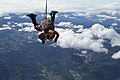 Skydiving France.jpg 5.184x3.456; 5,37 MB
-
 Small hill with snow in Vosges.jpg 6.072x4.736; 18,53 MB
-
 Solbach-Vue.jpg 3.452x2.520; 1,19 MB
-
 Sommet du Donon.jpg 4.608x3.456; 1,81 MB
-
 Spillmann - De l'hygiène des habitants des Hautes-Vosges, 1886.pdf 2.133 × 3.191, 24 de pagini; 3,91 MB
-
 Ste Marie aux mines - panoramio.jpg 2.048x1.536; 647 KB
-
 Ste Marie-aux-mines - panoramio.jpg 1.280x960; 290 KB
-
 Ste Marie-aux-Mines 010.JPG 2.560x1.920; 1,78 MB
-
 Storm Is Coming (235228331).jpeg 2.048x1.152; 720 KB
-
 Strobilomyces 050919 0062.JPG 1.664x2.496; 1,83 MB
-
 Tank top.JPG 2.592x1.728; 1,88 MB
-
 Terrasses de culture en pays sous-vosgien - Belfort.pdf 1.752x1.239; 374 KB
-
 Tete-des-champs-décembre-2006 1258.jpg 3.264x2.176; 1,11 MB
-
 Thur Thann.jpg 1.200x900; 220 KB
-
 Tâche de myrtilliers sauvages.jpg 2.448x3.264; 3,34 MB
-
 Tête de Fellering et Hasenkopf depuis le Drumont.jpg 4.320x3.240; 4,53 MB
-
 Tête des Russiers.jpg 4.320x3.240; 4,73 MB
-
 Urmatt-Forêt.jpg 2.832x2.082; 1,13 MB
-
 Vache vosgienne.jpg 1.059x1.536; 761 KB
-
 Vaches vosgiennes noires.jpg 3.264x2.448; 3,11 MB
-
 Vallee-chajoux.jpg 951x569; 118 KB
-
 Vallée de la Petite Fecht.jpg 1.024x768; 465 KB
-
 Vallée de la Wormsa 2.JPG 1.200x1.800; 238 KB
-
 Vallée de la Wormsa 4.JPG 1.712x1.158; 336 KB
-
 Vallée de la Wormsa1.JPG 1.716x1.164; 259 KB
-
 Vallée de Munster, Haut-Rhin.jpg 3.008x2.000; 2,85 MB
-
 Vallée du Nideck 1.JPG 4.000x2.530; 1,28 MB
-
 Vallée du Nideck 2.JPG 4.000x2.527; 1,5 MB
-
 Vallée du Nideck 3.JPG 4.000x2.527; 1,79 MB
-
 Veau de vache vosgienne.jpg 3.264x2.448; 3,12 MB
-
 View of Mittlach, Haut-Rhin.jpg 3.008x2.000; 2,73 MB
-
 Vignoble à Mittelwihr en hiver.jpg 3.264x2.448; 4,08 MB
-
 Vogesenblick Badenweiler Panorama.jpg 8.883x2.709; 11,12 MB


_-_Bethel.jpg)
.jpg)


_1.jpg)

.jpg)
.jpg)


.jpg)

.jpg)
,_Vue_g%C3%A9n%C3%A9rale_(Au_fond,_montagne_du_Croc).jpg)
.jpeg)


.jpg)


_Ebel,_Cr%C3%A9puscule_(Abendd%C3%A4mmerung).jpg)


.JPG)


.jpeg)


_-_001.jpg)

_vue_%C3%A0_partir_de_LAUW_-_panoramio.jpg)

.jpeg)
.jpeg)
_-_panoramio.jpg)


_1.JPG)


.jpg)
.jpg)


.jpeg)


_-_panoramio.jpg)