Category:Vredefort Dome
Vai alla navigazione
Vai alla ricerca
|
Questo sito è inserito nell'elenco del Patrimonio Mondiale dell'UNESCO sotto l'intitolazione :
Vredefort Dome.
|
largest verified impact crater on earth, dating from the Paleoproterozoic Era | |||||
| Carica un file multimediale | |||||
| Istanza di | |||||
|---|---|---|---|---|---|
| Prende il nome da | |||||
| Luogo |
| ||||
| Consiste di |
| ||||
| Designazione del patrimonio |
| ||||
| Data della scoperta o invenzione |
| ||||
| Diametro |
| ||||
| Superficie |
| ||||
| Considerato essere uguale a | Vredefort Impact Crater | ||||
 | |||||
Sottocategorie
Questa categoria contiene un'unica sottocategoria, indicata di seguito.
S
- Schoemansdrift (3 F)
Pagine nella categoria "Vredefort Dome"
Questa categoria contiene un'unica pagina, indicata di seguito.
File nella categoria "Vredefort Dome"
Questa categoria contiene 40 file, indicati di seguito, su un totale di 40.
-
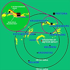
Map of Vredefort dome.jpg 10 000 × 8 319; 1,63 MB
-
South African Geology - Schwarz - 1912 Fig 51.png 1 516 × 1 301; 1,22 MB
-
The Quarterly journal of the Geological Society of London (1898) (14778506372).jpg 3 038 × 2 536; 1,53 MB
-
Vredefort crater & Witwatersrand.png 4 226 × 3 956; 383 KB
-
Vredefort crater & Witwatersrand2.png 4 226 × 3 956; 276 KB
-
Witwatersrand outcrops 2.jpg 10 000 × 9 902; 2,62 MB
-
Aasvoelkop - panoramio.jpg 2 048 × 1 536; 1,53 MB
-
Aasvoelkop - Vredefort dome - panoramio.jpg 2 048 × 1 536; 1,5 MB
-
Aasvoelkop and church - panoramio.jpg 1 024 × 681; 236 KB
-
Aasvoelkop.jpg 4 032 × 3 024; 4,91 MB
-
Church with Aasvoelkop in the background - panoramio.jpg 2 048 × 1 536; 1,19 MB
-
Fonteinplaas - panoramio.jpg 2 048 × 1 536; 1,23 MB
-
Fonteinplaas church - panoramio.jpg 2 048 × 1 536; 1,3 MB
-
Pseudotachylite Breccia of Vredefort in South Africa.jpg 1 280 × 851; 418 KB
-
Shocked zircon 02.jpg 2 323 × 2 869; 3,05 MB
-
Shocked zircon.jpg 6 630 × 5 075; 16,68 MB
-
Students in the field.jpg 4 032 × 3 024; 2,02 MB
-
Vaal river - from Aasvoelkop - panoramio.jpg 1 024 × 681; 250 KB
-
Vaal River, Vredefort Dome.jpg 3 525 × 2 133; 2,24 MB
-
Venterskroon, North West province, South Africa.jpg 3 222 × 2 053; 6,37 MB
-
Vredefort crater cross section 2.png 3 324 × 1 024; 131 KB
-
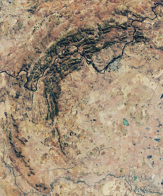
Vredefort Crater, South Africa, OLI satellite image, 27 June 2018 cropped.png 1 340 × 1 609; 5,58 MB
-
Vredefort Crater, South Africa, OLI satellite image, 27 June 2018.jpg 3 684 × 5 928; 9,32 MB
-
Vredefort crater.jpg 288 × 287; 28 KB
-
Vredefort dome - Vaal River - panoramio.jpg 2 048 × 1 536; 1,26 MB
-
Vredefort dome - world heritage site - panoramio.jpg 2 048 × 1 536; 1,47 MB
-
Vredefort Dome Information Centre.jpg 2 828 × 1 817; 3,24 MB
-
Vredefort Dome sign.jpg 3 228 × 2 189; 2,32 MB
-
Vredefort Dome STS51I-33-56AA.jpg 2 124 × 2 137; 1,93 MB
-
Vredefort Dome Vredefort-001.jpg 1 920 × 995; 770 KB
-
Vredefort Dome Vredefort-002.jpg 1 920 × 1 080; 907 KB
-
Vredefort dome world heritage site - panoramio.jpg 1 024 × 681; 229 KB
-
Vredefort Dome-113482.jpg 2 048 × 1 536; 1,06 MB
-
Vredefort Dome-113484.jpg 2 048 × 1 536; 1,09 MB
-
Vredefort Dome-113487.jpg 2 048 × 1 536; 1,16 MB
-
Vredefort Dome-113488.jpg 2 048 × 1 536; 1,16 MB
-
Vredefort Free State Wikivoyage Banner.jpg 3 969 × 567; 463 KB
-
Vredefort-arrow.jpg 641 × 524; 47 KB
-
Vredefort.jpg 1 024 × 768; 266 KB
-
Young geologist.jpg 4 032 × 3 024; 3,18 MB


