Category:Wackersberg
Salti al navigilo
Salti al serĉilo
komunumo en Bavario, Germanio    | |||||
| Alŝuti plurmedion | |||||
| Estas |
| ||||
|---|---|---|---|---|---|
| Parto de |
| ||||
| Loko | |||||
| Estro |
| ||||
| Loĝantaro |
| ||||
| Areo |
| ||||
| Supermara alteco |
| ||||
| Alia ol | |||||
| oficiala retejo | |||||
 | |||||
Subkategorioj
Ĉi tiu kategorio havas la 8 jenajn subkategoriojn, el 8 entute.
Dosieroj en kategorio “Wackersberg”
La jenaj 20 dosieroj estas en ĉi tiu kategorio, el 20 entute.
-
 DEU Wackersberg COA.svg 816 × 909; 39 KB
-
 Oberfischbach (Wackersberg).png 230 × 264; 15 KB
-
 Wappen von Wackersberg.png 127 × 140; 6 KB
-
 Bildstock Buchberg.jpg 3 648 × 5 472; 7,98 MB
-
 Brunnen Straß.jpg 3 648 × 5 472; 7,62 MB
-
 Kirchstein v. Probstbauernalm.jpg 3 258 × 2 074; 1,45 MB
-
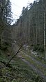
 Lainbach (Isar).jpg 1 456 × 2 592; 1,61 MB
-
 Lettenbach (Arzbach).jpg 1 456 × 2 592; 1,5 MB
-
 Nebellandschaft Wackersberg.jpg 4 000 × 3 000; 1,85 MB
-
 Ringelnatter Natrix Natrix 1.jpg 2 367 × 1 578; 3,02 MB
-
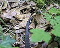 Ringelnatter Natrix Natrix 2.jpg 2 982 × 2 386; 4,94 MB
-
 Stallauer Weiher Bergpfad - panoramio.jpg 1 536 × 2 048; 660 KB
-
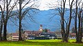
 Wackersberg v O 02.JPG 4 000 × 2 248; 3,04 MB
-
 Wackersberg v O.JPG 4 000 × 2 248; 1,61 MB
-
 Wackersberg v SO 02.JPG 4 000 × 3 000; 2,86 MB
-
 Wackersberg-2.jpg 4 896 × 2 752; 12,68 MB
-
 Wackersberg.jpg 4 000 × 3 000; 3,63 MB
-
 Wiese bei Linden - geo.hlipp.de - 12794.jpg 640 × 426; 128 KB
-
 Wiese bei Rothenrain - geo.hlipp.de - 12791.jpg 640 × 426; 185 KB
-
 Wiese zwischen Vorder- und Hinterrothenrain - geo.hlipp.de - 12792.jpg 640 × 426; 125 KB
.png)


.jpg)
.jpg)


