Category:Walbury Hill
ナビゲーションに移動
検索に移動
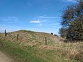
Deutsch: Walbury Hill 7 km südöstlich von Hungerford, Berkshire ist mit 297 m die höchste Erhebung in Süd-Ost England. Auf dem Hügel befinden sich die Überreste einer Befestigungsanlage aus der Eisenzeit.
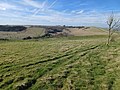
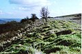
English: Walbury Hill is the highest point in the Berkshire region of the UK at higher than Leith Hill in Surrey which is the second highest point in the South East.
Norsk nynorsk: Walbury Hill er det høgaste punktet i Berkshire, 297 meter over havet. Det er òg det høgaste punktet i Søraust-England. Han er berre 3 meter høgare enn Leith Hill i Surrey, det nest høgaste punktet i Søraust-England.
hill in, and highest point of, the English county of Berkshire  | |||||
| メディアをアップロード | |||||
| 分類 | |||||
|---|---|---|---|---|---|
| 場所 | Combe, ウェスト・バークシャー, バークシャー, 南東イングランド, イングランド | ||||
| 標高 |
| ||||
| 主峰 | |||||
 | |||||
カテゴリ「Walbury Hill」にあるメディア
このカテゴリに属する 31 個のファイルのうち、 31 個を表示しています。
-
 Combe geograph-3589825-by-Ben-Brooksbank.jpg 2,375 × 1,483;2.75メガバイト
-
 Combe Gibbet views - east.jpg 1,600 × 1,200;619キロバイト
-
 Downland, Combe - geograph.org.uk - 763929.jpg 640 × 480;115キロバイト
-
 Test Way sign.jpg 428 × 655;123キロバイト
-
 The South Western Slopes of Walbury Hill - geograph.org.uk - 62332.jpg 640 × 480;414キロバイト
-
 View from Walbury Hill.jpg 2,272 × 1,704;1,008キロバイト
-
 Walbury Camp 01.jpg 4,000 × 3,000;4.14メガバイト
-
 Walbury Camp 02.jpg 4,000 × 3,000;4.19メガバイト
-
 Walbury Camp 03.jpg 4,000 × 3,000;4.99メガバイト
-
 Walbury Camp 04.jpg 4,000 × 3,000;7.22メガバイト
-
 Walbury Camp 05.jpg 4,000 × 3,000;5.12メガバイト
-
 Walbury Camp 06.jpg 4,000 × 3,000;5.61メガバイト
-
 Walbury Camp 07.jpg 4,000 × 3,000;4.75メガバイト
-
 Walbury Camp 08.jpg 4,000 × 3,000;4.83メガバイト
-
 Walbury Camp 09.jpg 4,000 × 3,000;5.79メガバイト
-
 Walbury Camp 10.jpg 4,000 × 3,000;3.65メガバイト
-
 Walbury Camp 11.jpg 4,000 × 3,000;5.33メガバイト
-
 Walbury Camp 12.jpg 4,000 × 3,000;4.35メガバイト
-
 Walbury Camp 13.jpg 4,000 × 3,000;5.25メガバイト
-
 Walbury Camp 14.jpg 4,000 × 3,000;4.81メガバイト
-
 Walbury Camp 15.jpg 4,000 × 3,000;5.85メガバイト
-
 Walbury Camp 16.jpg 4,000 × 3,000;4.14メガバイト
-
 Walbury Camp 17.jpg 4,000 × 3,000;4.29メガバイト
-
Walbury Camp aerial.webm 1分 10秒、 2,560 × 1,440;68.79メガバイト
-
 Walbury Hill - geograph.org.uk - 1895.jpg 640 × 480;57キロバイト
-
 Walbury Hill - geograph.org.uk - 763923.jpg 640 × 480;103キロバイト
-
 Walbury Hill - iron-age hillfort - geograph.org.uk - 1194117.jpg 640 × 420;76キロバイト
-
 Walbury Hill's southern side - geograph.org.uk - 762455.jpg 640 × 480;132キロバイト
-
 The Edge of Walbury Hill - geograph.org.uk - 59818.jpg 640 × 480;104キロバイト
-
 Valley between Summer and Walbury Hills - geograph.org.uk - 62315.jpg 640 × 480;164キロバイト
-


