Category:Walkern
Aller à la navigation
Aller à la recherche
English: Walkern (Derived from 'Walkerne') is a village and civil parish in East Hertfordshire. It is located on the River Beane about two miles from Stevenage, and is noted as the home of Jane Wenham, convicted for witchcraft in 1712. The village has several shops including a Londis, 'The Posy Palace' a flower shop, 'Jolie' a shop that features homestyle products, 'The Brewery Tearoom' serving fine teas and cakes, a drum shop, petrol station, a Christmas shop on the North side of the village and a public gallery near the White Lion public house. Other pubs include the Robin Hood and the Yew Tree which also offers Chinese cuisine. The village also features a primary school, doctors surgery, recreation ground and a range of seasonal clubs; according to the time of year there is cricket, football and many other clubs running. These function out of the 'Walkern Sports and Community Centre' towards the end of the village near the War Memorial and opposite an old mill.
village britannique  | |||||
| Téléverser des médias | |||||
| Nature de l’élément | |||||
|---|---|---|---|---|---|
| Lieu | East Hertfordshire, Hertfordshire, Angleterre de l'Est, Angleterre | ||||
 | |||||
Sous-catégories
Cette catégorie comprend 6 sous-catégories, dont les 6 ci-dessous.
W
- St Mary's Church, Walkern (4 F)
- Walkern Mill (2 F)
- Walkern War Memorial (3 F)
- The White Lion, Walkern (3 F)
Y
- The Yew Tree, Walkern (2 F)
Média dans la catégorie « Walkern »
Cette catégorie comprend 85 fichiers, dont les 85 ci-dessous.
-
 Across the field to The Bushes and Walkern - geograph.org.uk - 399013.jpg 640 × 480 ; 56 kio
-
 Amazing rainbow 1 (4464551889).jpg 2 640 × 1 980 ; 709 kio
-
 Amazing rainbow 2 (4464601955).jpg 2 640 × 1 980 ; 611 kio
-
 Amazing rainbow 5 (4465383260).jpg 3 472 × 2 604 ; 1,27 Mio
-
 Another crucifixion (4510732220).jpg 2 435 × 1 826 ; 1,07 Mio
-
 Aubries, Walkern - geograph.org.uk - 2283928.jpg 640 × 480 ; 63 kio
-
 B1037 heading south into Walkern - geograph.org.uk - 3102152.jpg 640 × 480 ; 89 kio
-
 Baron's Grove. - geograph.org.uk - 100392.jpg 640 × 482 ; 108 kio
-
 Benington and Burn's Green - geograph.org.uk - 4285169.jpg 3 264 × 2 448 ; 4,31 Mio
-
 Box Wood (8606873064).jpg 4 288 × 3 216 ; 4,41 Mio
-
 Box Wood - geograph.org.uk - 3102184.jpg 537 × 640 ; 67 kio
-
 Boxbury Farm and Stevenage from the air - geograph.org.uk - 2696575.jpg 640 × 480 ; 106 kio
-
 Bridleway to Churchend Common - geograph.org.uk - 534895.jpg 640 × 480 ; 109 kio
-
 Broken down grain store, Walkern - geograph.org.uk - 2997501.jpg 2 560 × 1 920 ; 1,1 Mio
-
 Byway Ford at Walkern - geograph.org.uk - 3458859.jpg 3 872 × 2 592 ; 2,36 Mio
-
 Caution Children about (5063249845).jpg 3 472 × 2 604 ; 1,63 Mio
-
 Cottages at Clay End - geograph.org.uk - 100406.jpg 640 × 527 ; 98 kio
-
 Country Lane - geograph.org.uk - 534915.jpg 480 × 640 ; 103 kio
-
 Cropped fields - geograph.org.uk - 534967.jpg 640 × 480 ; 128 kio
-
 Crossroads at Bassus Green - geograph.org.uk - 100401.jpg 640 × 482 ; 137 kio
-
 Farm building at Walkern Bury Farm (5736823958).jpg 2 312 × 1 734 ; 571 kio
-
 Farm building at Walkern Bury Farm (5736887187).jpg 2 640 × 1 980 ; 928 kio
-
 Farm building at Walkern Bury Farm (5736888359).jpg 2 643 × 1 977 ; 838 kio
-
 Farm track off Stevenage Road - geograph.org.uk - 3102180.jpg 640 × 480 ; 77 kio
-
 Farmland off Stevenage Road - geograph.org.uk - 3102179.jpg 640 × 480 ; 82 kio
-
 Farmland, Boxbury Farm - geograph.org.uk - 3102175.jpg 640 × 480 ; 50 kio
-
 Fields near Wood End from the air - geograph.org.uk - 3843885.jpg 640 × 480 ; 81 kio
-
 Fishermen's cars parked by the River Beane - geograph.org.uk - 3452800.jpg 4 320 × 3 240 ; 5,57 Mio
-
 Footpath along the field edge - geograph.org.uk - 534955.jpg 640 × 480 ; 139 kio
-
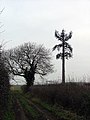 Footpath alongside mobile phone aerial. - geograph.org.uk - 118528.jpg 482 × 640 ; 106 kio
-
 Ford at Walkern - geograph.org.uk - 2997495.jpg 2 560 × 1 920 ; 1 Mio
-
 Fungus (4312606702).jpg 1 736 × 2 316 ; 840 kio
-
 Fungus (4312608228).jpg 2 318 × 1 736 ; 1 002 kio
-
 Funny little football head man (5106015728).jpg 2 318 × 1 738 ; 840 kio
-
 GOC Walkern and Great Ashby 001 Granary Cottage, Walkern (51392263661).jpg 4 106 × 3 083 ; 4,91 Mio
-
 GOC Walkern and Great Ashby 026 Great Ashby District Park (51396324877).jpg 4 608 × 3 456 ; 5,26 Mio
-
 GOC Walkern and Great Ashby 030 Great Ashby District Park (51397081726).jpg 4 608 × 3 456 ; 5,53 Mio
-
 GOC Walkern and Great Ashby 031 Great Ashby District Park (51397818184).jpg 4 608 × 3 456 ; 5,81 Mio
-
 GOC Walkern and Great Ashby 032 Great Ashby District Park (51397081546).jpg 4 608 × 3 456 ; 5,57 Mio
-
 GOC Walkern and Great Ashby 033 Great Ashby District Park (51397817874).jpg 4 608 × 3 456 ; 5,52 Mio
-
 Grazing land, Walkern - geograph.org.uk - 3102158.jpg 640 × 480 ; 65 kio
-
 Great Ashby - geograph.org.uk - 5548956.jpg 3 264 × 2 448 ; 3,54 Mio
-
 Gresley Way towards Great Ashby - geograph.org.uk - 3102187.jpg 640 × 480 ; 64 kio
-
 Hibernation 2 (5236675374).jpg 1 466 × 1 096 ; 238 kio
-
 High Street, Walkern - geograph.org.uk - 3102159.jpg 640 × 480 ; 81 kio
-
 High Wood, Berrington - geograph.org.uk - 4740265.jpg 3 264 × 2 448 ; 4,24 Mio
-
 Holmes Farm - geograph.org.uk - 534909.jpg 640 × 480 ; 112 kio
-
 Horse with swishy tail.jpg 2 640 × 1 980 ; 1,12 Mio
-
 Horses grazing - geograph.org.uk - 534920.jpg 640 × 480 ; 110 kio
-
 Houses on the A1037 at Walkern (geograph 4233939).jpg 3 623 × 2 714 ; 1,47 Mio
-
 Howell's Wood from the air - geograph.org.uk - 2964033.jpg 640 × 480 ; 110 kio
-
 Humberston (of Walkern, Hertfordshire) arms.svg 578 × 666 ; 13 kio
-
 Jubilee Plantation and Coble's Spring - geograph.org.uk - 399064.jpg 640 × 480 ; 74 kio
-
 Just Outside Stevenage - geograph.org.uk - 101591.jpg 640 × 479 ; 139 kio
-

-
 Looking towards Holmes Farm - geograph.org.uk - 534945.jpg 640 × 480 ; 101 kio
-
 Oakbeam, Ware-geograph.org.uk-4233939.jpg 518 × 417 ; 99 kio
-
 Old Rectory, Walkern-geograph.org.uk-4288150.jpg 4 320 × 3 240 ; 6,01 Mio
-
 Photograph of a bench (OpenBenches 164).jpg 2 466 × 1 849 ; 697 kio
-
 Ploughed Field - geograph.org.uk - 534950.jpg 640 × 480 ; 151 kio
-
 Ploughed field and woodland - geograph.org.uk - 534935.jpg 640 × 480 ; 122 kio
-
 Ploughed Fields - geograph.org.uk - 534928.jpg 640 × 480 ; 129 kio
-
 Ploughed fields - geograph.org.uk - 534940.jpg 640 × 480 ; 129 kio
-
 Ploughed fields - geograph.org.uk - 534976.jpg 640 × 480 ; 162 kio
-
 Ploughed fields - geograph.org.uk - 534981.jpg 640 × 480 ; 150 kio
-
 River Beane below Church End at Walkern - geograph.org.uk - 3655668.jpg 524 × 640 ; 105 kio
-
 River Beane seen from road bridge - geograph.org.uk - 3479462.jpg 4 320 × 3 240 ; 3,43 Mio
-
 Stevenage from the air - geograph.org.uk - 3029089.jpg 537 × 640 ; 149 kio
-
 Stevenage Road (B1037) - geograph.org.uk - 3102181.jpg 640 × 480 ; 62 kio
-
 Stevenage Road, Walkern (B1037) - geograph.org.uk - 3102171.jpg 640 × 480 ; 68 kio
-
 Sunrise at harvest time, Boxbury Farm - geograph.org.uk - 383422.jpg 640 × 480 ; 98 kio
-
 The Bungalow and Cornhill Common - geograph.org.uk - 302114.jpg 640 × 471 ; 132 kio
-
 The ford at Walkern - geograph.org.uk - 666074.jpg 640 × 480 ; 102 kio
-
 Track to Boxbury Farm - geograph.org.uk - 3102176.jpg 640 × 480 ; 57 kio
-
 Track to The Old Rectory - geograph.org.uk - 3102150.jpg 640 × 480 ; 81 kio
-
 Village infilling, Walkern - geograph.org.uk - 5591884.jpg 640 × 480 ; 108 kio
-
 Walkern - Manor Farm farmhouse (geograph 6869150).jpg 1 600 × 1 200 ; 759 kio
-
 Walkern Ford - geograph.org.uk - 3458870.jpg 3 872 × 2 592 ; 2,43 Mio
-
 Walkern from Walkern Lodge - geograph.org.uk - 3447498.jpg 2 121 × 1 314 ; 927 kio
-
 Walkern Hall - geograph.org.uk - 100399.jpg 640 × 318 ; 46 kio
-
 Walkern Park Farm from the air - geograph.org.uk - 3843867.jpg 640 × 480 ; 123 kio
-
 Walkern Park Farm from the air - geograph.org.uk - 3843874.jpg 640 × 417 ; 112 kio
-
 Walkern United Reformed Church (1811) - geograph.org.uk - 2105578.jpg 640 × 422 ; 98 kio
-
 War memorial, Walkern - geograph.org.uk - 5591881.jpg 640 × 480 ; 171 kio
-
 Boxbury Farm - geograph.org.uk - 302523.jpg 640 × 480 ; 90 kio

.jpg)
.jpg)
.jpg)
.jpg)


.jpg)


.jpg)


.jpg)
.jpg)
.jpg)


.jpg)
.jpg)
.jpg)
.jpg)
.jpg)
.jpg)
.jpg)
.jpg)
.jpg)


.jpg)


.jpg)

_arms.svg)


.jpg)


_-_geograph.org.uk_-_3102181.jpg)
_-_geograph.org.uk_-_3102171.jpg)


.jpg)


_-_geograph.org.uk_-_2105578.jpg)

