Category:Walkington
Vai alla navigazione
Vai alla ricerca
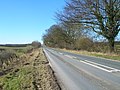
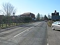
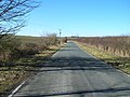
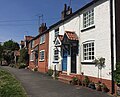
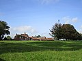
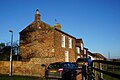
English: Walkington is a village and civil parish in the East Riding of Yorkshire, England. The village is on the B1230 road about 3 miles (5 km) southwest of Beverley.
village in the United Kingdom  | |||||
| Carica un file multimediale | |||||
| Istanza di | |||||
|---|---|---|---|---|---|
| Luogo | East Riding of Yorkshire, Yorkshire e Humber, Inghilterra | ||||
 | |||||
Sottocategorie
Questa categoria contiene le 9 sottocategorie indicate di seguito, su un totale di 9.
A
B
- The Barrel, Walkington (6 F)
D
- The Dog and Duck, Walkington (8 F)
H
- Hedges in Walkington (132 F)
L
- Little Wood, Walkington (5 F)
T
- The Old Rectory, Walkington (2 F)
W
- Walkington Hoard (3 F)
File nella categoria "Walkington"
Questa categoria contiene 200 file, indicati di seguito, su un totale di 386.
(pagina precedente) (pagina successiva)-
 A brief moment of quiet on the A1079 (geograph 6106349).jpg 1 024 × 768; 105 KB
-
 A Dwelling House, Walkington - geograph.org.uk - 679416.jpg 640 × 468; 86 KB
-
-
 A footpath towards Walkington - geograph.org.uk - 2174529.jpg 800 × 600; 296 KB
-
 A house in Walkington - Number 71 - geograph.org.uk - 1872075.jpg 2 608 × 1 952; 1,6 MB
-
 A Medieval silver coin; an Edwardian penny in two pieces (FindID 235910).jpg 1 443 × 1 176; 419 KB
-
 A play area at Walkington - geograph.org.uk - 2174533.jpg 800 × 600; 264 KB
-
 A post Medieval coin; silver threepence of Elizabeth I, 1582 (FindID 235909).jpg 1 413 × 1 110; 393 KB
-
 A wet day on the A1079 - geograph.org.uk - 6260698.jpg 1 024 × 691; 110 KB
-
 A1079 beverley westbound enh.png 300 × 225; 115 KB
-
 A1079 beverley westbound.jpg 2 048 × 1 536; 479 KB
-
 A1079 towards Hull - geograph.org.uk - 1861753.jpg 640 × 480; 69 KB
-
 Abandoned quarry - geograph.org.uk - 4471398.jpg 1 024 × 768; 199 KB
-
 Abbyo's Ice Cream Van, Walkington - geograph.org.uk - 4476802.jpg 2 448 × 1 624; 1,32 MB
-
 Access road to Butt Farm (geograph 3362082).jpg 4 000 × 3 000; 2,98 MB
-
-
 All Hallows Church, Kirk Lane, Walkington - geograph.org.uk - 3255174.jpg 1 200 × 1 600; 317 KB
-
 All Hallows Church, Kirk Lane, Walkington - geograph.org.uk - 3255179.jpg 1 600 × 1 200; 395 KB
-
 All Hallows Church, Kirk Lane, Walkington - geograph.org.uk - 3255184.jpg 1 200 × 1 600; 345 KB
-
 All Hallows Church, Walkington - geograph.org.uk - 2601956.jpg 768 × 1 024; 203 KB
-
 All Hallows Church, Walkington - geograph.org.uk - 4193425.jpg 1 942 × 2 428; 1,56 MB
-
 All Hallows Church, Walkington - geograph.org.uk - 5459816.jpg 1 200 × 799; 304 KB
-
 All Hallows Church, Walkington - geograph.org.uk - 5459820.jpg 1 200 × 799; 219 KB
-
 All Hallows Church, Walkington - geograph.org.uk - 5459823.jpg 799 × 1 200; 244 KB
-
 All Hallows Church, Walkington - geograph.org.uk - 5459827.jpg 1 200 × 799; 296 KB
-
 All Hallows Church, Walkington - geograph.org.uk - 5459838.jpg 1 200 × 799; 297 KB
-
 All Hallows Church, Walkington - geograph.org.uk - 5459843.jpg 753 × 1 200; 527 KB
-
 All Hallows Church, Walkington - geograph.org.uk - 5459850.jpg 799 × 1 200; 293 KB
-
 All Hallows Church, Walkington - geograph.org.uk - 5459856.jpg 994 × 1 200; 487 KB
-
 All Hallows Church, Walkington - geograph.org.uk - 5459860.jpg 755 × 1 200; 373 KB
-
 All Hallows Church, Walkington - geograph.org.uk - 5459867.jpg 1 029 × 1 200; 670 KB
-
 All Hallows Church, Walkington - geograph.org.uk - 5459870.jpg 660 × 1 200; 442 KB
-
 All Hallows Church, Walkington - geograph.org.uk - 5459876.jpg 1 200 × 799; 259 KB
-
 All Hallows church, Walkington - geograph.org.uk - 5785288.jpg 2 592 × 1 944; 1,88 MB
-
 All Hallows church, Walkington - geograph.org.uk - 5785293.jpg 1 943 × 2 592; 1 021 KB
-
 All Hallows parish church, Walkington - geograph.org.uk - 5729935.jpg 2 771 × 4 925; 3,26 MB
-
 All Pylon - geograph.org.uk - 2507733.jpg 2 638 × 3 464; 1,55 MB
-

-

-
 Autherd Drain - geograph.org.uk - 267203.jpg 640 × 425; 89 KB
-
 Autherd Garth, Walkington - geograph.org.uk - 614454.jpg 640 × 480; 179 KB
-
 Autherd Garth, Walkington - geograph.org.uk - 699852.jpg 640 × 480; 104 KB
-
 B1230 towards North Cave - geograph.org.uk - 1733461.jpg 800 × 600; 172 KB
-
 B1230 towards North Cave - geograph.org.uk - 1868360.jpg 640 × 480; 66 KB
-
 B1230 towards Walkington - geograph.org.uk - 1733145.jpg 800 × 600; 118 KB
-
 Bales still in a field in January - geograph.org.uk - 3375846.jpg 4 000 × 3 000; 3,35 MB
-
 Barley ripening on Ella Hill, Yorkshire Wolds (geograph 7227892).jpg 5 049 × 3 787; 4,81 MB
-
 Barn conversion, West End, Walkington - geograph.org.uk - 4209106.jpg 1 024 × 768; 210 KB
-
 Bell tower at the stables, Walkington Hall - geograph.org.uk - 4208983.jpg 768 × 1 024; 240 KB
-
 Beverley 20 footpath near Walkington - geograph.org.uk - 614479.jpg 640 × 480; 199 KB
-
 Beverley 20 footpath, Walkington - geograph.org.uk - 679438.jpg 640 × 485; 119 KB
-
 Beverley 20 towards Walkington - geograph.org.uk - 5102586.jpg 1 600 × 1 065; 626 KB
-
 Beverley 20 towards Walkington - geograph.org.uk - 5102594.jpg 1 600 × 1 065; 712 KB
-
 Beverley 20 towards Walkington - geograph.org.uk - 5102598.jpg 1 600 × 1 065; 760 KB
-
 Beverley 20 towards Walkington Plantation - geograph.org.uk - 5102583.jpg 1 600 × 1 065; 618 KB
-
 Beverley bypass (geograph 3209660).jpg 640 × 427; 63 KB
-
 Beverley Twenty near Beverley Westwood (geograph 6540037).jpg 1 600 × 1 065; 973 KB
-
 Beverley Twenty towards Beverley Westwood (geograph 6540034).jpg 1 600 × 1 065; 719 KB
-
 Blackmeredale Bottom - geograph.org.uk - 481167.jpg 480 × 640; 145 KB
-
 Bluestone Bottoms - geograph.org.uk - 1733477.jpg 800 × 600; 151 KB
-
 Bluestone Farm - geograph.org.uk - 1733472.jpg 800 × 582; 68 KB
-
 Boxing Day Hunt - geograph.org.uk - 97631.jpg 640 × 480; 101 KB
-

-
 Bridleway from Broadgate to Newbald Road - geograph.org.uk - 4946250.jpg 4 602 × 3 448; 6,78 MB
-
 Bridleway to Halfpenny Gate Cottage - geograph.org.uk - 1733467.jpg 800 × 600; 182 KB
-
 Building site, Walkington (geograph 6468565).jpg 1 024 × 816; 1,24 MB
-
 Bunting on East End, Walkington - geograph.org.uk - 4476787.jpg 2 448 × 1 624; 1,74 MB
-
 Bus shelter on East End, Walkington - geograph.org.uk - 4476777.jpg 2 448 × 1 624; 1,93 MB
-

-
 By Grange Farm on Walkington Wold - geograph.org.uk - 6110332.jpg 1 024 × 768; 314 KB
-
-
 Church Walk, Walkington - geograph.org.uk - 699836.jpg 640 × 480; 123 KB
-
 Church Walk, Walkington IMG 1625 - panoramio.jpg 1 400 × 742; 471 KB
-
 Close up, Elizabeth II postbox on Middlehowe Green, Walkington (geograph 6358089).jpg 1 440 × 2 728; 1,14 MB
-
 Common Road towards Walkington - geograph.org.uk - 1868936.jpg 640 × 480; 79 KB
-
 Coppleflat Lane (geograph 6436411).jpg 1 024 × 768; 182 KB
-
 Coppleflat Lane towards Bentley - geograph.org.uk - 2174541.jpg 800 × 600; 312 KB
-

-
 Coppleflat Lane, near Walkington - geograph.org.uk - 894345.jpg 640 × 480; 232 KB
-
 Coppleflat Lane, Walkington - geograph.org.uk - 699245.jpg 640 × 385; 50 KB
-
 Cottages in Walkington (geograph 6468508).jpg 1 024 × 810; 1,4 MB
-
 Crawberry Hill Anti-Fracking Protest Camp - geograph.org.uk - 4193503.jpg 2 488 × 1 933; 1,56 MB
-
 Crop to the east of Walkington (geograph 6538674).jpg 1 600 × 1 065; 777 KB
-
 Crop to the east of Walkington (geograph 6538685).jpg 1 600 × 1 194; 781 KB
-

-
 Crossroads at Walkington - geograph.org.uk - 6260760.jpg 1 024 × 531; 130 KB
-
 Crossroads on Walkington Heads (geograph 6360767).jpg 800 × 574; 129 KB
-
 Defibrillator on Walkington Village Hall (geograph 6360811).jpg 600 × 800; 157 KB
-
 Descending to Autherd Drain (geograph 4446665).jpg 1 280 × 960; 1,18 MB
-
 Distant Bales - geograph.org.uk - 63884.jpg 640 × 461; 117 KB
-
 Disused pit - geograph.org.uk - 4215003.jpg 1 024 × 768; 305 KB
-
 Downhill all the way B1230 into Walkington (geograph 6847305).jpg 3 578 × 2 607; 1,55 MB
-
 Dream Shakers ice cream van, Walkington - geograph.org.uk - 4476817.jpg 2 448 × 1 624; 1,67 MB
-
 Driveway to Littlewood - geograph.org.uk - 182699.jpg 640 × 480; 105 KB
-
 Duck swims across grid line - geograph.org.uk - 1772904.jpg 640 × 480; 150 KB
-
 East End (B1230), Walkington (geograph 6355230).jpg 4 644 × 3 329; 3,64 MB
-
 East End (B1230), Walkington - geograph.org.uk - 699842.jpg 640 × 480; 63 KB
-
 East End, Walkington - geograph.org.uk - 4476546.jpg 2 448 × 1 624; 1,98 MB
-
 East End, Walkington - geograph.org.uk - 4476773.jpg 2 448 × 1 624; 1,98 MB
-
 East End, Walkington - geograph.org.uk - 4476820.jpg 2 448 × 1 624; 1,55 MB
-
 East Plantation - geograph.org.uk - 174348.jpg 640 × 480; 81 KB
-
 East Plantation - geograph.org.uk - 6116059.jpg 1 024 × 768; 335 KB
-
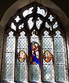
 East window, All Hallows church - geograph.org.uk - 4209111.jpg 1 024 × 768; 201 KB
-
 Elizabeth II postbox on Middlehowe Green, Walkington (geograph 6358087).jpg 3 096 × 2 268; 1,77 MB
-
 Ella Hill - geograph.org.uk - 743735.jpg 480 × 640; 199 KB
-
 Entering the Lion's Den - geograph.org.uk - 704465.jpg 640 × 433; 142 KB
-
 Entering Walkington - geograph.org.uk - 1227179.jpg 640 × 404; 37 KB
-
 Entrance to Middle Farm - geograph.org.uk - 6260773.jpg 1 024 × 850; 208 KB
-
 Entrance to Middle Farm on right B1230 (geograph 6847300).jpg 2 961 × 2 411; 1,09 MB
-
 Entrance to Moor Lane - geograph.org.uk - 1999713.jpg 2 304 × 1 728; 1,83 MB
-
 Entrance Walkington (geograph 6360783).jpg 800 × 572; 76 KB
-
 Farm Track - geograph.org.uk - 174341.jpg 640 × 480; 99 KB
-
 Farm track off Hunsley Road - geograph.org.uk - 4808567.jpg 1 024 × 768; 233 KB
-
 Farm track west of Littlewood Farm (geograph 7227910).jpg 3 888 × 5 184; 4,08 MB
-
 Farmland near Westfield Farm - geograph.org.uk - 1861804.jpg 640 × 480; 65 KB
-

-
 Farmland off Common Road - geograph.org.uk - 1868934.jpg 640 × 480; 89 KB
-
 Farmland West of Halfpenny Gate Cottage - geograph.org.uk - 1733470.jpg 800 × 600; 118 KB
-
 Farmland West of Walkington - geograph.org.uk - 1733462.jpg 800 × 600; 149 KB
-
 Field Bindweed - geograph.org.uk - 481158.jpg 640 × 463; 153 KB
-
 Field Boundary near Walkington Wold - geograph.org.uk - 1227204.jpg 640 × 480; 40 KB
-
 Field boundary off Burton Gates - geograph.org.uk - 4209154.jpg 1 024 × 768; 170 KB
-
 Field boundary off Wold Road - geograph.org.uk - 4209117.jpg 1 024 × 768; 208 KB
-
 Field edge footpath (geograph 4979666).jpg 4 608 × 3 456; 5,77 MB
-
 Field edge footpath toward Beverley Westwood (geograph 4979660).jpg 4 608 × 3 456; 5,16 MB
-
 Field edge plantation south of Middlehowe road - geograph.org.uk - 5012938.jpg 4 592 × 3 434; 5,58 MB
-
 Field edge track and Oilseed Rape crop - geograph.org.uk - 5012869.jpg 4 538 × 3 360; 4,65 MB
-
 Field edge track to Ella Hill - geograph.org.uk - 5012825.jpg 4 516 × 3 332; 5,66 MB
-
 Field near Westfield Farm - geograph.org.uk - 5691214.jpg 6 000 × 4 000; 5,58 MB
-
 Field off Middlehowe Road - geograph.org.uk - 4209120.jpg 1 024 × 768; 179 KB
-
 Field side track near Walkington - geograph.org.uk - 1227144.jpg 640 × 480; 51 KB
-
 Field track to Cold Harbour - geograph.org.uk - 5611781.jpg 640 × 480; 87 KB
-
 Fields and turbine near Sample's Farm - geograph.org.uk - 6116076.jpg 1 024 × 768; 171 KB
-
 Fields near Walkington - geograph.org.uk - 5611284.jpg 640 × 480; 89 KB
-
 Fields north of Bentley Moor Woods - geograph.org.uk - 1999732.jpg 2 304 × 1 728; 1,79 MB
-

-
 Footpath in Walkington - geograph.org.uk - 699859.jpg 640 × 480; 137 KB
-
 Footpath near Manor Farm - geograph.org.uk - 5687069.jpg 6 000 × 4 000; 6,14 MB
-
 Footpath north of Walkington - geograph.org.uk - 2832841.jpg 3 264 × 2 448; 1,95 MB
-
 Footpath on the southern fringe of Walkington - geograph.org.uk - 4467641.jpg 1 024 × 768; 225 KB
-
 Footpath T-junction - geograph.org.uk - 642904.jpg 640 × 469; 188 KB
-
 Footpath to Butt Farm (geograph 1999742).jpg 2 304 × 1 728; 1,79 MB
-
 Footpath to Walkington - geograph.org.uk - 1999682.jpg 2 304 × 1 728; 1,69 MB
-

-
 Galloping dog in Middlehowe Road - geograph.org.uk - 4251380.jpg 640 × 427; 65 KB
-
 Gate and entrance to footpath - geograph.org.uk - 4214701.jpg 1 024 × 768; 207 KB
-
 Gate on Moor Lane - geograph.org.uk - 4446632.jpg 1 280 × 960; 1,72 MB
-
 George V postbox on East End, Walkington (geograph 6355228).jpg 301 × 640; 53 KB
-
 Glazing at Walkington - geograph.org.uk - 5459914.jpg 1 200 × 799; 530 KB
-
 Halfpenny Gate Cottages (geograph 6436406).jpg 1 024 × 768; 121 KB
-
 Halfpenny Gate Cottages, Risby Park - geograph.org.uk - 716827.jpg 640 × 480; 204 KB
-
 High Beeches - geograph.org.uk - 5687075.jpg 6 000 × 4 000; 6,79 MB
-
 High Hunsley circuit path - geograph.org.uk - 6152159.jpg 1 024 × 768; 289 KB
-
 High Hunsley Circuit towards Bishop Burton - geograph.org.uk - 6040626.jpg 1 600 × 1 064; 473 KB
-
 House on Autherd Garth, Walkington (geograph 6360801).jpg 800 × 575; 123 KB
-
 House on Autherd Garth, Walkington - geograph.org.uk - 5102727.jpg 1 600 × 1 065; 589 KB
-
 House on Crake Wells (road) Walkington - geograph.org.uk - 5102718.jpg 1 600 × 1 065; 647 KB
-
 House on East End, Walkington - geograph.org.uk - 4476540.jpg 2 448 × 1 624; 1,2 MB
-
 Houses on West End, Walkington (geograph 6360826).jpg 800 × 547; 85 KB
-
 Houses on West End, Walkington (geograph 6468558).jpg 1 024 × 825; 1,23 MB
-
 Isbel Lane north of Walkington - geograph.org.uk - 3154415.jpg 640 × 427; 111 KB
-

-
 Lane's End near Holme-on-the-Wolds - geograph.org.uk - 709615.jpg 640 × 427; 197 KB
-

-
 Little Weighton Road (geograph 6361364).jpg 800 × 600; 88 KB
-
 Little Weighton Road, Walkington - geograph.org.uk - 1733464.jpg 800 × 600; 165 KB
-
 Little Wood - geograph.org.uk - 1861823.jpg 640 × 480; 151 KB
-
 Littlewood Farm - geograph.org.uk - 4979638.jpg 1 024 × 768; 158 KB
-
 Littlewood Farm - geograph.org.uk - 97931.jpg 640 × 480; 153 KB
-
 Littlewood Farm, near Walkington - geograph.org.uk - 802230.jpg 640 × 311; 119 KB
-
 Littlewood Road (geograph 7227906).jpg 3 787 × 5 049; 4,12 MB
-
 Littlewood Road passing on the left Littlewood Farm - geograph.org.uk - 5012879.jpg 3 842 × 2 882; 4,28 MB
-
 Littlewood Road toward Littlewood Farm - geograph.org.uk - 5012839.jpg 4 530 × 3 348; 4,78 MB
-
 Littlewood Road towards Newbald - geograph.org.uk - 1868384.jpg 640 × 480; 85 KB
-
 Long straight on the B1230 toward High Hunsley (geograph 6682624).jpg 1 552 × 1 164; 248 KB
-
 Looking south down Burton Gates - geograph.org.uk - 2216137.jpg 800 × 600; 318 KB
-
 Looking towards Ella Hill - geograph.org.uk - 1278554.jpg 640 × 480; 129 KB
-

-
-
 Manor Farm corner Middlehowe Road - geograph.org.uk - 2832852.jpg 3 264 × 2 448; 1,92 MB
-
 Manor Farm, Walkington - geograph.org.uk - 4214993.jpg 1 024 × 768; 153 KB
-
 Manor Farm, Walkington - geograph.org.uk - 6040613.jpg 1 600 × 1 064; 600 KB
-
 Manor Lane, Walkington - geograph.org.uk - 5687063.jpg 6 000 × 4 000; 7,38 MB
-
 Manorhouse Lane at Middlehowe Green, Walkington - geograph.org.uk - 6040619.jpg 1 600 × 1 064; 839 KB
-
 Manorhouse Lane from Northgate - geograph.org.uk - 6040256.jpg 1 600 × 1 064; 826 KB
-
 Manorhouse Lane, Walkington - geograph.org.uk - 6040605.jpg 1 600 × 1 064; 638 KB
-
 Manure to be spread after the harvest is in - geograph.org.uk - 5012911.jpg 4 608 × 3 456; 6,02 MB
-
 Massive Power - geograph.org.uk - 64049.jpg 640 × 481; 94 KB
-
 Meadow Way, Walkington - geograph.org.uk - 5102614.jpg 1 600 × 1 065; 561 KB
-
 Meadow Way, Walkington - geograph.org.uk - 5102617.jpg 1 600 × 1 065; 508 KB
-
 Meadow Way, Walkington - geograph.org.uk - 5102619.jpg 1 600 × 1 065; 484 KB
-
 Memorial in North Middlehowe Remembrance Wood - geograph.org.uk - 4606013.jpg 1 600 × 1 065; 847 KB
-
 Methodist Church Walkington.jpg 640 × 621; 150 KB
-
 Middlehowe Green, Walkington (geograph 6358097).jpg 5 184 × 3 888; 6,53 MB
-
 Middlehowe Lane - geograph.org.uk - 5687084.jpg 5 753 × 3 835; 4,7 MB
-
 Middlehowe Road - geograph.org.uk - 4209116.jpg 1 024 × 768; 222 KB
-
 Middlehowe Road near Walkington (geograph 7227904).jpg 3 888 × 5 184; 4,92 MB
-
 Middlehowe Road passing Westfield Lodge - geograph.org.uk - 5012944.jpg 4 040 × 2 904; 3,71 MB
-
 Middlehowe Road toward Walkington (2) - geograph.org.uk - 5012929.jpg 4 600 × 3 446; 4,91 MB
-
 Middlehowe Road toward Walkington - geograph.org.uk - 5012899.jpg 3 066 × 2 301; 2,26 MB
.jpg)


.jpg)

.jpg)


.jpg)


.jpg)


.jpg)
.jpg)
.jpg)


.jpg)


.jpg)

.jpg)


.jpg)

.jpg)
.jpg)


.jpg)
.jpg)
.jpg)


.jpg)


,_Walkington_(geograph_6355230).jpg)
,_Walkington_-_geograph.org.uk_-_699842.jpg)


.jpg)


.jpg)

.jpg)


.jpg)


.jpg)
.jpg)


.jpg)


.jpg)

.jpg)


.jpg)

_Walkington_-_geograph.org.uk_-_5102718.jpg)

.jpg)
.jpg)


_(28868523860).jpg)
.jpg)


.jpg)


.jpg)


.jpg)


.jpg)

_-_geograph.org.uk_-_5012929.jpg)
