Category:Wallops Island
Zur Navigation springen
Zur Suche springen
Insel in den Vereinigten Staaten  | |||||
| Medium hochladen | |||||
| Ist ein(e) | |||||
|---|---|---|---|---|---|
| Ort | Accomack County, Virginia | ||||
| Liegt am oder im Gewässer | |||||
| Einwohnerzahl |
| ||||
| Fläche |
| ||||
 | |||||
Unterkategorien
Diese Kategorie enthält folgende Unterkategorie:
In Klammern die Anzahl der enthaltenen Kategorien (K), Seiten (S), Dateien (D)
W
- Wallops Island (July 13, 2015) (32 D)
Medien in der Kategorie „Wallops Island“
Folgende 64 Dateien sind in dieser Kategorie, von 64 insgesamt.
-
 330-ps-9251-usn-710299 15486444489 o.jpg 2.268 × 2.928; 326 KB
-
 330-ps-9251-usn-710299a 15487516680 o.jpg 2.276 × 2.959; 836 KB
-
 330-ps-9307-428-gx-usn-710339 15414808698 o.jpg 3.451 × 1.980; 3,64 MB
-
 A parabolic antenna at Wallops Island (2268-202).jpg 1.196 × 1.568; 849 KB
-
 A parabolic antenna at Wallops Island (2268-203).jpg 1.180 × 1.808; 953 KB
-
 A-ONE visibility map.jpg 3.000 × 1.744; 719 KB
-
 Antares CRS-18 Launch.jpg 2.030 × 1.353; 412 KB
-
 Capsule Escape Tests - Wallops Island (LRC-1959-B701 P-02768).tif 5.640 × 3.804; 4,57 MB
-

-

-

-

-

-
 DR. JOHN CAMPELL-ABOUT GODDARD - DPLA - aeb33b2ddfe8ae6240a08635eca61ddc.jpg 2.920 × 1.903; 2,55 MB
-
 Electronic equipment at the Wallops Island CDA (2268-220).jpg 1.536 × 1.176; 1,24 MB
-

-
 First AFSWC Javelin Sounding Rocket On Launcher at Wallops Island (LRC-1959-B701 P-05144).tif 3.200 × 4.000; 11,28 MB
-
 First AFSWC Javelin Sounding Rocket On Launcher at Wallops Island (LRC-1959-B701 P-05145).tif 3.200 × 4.000; 11,33 MB
-
 First AFSWC Javelin Sounding Rocket On Launcher at Wallops Island (LRC-1959-B701 P-05146).tif 3.200 × 4.000; 22,76 MB
-
 First AFSWC Javelin Sounding Rocket On Launcher at Wallops Island (LRC-1959-B701 P-05147).tif 3.200 × 4.000; 11,24 MB
-
 First AFSWC Javelin Sounding Rocket On Launcher at Wallops Island (LRC-1959-B701 P-05148).tif 4.000 × 3.200; 10,85 MB
-
 GOES day night picture distribution (2268-511).jpg 2.487 × 1.701; 275 KB
-
 Graphic of GOES Central Data Distribution System (2297-24).jpg 1.776 × 1.200; 1,05 MB
-
 Graphic of GOES data collection system (2297-25).jpg 1.788 × 1.188; 1,09 MB
-

-
 HIWIND.jpg 1.041 × 781; 92 KB
-

-
 L4-478 Scout (ST-3) Systems Test in Shop (LRC-1960-B701 P-07980).tif 4.000 × 3.200; 9,55 MB
-
 Launch Area -3 for Scout - Wallops Island (LRC-1960-B701 P-07626).tif 4.947 × 4.304; 18,07 MB
-
 Launch of Orbital ATK’s Antares Rocket - Flickr - NASA Goddard Photo and Video.jpg 2.489 × 2.489; 308 KB
-
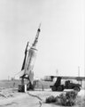 Little Joe on launcher at Wallops Island (LRC-1959-B701 P-05136).tif 3.630 × 4.538; 13,47 MB
-

-
 Minotaur V Launch with LADEE lunar probe - Flickr - brownpau.jpg 4.592 × 2.576; 2,91 MB
-
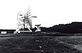
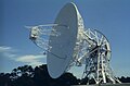
 Monitoring antenna tracking at Wallops Island (2268-195).jpg 1.760 × 1.188; 1,28 MB
-
 Monitoring satellite operations at Wallops Island (2268-212).jpg 1.496 × 1.200; 1,02 MB
-
 Nike-Cajun Sounding Rocket with University of Iowa Payload (LRC-1959-B701 P-03802).tif 3.021 × 3.787; 23,59 MB
-
 Nike-Cajun Sounding Rocket with University of Iowa Payload (LRC-1959-B701 P-03803).tif 3.833 × 2.808; 20,79 MB
-
 Northrop Grumman CRS-18 Cygnus Processing - Flickr - NASA Goddard Photo and Video.jpg 3.042 × 4.101; 1,77 MB
-
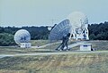
 Parabolic antennas at Wallops Island (2268-206).jpg 1.820 × 1.164; 857 KB
-

-
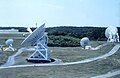
 Pre-GOES satellite antenna configuration at Wallops Island (2268-191).jpg 1.728 × 1.180; 1,05 MB
-
 Satellite antenna at Wallops Island, Virginia (2268-464).jpg 1.662 × 2.500; 560 KB
-
 Satellite antenna at Wallops Island, Virginia (2268-465).jpg 1.976 × 2.828; 745 KB
-
 Satellite antenna at Wallops Island, Virginia (2268-466).jpg 2.500 × 1.651; 453 KB
-
 Satellite antennas at Wallops Island (2268-512).jpg 2.424 × 3.484; 1,44 MB
-
 Satellite antennas at Wallops Island (2268-513).jpg 3.368 × 2.296; 1,02 MB
-
 Satellite antennas at Wallops Island (2268-514).jpg 2.500 × 1.628; 499 KB
-
 Satellite antennas at Wallops Island (2268-515).jpg 2.500 × 2.659; 705 KB
-
 Satellite antennas at Wallops Island (2268-516).jpg 2.500 × 1.598; 455 KB
-
 Satellite signal receiving station at Wallops Island, Virginia (2268-497).jpg 2.500 × 1.617; 499 KB
-
 Satellite signal receiving station at Wallops Island, Virginia (2268-498).jpg 2.500 × 1.653; 466 KB
-
 Satellite signal receiving station at Wallops Island, Virginia (2268-499).jpg 2.500 × 1.653; 459 KB
-
 The Black Brant XII Sounding Rocket Launched From Wallops Virginia (51184154448).jpg 4.007 × 2.603; 1,72 MB
-
 The Black Brant XII Sounding Rocket Launched From Wallops Virginia (51185013040).jpg 4.789 × 3.057; 2,96 MB
-
 The Command and Data Acquisition (CDA) station at Wallops Island (2268-125).jpg 1.820 × 968; 939 KB
-

-
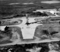
 Wallops Island - Overview.jpg 1.024 × 727; 191 KB
-
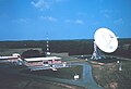
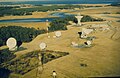
 Wallops Island Command and Data Acquisition (CDA) facility (2268-200).jpg 1.816 × 1.192; 1,15 MB
-
 Wallops Island imaged by a KH-9.5 on 1973-04-14.jpg 9.218 × 9.594; 39,22 MB
-
 Wallops Island imaged by KH-9.10 on 1975-06-17 - D3C1210-100092A021.jpg 14.033 × 11.428; 103,1 MB
-
 Wallops Island imaged by KH-9.2 on 1972-08-10.jpg 9.258 × 9.389; 55,67 MB
-
 Wallops Island map.png 429 × 560; 281 KB
-

-
 Wallops Island.jpg 441 × 292; 199 KB


.jpg)
.jpg)


_(2268-620).jpg)
_parabolic_antenna_at_the_Wallops_Island_CDA_(2268-211).jpg)
_(2268-624).jpg)
_(2268-622).jpg)
_(2268-621).jpg)

.jpg)
.jpg)
.jpg)
.jpg)
.jpg)
Total_System_Satellite_shown_is_similar_to_early_GOES_(2297-23).jpg)

.jpg)

.jpg)

.jpg)

.jpg)
.jpg)
.jpg)
.jpg)
.jpg)
.jpg)
.jpg)
.jpg)
.jpg)
.jpg)
.jpg)
.jpg)
.jpg)
.jpg)
.jpg)
.jpg)
_station_at_Wallops_Island_(2268-125).jpg)
_(2268-623).jpg)
_facility_(2268-200).jpg)


.jpg)

.jpg)