Category:Wansford, Cambridgeshire
Aller à la navigation
Aller à la recherche
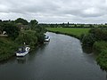
English: Wansford, sometimes Wansford-in-England is a village on the Great North Road (A1) near Peterborough and eight miles south of Stamford. Wansford station is the home of the Nene Valley Railway.
localité britannique du comté anglais de Cambridgeshire  | |||||
| Téléverser des médias | |||||
| Nature de l’élément | |||||
|---|---|---|---|---|---|
| Lieu | City of Peterborough, Cambridgeshire, Angleterre de l'Est, Angleterre | ||||
| Population |
| ||||
 | |||||
Sous-catégories
Cette catégorie comprend 7 sous-catégories, dont les 7 ci-dessous.
H
- The Haycock, Wansford (14 F)
M
W
- Wansford Bridge (12 F)
- Wansford Old Bridge (16 F)
- Wansford Pasture (5 F)
- Wansford Road railway station (14 F)
Média dans la catégorie « Wansford, Cambridgeshire »
Cette catégorie comprend 157 fichiers, dont les 157 ci-dessous.
-

-
 'Drofsnaw' village sign - geograph.org.uk - 4779289.jpg 956 × 1 280 ; 237 kio
-
 84 miles to London - geograph.org.uk - 2647889.jpg 640 × 549 ; 151 kio
-
 A1 bridge at A47 junction - geograph.org.uk - 3460155.jpg 1 764 × 1 144 ; 971 kio
-
 A1 Bridge Wansford - geograph.org.uk - 2059175.jpg 640 × 360 ; 54 kio
-
 A1 heads uphill from the Nene crossing - geograph.org.uk - 2642448.jpg 640 × 428 ; 107 kio
-
 A1 north of Wansford - geograph.org.uk - 3182646.jpg 640 × 430 ; 48 kio
-
 A1 northbound, Wansford - geograph.org.uk - 3019629.jpg 640 × 480 ; 49 kio
-
 A47 at the western A1 roundabout, Wansford - geograph.org.uk - 3586196.jpg 640 × 480 ; 59 kio
-
 A47 bridge over the A1 - geograph.org.uk - 3182644.jpg 640 × 430 ; 42 kio
-
 A47 heading east towards Peterborough - geograph.org.uk - 3019634.jpg 640 × 480 ; 69 kio
-
 A47 meets the original route via Wansford - geograph.org.uk - 3586212.jpg 640 × 480 ; 56 kio
-
 A47 overbridge, A1 - geograph.org.uk - 2511168.jpg 640 × 430 ; 43 kio
-
 Artwork in the Wansford subway - geograph.org.uk - 3047208.jpg 2 560 × 1 920 ; 1,05 Mio
-
 Back garden beside the river at Wansford - August 2013 - panoramio.jpg 4 000 × 3 000 ; 2,29 Mio
-
 Beneath the southbound A1 - geograph.org.uk - 4912104.jpg 800 × 600 ; 111 kio
-
 Bridge End - geograph.org.uk - 529613.jpg 640 × 427 ; 73 kio
-
 Bridge End, Wansford - geograph.org.uk - 4778417.jpg 1 280 × 955 ; 223 kio
-
 Church House, Bridge End, Wansford - geograph.org.uk - 4778422.jpg 1 280 × 958 ; 271 kio
-
 Close to Wansford on the River Nene - August 2013 - panoramio.jpg 3 882 × 2 836 ; 1,63 Mio
-
 Closed services, A1, Wansford - geograph.org.uk - 2621770.jpg 640 × 430 ; 52 kio
-
 Closing in on Wansford - August 2013 - panoramio.jpg 3 000 × 4 000 ; 2,69 Mio
-
 Complicated route to the Country Centre - geograph.org.uk - 3586191.jpg 640 × 480 ; 74 kio
-
 Cottage in Wansford, Northants.jpg 576 × 361 ; 59 kio
-
 County boundary marker, Wansford Bridge - geograph.org.uk - 6221317.jpg 1 024 × 768 ; 207 kio
-
 Cruising on the River Nene - geograph.org.uk - 6220895.jpg 1 024 × 768 ; 207 kio
-
 Derelict building by the A1 - geograph.org.uk - 3182640.jpg 640 × 430 ; 44 kio
-
 Derelict Wansford Services on the A1 - geograph.org.uk - 4912144.jpg 800 × 611 ; 130 kio
-
 Dip on the A47 near Heath House - geograph.org.uk - 3586184.jpg 640 × 480 ; 88 kio
-
 Downstream of Wansford on the Nene - August 2013 - panoramio.jpg 4 000 × 3 000 ; 1,89 Mio
-

-
 Empty chair, empty dock - Wansford - August 2013 - panoramio.jpg 4 000 × 3 000 ; 1,97 Mio
-
 Field adjacent to the Old Pump House, Wansford - geograph.org.uk - 6588090.jpg 1 024 × 768 ; 196 kio
-
 First glimpse of the oldest stone bridge at Wansford - August 2013 - panoramio.jpg 4 000 × 3 000 ; 2,26 Mio
-
 Flooded River Nene from Wansford Bridge - geograph.org.uk - 4791062.jpg 8 845 × 4 096 ; 6,02 Mio
-
 Footpath and milepost at Wansford - geograph.org.uk - 2647890.jpg 640 × 631 ; 170 kio
-
 Footpath From Wansford - geograph.org.uk - 2542958.jpg 1 496 × 1 122 ; 946 kio
-
 Footpath to Yarwell - geograph.org.uk - 6221328.jpg 1 024 × 768 ; 209 kio
-
 Gardens beside the River Nene in Wansford - August 2013 - panoramio.jpg 4 000 × 3 000 ; 2,35 Mio
-
 Geese attacking the new homes near Wansford - August 2013 - panoramio.jpg 4 000 × 3 000 ; 2,25 Mio
-
 Great North Road Bridge, Wansford - geograph.org.uk - 6671379.jpg 2 656 × 1 768 ; 2,05 Mio
-
 Heading upsteam to Wansford - August 2013 - panoramio.jpg 2 888 × 3 918 ; 1,46 Mio
-
 House on Peterborough Road, Wansford - geograph.org.uk - 3019617.jpg 640 × 480 ; 88 kio
-
 Houses at Wansford - geograph.org.uk - 2616269.jpg 640 × 404 ; 61 kio
-
 Houses on Old North Road - geograph.org.uk - 4779282.jpg 1 280 × 916 ; 204 kio
-
 Houses on the east side of Bridge End, Wansford (geograph 6221324).jpg 1 024 × 768 ; 243 kio
-
 Just about to go under the first of the Wansford bridges - August 2013 - panoramio.jpg 4 000 × 3 000 ; 1,77 Mio
-
 King's Cliffe Road heading towards King's Cliffe - geograph.org.uk - 4912272.jpg 800 × 594 ; 109 kio
-
 Large house on Old North Road, Wansford - geograph.org.uk - 4577418.jpg 4 320 × 3 240 ; 5,37 Mio
-
 Lining to the otherwise stone bridge^ Wansford - August 2013 - panoramio.jpg 4 000 × 3 000 ; 2,49 Mio
-
 London Road - geograph.org.uk - 528962.jpg 640 × 427 ; 66 kio
-

-
 Looking back under the northbound A1 - Wansford - August 2013 - panoramio.jpg 4 000 × 3 000 ; 1,8 Mio
-
 Looking back upstream under the oldest of the Wansford bridges - August 2013 - panoramio.jpg 4 000 × 3 000 ; 2,1 Mio
-
 Looking down Bridge End, Wansford - geograph.org.uk - 4779279.jpg 1 280 × 960 ; 176 kio
-
 Meadow Cottage, Bridge End, Wansford - geograph.org.uk - 4779293.jpg 1 280 × 960 ; 212 kio
-
 Meadow Cottage, Wansford (geograph 6221320).jpg 1 024 × 768 ; 191 kio
-
 Meadow Cottage, Wansford - geograph.org.uk - 3931450.jpg 2 916 × 1 944 ; 2,8 Mio
-
 Mile Post on the Old Great North Road - geograph.org.uk - 3047179.jpg 2 560 × 1 920 ; 944 kio
-
 Nene Way - geograph.org.uk - 529620.jpg 640 × 427 ; 102 kio
-
 New Mermaid Inn - geograph.org.uk - 1209292.jpg 640 × 480 ; 59 kio
-
 Not that way^ June 2013 - panoramio.jpg 4 000 × 3 000 ; 2,02 Mio
-
 Old Great North Road past Thackers Close - geograph.org.uk - 2647892.jpg 640 × 487 ; 137 kio
-
 Old Great North Road towards A1 - geograph.org.uk - 2647886.jpg 640 × 546 ; 140 kio
-
 Old Great North Road-A1 sliproad junction - geograph.org.uk - 2647891.jpg 640 × 466 ; 94 kio
-
 Old hedgerow outside Wansford - geograph.org.uk - 2957352.jpg 4 000 × 3 000 ; 4,31 Mio
-
 Old Milepost - geograph.org.uk - 3252467.jpg 1 024 × 768 ; 350 kio
-
 Old Milepost - geograph.org.uk - 3252472.jpg 768 × 1 024 ; 326 kio
-
 Old Milepost on the old A1 at Wansford (geograph 5622643).jpg 295 × 448 ; 79 kio
-
 Old North Road - geograph.org.uk - 529621.jpg 640 × 427 ; 77 kio
-
 Old North Road - geograph.org.uk - 529821.jpg 640 × 427 ; 69 kio
-
 Old North Road, Wansford - geograph.org.uk - 5328451.jpg 1 942 × 1 382 ; 950 kio
-
 On Wansford Bridge - geograph.org.uk - 4779297.jpg 1 280 × 960 ; 247 kio
-
 Ordnance Survey Cut Mark with Bolt - geograph.org.uk - 4126044.jpg 4 000 × 3 000 ; 4,96 Mio
-
 Ordnance Survey Flush Bracket 1038 - geograph.org.uk - 4109958.jpg 4 000 × 3 000 ; 3,87 Mio
-
 Passing through Wansford on the River Nene - August 2013 - panoramio.jpg 4 000 × 3 000 ; 2,72 Mio
-
 Path To Thornhaugh - geograph.org.uk - 2543170.jpg 1 496 × 1 122 ; 720 kio
-
 Peterborough Road, Wansford - geograph.org.uk - 3019618.jpg 640 × 480 ; 85 kio
-
 Peterborough Road, Wansford - geograph.org.uk - 5265075.jpg 1 024 × 683 ; 401 kio
-
 Postbox at The Old Post Office, Wansford, ref PE8 80 - geograph.org.uk - 4778424.jpg 960 × 1 280 ; 242 kio
-
 Quarry near Wansford - geograph.org.uk - 1211210.jpg 640 × 480 ; 68 kio
-
 River and Railway - geograph.org.uk - 187441.jpg 640 × 480 ; 84 kio
-
 River Nene - geograph.org.uk - 1129109.jpg 640 × 427 ; 98 kio
-
 River Nene - geograph.org.uk - 1129112.jpg 640 × 427 ; 104 kio
-
 River Nene - geograph.org.uk - 2616270.jpg 640 × 354 ; 51 kio
-
 River Nene - geograph.org.uk - 3182638.jpg 640 × 351 ; 43 kio
-
 River Nene - geograph.org.uk - 4132260.jpg 1 600 × 1 000 ; 533 kio
-
 River Nene - geograph.org.uk - 528941.jpg 640 × 427 ; 97 kio
-
 River Nene - geograph.org.uk - 528943.jpg 640 × 427 ; 70 kio
-
 River Nene - geograph.org.uk - 531211.jpg 640 × 427 ; 70 kio
-
 River Nene above Wansford Bridge - geograph.org.uk - 6209290.jpg 1 024 × 768 ; 136 kio
-
 River Nene at Wansford - geograph.org.uk - 2616271.jpg 640 × 513 ; 65 kio
-
 River Nene at Wansford - geograph.org.uk - 4778396.jpg 1 280 × 960 ; 274 kio
-
 River Nene at Wansford - geograph.org.uk - 4778407.jpg 1 280 × 960 ; 206 kio
-
 River Nene below Wansford Bridge - geograph.org.uk - 6126649.jpg 3 648 × 2 736 ; 5,19 Mio
-
 River Nene close to Wansford - August 2013 - panoramio.jpg 4 000 × 3 000 ; 1,96 Mio
-
 River Nene eastwards - geograph.org.uk - 2616272.jpg 640 × 478 ; 85 kio
-
 River Nene, heading to Wansford Lock - August 2013 - panoramio.jpg 4 000 × 3 000 ; 2,18 Mio
-
 River Nene, Wansford - geograph.org.uk - 3863021.jpg 2 464 × 1 640 ; 1,28 Mio
-
 River Nene, Wansford Bridge - geograph.org.uk - 3019621.jpg 640 × 480 ; 55 kio
-
 Road bridge on A47 2.jpg 3 264 × 1 472 ; 2,33 Mio
-
 Road bridge on A47.jpg 3 264 × 1 472 ; 1,6 Mio
-
 Roman Road heading east towards Wansford - geograph.org.uk - 3019611.jpg 640 × 480 ; 105 kio
-
 Roman Road heading east towards Wansford - geograph.org.uk - 3019614.jpg 640 × 480 ; 73 kio
-
 Service station on the A47 - geograph.org.uk - 3019633.jpg 640 × 480 ; 55 kio
-
 Smiles 1878 robertdickbaker00smil 0292 Wansford Northamptonshire.jpg 1 982 × 1 206 ; 353 kio
-
 Southbound A1 crossing the River Nene - geograph.org.uk - 4912098.jpg 800 × 611 ; 158 kio
-
 St Mary the Virgin, Wansford - geograph.org.uk - 6545328.jpg 4 320 × 3 240 ; 3,05 Mio
-
 Stepping up the cutwaters - geograph.org.uk - 4778380.jpg 1 280 × 1 280 ; 342 kio
-
 Subway artwork, Wansford - geograph.org.uk - 3047204.jpg 2 560 × 1 920 ; 1,04 Mio
-
 Subway artwork, Wansford - geograph.org.uk - 3047216.jpg 2 560 × 1 920 ; 1,07 Mio
-
 Subway entrance under the A47 at Wansford - geograph.org.uk - 1292358.jpg 640 × 361 ; 72 kio
-
 Thackers Close - geograph.org.uk - 2647893.jpg 640 × 504 ; 91 kio
-
 Thackers Close sign - geograph.org.uk - 2647894.jpg 640 × 468 ; 127 kio
-
 Thatched cottage, Wansford Bridge - geograph.org.uk - 3019619.jpg 640 × 480 ; 78 kio
-
 The A1 and the River Nene - geograph.org.uk - 2488727.jpg 4 000 × 3 000 ; 4,29 Mio
-
 The A47 near Stibbington - geograph.org.uk - 6141627.jpg 1 786 × 1 022 ; 878 kio
-
 The Corner House, Wansford - geograph.org.uk - 4779285.jpg 1 280 × 872 ; 166 kio
-
 The Nene Valley way following the river towards Wansford - geograph.org.uk - 6671405.jpg 2 655 × 1 767 ; 1,04 Mio
-
 The Nene Way path near Wansford - geograph.org.uk - 4912086.jpg 800 × 518 ; 146 kio
-
 The Old Post Office on Bridge End - geograph.org.uk - 4218448.jpg 1 600 × 1 068 ; 388 kio
-
 The Old Post Office Wansford. (3505332544).jpg 2 304 × 3 072 ; 2,52 Mio
-
 The Old Post Office, Bridge End, Wansford - geograph.org.uk - 3843615.jpg 1 024 × 755 ; 185 kio
-
 The Old Post Office, Bridge End, Wansford - geograph.org.uk - 4778423.jpg 1 280 × 960 ; 272 kio
-
 The Paper Mills - geograph.org.uk - 528960.jpg 640 × 427 ; 76 kio
-
 The River Nene at Wansford - geograph.org.uk - 3843806.jpg 1 024 × 768 ; 210 kio
-
 The River Nene at Wansford - geograph.org.uk - 3843821.jpg 1 024 × 768 ; 148 kio
-
 The River Nene at Wansford bridge - geograph.org.uk - 4577785.jpg 4 320 × 3 240 ; 5,91 Mio
-
 The River Nene below Wansford Bridge - geograph.org.uk - 6221114.jpg 1 024 × 768 ; 158 kio
-
 The River Nene east of Wansford - geograph.org.uk - 4559570.jpg 4 320 × 3 240 ; 5,59 Mio
-
 The River Nene near Wansford - geograph.org.uk - 2488734.jpg 4 000 × 3 000 ; 3,95 Mio
-
 The River Nene near Wansford - geograph.org.uk - 4912077.jpg 800 × 516 ; 119 kio
-
 Track off Sutton Heath Road - geograph.org.uk - 3221974.jpg 1 600 × 1 064 ; 460 kio
-
 Tree lined river - Wansford - August 2013 - panoramio.jpg 4 000 × 3 000 ; 2,07 Mio
-
 Two way traffic ahead - geograph.org.uk - 3586209.jpg 640 × 480 ; 56 kio
-
 View along Wansford Bridge - geograph.org.uk - 4778398.jpg 1 280 × 960 ; 261 kio
-
 Wansford - geograph.org.uk - 531226.jpg 640 × 427 ; 77 kio
-
 Wansford Bridge - geograph.org.uk - 3931447.jpg 3 000 × 2 000 ; 2,65 Mio
-
 Wansford Bridge - geograph.org.uk - 6220893.jpg 1 024 × 768 ; 166 kio
-
 Wansford Bridge - geograph.org.uk - 6221329.jpg 1 024 × 768 ; 175 kio
-
 Wansford Bridge crossing the River Nene - geograph.org.uk - 6671352.jpg 2 656 × 1 768 ; 2,93 Mio
-
 Wansford from the river meadows - geograph.org.uk - 4778408.jpg 1 280 × 855 ; 182 kio
-
 Wansford hidden in trees - August 2013 - panoramio.jpg 4 000 × 3 000 ; 1,9 Mio
-
 Wansford Mews - geograph.org.uk - 5265070.jpg 1 024 × 683 ; 411 kio
-
 Wansford post office ... (3505534524).jpg 2 304 × 3 072 ; 2,39 Mio
-
 Wansford postbox - geograph.org.uk - 529615.jpg 427 × 640 ; 81 kio
-
 Wansford Pumping Station and mobile mast - geograph.org.uk - 6671437.jpg 2 656 × 1 768 ; 2,18 Mio
-
 Wansford Subway - geograph.org.uk - 3047188.jpg 2 560 × 1 920 ; 1,11 Mio
-
 Wansford Subway under the A47 - geograph.org.uk - 3047198.jpg 640 × 480 ; 56 kio
-
 Wansford wterside gardens - August 2013 - panoramio.jpg 3 000 × 4 000 ; 1,55 Mio
-
 Wansford's Mini Roundabout - geograph.org.uk - 484816.jpg 640 × 448 ; 74 kio
-
 Wansford, The old post office - geograph.org.uk - 5175033.jpg 4 336 × 2 896 ; 7,17 Mio
-
 Water pump - geograph.org.uk - 531207.jpg 427 × 640 ; 140 kio
-
 Waterside gardens - Wansford - August 2013 - panoramio.jpg 4 000 × 3 000 ; 2,08 Mio
-
 Weir on the Nene Way - geograph.org.uk - 116706.jpg 640 × 413 ; 163 kio
-
 River Nene at Wansford - geograph.org.uk - 255897.jpg 640 × 480 ; 130 kio
-
 River Nene at Wansford - geograph.org.uk - 93073.jpg 640 × 480 ; 101 kio


.jpg)


.jpg)


.jpg)


.jpg)


.jpg)


