Category:Wappenham
Aller à la navigation
Aller à la recherche
village britannique  | |||||
| Téléverser des médias | |||||
| Nature de l’élément | |||||
|---|---|---|---|---|---|
| Lieu | West Northamptonshire, Northamptonshire, Midlands de l'Est, Angleterre | ||||
| Population |
| ||||
| Superficie |
| ||||
 | |||||
Sous-catégories
Cette catégorie comprend seulement la sous-catégorie ci-dessous.
Média dans la catégorie « Wappenham »
Cette catégorie comprend 81 fichiers, dont les 81 ci-dessous.
-
 Bridleway crosses the stream - geograph.org.uk - 5343873.jpg 1 600 × 1 066 ; 707 kio
-
 Bridleway to Green Park - geograph.org.uk - 5152362.jpg 1 600 × 1 066 ; 459 kio
-
 Bridleway to Green's Park - geograph.org.uk - 5343884.jpg 1 600 × 1 066 ; 412 kio
-
 Bridleway to Wappenham - geograph.org.uk - 5216299.jpg 640 × 480 ; 172 kio
-
 Bridleway to Woodend - geograph.org.uk - 5384976.jpg 1 024 × 768 ; 136 kio
-
 Course of the Northampton and Banbury Junction Railway - geograph.org.uk - 5171946.jpg 1 024 × 768 ; 194 kio
-
 Derelict barn near Wappenham - geograph.org.uk - 5368423.jpg 1 024 × 768 ; 184 kio
-
 Driveway to Priesthay Wood Farm - geograph.org.uk - 430811.jpg 640 × 624 ; 173 kio
-
 Farm buildings by track - geograph.org.uk - 5152367.jpg 1 600 × 1 066 ; 399 kio
-
 Farm track near Manor Farm - geograph.org.uk - 5384978.jpg 1 024 × 768 ; 113 kio
-
 Field barn near Bucknell Wood - geograph.org.uk - 5192540.jpg 1 024 × 768 ; 241 kio
-
 Field by Manor Farm - geograph.org.uk - 5152322.jpg 1 600 × 1 066 ; 477 kio
-
 Field of grass by the path - geograph.org.uk - 5152405.jpg 1 600 × 1 066 ; 492 kio
-
 Footpath and Bridleway - geograph.org.uk - 214440.jpg 640 × 480 ; 103 kio
-
 Footpath and Pipes - geograph.org.uk - 214445.jpg 640 × 480 ; 99 kio
-
 Footpath in to Wappenham - geograph.org.uk - 5343925.jpg 1 600 × 1 066 ; 563 kio
-
 Footpath to Brookside - geograph.org.uk - 5152395.jpg 1 600 × 1 066 ; 618 kio
-
 Footpath to Weedon Lois - geograph.org.uk - 5152328.jpg 1 600 × 1 066 ; 556 kio
-
 Gates and Home Manor Farm - geograph.org.uk - 5175746.jpg 1 024 × 768 ; 140 kio
-
 Gates on Brackley Lane - geograph.org.uk - 5171925.jpg 1 024 × 768 ; 220 kio
-
 Grass field near Wappenham - geograph.org.uk - 5171929.jpg 1 024 × 768 ; 129 kio
-
 Greenside, Wappenham - geograph.org.uk - 5175748.jpg 1 024 × 768 ; 142 kio
-
 Greenside, Wappenham - geograph.org.uk - 5608578.jpg 640 × 360 ; 54 kio
-
 Greenside, Wappenham - geograph.org.uk - 5608603.jpg 640 × 360 ; 71 kio
-
 Hedgerow off Helmdon Road - geograph.org.uk - 5107631.jpg 1 024 × 768 ; 118 kio
-
 Helmdon Road, Wappenham - geograph.org.uk - 5608612.jpg 640 × 360 ; 64 kio
-
 High Street, Wappenham - geograph.org.uk - 5608569.jpg 360 × 640 ; 56 kio
-
 Manor Farm - geograph.org.uk - 5368425.jpg 1 024 × 768 ; 202 kio
-
 New tree planting by the stream - geograph.org.uk - 5343881.jpg 1 600 × 1 066 ; 711 kio
-
 Poplar trees on the edge of Wappenham - geograph.org.uk - 5192591.jpg 1 024 × 768 ; 188 kio
-
 Public footpath to Wappenham - geograph.org.uk - 5343927.jpg 1 066 × 1 600 ; 514 kio
-
 Quiet corner - geograph.org.uk - 5192550.jpg 1 024 × 768 ; 178 kio
-
 Railway now Water - geograph.org.uk - 190780.jpg 640 × 480 ; 101 kio
-

-
 Road from Wappenham to Slapton and Abthorpe - geograph.org.uk - 5216343.jpg 640 × 480 ; 183 kio
-
 Roadway to Wappenham Lodge Farm - geograph.org.uk - 4996614.jpg 1 024 × 768 ; 135 kio
-
 Roadway to Wappenham Lodge Farm - geograph.org.uk - 5107501.jpg 1 024 × 768 ; 230 kio
-
 School Lane, Wappenham - geograph.org.uk - 5608560.jpg 640 × 360 ; 68 kio
-

-
 Slapton-Dismantled Railway - geograph.org.uk - 4046373.jpg 1 024 × 768 ; 324 kio
-
 St Mary the Virgin - geograph.org.uk - 5152337.jpg 1 600 × 1 066 ; 321 kio
-
 St Mary the Virgin, Wappenham - geograph.org.uk - 5608541.jpg 640 × 360 ; 47 kio
-
 St Mary the Virgin, Wappenham - geograph.org.uk - 5608553.jpg 640 × 360 ; 40 kio
-
 St Mary the Virgin, Wappenham, chancel - geograph.org.uk - 5608546.jpg 640 × 360 ; 46 kio
-
 St Mary the Virgin, Wappenham, niche - geograph.org.uk - 5608552.jpg 360 × 640 ; 43 kio
-
 Start of public byway - geograph.org.uk - 5216340.jpg 640 × 480 ; 196 kio
-
 The Old Bull, Wappenham - geograph.org.uk - 5608595.jpg 360 × 640 ; 71 kio
-
 Track to the farm - geograph.org.uk - 5152410.jpg 1 600 × 1 066 ; 465 kio
-
 Trees by the stream - geograph.org.uk - 5343876.jpg 1 600 × 1 066 ; 415 kio
-
 View towards Astwell Mill - geograph.org.uk - 4996617.jpg 1 024 × 768 ; 133 kio
-
 View towards Spring Hill - geograph.org.uk - 5192571.jpg 1 024 × 768 ; 162 kio
-
 View towards Weedon Copse - geograph.org.uk - 5384981.jpg 1 024 × 768 ; 165 kio
-
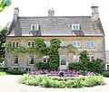 Wappenham - Manor House.jpg 3 600 × 3 045 ; 11,12 Mio
-
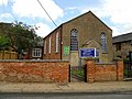 Wappenham Chapel - geograph.org.uk - 3033941.jpg 640 × 480 ; 87 kio
-
 Wappenham chapel - geograph.org.uk - 5152352.jpg 1 600 × 1 067 ; 407 kio
-
 Wappenham cottage - geograph.org.uk - 5152332.jpg 1 600 × 1 066 ; 488 kio
-
 Wappenham Greenside - geograph.org.uk - 3033996.jpg 640 × 480 ; 71 kio
-
 Wappenham High Street - geograph.org.uk - 3027436.jpg 640 × 480 ; 91 kio
-
 Wappenham High Street - geograph.org.uk - 3033961.jpg 640 × 493 ; 81 kio
-
 Wappenham Lodge Farm - geograph.org.uk - 4996613.jpg 1 024 × 768 ; 134 kio
-
 Wappenham Lodge Farm - geograph.org.uk - 5609448.jpg 640 × 360 ; 40 kio
-
 Wappenham Vicarage.JPG 5 157 × 3 400 ; 9,56 Mio
-
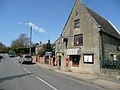
 Wappenham Village Stores - geograph.org.uk - 3033970.jpg 640 × 480 ; 84 kio
-
 Wappenham village stores - geograph.org.uk - 772919.jpg 640 × 480 ; 78 kio
-
 Wappenham Village.jpg 600 × 417 ; 43 kio
-
 Watney's sign - geograph.org.uk - 772925.jpg 640 × 480 ; 68 kio
-
 Weedon Copse - geograph.org.uk - 5152221.jpg 1 600 × 1 066 ; 516 kio
-
 Abandoned farm machinery - geograph.org.uk - 430829.jpg 640 × 480 ; 146 kio
-
 An odd sign to find in the corner of a field - geograph.org.uk - 461211.jpg 640 × 480 ; 114 kio
-
 Byway - geograph.org.uk - 461227.jpg 640 × 423 ; 96 kio
-
 Byway starts here - geograph.org.uk - 461294.jpg 640 × 423 ; 105 kio
-
 Footpath to Wappenham - geograph.org.uk - 430831.jpg 640 × 480 ; 124 kio
-
 Gates to Wappenham Lodge Farm - geograph.org.uk - 461236.jpg 640 × 438 ; 83 kio
-
 Inside Out Gates - geograph.org.uk - 214450.jpg 640 × 480 ; 146 kio
-
 Manor Farm Fields - geograph.org.uk - 190779.jpg 640 × 480 ; 124 kio
-
 Old and new barns - geograph.org.uk - 461196.jpg 640 × 330 ; 53 kio
-
 Path to Wappenham - geograph.org.uk - 214447.jpg 640 × 480 ; 111 kio
-
 Start of footpath and bridleway - geograph.org.uk - 430822.jpg 480 × 640 ; 91 kio
-
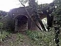
 Station now Barn - geograph.org.uk - 190781.jpg 640 × 480 ; 95 kio
-
 Steep Track - geograph.org.uk - 190782.jpg 640 × 480 ; 97 kio
-
 Wappenham Lodge Farm - geograph.org.uk - 461216.jpg 2 816 × 2 112 ; 1,21 Mio


