Category:Wareham, Massachusetts
Vai alla navigazione
Vai alla ricerca
comune statunitense del Massachusetts   | |||||
| Carica un file multimediale | |||||
| Istanza di | |||||
|---|---|---|---|---|---|
| Parte di |
| ||||
| Luogo | contea di Plymouth, Massachusetts, Stati Uniti d'America | ||||
| Data di fondazione o creazione |
| ||||
| Popolazione |
| ||||
| Superficie |
| ||||
| Altezza sul mare |
| ||||
| sito web ufficiale | |||||
 | |||||
Sottocategorie
Questa categoria contiene le 11 sottocategorie indicate di seguito, su un totale di 11.
File nella categoria "Wareham, Massachusetts"
Questa categoria contiene 47 file, indicati di seguito, su un totale di 47.
-
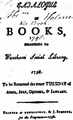
 1798 Wareham Social Library Massachusetts p1.png 256 × 405; 96 KB
-
 1798 Wareham Social Library Massachusetts.png 312 × 514; 116 KB
-

-

-
 Bathing beach and cottages, Swifts Beach, Mass (70421).jpg 3 312 × 2 052; 2,71 MB
-
 Bathing beach and cottages, Swifts Beach, Mass (73257).jpg 3 318 × 2 049; 2,63 MB
-
 Byron's Seafood Restaurant sign, Wareham, Massachusetts LCCN2017709565.tif 5 175 × 3 580; 106,05 MB
-

-
 Church of the Good Shepherd, Wareham, Massachusetts.jpg 2 077 × 3 000; 2,68 MB
-
 Coffrin 000550 172935 518399 4578 (36825825711).jpg 1 920 × 1 440; 1,25 MB
-
 Darron Cox Wareham Gatemen.jpg 323 × 406; 72 KB
-

-

-

-

-
-
 Main Street, Wareham MA.jpg 3 264 × 2 448; 2,3 MB
-
 Map of Wareham. LOC 76692180.jpg 7 311 × 6 443; 7,11 MB
-
 Map of Wareham. LOC 76692180.tif 7 311 × 6 443; 134,77 MB
-
 Mill Pond Diner, Wareham, Massachusetts.jpg 3 000 × 1 486; 2,1 MB
-
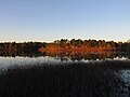 Mill Pond, Wareham MA.jpg 3 264 × 2 448; 1,66 MB
-
 Old Company Store, Wareham MA.jpg 2 592 × 1 728; 971 KB
-
 Parker Mills Pond, Wareham MA.jpg 5 472 × 3 648; 4,03 MB
-

-
-
 Seal of Wareham, Massachusetts.png 218 × 221; 67 KB
-
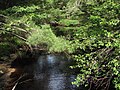
 Sippican River, Massachusetts (lower river).png 666 × 782; 213 KB
-
 Sippican River, Wareham and Marion MA.jpg 2 272 × 1 704; 2,09 MB
-
 Spectacle Pond, Wareham MA.jpg 3 264 × 2 448; 1,71 MB
-
 Stephen Minot Weld Jr.-Indian Neck East House, 31 Warren Point Rd, Wareham.jpg 1 455 × 1 014; 95 KB
-
 Surf at Swifts Beach, Mass (73256).jpg 3 309 × 2 088; 2,56 MB
-
 Swifts Beach Road and entrance to bathing beach, Swifts Beach, Mass (70427).jpg 3 309 × 2 094; 3,12 MB
-
 Tobey Hospital, Wareham, Massachusetts.jpg 3 000 × 1 701; 2,15 MB
-
 Wareham High School 2019.jpg 2 324 × 1 291; 925 KB
-
 Wareham MA Gateway.jpg 1 600 × 1 200; 456 KB
-
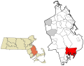
 Wareham ma highlight.png 788 × 466; 54 KB
-
 Wareham River railroad bridge, Wareham, MA (cropped).jpg 5 184 × 741; 2,28 MB
-
 Wareham River railroad bridge, Wareham, MA.jpg 5 184 × 3 456; 6,76 MB
-
 Wareham Town Hall with sign.jpg 3 000 × 1 971; 2,05 MB
-
 Wareham Town Hall, Massachusetts.jpg 3 000 × 2 004; 1,84 MB
-
 Wareham, Massachusetts Civil War Memorial.jpg 2 027 × 3 000; 2,72 MB
-
 Wareham-Bourne, Dalton Bridge, May 16, 2013 (8747030883).jpg 4 000 × 3 000; 2,62 MB
-
 Wareham-Bourne, Dalton Bridge, Route 6-28, May 16, 2013 (8747030979).jpg 4 000 × 3 000; 2,64 MB
-
 WarehamMA TobeyHomestead.jpg 1 024 × 680; 239 KB
-
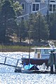
 WarehamMA WitchCatboat 1.jpg 1 024 × 680; 268 KB
-
 WarehamMA WitchCatboat 2.jpg 680 × 1 024; 158 KB
-
 Weweantic River (Massachusetts) map.jpg 3 042 × 5 713; 8,02 MB


.jpg)
.jpg)


.jpg)


.png)


.jpg)
.jpg)


.jpg)
.jpg)


_map.jpg)
.jpg)