Category:Wareham Town
Zur Navigation springen
Zur Suche springen
civil parish in Purbeck, Dorset, England | |||||
| Medium hochladen | |||||
| Ist ein(e) | |||||
|---|---|---|---|---|---|
| Ort | Purbeck, Dorset, Südwestengland, England | ||||
 | |||||
Unterkategorien
Diese Kategorie enthält folgende Unterkategorie:
In Klammern die Anzahl der enthaltenen Kategorien (K), Seiten (S), Dateien (D)
W
Medien in der Kategorie „Wareham Town“
Folgende 200 Dateien sind in dieser Kategorie, von 500 insgesamt.
(vorherige Seite) (nächste Seite)-
 02.09.17 Wareham 444026 (36986963115).jpg 4.972 × 2.758; 10,16 MB
-
 1 Church Lane Wareham - geograph.org.uk - 4253994.jpg 3.763 × 2.508; 2,1 MB
-
 23, South Street, Wareham (geograph 6289768).jpg 4.288 × 2.848; 2,5 MB
-
 33 to 43 North Street, Wareham - geograph.org.uk - 4253934.jpg 2.816 × 1.880; 2,05 MB
-
 A pleasant corner - geograph.org.uk - 4487691.jpg 4.320 × 3.240; 5,58 MB
-
 A shed by the walls - geograph.org.uk - 4748034.jpg 5.800 × 3.867; 2,41 MB
-
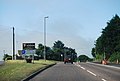
 A351 - geograph.org.uk - 3635131.jpg 640 × 430; 87 KB
-
 A351 Approaching Sandford - geograph.org.uk - 3276841.jpg 640 × 480; 443 KB
-
 A351 at River Piddle bridge - geograph.org.uk - 3203819.jpg 640 × 428; 60 KB
-
 A351 roundabout, Wareham - geograph.org.uk - 3203830.jpg 640 × 428; 97 KB
-
 A351 Wareham Bypass (northbound) - geograph.org.uk - 3276489.jpg 640 × 480; 423 KB
-
 A351, Sandford - geograph.org.uk - 3276851.jpg 640 × 480; 581 KB
-
 A351, Wareham - geograph.org.uk - 3276499.jpg 640 × 427; 374 KB
-
 A351, Wareham Bypass, at Northport - geograph.org.uk - 3276821.jpg 640 × 480; 424 KB
-
 Abbots Quay ^ Holy Trinity, Wareham - geograph.org.uk - 6257022.jpg 4.288 × 2.848; 1,48 MB
-
 Abbots Quay ^ Holy Trinity, Wareham - geograph.org.uk - 6289979.jpg 3.738 × 2.480; 1,5 MB
-

-
 Age UK charity shop, Wareham - geograph.org.uk - 2741579.jpg 1.600 × 1.023; 318 KB
-
 Alas Black Bear, I know you well... - geograph.org.uk - 6222661.jpg 480 × 640; 55 KB
-
 All lined up, Wareham - geograph.org.uk - 2243027.jpg 640 × 481; 65 KB
-
 Almshouse garden - geograph.org.uk - 4748255.jpg 5.800 × 3.867; 3,62 MB
-
 Almshouse gate - geograph.org.uk - 4748263.jpg 5.800 × 3.867; 3,33 MB
-
 Almshouse gate - geograph.org.uk - 4758723.jpg 5.500 × 3.667; 2,09 MB
-
 Almshouse wall - geograph.org.uk - 4748279.jpg 5.800 × 3.867; 2,47 MB
-
 Almshouses - geograph.org.uk - 4748240.jpg 5.800 × 3.867; 2,06 MB
-
 Altogether Care, South Street - geograph.org.uk - 6222816.jpg 480 × 640; 64 KB
-
 Anglebury House Hotel, Wareham - geograph.org.uk - 2773356.jpg 640 × 480; 56 KB
-
 Anglebury House sign - geograph.org.uk - 6266272.jpg 2.961 × 3.948; 561 KB
-

-
 April flowers, West Street - geograph.org.uk - 6222843.jpg 480 × 640; 85 KB
-
 At Westport House - geograph.org.uk - 4748070.jpg 5.800 × 3.867; 2,52 MB
-
-
 Barnet's, South Street - geograph.org.uk - 6222796.jpg 480 × 640; 84 KB
-
 Bear's head - geograph.org.uk - 4758682.jpg 5.500 × 3.667; 1,75 MB
-
 Bell tower - geograph.org.uk - 4748249.jpg 3.867 × 5.800; 1,25 MB
-
 Bench on Church Green - geograph.org.uk - 3961069.jpg 640 × 480; 103 KB
-
-
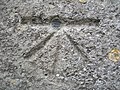
 Benchmark on ^2Egdon Road - geograph.org.uk - 2500638.jpg 683 × 1.024; 183 KB
-
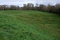
 Bestwall Nature Reserve - Wareham - geograph.org.uk - 2264564.jpg 3.648 × 1.824; 809 KB
-
 Bestwall, access road - geograph.org.uk - 3513231.jpg 1.024 × 768; 329 KB
-
 Bestwall, access road - geograph.org.uk - 3513245.jpg 1.024 × 768; 263 KB
-
 Bestwall, cattle grazing - geograph.org.uk - 3513196.jpg 1.024 × 768; 161 KB
-
 Bestwall, farm track - geograph.org.uk - 3513219.jpg 1.024 × 768; 341 KB
-
 Bestwall, footpath - geograph.org.uk - 3513179.jpg 1.024 × 768; 284 KB
-
 Bestwall, footpath marker - geograph.org.uk - 3513205.jpg 1.024 × 750; 234 KB
-
 Bestwall, gates - geograph.org.uk - 3512796.jpg 1.024 × 768; 252 KB
-
 Bestwall, gates - geograph.org.uk - 3513211.jpg 1.024 × 768; 330 KB
-
 Bestwall, lake - geograph.org.uk - 3512872.jpg 1.024 × 768; 157 KB
-
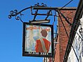
 Black Bear Hotel, Wareham - geograph.org.uk - 5670786.jpg 1.202 × 1.600; 684 KB
-
 Black Bear Hotel, Wareham - geograph.org.uk - 6289757.jpg 2.729 × 3.660; 1,49 MB
-

-
 Bloody Bank, Wareham - geograph.org.uk - 6267057.jpg 4.288 × 2.848; 2,03 MB
-
 Bluebird Care, West Street - geograph.org.uk - 6222842.jpg 480 × 640; 87 KB
-
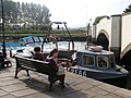
 Boating on the Frome - geograph.org.uk - 2773364.jpg 640 × 480; 48 KB
-
 Boats on the River Frome - geograph.org.uk - 1936296.jpg 1.200 × 1.600; 587 KB
-
 Boats on The River Frome above Abbots Quay - geograph.org.uk - 1937547.jpg 1.600 × 1.200; 509 KB
-
 Bookies in West Street - geograph.org.uk - 6222846.jpg 640 × 480; 59 KB
-
 Boots, North Street - geograph.org.uk - 6222858.jpg 640 × 480; 79 KB
-
 Bowling Green, Wareham - geograph.org.uk - 6268481.jpg 4.288 × 2.848; 1,33 MB
-
 Bowling Green, Wareham - geograph.org.uk - 6268536.jpg 4.288 × 2.848; 1,93 MB
-
 Bridge House, Wareham (geograph 6289839).jpg 4.225 × 2.649; 880 KB
-
 Buildings on West Street, Wareham (geograph 6112289).jpg 3.731 × 2.552; 977 KB
-
 Bullock ^ Lee, North Street - geograph.org.uk - 6222876.jpg 480 × 640; 69 KB
-
 Bungalows and back gardens, Wareham - geograph.org.uk - 5530128.jpg 640 × 384; 73 KB
-
 Car Park - geograph.org.uk - 4748350.jpg 5.800 × 3.867; 2,82 MB
-
 Castle Gardens, Wareham - geograph.org.uk - 6289994.jpg 4.288 × 2.848; 2,12 MB
-
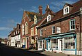
 Centre of Wareham - geograph.org.uk - 2771493.jpg 640 × 455; 55 KB
-
 Chemist's shop window, South Street, Wareham - geograph.org.uk - 2417449.jpg 1.600 × 1.600; 508 KB
-
 Chippies, South Street - geograph.org.uk - 6222811.jpg 480 × 640; 82 KB
-
 Church Green, Wareham - geograph.org.uk - 3961065.jpg 640 × 480; 54 KB
-

-
 Cinema - geograph.org.uk - 4500984.jpg 3.240 × 4.320; 4,27 MB
-
 Cobblers in North Street - geograph.org.uk - 6222860.jpg 480 × 640; 47 KB
-
 Convenience store in North Street - geograph.org.uk - 6222873.jpg 480 × 640; 67 KB
-
 Corner of The Quay, Wareham - geograph.org.uk - 6285858.jpg 2.677 × 3.887; 1,8 MB
-
 Cottage in East Street - geograph.org.uk - 4488630.jpg 4.320 × 3.240; 5,35 MB
-
 Cottage on Pound Lane, Wareham - geograph.org.uk - 6290100.jpg 4.121 × 2.746; 1,33 MB
-
 Cottages in Howard's Lane, Wareham - geograph.org.uk - 2417478.jpg 1.024 × 768; 215 KB
-
 Council sign - geograph.org.uk - 4748065.jpg 5.800 × 3.867; 2,81 MB
-
 Country Theme, South Street - geograph.org.uk - 6222813.jpg 640 × 480; 70 KB
-
 Cow Lane, Wareham (geograph 6267027).jpg 4.288 × 2.848; 1,54 MB
-
 Cow Lane, Wareham - geograph.org.uk - 6257672.jpg 3.760 × 2.553; 705 KB
-
 Crest, water pump, Wareham - geograph.org.uk - 6298403.jpg 1.024 × 1.024; 368 KB
-
 Crossroads in Wareham town centre - geograph.org.uk - 6222855.jpg 640 × 480; 52 KB
-
-
-
 Cyclist on the A351 - geograph.org.uk - 3276826.jpg 640 × 480; 418 KB
-
 D-Day plaque in South Street - geograph.org.uk - 6222786.jpg 640 × 480; 114 KB
-
 Daisy May's, South Street - geograph.org.uk - 6222810.jpg 640 × 480; 58 KB
-
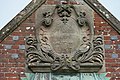 Datestone - geograph.org.uk - 4748227.jpg 5.800 × 3.867; 3,74 MB
-
 Day Centre - geograph.org.uk - 4487688.jpg 4.320 × 3.240; 5,76 MB
-
 Day lewis Pharmacy, South Street - geograph.org.uk - 6222815.jpg 640 × 480; 87 KB
-
 Dedicatory plaque - geograph.org.uk - 4484167.jpg 4.320 × 3.240; 5,74 MB
-
 Dedicatory plaque - geograph.org.uk - 4748220.jpg 5.800 × 3.867; 2,65 MB
-
-

-
-

-

-
 Dollins Lane - geograph.org.uk - 4483539.jpg 4.320 × 3.240; 5,78 MB
-
 DOMVS, South Street - geograph.org.uk - 6222830.jpg 480 × 640; 71 KB
-
 Dragon and Pigeon - geograph.org.uk - 4748320.jpg 5.800 × 3.867; 699 KB
-
 Dress Code, South Street - geograph.org.uk - 6222827.jpg 480 × 640; 85 KB
-
 Duke of Wellington sign - geograph.org.uk - 6266265.jpg 4.460 × 3.345; 733 KB
-
 Duke of Wellington sign - geograph.org.uk - 6266266.jpg 4.126 × 3.094; 621 KB
-
 East Street, Wareham, in 1996 - geograph.org.uk - 2144355.jpg 431 × 640; 55 KB
-
 East Street, Wareham. - geograph.org.uk - 1998254.jpg 2.592 × 1.944; 2,8 MB
-
 Eastern end of Almshouses - geograph.org.uk - 4748214.jpg 5.800 × 3.867; 3,35 MB
-
 Empty Shop, North Street, Wareham - geograph.org.uk - 5564088.jpg 1.600 × 940; 392 KB
-
 Enjoying lunch, Wareham - geograph.org.uk - 2773371.jpg 640 × 480; 66 KB
-
 Enjoying the evening sun, Wareham - geograph.org.uk - 2773389.jpg 640 × 480; 64 KB
-
 Entering Wareham, A351 - geograph.org.uk - 3635137.jpg 640 × 430; 47 KB
-
-
 Feeding birds, Wareham - geograph.org.uk - 2773445.jpg 640 × 480; 63 KB
-
 Footpath Boardwalk near the River Frome - geograph.org.uk - 1936312.jpg 1.600 × 1.200; 729 KB
-
 Former drill hall - North Street - geograph.org.uk - 4172372.jpg 1.600 × 1.064; 433 KB
-
 Former Holy Trinity church, Wareham - geograph.org.uk - 6290066.jpg 2.696 × 3.434; 924 KB
-
 Former Unitarian Church off South Street, Wareham - geograph.org.uk - 4254008.jpg 3.862 × 2.574; 1,92 MB
-
 Furzebrook Road Wareham Dorset - geograph.org.uk - 5952093.jpg 1.024 × 657; 103 KB
-
 Furzebrook Road Wareham Dorset - geograph.org.uk - 5975789.jpg 1.024 × 576; 145 KB
-
 Garden Gate Tea Room, North Street - geograph.org.uk - 6222863.jpg 480 × 640; 60 KB
-
 Gate post - geograph.org.uk - 4748067.jpg 3.867 × 5.800; 2,66 MB
-
 Gateway to electricity installation, West Walls, Wareham - geograph.org.uk - 5666216.jpg 1.600 × 1.200; 837 KB
-
 Gateway to the Jurassic Coast - geograph.org.uk - 1854264.jpg 800 × 476; 75 KB
-
 Georgian quality (geograph 4494395).jpg 4.320 × 3.240; 5,79 MB
-

-
 Harry's, South Street - geograph.org.uk - 6222795.jpg 640 × 480; 86 KB
-
 Hay's Travel, South Street - geograph.org.uk - 6222822.jpg 640 × 480; 75 KB
-
 Heirlooms, South Street - geograph.org.uk - 6222807.jpg 480 × 640; 76 KB
-
 Historic buildings - geograph.org.uk - 4488607.jpg 4.320 × 3.240; 5,75 MB
-
 House in Pound Lane - geograph.org.uk - 4748306.jpg 5.800 × 3.867; 2,25 MB
-
 Houses and the town walls, Bells Orchard Lane - geograph.org.uk - 5666271.jpg 1.600 × 1.200; 827 KB
-
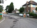
 Houses in St John's Hill, Wareham - geograph.org.uk - 5919249.jpg 640 × 453; 62 KB
-
 Houses in Wareham - geograph.org.uk - 4758727.jpg 5.500 × 3.667; 2,34 MB
-
 Houses on North Street - geograph.org.uk - 5564092.jpg 3.296 × 2.449; 1,93 MB
-
 Houses on Pound Lane, Wareham - geograph.org.uk - 6285900.jpg 4.288 × 2.848; 1,08 MB
-
 Housing block - geograph.org.uk - 4487694.jpg 4.320 × 3.240; 5,31 MB
-
 Howards Lane Car Park, Wareham - geograph.org.uk - 6222883.jpg 640 × 480; 68 KB
-
 Hyde Hill, Stoborough Heath, Wareham, Dorset - geograph.org.uk - 5964700.jpg 1.024 × 576; 188 KB
-
 In which I Poole my resources (14) - geograph.org.uk - 3945225.jpg 640 × 480; 64 KB
-
 Inquisitive swans, Wareham - geograph.org.uk - 2773448.jpg 640 × 480; 55 KB
-
 Juicy One, South Street - geograph.org.uk - 6222832.jpg 480 × 640; 102 KB
-
 Junction by the Town Walls, Wareham - geograph.org.uk - 6286043.jpg 4.124 × 2.437; 1,39 MB
-
 Junction of South Street ^ West Street, Wareham - geograph.org.uk - 1998246.jpg 2.592 × 1.944; 2,9 MB
-
 K.W., South Street - geograph.org.uk - 6222801.jpg 480 × 640; 83 KB
-
 Keep off the grass - geograph.org.uk - 4748288.jpg 5.800 × 3.867; 3,09 MB
-
 Kings Arms sign - geograph.org.uk - 6266275.jpg 2.961 × 3.948; 768 KB
-
 Lady St Mary church, Wareham - geograph.org.uk - 6269517.jpg 2.848 × 4.288; 927 KB
-
 Lamppost in Church Street - geograph.org.uk - 3961071.jpg 480 × 640; 56 KB
-
 Launching a boat, Wareham - geograph.org.uk - 2773376.jpg 640 × 480; 69 KB
-

-

-
 Legion Club, Wareham - geograph.org.uk - 2243001.jpg 478 × 640; 87 KB
-
 Listed buildings, Wareham (geograph 6269488).jpg 2.748 × 4.021; 1,12 MB
-
 Listed buildings, Wareham - geograph.org.uk - 6267539.jpg 4.288 × 2.848; 2,7 MB
-
 Lloyds Bank, 3 South Street, Wareham - geograph.org.uk - 4254031.jpg 3.888 × 2.592; 2,84 MB
-

-

-

-

-

-
-
-

-
 Looking southwards in South Street - geograph.org.uk - 6222783.jpg 640 × 480; 53 KB
-
-
 Magpies, South Street - geograph.org.uk - 6222799.jpg 480 × 640; 84 KB
-
 Manor House - geograph.org.uk - 6222818.jpg 480 × 640; 91 KB
-
 Manor House, Wareham - geograph.org.uk - 6289658.jpg 4.288 × 2.848; 1,38 MB
-
 Map by ticket machine - geograph.org.uk - 4748357.jpg 3.867 × 5.800; 1,49 MB
-
 Masonic Hall, Howards Lane - geograph.org.uk - 6222880.jpg 640 × 480; 72 KB
-
 Meadowland at Wareham - geograph.org.uk - 3944391.jpg 1.024 × 680; 239 KB
-
 Methodist Church - geograph.org.uk - 4487682.jpg 4.320 × 3.240; 5,5 MB
-
 Mill Lane, Wareham - geograph.org.uk - 6257666.jpg 3.650 × 2.547; 853 KB
-
 Mill Lane, Wareham - geograph.org.uk - 6257668.jpg 4.270 × 2.546; 1,01 MB
-
 Moored at the Frome - geograph.org.uk - 2773399.jpg 640 × 480; 73 KB
-
 Mooring on the River Frome - geograph.org.uk - 4439257.jpg 4.000 × 2.666; 7,04 MB
-
 Museum Sign - geograph.org.uk - 4488706.jpg 4.320 × 3.240; 5,34 MB
-
 Narrow lane - geograph.org.uk - 4488571.jpg 4.320 × 3.240; 5,64 MB
-
 North Mill House, Wareham - geograph.org.uk - 6267382.jpg 3.239 × 1.530; 1,05 MB
-
 North Mill House, Wareham - geograph.org.uk - 6267405.jpg 3.264 × 1.526; 1,29 MB
-
 North Mill House, Wareham - geograph.org.uk - 6267408.jpg 3.248 × 1.545; 779 KB
-
 North Street Country Theme, Wareham - geograph.org.uk - 2773361.jpg 640 × 480; 63 KB
-
 North Street, Wareham (geograph 6289650).jpg 3.831 × 2.404; 973 KB
-
 North Street, Wareham - geograph.org.uk - 6267548.jpg 4.235 × 2.531; 964 KB
-
 North Street, Wareham - geograph.org.uk - 6267625.jpg 4.256 × 2.671; 1,32 MB
-
 Northport, nursery - geograph.org.uk - 5149685.jpg 1.024 × 768; 217 KB
-
 Northport, post office - geograph.org.uk - 5149692.jpg 1.024 × 768; 165 KB
-
 Northport, roadbridge - geograph.org.uk - 5149679.jpg 1.024 × 769; 143 KB
-
 Old and New - geograph.org.uk - 4748334.jpg 5.800 × 3.867; 2,01 MB
-
 Old Brewery, Wareham - geograph.org.uk - 6115512.jpg 2.534 × 3.703; 1,01 MB
-
 Old Granary Pub - geograph.org.uk - 6266258.jpg 800 × 534; 120 KB
-
 On the River Frome, Wareham - geograph.org.uk - 2773434.jpg 640 × 480; 70 KB
-
 Opticians in North Street - geograph.org.uk - 6222877.jpg 480 × 640; 68 KB
-
 Ordnance Survey Bolt - geograph.org.uk - 3685100.jpg 640 × 480; 151 KB
-
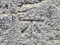 Ordnance Survey Cut Mark with Bolt - geograph.org.uk - 4994528.jpg 4.000 × 3.000; 4,73 MB
-
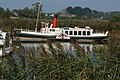 Paddle steamer Monarch on the River Frome - geograph.org.uk - 4178425.jpg 1.600 × 1.064; 468 KB
-
 Pastures southeast of Ferncroft Farm - geograph.org.uk - 5530092.jpg 640 × 384; 53 KB
-
 Paul's, South Street - geograph.org.uk - 6222805.jpg 480 × 640; 83 KB
-
 Pay and display - geograph.org.uk - 4748356.jpg 3.867 × 5.800; 2,94 MB
.jpg)

.jpg)


_-_geograph.org.uk_-_3276489.jpg)


.jpg)
.jpg)


.jpg)


_-_geograph.org.uk_-_4842453.jpg)
_-_geograph.org.uk_-_4842455.jpg)
_-_geograph.org.uk_-_4842465.jpg)
_-_geograph.org.uk_-_4842470.jpg)
_-_geograph.org.uk_-_4842475.jpg)


.jpg)


_-_geograph.org.uk_-_3945225.jpg)


.jpg)


.jpg)


