Category:Waresley
Aller à la navigation
Aller à la recherche
localité britannique du comté anglais de Cambridgeshire  | |||||
| Téléverser des médias | |||||
| Nature de l’élément |
| ||||
|---|---|---|---|---|---|
| Lieu | Waresley-cum-Tetworth, Huntingdonshire, Cambridgeshire, Angleterre de l'Est, Angleterre | ||||
 | |||||
English: Waresley is a village in the civil parish of Waresley cum Tetworth within the Huntingdonshire district of Cambridgeshire, England.
Sous-catégories
Cette catégorie comprend 4 sous-catégories, dont les 4 ci-dessous.
B
- Buildings in Waresley (15 F)
D
- Duncombe Arms, Waresley (7 F)
J
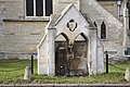
- St James' Church, Waresley (13 F)
S
- Streets in Waresley (10 F)
Média dans la catégorie « Waresley »
Cette catégorie comprend 30 fichiers, dont les 30 ci-dessous.
-
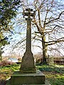 Cross, Waresley Old Churchyard.jpg 3 024 × 4 032 ; 5,99 Mio
-
 Duncombe Arms Postbox - geograph.org.uk - 3254223.jpg 2 152 × 2 869 ; 1,88 Mio
-
 Duncombe Arms Postbox - geograph.org.uk - 3254226.jpg 2 215 × 2 953 ; 1,99 Mio
-
 Farm entrance - geograph.org.uk - 385239.jpg 640 × 481 ; 81 kio
-
 Farmland - geograph.org.uk - 385243.jpg 640 × 481 ; 66 kio
-
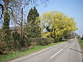
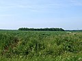
 Fields north-east of Gamlingay - geograph.org.uk - 553304.jpg 640 × 447 ; 58 kio
-
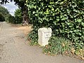 Milestone - Waresley.jpg 4 032 × 3 024 ; 6,09 Mio
-
-

-
 Old Milestone by the B1040, Waresley Parish (geograph 6044659).jpg 295 × 448 ; 51 kio
-
 Ornate lamp standard, Waresley - geograph.org.uk - 3480115.jpg 3 240 × 4 320 ; 2,96 Mio
-
 To St. Ives 12 - geograph.org.uk - 5525235.jpg 682 × 1 024 ; 199 kio
-
 Post Box, Waresley, Cambridgeshire - geograph.org.uk - 331978.jpg 427 × 640 ; 98 kio
-
 Pump, Waresley, Cambridgeshire - geograph.org.uk - 331975.jpg 640 × 427 ; 127 kio
-
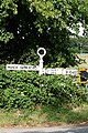
 Sign Post, Waresley, Cambridgeshire - geograph.org.uk - 331977.jpg 427 × 640 ; 127 kio
-
 Waresley - phone box by Duncombe Arms.jpg 3 024 × 4 032 ; 4,35 Mio
-
 Waresley - pump on Manor Farm Road.jpg 4 032 × 3 024 ; 6,61 Mio
-
 Waresley - street lamp by Duncombe Arms.jpg 3 024 × 4 032 ; 3,27 Mio
-
 Waresley - wall in Vicarage Road.jpg 4 032 × 3 024 ; 7,65 Mio
-
 Waresley - Waresley Park Garden Centre.jpg 4 032 × 3 024 ; 6,34 Mio
-
 Waresley Park Garden Centre - geograph.org.uk - 799384.jpg 640 × 480 ; 67 kio
-
 Waresley Village Name sign on Manor Farm Road - geograph.org.uk - 4292851.jpg 2 970 × 2 225 ; 3,45 Mio
-
 Bench next to dung heap, Waresley, Cambridgeshire - geograph.org.uk - 331376.jpg 640 × 427 ; 105 kio
-
 Entrance to "Windy Ridge" - geograph.org.uk - 454817.jpg 640 × 480 ; 118 kio
-
 Golden oak - geograph.org.uk - 597970.jpg 640 × 638 ; 144 kio
-
 Looking down towards Lily Hill Plantation - geograph.org.uk - 454840.jpg 640 × 480 ; 79 kio
-
 Mickle Hill Plantation - geograph.org.uk - 597972.jpg 640 × 332 ; 64 kio
-
 Road to Waresley Wood, Waresley, Cambridgeshire - geograph.org.uk - 331986.jpg 640 × 427 ; 125 kio
-

-
 Vapour, Waresley, Cambridgeshire - geograph.org.uk - 331402.jpg 640 × 427 ; 85 kio


.jpg)


