Category:Warmund Ygl's map of Tyrol
Zur Navigation springen
Zur Suche springen
Karte von Tirol von Warmiund Ygl  | |||||
| Medium hochladen | |||||
| Ist ein(e) | |||||
|---|---|---|---|---|---|
| Zentrales Thema | |||||
| Autor | |||||
| Erscheinungsort | |||||
| Veröffentlichungsdatum |
| ||||
| |||||
Medien in der Kategorie „Warmund Ygl's map of Tyrol“
Folgende 7 Dateien sind in dieser Kategorie, von 7 insgesamt.
-
 Achensee Ygl.jpg 818 × 720; 266 KB
-
 Grafschaft Tirol & Nachbargebiete von Warmund Ygl.jpg 9.616 × 11.522; 30,05 MB
-
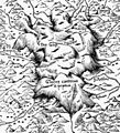 Grosser Ferner Ygl.jpg 1.497 × 1.652; 1,27 MB
-
 Innsbruck Ygl.jpg 1.216 × 948; 672 KB
-
 Stanzertal Paznaun Ygl.jpg 1.272 × 1.316; 815 KB
-
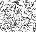
 Ursprung Inn Ygl.jpg 419 × 390; 69 KB
-
 Ygl Wappen.jpg 631 × 853; 252 KB


